
the 'Guess the Photo' thread
-
Hikin_Jim

- Posts: 4688
- Joined: Thu Sep 27, 2007 9:04 pm
Yes, just a bit.Zé wrote:that looks rough on the knee, HJ!
If you look closely, you can see some webbing on the downed tree that someone used as an anchor, someone with better sense than me evidently. It had been some time since I had been down this route (15 years?). The drop in didn't used to be that rough. There was sort of a switch backy use trail that got you down quite a bit further to a much easier drop in. I could find only a couple of traces of that use trail which is of no further value; you just have to drop in. One could also ascend this drop in, which would probably be easier since it's an ascent. Either way, it's a good bit of exposure.
HJ

-
AW~

- Posts: 2110
- Joined: Mon Oct 01, 2007 12:00 pm
previous one was from the east of it...this one from SE...

-
Taco

- Snownado survivor
- Posts: 6193
- Joined: Thu Sep 27, 2007 4:35 pm
Looking into Rattlesnake Canyon?
-
HikeUp

- Posts: 4070
- Joined: Thu Sep 27, 2007 9:21 pm
I'm gonna have to disagree....that doesn't look like Rattlesnake. This is Rattlesnake from the SE...

Even from down in the ditches (canyons ) I don't think it'd look like your SE picture. But, then again, I don't go down into those ditches too often!
edit: Maybe from the NE (like Taco says, looking up Rattlesnake Cyn.)
Even from down in the ditches (canyons
edit: Maybe from the NE (like Taco says, looking up Rattlesnake Cyn.)
-
Hikin_Jim
- Posts: 4688
- Joined: Thu Sep 27, 2007 9:04 pm
And provide us with the answer. Does take some of the guesswork out of it I guess. 
HJ
HJ
-
Taco
- Snownado survivor
- Posts: 6193
- Joined: Thu Sep 27, 2007 4:35 pm
I think I recognize the lump in the foreground as that one you pass just before reaching the BTN.
-
AW~
- Posts: 2110
- Joined: Mon Oct 01, 2007 12:00 pm
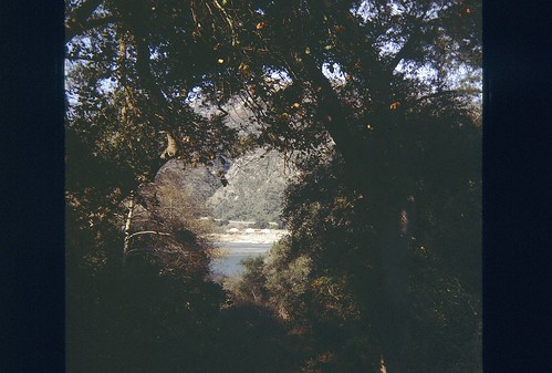
Yup, I always get that one confused....but someone else continue the thread....hehehe I don't have many peak pictures....maybe someone knows where this is...
hints:
1) Lots of people pass by this one
2) canyon with lots of water by SG standards
3) location is top of named waterfall

hints:
1) Lots of people pass by this one
2) canyon with lots of water by SG standards
3) location is top of named waterfall

-
Ze Hiker

- Posts: 1432
- Joined: Mon Jul 28, 2008 7:14 pm
no idea, just gonna guess...trail canyon falls?

-
AW~
- Posts: 2110
- Joined: Mon Oct 01, 2007 12:00 pm
nope to both.....I wonder how many named waterfalls on the topo there are...Im thinking 3....Bonita, Wolfskill, and this one.

-
realshafer

- Posts: 10
- Joined: Sun Aug 24, 2008 6:04 pm

I didn't take this photo. Caption reads:
P-51 'Mustang' fighter in flight. Inglewood, California, October 1942.
Does anyone know the area this plane is flying over? What's that prominent ridge in the background?
Other info: Reproduction from color slide. Photo by Alfred T. Palmer. Prints and Photographs Division, Library of Congress. Found here: http://extras.denverpost.com/archive/captured.asp
-
AW~
- Posts: 2110
- Joined: Mon Oct 01, 2007 12:00 pm
tough one....my guess is the photo is flying over the forest just north of Asuza. In that case the ridge is the Redbox-Rincon rd and Pine Mtn is shown. The road at the bottom would be the Silver Fish road/trail. The ridge coming down from Pine Mtn is a firebreak that they plan to restore...actually last time I thought I saw it had been mostly restored with the Morris Fire.
South side of Pine Mtn on Google Earth compared to your photo

South side of Pine Mtn on Google Earth compared to your photo
-
Taco
- Snownado survivor
- Posts: 6193
- Joined: Thu Sep 27, 2007 4:35 pm
Daaaaaaaaaayum, early P51! P51B? 4x .50's. Nutso! Sweet pic!
And yup, that's little Pine.
And yup, that's little Pine.

-
Elwood

- Posts: 623
- Joined: Fri Aug 15, 2008 5:23 pm
I'll take a WAG at looking north across East Fork around Davis Mine or Follow's Camp.
-
Ze Hiker
- Posts: 1432
- Joined: Mon Jul 28, 2008 7:14 pm
looking at morris resevoir & R39 with Silver mt in the background, from GMR?