
This past weekend, hiked from chantry flats, followed the gabrielino trail over newcomb pass, to devore camp, with plans to camp at West Fork campground. Had never taken this trail further then Spruce Grove, and which point all my past trips went to the Wilson summit via sturtevant trail.
Chantry Flats - Newcomb Pass
Trail was well kept and traveled, though section from Spruce Grove to Newcomb is seemingly less popular, which was nice because it gives you some needed solitude
Newcomb Pass - Devore Camp
POISON OAK CITY!!! trail is in fine condition, but watch out for poison oak gunning for your ankles constantly. Also, bugs are pretty bad passed newcomb pass. bring your DEET.
Devore to West Fork
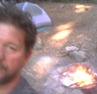
Trail between Devore Camp and West Fork is in horrible condition. Looks like it hasnt been used much at all in a while, and me and my trip partner had to blaze a path through overgrown brush... many times while next to steep drop offs. Be careful. This path requires at least 10 crossings in this mile and a half, and none of them have often used logical paths, so prepare to get your feet wet or wear your Gore Tex boots. Many places with trees down and covering path, or the trail getting lost in a maze of branches and sand and overgrown weeds.
We ended up returning to Devore to camp, as it is a much nicer site. West Fork looked pretty run down. Devore is a simpler camp, with less amenitiies, but much more peaceful setting. The trail between these two camps could really use some maintenance.
Gabrielino Trail - Chantry Flat to West Fork
-
HikeUp

- Posts: 4028
- Joined: Thu Sep 27, 2007 9:21 pm
Thanks for the trail info. Was there plenty of water at Devore and/or West Fork? Did you filter it?
-
bradical1982
- Posts: 4
- Joined: Wed May 09, 2012 7:11 pm
Yes plenty of water. Flowing quite swiftly at devore. Made for a nice white noise background while sleeping.
I did filter, using my katydn hiker pump. But river was flowing quite rapidly and water looked clear. Tasted good too! No idea if you could get away with no filtering. But I had my filter on me so why not use it.
I did filter, using my katydn hiker pump. But river was flowing quite rapidly and water looked clear. Tasted good too! No idea if you could get away with no filtering. But I had my filter on me so why not use it.
-
palmeredhackle
- Posts: 37
- Joined: Mon Apr 02, 2012 10:14 pm
I went through there when I did my partial gabrielino trail solo about a month ago. Started at Switzer and came out at Chantry. I found the trail from West Fork to Devore to be not all too difficult to find so perhaps it's a matter of which direction you travel? Stream crossings galore like you said, and the water was much higher than when I had previously visited a few years ago. Downed trees in a couple spots but still one of my favorite local areas! The section from Red Box down to West Fork sure had some nasty spots though where I got completely lost in fields of poodle dog bush. That stuff was everywhere!
-
robnokshus
- Posts: 130
- Joined: Fri Apr 04, 2008 7:25 am
Are you referring to the section of trail between Valley Forge and West Fork? We started down that stretch last year and had to double back and take the road due to sketchy trail conditions. There were crews working on it at the time though, so I am curious as to how far they got. We hiked down to Valley Forge a couple of weeks ago and the trail was in decent enough shape, though I do have a Poodle Dog souvenir on my leg.palmeredhackle wrote: The section from Red Box down to West Fork sure had some nasty spots though where I got completely lost in fields of poodle dog bush. That stuff was everywhere!
-
palmeredhackle
- Posts: 37
- Joined: Mon Apr 02, 2012 10:14 pm
From Red Box down to Valley Forge I believe was all free and clear. Valley Forge to West Fork was a different story. They had definitely worked on areas, though it looked like it had been awhile back. Many places I was searching for the orange survey tape to find my way point to point. I think the poodle dog bush just grows so fast it's hard to keep it under control. I had been dropped off at Switzer and going back was not really an option so I pressed on through. I never felt in any true danger of getting lost though I definitely lost the trail several times. It would just dead end into a giant thicket of poodle dog. I just kept going across the ridge in a relatively horizontal direction and looked above and below for signs of trail. It's still doable, but only if it's a trail you were familiar with prior to the station fire I think. There is one unmarked trail split when you drop down close to the WFSGR with remnants of a burned out sign. I don't remember that junction though I found it on my map. Trusted the map and was correct.