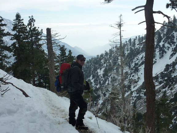
snow + hot sun during day = icy at night and that icy can last into day if the sun hides behind a cloud or in shady areas. i would not recommend Baldy at this time. maybe someone will post about Icehouse Cyn conditions. save Baldy with a 7 year old for when it melts out below the hut or for Father's Day.
Ski hut trail (below the hut) still covered in snow on Sunday (3 days ago)
why not drive further north and take him to the Mount Wilson area? if you haven't been to Chantry Flat and up the San Gabrielino Trail into Big Santa Anita Canyon your 7 year old will be in for a treat!! big trees, creek crossings, lots of fun and it's pretty! back at Chantry Flat you can show him the donkeys at the Adam's Pack Station and end the day with a burger & soda at their grill. http://www.adamspackstation.com/index.html
Thank you very much. I will definitely check out Chantry Flat.
Wow, too many late nights of research I guess. I don't know how I came to the conclusion lower Baldy may be ok. Like I said, anxious! I think the view from Rancho Cucamonga the other day threw me off. I should have figured as the mountains look like they are still in a winter wonderland from the desert.
I am very unfamiliar with the San Gabriel Mountains and I have a lot of research to do. I did Icehouse with my wife last summer and I absolutely loved the area. I can't wait to get back up.
Thank you for the Icehouse info.
Looks like we will be heading to the Mt Wilson area! He's excited. Thank you. I can't wait until he is old enough to strap on a pair of crampons for a winter accent!
I'll second Chantry Flats as a good destination. You can do the Hoegee's Loop in several hours. There's also beautiful Sturdevant Falls and at Hermit Falls, there's some good swimming on a hot day.
I can work up an online map if you're interested. Tom Harrison Maps puts out an Angeles Front Country map which I can also recommend.
If you decided to head all the way up to Mt. Wilson from Chantry Flat, beware that there might still be a few patches of snow/ice on the trail(s) near the top. There might not be. Hopefully someone will chime in with up to date info. The Mt. Wilson cam seems to be still showing some snow on the ground so...
A few years ago some one slipped and fell to their death on a portion of the trail that happened to still have some ice on it.
If you're heading up to Chantry on the weekend, be sure to leave extra early! The parking lot fills up before 8am most weekends. You will need and Adventure Pass too, or you can pay to park in the pack station's lot. www.bigsantaanitacanyon.com has a lot of info you might find interesting. You and your son should have a great time!
There are a number of hikes out of Chantry Flats, all of them worthwhile. ARRIVE EARLY. I've seen the lot full before 7:00 AM plenty of times.
1. Chantry Flats to Sturtevant Falls. This is the "classic" hike. Follow the letters on the map as follows: A - B - C - D - E and return. The return up to Chantry Flats is a pain, but not undoable.
2. Chantry Flats to Hermit Falls. A - B - F - G and return.
3. The "Hoegee's Loop." A - B - C - H - I - J - K - A. This one avoids the tedious climb back up to Chantry Flats.
4. The "Zion Loop." A fun hike, but longer and harder than the others. I think it's 9 miles round trip. Visit Camp Sturtevant while you're there. They're super hiker friendly. A - B - C - D - L - M - N - O - I - J - K - A or A - B - C - D - L - M - N - O - I - H - C - B - A. The latter is slightly shorter; the former avoids the climb back up to Chantry Flats.
Obviously, there are other trails in the area, including going all the way to Mt. Wilson which is a great trip.
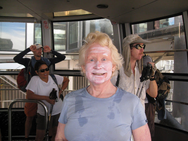
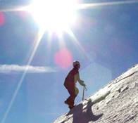
That is the famous Steve Fossett -- the uber hiker, not the aviator 8) I met him on my first C2C (Palm Springs to the top of San Jacinto to the tram) on Cinco de Mayo in 2007. He took one look at me at the summit, saw how trashed I was and kindly accompanied me back to the tram. At that time, he had completed over 150 full C2C's -- wouldn't be surprised if he's close to 200 now. Great guy.
Hi, has anyone been up the main trail to the summit recently? Any news on current conditions would be most appreciated! I'd like to head up on Sunday without winter gear.
There will be snow in the trees on the ridge climb away from the bowl for another month or more, but most of the trail is snow free. Many people go without winter gear, but some use microsppikes or crampons.
Thinking of heading up to Mt Baldy and completing the summit loop in a few Sundays, 5/22 to be exact. I was wondering if anyone has been up there recently and could tell me how the conditions are, specifically if there is any snow on the trail/summit/devils backbone? A couple of us plan to go but we have no experience with hiking in the snow or using crampons so it would probably be wise for us to wait a bit should the trail still be covered with snow. Any info is appreciated. Thanks
There's still some snow at the upper portions of the ski-hut trail, that you have to traverse around or up to the ridge. Theres also still large patches of snow atop baldy, and a large 100 yard patch or so from the peak down towards harwood. There's also a very narrow 30 yard section on the backbone that is in poor shape and dangerous if you're not sure footed.