Smith Mountain (5111'/1558m)

TRs for the San Gabriel Mountains.
Post Reply
User avatar
Hikin_Jim
Posts: 4686
Joined: Thu Sep 27, 2007 9:04 pm

Post by Hikin_Jim »

A buddy and I decided to tackle Smith Mountain on the edge of the San Gabriel Wilderness off of Highway 39 on Saturday.

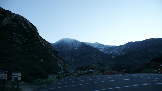
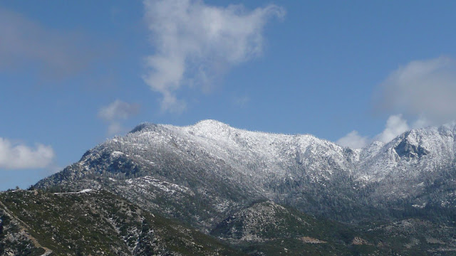
We hit the trailhead shortly before first light. Overnight, the mountains had gotten a light dusting of snow.
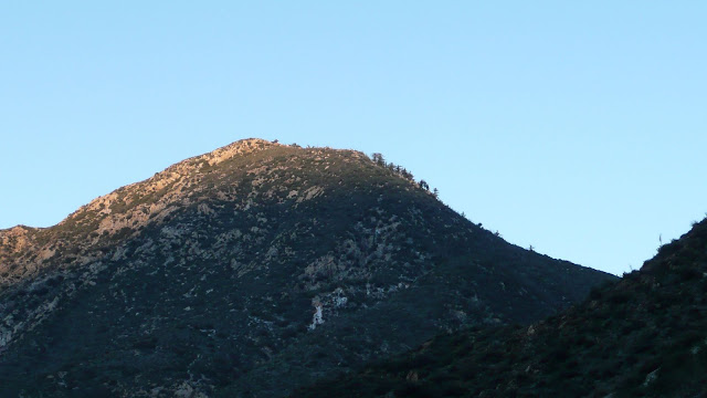
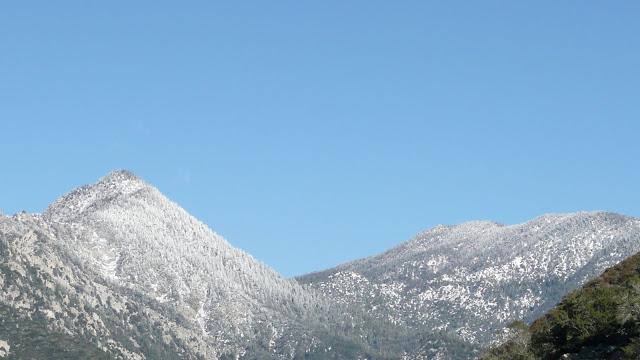
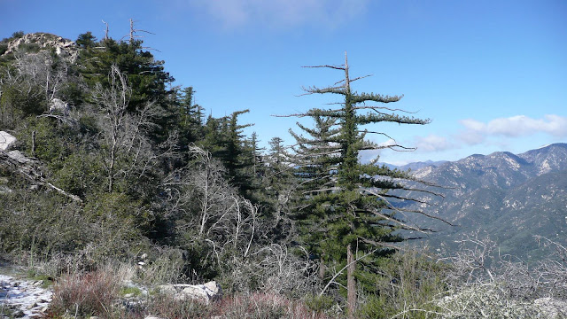
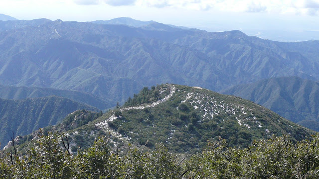
Image
South Mount Hawkins
Image

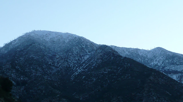
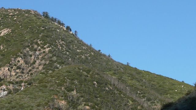
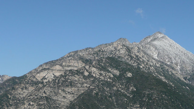
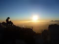
The first light of dawn illumines the upper slopes of Smith Mountain (5111'/1558m).
Image

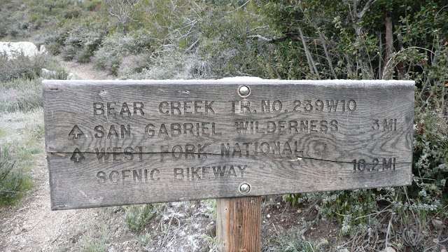
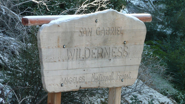
The trailhead sign. Note snow on top of sign. Our first destination is Smith Saddle (4300'/1310m) which marks the eastern boundary of the San Gabriel Wilderness.
Image

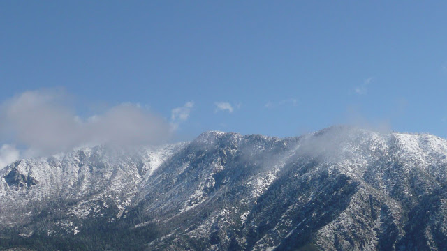
The north face of Smith Mountain. This is the standard approach.
Image

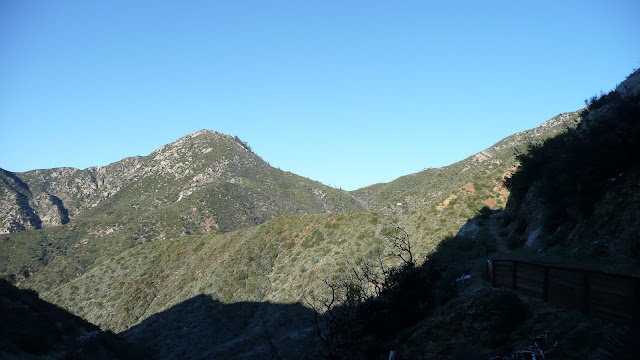
As we ascend, Smith Saddle comes into view.
Image

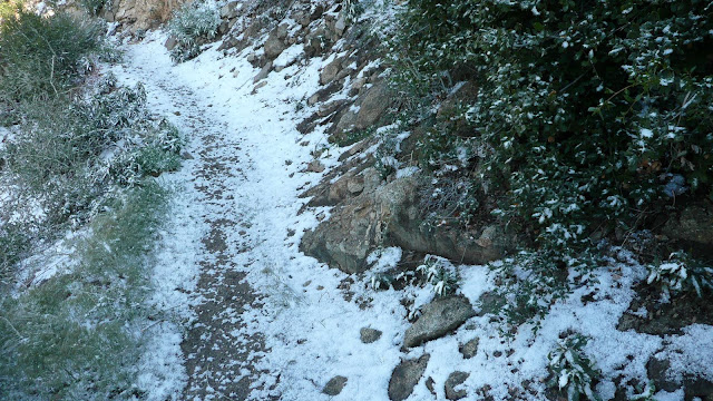
The higher we go, the more snow we encounter, although we never encountered anything more than half an inch.
Image

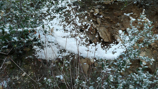
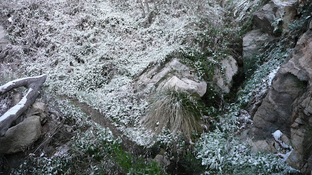
Here, a spider's web captures some snow.
Image

Surprisingly, we crossed not one but four flowing streams. Normally, all of the streams would not be running. In fact, in most years, I seem to recall that none of the streams were running.

The first stream crossing.
Image

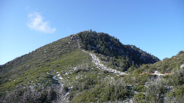
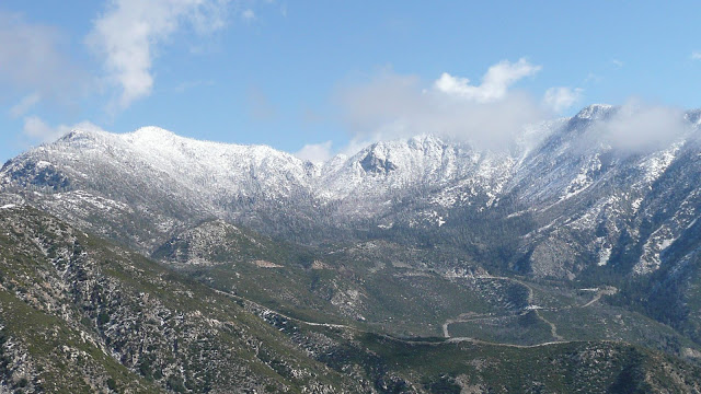
Approaching Smith Saddle. Note how snow highlights the firebreak that leads to Smith Mountain.
Image

Wilderness boundary sign at Smith Saddle.
Image

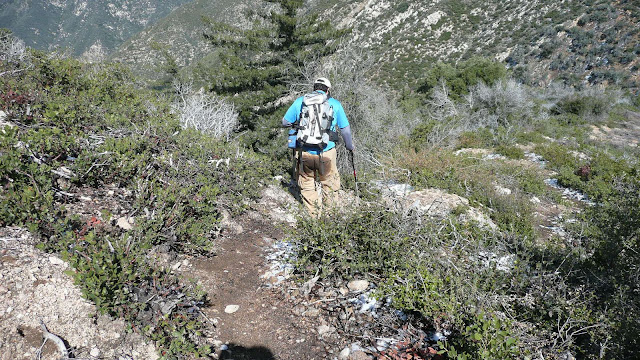
Having gained the saddle, it's now time to depart the trail and head essentially cross country up to Smith Mountain. The route follows a fire break. There's a use trail of sorts up the fire break.

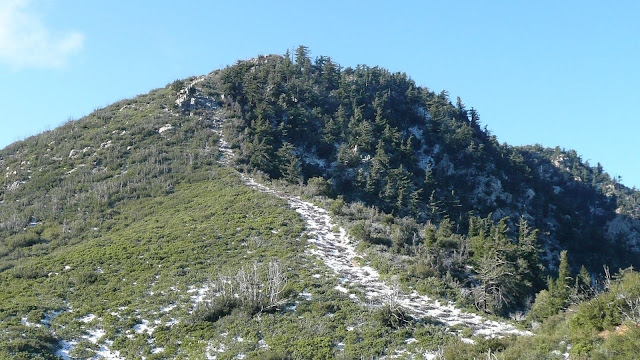
At the spot where the vegetation to the left of the fire break changes from light green to dark is the start of the "crux" of the route.
Image

I put the word "crux" in quotes, since this really isn't a difficult route. There are a couple of very short sections of class three. However, my friend, Will, had injured his hand playing basketball. He elected not to try to go up over the rocky section with only one good hand. The conditions were a bit less than fully optimal having about a half inch of snow on the route. Probably a good call on his part.

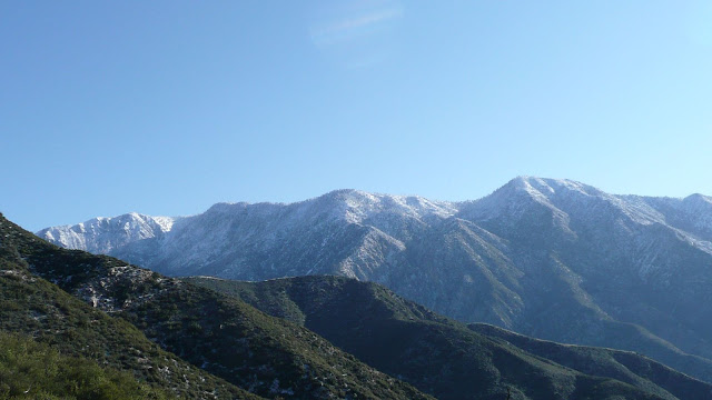
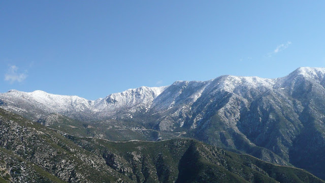
Some views on the ascent:
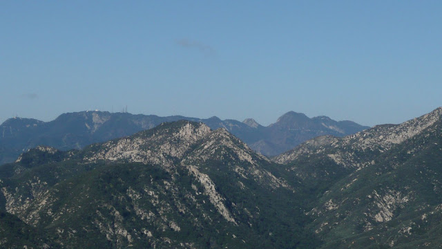
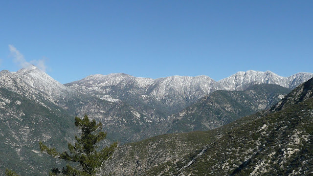
East Twin Peak and Mount Waterman.
Image

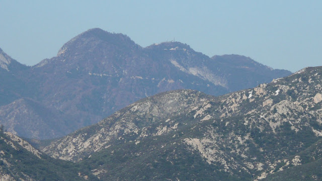
L to R: Mount Harvard (extreme left), Mount Wilson (with observatory dome and antennae), Occidental Peak (pyramidal), Mount Markham (flat-topped), San Gabriel Peak (highest in view), Mount Disappointment, Mount Deception (HPS name).
Image

L to R: San Gabriel Peak, Mount Disappointment (antenna), and Mount Deception (HPS name).
Image

Random summit on ridge leading down from Twin Peak.
Image

E Twin and south ridge.
Image

L to R: E Twin, Mount Waterman, Kratka Ridge.
Image

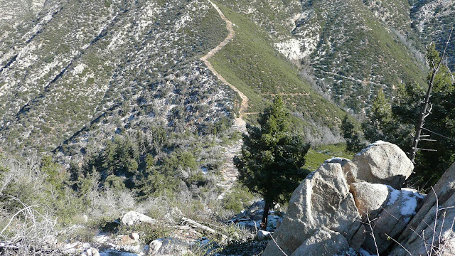
Looking back down at Smith Saddle from above the crux.
Image

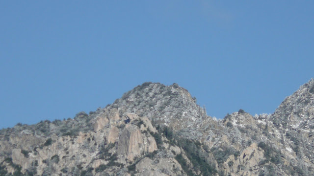
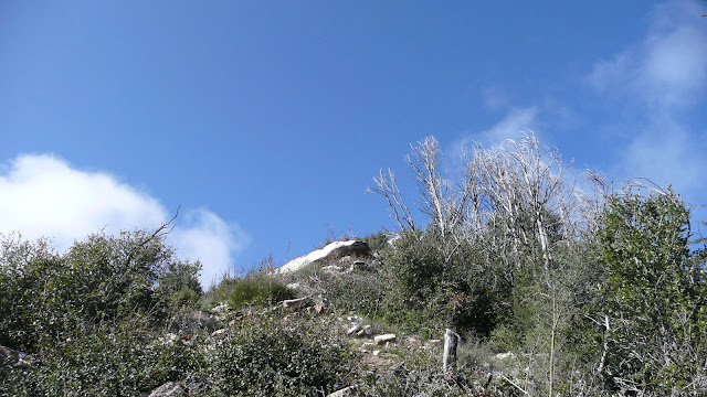
Looking up at the last real climb to reach the summit. The rock seen is a false summit, but the ridge is relatively easy to ascend beyond the rock.
Image

Old growth douglas firs on the NW face of Smith Mountain.
Image

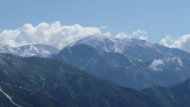
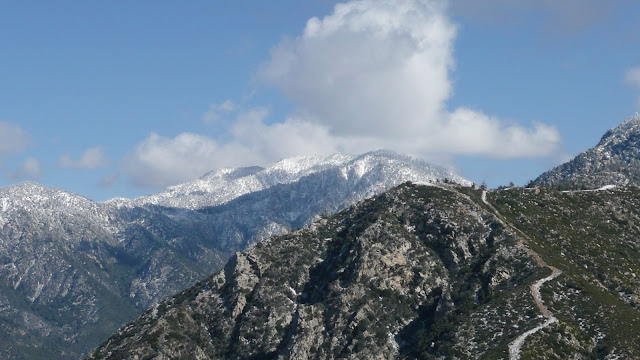
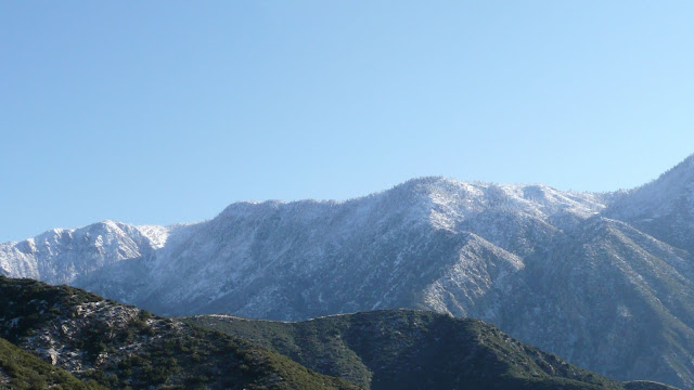
L to R: Pine Mtn, Dawson Peak, and Mount Baldy.
Image

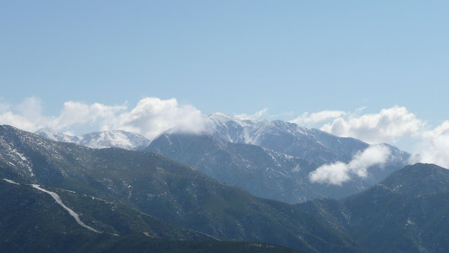
Mount Baldy. Iron Mountain is the dark peak outlined agains the snowy west slops of Mount Baldy.
Image

The SW summit of Smith Mountain. This summit looks as though it might be higher than the named summit, but the geo survey marker is on the named summit.
Image

Mount Williamson
Image

Crystal Lake basin
Image

I think that's Mount Lawlor on the left and Strawberry Peak on the right.
Image
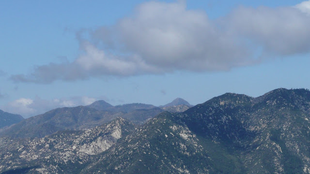
Not sure about that one.

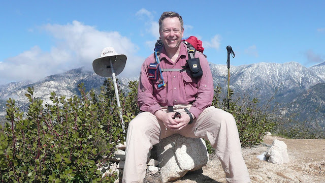
On the summit of Smith Mountain.
Image

Will descends the use trail on Smith Mountain.
Image

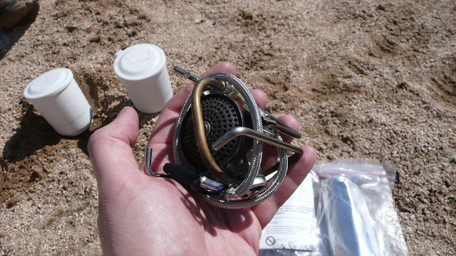
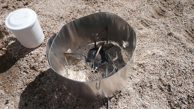
Back at the saddle, we paused for a little brew up.
Image

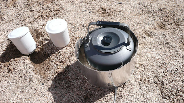
We used a Soto OD-1NP Muka stove, the latest thing from Japan.
Image
Image

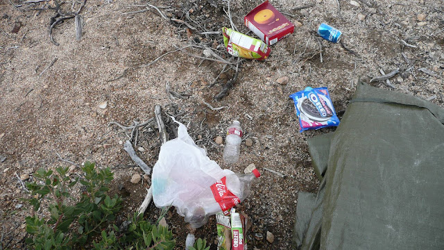
Trash at Smith Saddle. We removed all the trash except the four (six?) person car camping tent seen at the right. The tent was simply too large and too heavy for us to be willing to carry it out.
Image

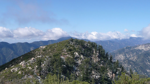
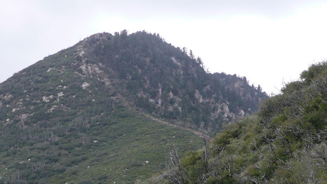
Looking back at Smith Mountain. The gray rocks that can be seen are the "crux" of the route. One must scramble up these rocks en route to the summit.
Image

On our descent, it clouded up and began snowing. As we descended further, the snow gave way to light, intermittent rain. Just minutes after we got back in the car, the heavens opened up and it began to really rain. Good timing on our part. :)

In all, a really fun hike with lots of good views.

HJ
User avatar
everyday
Posts: 455
Joined: Tue Mar 15, 2011 12:36 pm

Post by everyday »

Nice hike :D Looks like it'd be a good trail to run too... Im already missing being able to get out :(
User avatar
obie
Posts: 339
Joined: Thu Jan 07, 2010 9:36 pm

Post by obie »

HJ: cool pics and, thanks for taking the time to ID the peaks. Good stuff.
User avatar
lilbitmo
Posts: 1092
Joined: Tue Mar 04, 2008 9:44 pm

Post by lilbitmo »

HJ nice Pictorial TR, looks like a very fun outing, thanks for sharing. :D
User avatar
TracieB
Posts: 216
Joined: Mon Feb 22, 2010 8:57 am

Post by TracieB »

obie wrote: HJ: cool pics and, thanks for taking the time to ID the peaks. Good stuff.
Ditto that :)
User avatar
Illusive
Posts: 115
Joined: Fri Jan 28, 2011 2:19 pm

Post by Illusive »

Thanks for the clean up on the saddle too. I cant stand to see people leaving their trash like that in the wild.
User avatar
HikeUp
Posts: 3861
Joined: Thu Sep 27, 2007 9:21 pm

Post by HikeUp »

Hikin_Jim wrote: I put the word "crux" in quotes, since this really isn't a difficult route. There are a couple of very short sections of class three. However, my friend, Will, had injured his hand playing basketball. He elected not to try to go up over the rocky section with only one good hand. The conditions were a bit less than fully optimal having about a half inch of snow on the route. Probably a good call on his part.
I agree it was probably a good call. Will may have been able to make it up that section but could easily have hurt something on the way down. I need my hands more on the descent than the ascent through areas like that.

Fun hill to climb for sure.
User avatar
Mike P
Posts: 1005
Joined: Tue Oct 02, 2007 10:48 pm

Post by Mike P »

HJ, a lot has changed in one week, with the snow and all. The trash on the saddle was what was in a small lightweight pack.

When we arrived at the saddle on Saturday, 4/2, the backpack was there along with the tent and a tent bag full of water jugs. We figured that someone had cleaned out a drug encampment and left the crap at the saddle. Bear Creek looks like a good place for a mary jane garden.

Evidently, some loser took the pack and left the trash. (We couldn't take anything out because we were hauling loppers and stuff...)

Thanks for the photos. It's a fun trip, isn't it?
User avatar
labgloves
Posts: 3
Joined: Mon Dec 07, 2009 12:05 pm

Post by labgloves »

HJ,

I believe my girlfriend and I ran into you at the trailhead. You were finishing, while we were getting ready to head up. We pulled up next to you in a Jetta.

It sure looked different later in the day . . .

All the snow had melted, except for 2 or 3 small pockets. But, clouds had rolled in changing the view substantially. This led to a little snow and hail throughout the hike.

I'll post some pictures tonight if I get a chance.

I had never been there before and found it a surprisingly awesome hike.

everyday - looks like a great trail run to the saddle. I was thinking that the entire time.

- Chris
User avatar
mcphersonm80
Posts: 243
Joined: Mon Aug 23, 2010 11:46 am

Post by mcphersonm80 »

Great report, HJ! Love the peak IDs
User avatar
Hikin_Jim
Posts: 4686
Joined: Thu Sep 27, 2007 9:04 pm

Post by Hikin_Jim »

everyday wrote: Nice hike :D Looks like it'd be a good trail to run too... Im already missing being able to get out :(
The trail is in really good shape thanks to the San Gabriel Mountains Trailbuilders who have invested a lot of time in it. It's a very steady grade.

It's been some time sine I've taken the trail all the way down into the Bear Creek area. I'm itchin' to get back down in there again.

HJ
User avatar
Hikin_Jim
Posts: 4686
Joined: Thu Sep 27, 2007 9:04 pm

Post by Hikin_Jim »

obie wrote: HJ: cool pics and, thanks for taking the time to ID the peaks. Good stuff.
Ha! And I thought it was only me that tried to identify all the nearby peaks on hikes.

Here's a few more:
Middle Hawkins and "Sadie" Hawkins.
Image

Middle Hawkins, "Sadie" Hawkins, and South Hawkins.
Image

Crystal Lake basin. Mount Islip (far left), Windy Gap, Middle Hawkins, "Sadie" Hawkins, South Hawkins (far right).
Image

Mount Islip and Windy Gap.
Image

Middle Hawkins and "Sadie" Hawkins
Image

"Sadie" Hawkins and South Hawkins
Image

Peak 4693
Image

HJ
User avatar
Hikin_Jim
Posts: 4686
Joined: Thu Sep 27, 2007 9:04 pm

Post by Hikin_Jim »

HikeUp wrote:
Hikin_Jim wrote: I put the word "crux" in quotes, since this really isn't a difficult route. There are a couple of very short sections of class three. However, my friend, Will, had injured his hand playing basketball. He elected not to try to go up over the rocky section with only one good hand. The conditions were a bit less than fully optimal having about a half inch of snow on the route. Probably a good call on his part.
I agree it was probably a good call. Will may have been able to make it up that section but could easily have hurt something on the way down. I need my hands more on the descent than the ascent through areas like that.

Fun hill to climb for sure.
Definitely. Just enough to make it interesting. Hiking on trails is OK, but the really interesting stuff is cross country and nav.

HJ
User avatar
Hikin_Jim
Posts: 4686
Joined: Thu Sep 27, 2007 9:04 pm

Post by Hikin_Jim »

Mike P wrote: HJ, a lot has changed in one week, with the snow and all. The trash on the saddle was what was in a small lightweight pack.

When we arrived at the saddle on Saturday, 4/2, the backpack was there along with the tent and a tent bag full of water jugs. We figured that someone had cleaned out a drug encampment and left the crap at the saddle. Bear Creek looks like a good place for a mary jane garden.

Evidently, some loser took the pack and left the trash. (We couldn't take anything out because we were hauling loppers and stuff...)

Thanks for the photos. It's a fun trip, isn't it?
Mike,

Actually, the little blue pack was still there. Some of the trash was scattered down the east side of the saddle, possibly by animals. We shoved everything into the tent bag and the little backpack and hauled it all out. Dunno who hauled it all up there, but the gallon water jugs alone would have been a lot of weight.

We noticed that there were road flares in amongst the trash. Not liking that!

HJ
User avatar
Hikin_Jim
Posts: 4686
Joined: Thu Sep 27, 2007 9:04 pm

Post by Hikin_Jim »

labgloves wrote: HJ,

I believe my girlfriend and I ran into you at the trailhead. You were finishing, while we were getting ready to head up. We pulled up next to you in a Jetta.

It sure looked different later in the day . . .

All the snow had melted, except for 2 or 3 small pockets. But, clouds had rolled in changing the view substantially. This led to a little snow and hail throughout the hike.

I'll post some pictures tonight if I get a chance.

I had never been there before and found it a surprisingly awesome hike.

everyday - looks like a great trail run to the saddle. I was thinking that the entire time.

- Chris
Hey, Chris,

I definitely remember you two guys.

Yeah, on the way up it was snowy, and on the way down it was muddy. I was really glad I had brought trekking poles at one point in descending the peak. My foot slipped on the thin layer of mud on a rock, but I caught myself with my trekking pole. :shock:

Definitely post pics if you get a chance.

HJ
User avatar
Taco
Snownado survivor
Posts: 6010
Joined: Thu Sep 27, 2007 4:35 pm

Post by Taco »

There's also Sadie Hawkins (named after the gal who worked at the Crystal Lake Restaurant back in the day or something), I think it's between Middle and South.
User avatar
Hikin_Jim
Posts: 4686
Joined: Thu Sep 27, 2007 9:04 pm

Post by Hikin_Jim »

Taco wrote: There's also Sadie Hawkins (named after the gal who worked at the Crystal Lake Restaurant back in the day or something), I think it's between Middle and South.
Nellie Hawkins was a waitress who worked at the Squirrel Inn on the N Fork of the San Gabriel back in the gold mining days. Mt. Hawkins is named for her. The Squirrel Inn was located at what today is Coldbrook CG. Apparently, she was quite the looker; she got four summits named after her, two official, two unofficial.

The official summits are Mount Hawkins (8850') and South Mount Hawkins (7783'). The two bumps in between are unofficially called Middle Hawkins (8505') and "Sadie" Hawkins (8047').

Sadie Hawkins was a rather "plain" girl who had trouble with boys. Quite the opposite of Nellie. Naming a peak "Sadie" Hawkins is something of a joke in the context of Nellie Hawkins.

Now, in looking more closely at the topo map, I'm not sure that we can see Mount Hawkins proper ("A") at all in my photos. From Smith Mountain ("E"), Middle ("B") and Hawkins ("A") are very close together. Hawkins ("A") would just be poking up over the ridge to the right Middle ("B") -- if it can be seen at all. In looking more closely at my photos I'm not sure if I can see Hawkins or just part of the ridge of Middle.

"Sadie" Hawkins ("C") and South Hawkins ("D") are pretty easy to distinguish. Point "F" is Smith Saddle and point "G" is the Valley of the Moon trailhead.

HJ
User avatar
HikeUp
Posts: 3861
Joined: Thu Sep 27, 2007 9:21 pm

Post by HikeUp »

Middle and Sadie Hawkinessssesesssss are made up just to give the peak baggers among us something to do when traipsing along the ridge between Hawkins and South Hawkins. :D

Great pictures.
User avatar
Taco
Snownado survivor
Posts: 6010
Joined: Thu Sep 27, 2007 4:35 pm

Post by Taco »

Yes.
User avatar
Hikin_Jim
Posts: 4686
Joined: Thu Sep 27, 2007 9:04 pm

Post by Hikin_Jim »

Nellie was so hot in fact they built this tower so the guys could check her out.

Image

HJ
User avatar
Taco
Snownado survivor
Posts: 6010
Joined: Thu Sep 27, 2007 4:35 pm

Post by Taco »

NSFW, Jimbo.
User avatar
Hikin_Jim
Posts: 4686
Joined: Thu Sep 27, 2007 9:04 pm

Post by Hikin_Jim »

Post corrected per order of Fearless Leader.

HJ
User avatar
everyday
Posts: 455
Joined: Tue Mar 15, 2011 12:36 pm

Post by everyday »

HaHaHa! Image yooouu got in trouuble
User avatar
Hikin_Jim
Posts: 4686
Joined: Thu Sep 27, 2007 9:04 pm

Post by Hikin_Jim »

Yeah, but did you see the original photo? Woo hoo! It was worth it.

HJ
User avatar
Hikin_Jim
Posts: 4686
Joined: Thu Sep 27, 2007 9:04 pm

Post by Hikin_Jim »

Sadie Hawkins. Sorry, no photo of Nellie available.
Image

HJ
User avatar
HikeUp
Posts: 3861
Joined: Thu Sep 27, 2007 9:21 pm

Post by HikeUp »

Finally! A picture of FO.
User avatar
Hikin_Jim
Posts: 4686
Joined: Thu Sep 27, 2007 9:04 pm

Post by Hikin_Jim »

Post Reply