Mill Creek Feb 20th - Breaking Trail is a B****!

Archived TRs for ranges in California.
Post Reply
User avatar
Burchey
Posts: 304
Joined: Tue Dec 28, 2010 11:28 am

Post by Burchey »

What do you do??? A huge winter storm is coming, promising to dump a ton of powder in the local mountains with crazy winds and cold temperatures….so you call up 3 of your friends and organize a snowshoe/summit attempt - and they will all promptly bail out because the conditions might not be as “comfortable” as they’d hoped. Yeah! Hi-five yourself!

Fast-forward to 8 pm Saturday night, you’re strapping on tire cables at 5500 feet heading towards Forest Falls, hoping that they at least scraped the main path in the parking lot so you can cram your 1999 Nissan Maxima into a comfortable resting place for the night. I had planned on sleeping in the tent a few hundred yards from the car at the day-use area, but ended up sleeping in the reclined passenger seat…not too bad, sleeping bag up to my waist, down jacket on plus a hat…good to go. Set the alarm for 330 am and drifted off to sleep, dreaming of Adventure passes and Espresso Trail mix from Henrys (which, by the way, is the BUSINESS).

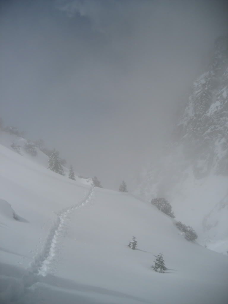
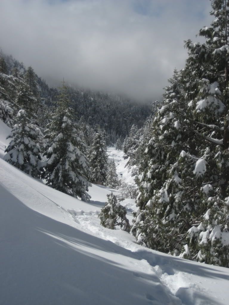
I strapped on the snowshoes at 4 am Sunday morning, and headed east along the southern edge of Mill Creek towards my ultimate goal: Galena Peak. In the trees, I had my headlamp blazing, but it was tough to see in the thick snow coming down. I also had my ice-axe out; been a little paranoid about the critters as of late.

Image

The Evo Ascents plus 4” tails weren’t doing a whole lot to keep me above the snow – the powder was so light that I’d sink down 8 inches or so in the flat, and even more on the slopes. This was my first experience shoeing in a lot of fresh powder, and it takes a lot of strength to break the trail in such conditions. I had to take it very slow.

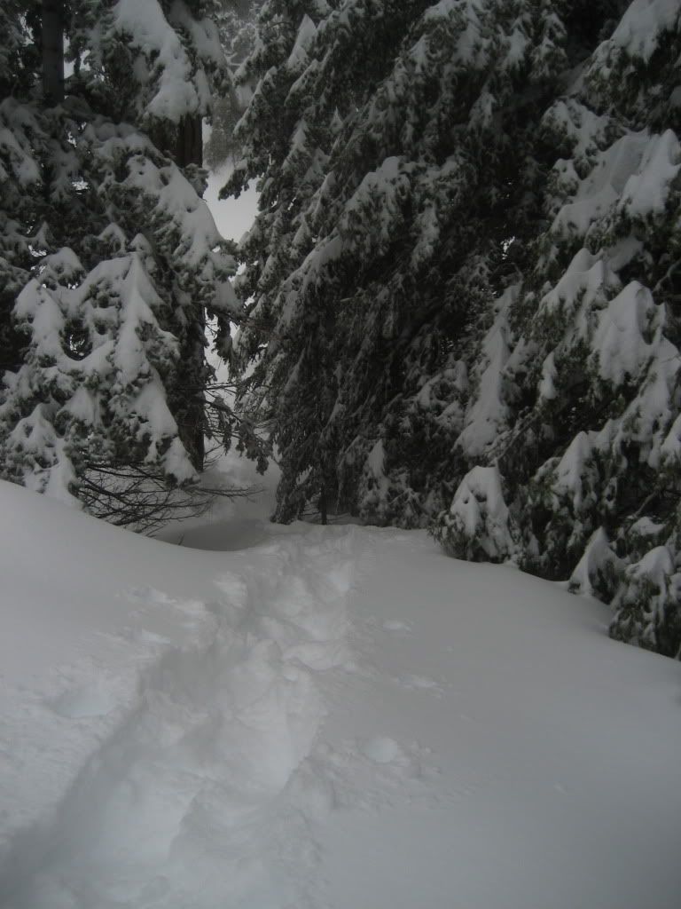
Later in the trail, but you get the idea


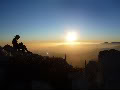
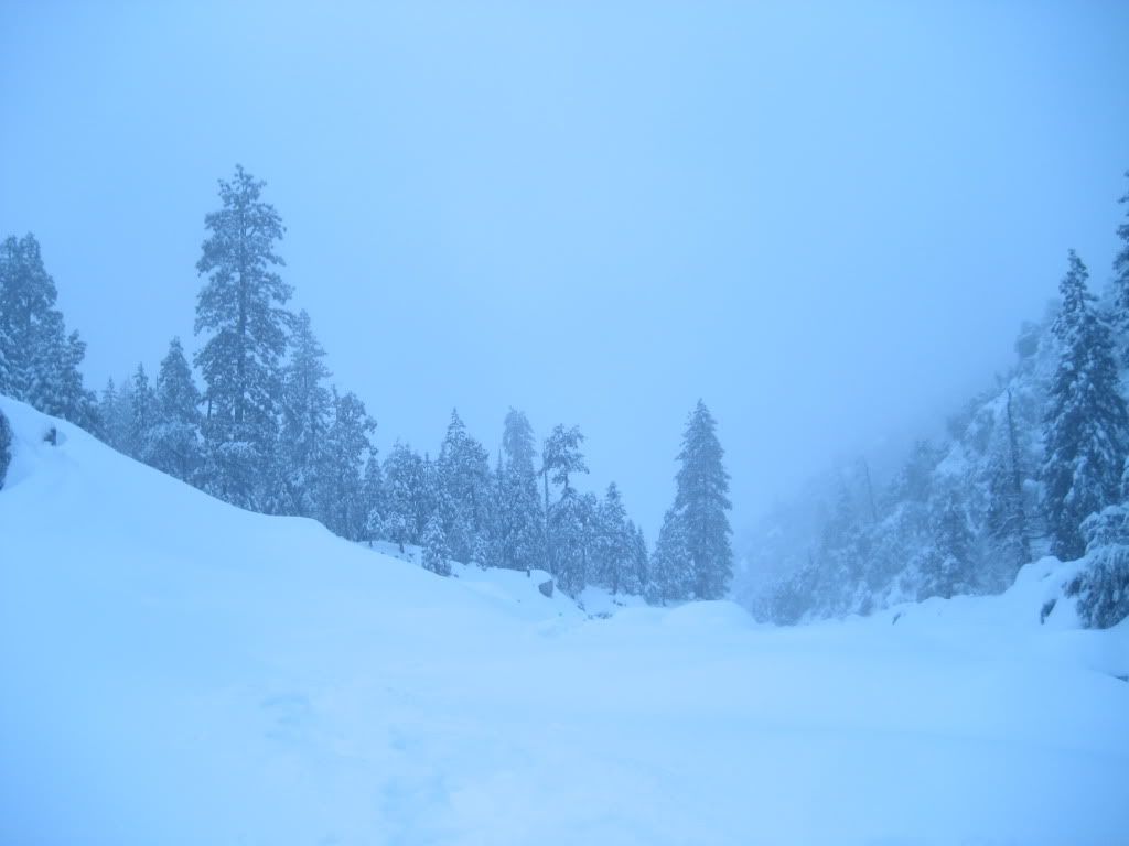
EARLY morning - long exposure
Image

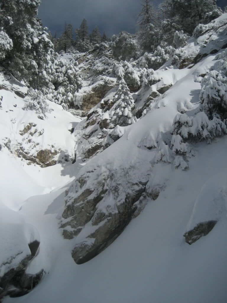
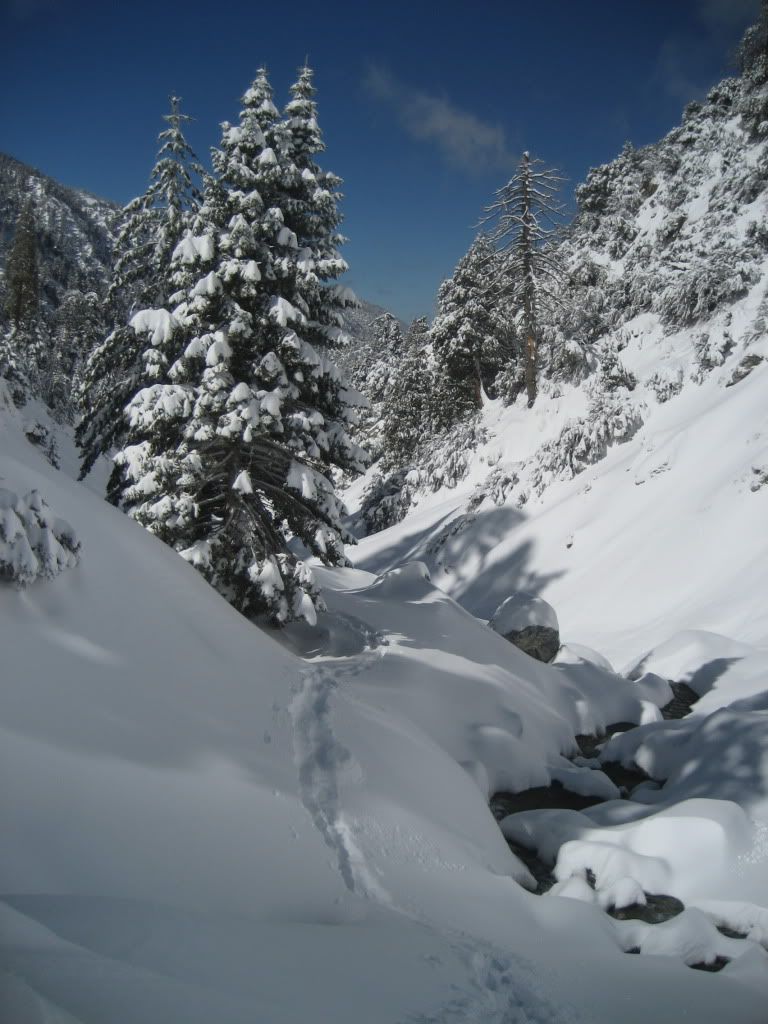
I eventually left the tree line and crossed down into the creek bed itself, the woods were a maze of drifts and fallen trees, and aside from having to negotiate several stream crossings, the bed was much easier to navigate. Even before the sun came up, you could get by in the snow with no head lamp. I loved it. My new favorite pastime, by the way, is guessing whether the snow above running water will hold you as you cross it or not. Penalty for failure is a frickin’ treat.

Image

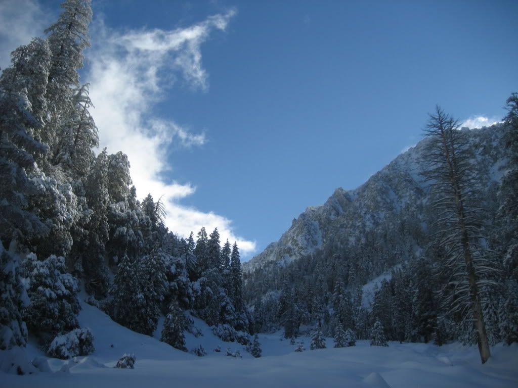
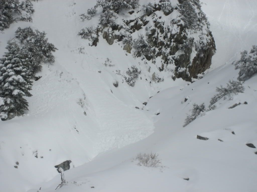
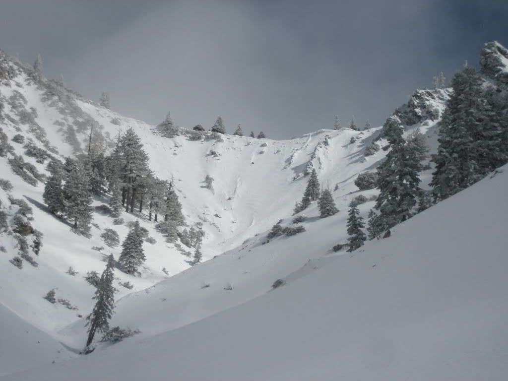
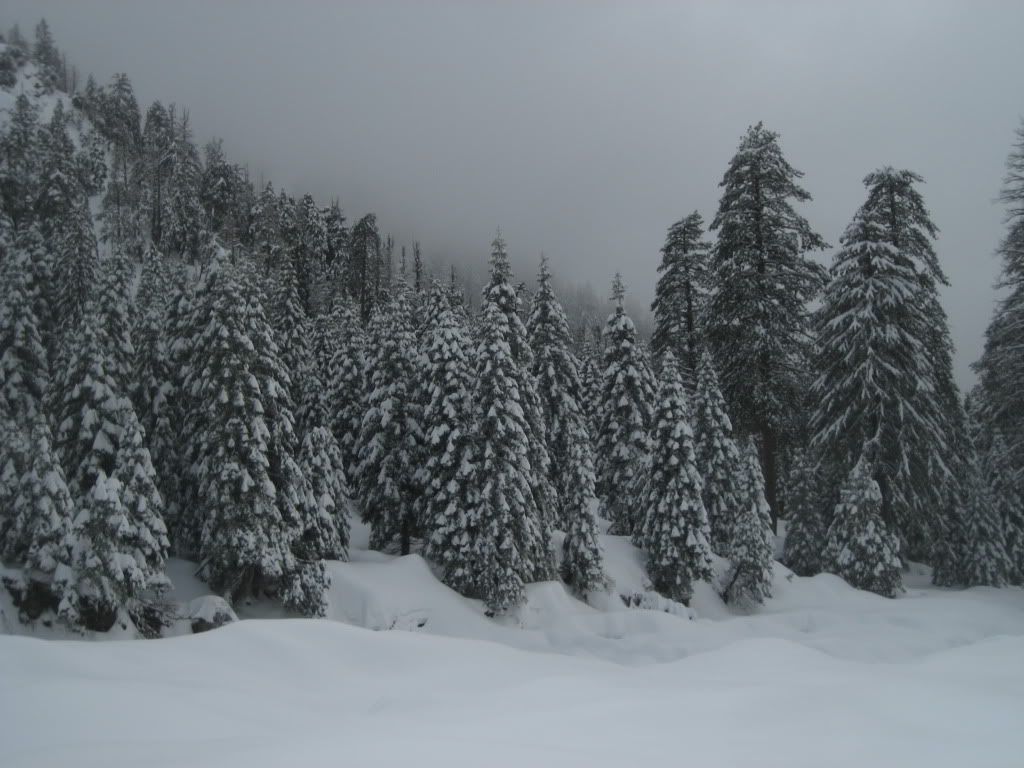
Car was around 6000 feet, and the route was pretty quiet until about 6800 feet or so. I think this is due to the shape of the valley walls to that point, and to the lack of sun at that early hour. I didn’t see or hear any evidence of rock/snow movement for the first several hours of travel, but that would soon change. As soon as the sun hit the south side of the valley, the giants came to life. More on that later, but I did pass a couple large old slides that were completely across Mill Creek, and were being undercut by the running water.

Speak of the Devil - fresh snow on top
Image

The going was so tough and so beautiful, I respect so much the effort required to move through a large amount of loose powder. I wanted to get up to Galena Peak summit, but there was no way I was going to be able to make it.

Image

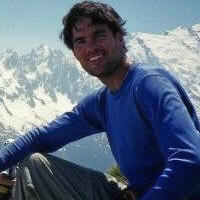
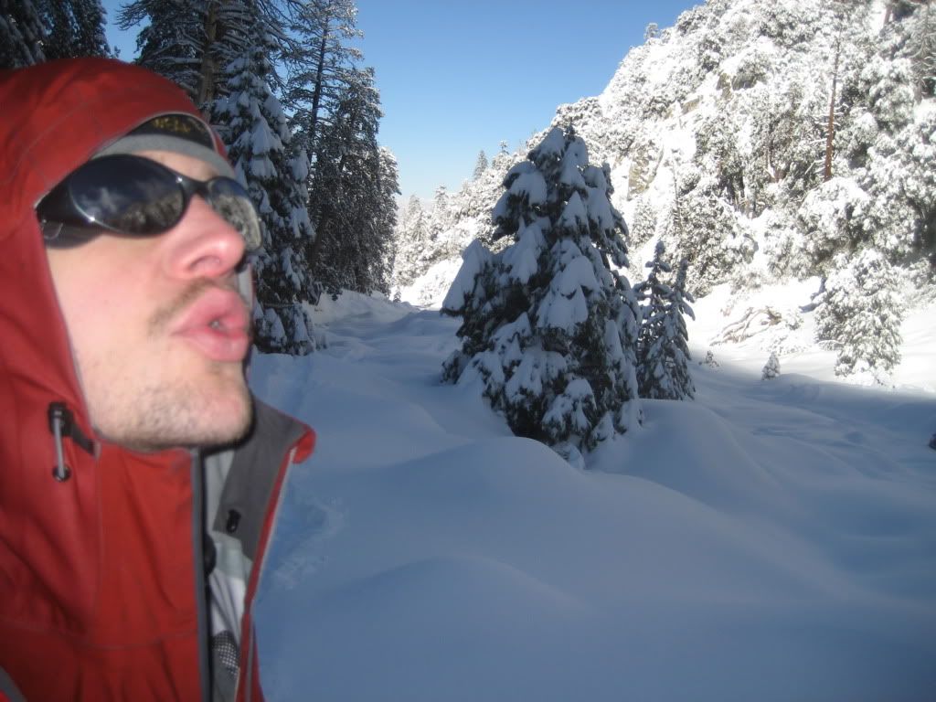
Lone Wolf ( see: Idiot )
Image

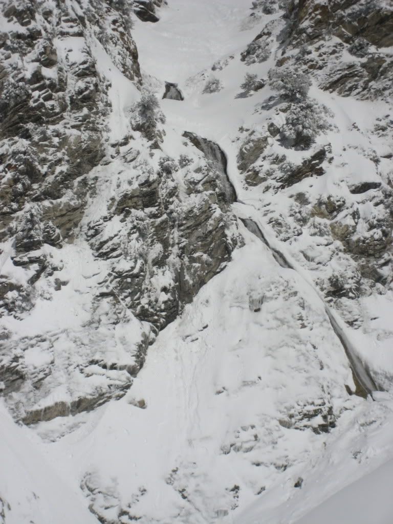
Route up the Gauntlet: not condition-appropriate
Image

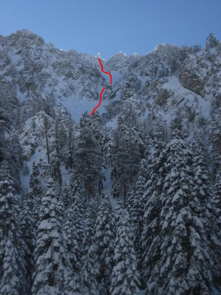
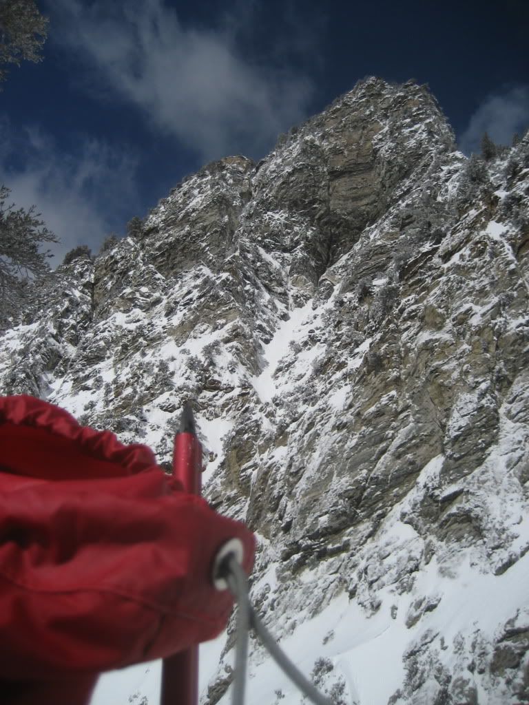
Another interesting looking route near Galena
Image

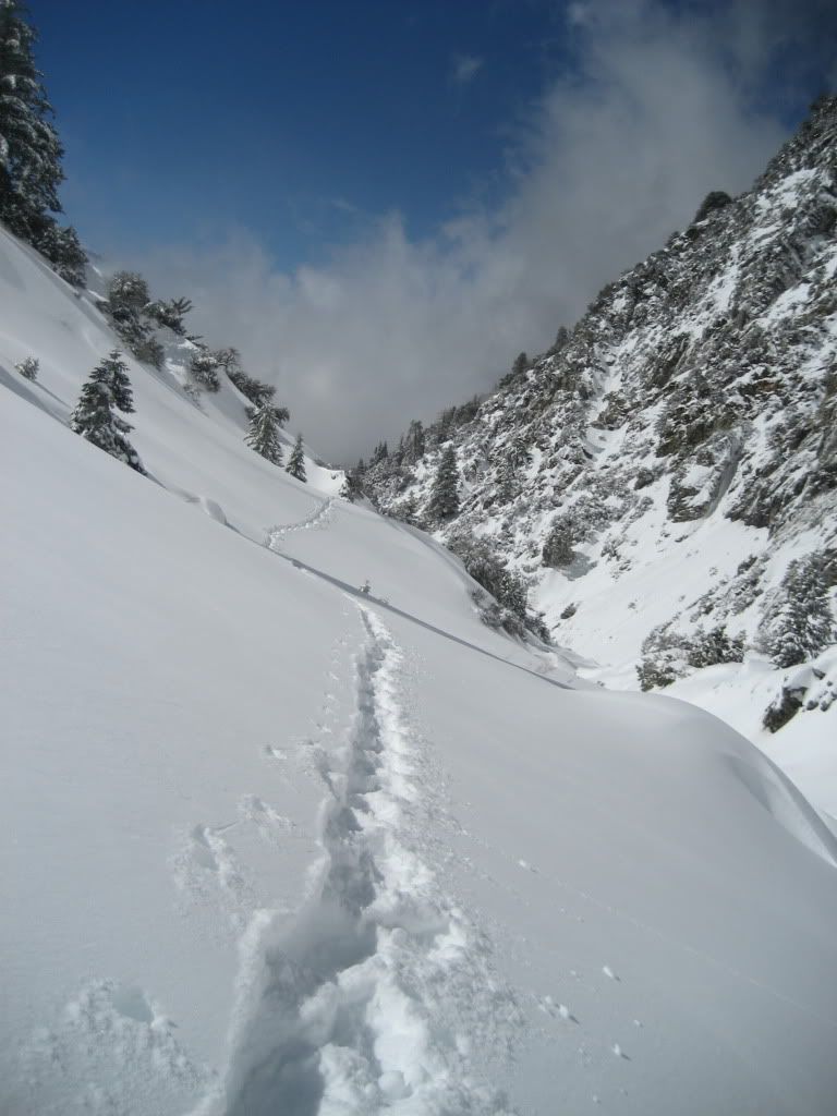
Anything more than a 15-20 degree incline was a struggle…I resolved to just get to the headwall and see how I felt, dreading the trip back to the car as well. I didn’t know how much faster and easier going downhill on old tracks would be – that turned out to be a nice surprise.


As the sun warmed the mountains across the creek from me, the rocks began to fall. I’d sit and munch on my snacks, melting snow in the MSR reactor I brought along (which was everything HJ said it would be), and just watch and listen things come loose from the other side.


Showers of just rocks, then rocks and snow, and then full on slides would come down the narrow chutes lining the face of the gorge. I found myself just stopping and staring, but not quick enough to get the camera out for any action shots.

Image

Image

Image

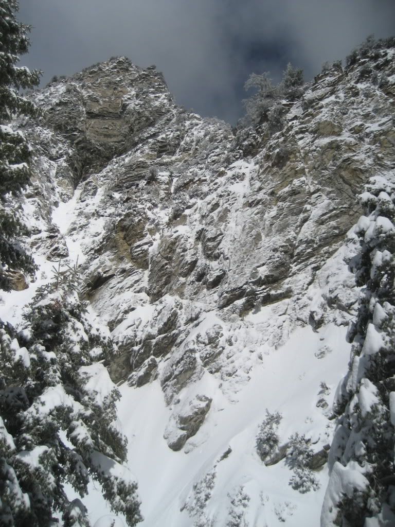
As the headwall came into view, the slides on the south face of the mountains were becoming larger and more frequent. It's creepy and awesome to watch the snow sliding down - giving thanks that you aren't directly below and being careful not to drop your trail mix in the powder below you.
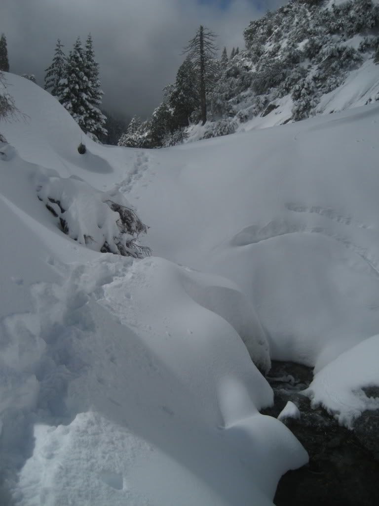
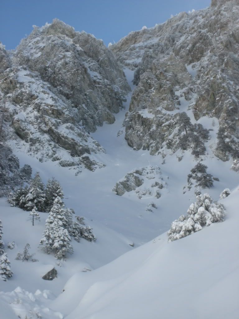
High Creek
Image

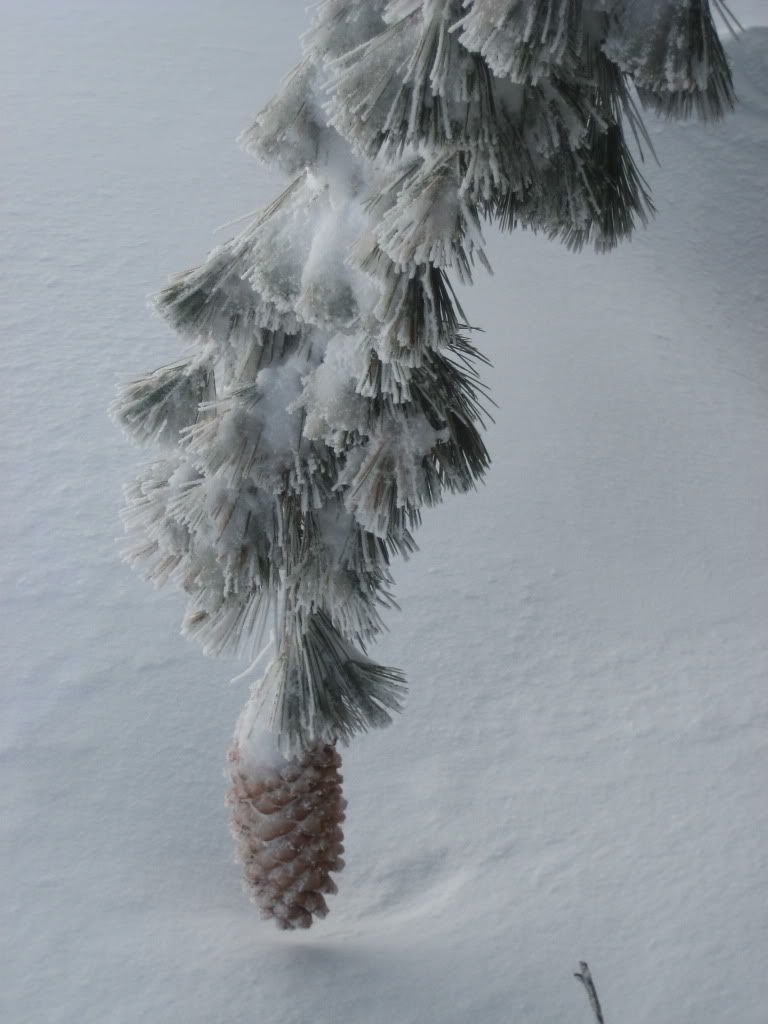
Treats! I want to be IN that.
Image

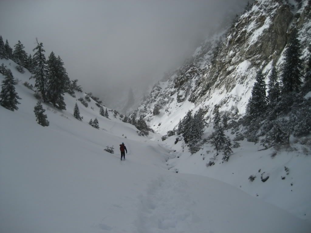
I packed up the stove and continued on towards the headwall, always looking back to appreciate the view and my single track cutting through the virgin powder. So nice.

Image
Image

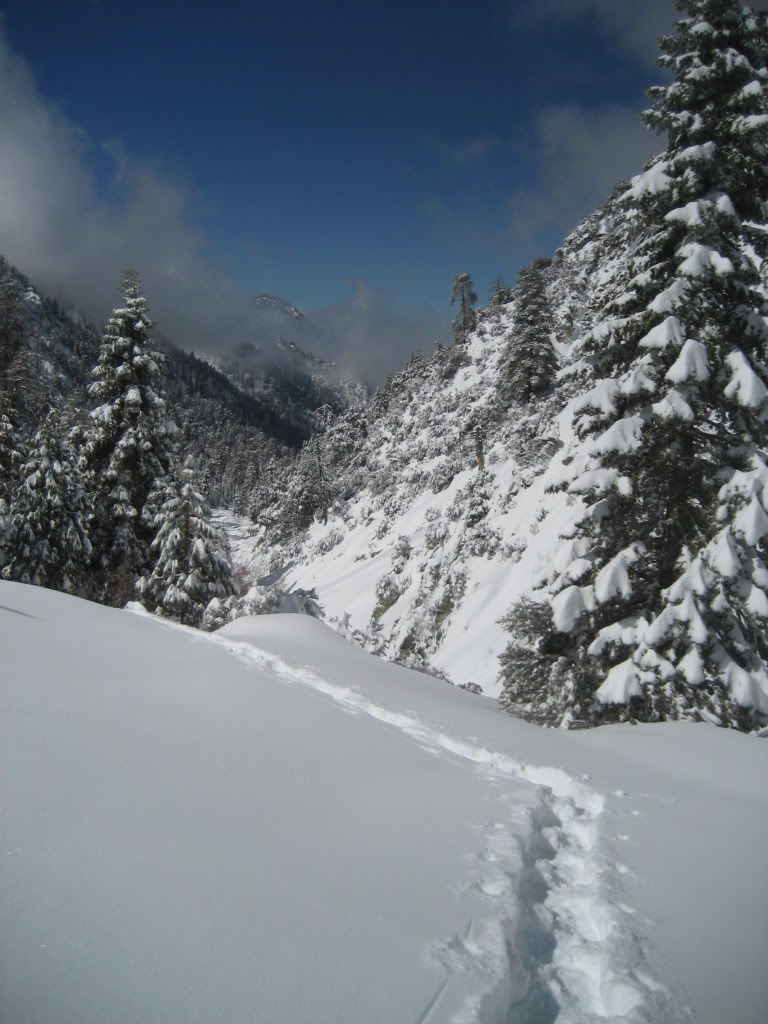
One added bonus was the weather - it would be sunny for 5 minutes, then a haze would fly up the canyon and cover you, then sunny again 10 minutes later. I wasn't worried about getting lost - even with no compass/GPS it would be tough to go anywhere but along the creek back to the car.

Image
Image

About 7600 feet, I decided that it probably wasn't the best idea to continue. There were active slides, the powder was deep, and I was running out of mix. With the headwall in sight, I tucked my tail between my legs and headed back towards Forest Falls.

Image

Image

Image

Image

Image

As far as timing goes (and I wasn't trying to set any speed records) it took me about 8 hours to travel a few miles and 1600 feet going up, and about 2 hours to get back. One added bonus on the way back, a few sections of my tracks were covered in slides (good timing on my part), with one creek crossing now a nice and easy bridge of snow pile. Back at the car around 2 pm, I was greeted by a ton of families out having fun in the snow. Of course, there was the requisite piling of the snow on your minivan roof and/or building snowmen on the radio antennae of your car. I don't get it.

Things I learned:

1. Espresso Trail mix from Henrys...gots choc covered espresso beans in there, so you can get a little caffiene as you go

2. If you plan on moving fast, wait a couple days after a lot of powder (duh). I just wanted to experience it

3. MSR Evo Ascent...cool, but not great in fresh powder. Even with the tails, I didn't see the gain in float outweighing the extra bulk and weight of the bigger shoe. I've only shoed in MSR shoes, so I can't compare with other types.

4. Respect the mountain
User avatar
lilbitmo
Posts: 1092
Joined: Tue Mar 04, 2008 9:44 pm

Post by lilbitmo »

Burchey,

Nice TR and great pictures, glad you went out and enjoyed the snow and made it back safely. The avalances are just getting started, old icy snow underneath is piled high with sugary supersoft stuff on top - add wind and sun and that makes for a slide.

Thanks for the report :D
User avatar
Sam Page
Posts: 267
Joined: Fri Sep 04, 2009 10:59 am

Post by Sam Page »

Nice trip report and photos. I've also been scoping that "interesting route near Galena", but the upper portion is a big question mark -- it looks very steep. Plus, anything falling from above (rock or snow) would presumably funnel into the narrow chute at the bottom.
User avatar
Dave G
Posts: 321
Joined: Sun Jun 22, 2008 9:51 am

Post by Dave G »

Cool adventure Burchey, thanks for sharing. Your buddies missed out IMHO! 8)
User avatar
hvydrt
Posts: 494
Joined: Thu Sep 27, 2007 8:18 pm

Post by hvydrt »

Thanks for the report! That places is constant rock fall, even in the summer.
MSR Evo Ascent...cool, but not great in fresh powder
8" isn't too bad for being out only a few hours after the storm. Better than 18"+ without them. :D
User avatar
Burchey
Posts: 304
Joined: Tue Dec 28, 2010 11:28 am

Post by Burchey »

Sam - on that route - I'm guessing you've checked on it from above when you were up on Galena? I don't think I could see the final section because it curved around behind the wall, just wondering if tops off with a rock climb or is it snow/ice the whole way...I know this depends on conditions as well. I'd definitely wait until some serious consolidation took place, but you can't remove the falling rock factor totally. I didn't notice much coming down from that side of the canyon, but past performance doesn't always predict future results. What's the max incline you'd head up with just a trad mountaineering axe?

Hvydrt - Good point, I shouldn't complain about the sinking in, it could have been worse. I've often wondered, if you were packing heavy, would it make sense to drag it on a light-weight sled behind you so you didn't sink too much, or would that be more trouble than it's worth?
User avatar
Sam Page
Posts: 267
Joined: Fri Sep 04, 2009 10:59 am

Post by Sam Page »

Burchey wrote: Sam - on that route - I'm guessing you've checked on it from above when you were up on Galena? I don't think I could see the final section because it curved around behind the wall, just wondering if tops off with a rock climb or is it snow/ice the whole way...I know this depends on conditions as well. I'd definitely wait until some serious consolidation took place, but you can't remove the falling rock factor totally. I didn't notice much coming down from that side of the canyon, but past performance doesn't always predict future results. What's the max incline you'd head up with just a trad mountaineering axe?
I have seen it from above. I'm guessing it's about 55 degrees, which is the limit of my comfort level with one axe. The upper section does get plastered with snow.
User avatar
Burchey
Posts: 304
Joined: Tue Dec 28, 2010 11:28 am

Post by Burchey »

Sam Page wrote: I have seen it from above. I'm guessing it's about 55 degrees, which is the limit of my comfort level with one axe. The upper section does get plastered with snow.
Thanks Sam. I've been thinking about improving the axe situation over here, get something a little more technical but not a true ice tool (as I don't have the guts to get into the almost vert/vertical stuff that would require it).

Maybe this guy Imagehttp://www.e-omc.com/catalog/products/1 ... 8_b1653e53
can't decide on hammer or adze. I already have the REI Yeti with the adze, 75 cm, which is nice for arrests/walking on inclines, etc. I think I might benefit from a more technical primary tool when I'm trying to climb up a steeper grade with harder ice/snow conditions. Who knows? Still learning.
User avatar
He219
Posts: 386
Joined: Thu Sep 27, 2007 11:18 pm

Post by He219 »

Nice TR, Burchey! I love those blower conditions.
Skis offer even more flotation than snowshoes for breaking trail ..

The Venom hybrid axe/tool is great as a secondary for steeper alpine climbing.
It placed in the top spot of the Ice Axe Round-up
User avatar
Burchey
Posts: 304
Joined: Tue Dec 28, 2010 11:28 am

Post by Burchey »

He219 wrote: Nice TR, Burchey! I love those blower conditions.
Skis offer even more flotation than snowshoes for breaking trail ..

The Venom hybrid axe/tool is great as a secondary for steeper alpine climbing.
It placed in the top spot of the Ice Axe Round-up
Gracias, I think I saw that report in a past post of yours.

Skis sound great, but I'm already spending too much on gear...gotta keep my focus, wish I'd gone with a split-board when I bought my snowboard a few years ago.
User avatar
The Dude
Posts: 12
Joined: Wed Jan 26, 2011 7:58 pm

Post by The Dude »

Awesome pics, great TR.
User avatar
rokclimbr
Posts: 124
Joined: Mon Jan 03, 2011 5:32 pm

Post by rokclimbr »

I love that canyon, during the spring there is a waterfall every 1/4 mile, absolutely stunning. My buddy and I hiked up there a very long time ago in April or May and right below the jump off the creek had cut a tunnel through the glacier. We hiked right through it, tall enough to walk through without crouching. It was surreal must have been a few hundred feet long too! Then on the other side we watched as a few hikers climbed up the jump off and caused a rockslide that punched a few holes in the tunnel roof! Yikes!

Any ice climbers out there (duh)? Check out rattlesnake canyon which is on the way up Mill Creek, small tributary to the south :D
User avatar
Illusive
Posts: 115
Joined: Fri Jan 28, 2011 2:19 pm

Post by Illusive »

Looks like it was a blast. Great trip report and photos.
User avatar
Burchey
Posts: 304
Joined: Tue Dec 28, 2010 11:28 am

Post by Burchey »

For those that have been up this way during the warmer months, is there actually a trail along the creek, or are you just making your way the entire trek up to the headwall?
User avatar
rokclimbr
Posts: 124
Joined: Mon Jan 03, 2011 5:32 pm

Post by rokclimbr »

Way back in the early 90's a developer came up with an idea for a private/exclusive very expensive planned community about 2 miles up the canyon from the Vivian Creek Trailhead. They got permission from the NP service to carve a road up the canyon, utilizing a few very large front end loaders, to conduct surveying.

They ran into two problems:
First was county code requiring two entrances to the community (in case of a flood or avalanche there had to be another way for residents to evacuate). So the developers looked into putting in a road along the Oak Glen ridge that would drop into the canyon.
The second problem they ran into, that also prevented this massive construction project from taking place, was the glen they had chosen to build the neighborhood and the forest the roads would cut through were habitat for the endangered spotted owl. The environmentalist through a fit, thank GOD!, and the project was abandoned.

You can still find remnants of the dirt road above the point where the Vivian Creek trail cut across the creek, however after nearly 15 years the road has pretty much disappeared due to floods, rock slides and avalanches.

There are no trails that go up the canyon past Vivian Creek trail, mostly due to the fact that maintenance would be a monumental task. During the months of July and August, the monsoon season for the San Berdoo's, there are HUGE stormcells that can dump large amounts of rain in a short period of time which cause massive floods/mudslides.

http://landslides.usgs.gov/recent/archi ... report.php

Figure 6 - is a picture of my childhood friends home.
User avatar
Burchey
Posts: 304
Joined: Tue Dec 28, 2010 11:28 am

Post by Burchey »

Wow, thanks for the involved post rokclimbr, a lot to think about there. It's amazing the power of moving water.

I can jump avalances, but I don't think I could jump over that.
User avatar
LetsGlissadeLhotze
Posts: 20
Joined: Tue Jan 11, 2011 9:50 pm

Post by LetsGlissadeLhotze »

Image


San Jacinto... Ridding on the coat tails of snowshoers
User avatar
Taco
Snownado survivor
Posts: 6010
Joined: Thu Sep 27, 2007 4:35 pm

Post by Taco »

rokclimbr wrote: Any ice climbers out there (duh)? Check out rattlesnake canyon which is on the way up Mill Creek, small tributary to the south :D
How is it, pretty good?
User avatar
rokclimbr
Posts: 124
Joined: Mon Jan 03, 2011 5:32 pm

Post by rokclimbr »

@ Burchey - sorry got kind of carried away with my history lesson :D

@ Taco - So I did a bit of research, in an attempt to not mislead you, and after looking at Google Maps I only confused my foggy memory further. It has been years since I hiked up there (and heard rumors about it freezing) but if my memory serves me correctly you can find the falls in either the main drainage (Rattlesnake Canyon) coming off of Little San Gorgonio Peak or the smaller drainage just after - to the east. It's not a high flow fall so it doesn't take much to freeze and it has 2-3 big (50+) drops that I have heard freeze when the weather is right. They are northwest facing so they only get late day sun if at all and at 7,000 feet it stays pretty cold...

On a side note went up Ice House Canyon today (2-28) and spotted a 10 foot (maybe) frozen icicle (pretty big spotted it from the other side of the canyon) at the base of Delker Canyon (where it drops into IH canyon)...
User avatar
Taco
Snownado survivor
Posts: 6010
Joined: Thu Sep 27, 2007 4:35 pm

Post by Taco »

Very cool! Thanks!

Delker is odd about supporting good ice. Weird terrain at the falls, I guess.
User avatar
Burchey
Posts: 304
Joined: Tue Dec 28, 2010 11:28 am

Post by Burchey »

You guys and your crazy ice climbing - that scares the crap out of me.

Somewhat related - picked up the 50cm Venom hammer to keep it real with, I'm guessing I'll start carrying both axes at first, then end up leaving my 75cm Yeti at home to save weight, then curse myself when I need to glissade because it isn't long enough, then fool myself into thinking I can climb steeper ice/snow than I should because I have a more technical looking axe, then break my arm falling off a 10 foot icicle in Delker canyon, then sell it on Craigslist for $4.
User avatar
Hikin_Jim
Posts: 4686
Joined: Thu Sep 27, 2007 9:04 pm

Post by Hikin_Jim »

Burchey wrote: You guys and your crazy ice climbing - that scares the crap out of me.

Somewhat related - picked up the 50cm Venom hammer to keep it real with, I'm guessing I'll start carrying both axes at first, then end up leaving my 75cm Yeti at home to save weight, then curse myself when I need to glissade because it isn't long enough, then fool myself into thinking I can climb steeper ice/snow than I should because I have a more technical looking axe, then break my arm falling off a 10 foot icicle in Delker canyon, then sell it on Craigslist for $4.
Please let me know when the Craigslist listing is up. :wink:

HJ
User avatar
rokclimbr
Posts: 124
Joined: Mon Jan 03, 2011 5:32 pm

Post by rokclimbr »

@ Taco - went to REI and looked at a map, while I was shopping for a few items, and I realized that the canyon is Camp Creek, not Rattlesnake Canyon (although Rattlesnake is pretty cool too)... hope you read this before heading up there...
User avatar
HikeUp
Posts: 3861
Joined: Thu Sep 27, 2007 9:21 pm

Post by HikeUp »

I was curious so I looked this up too...
ACME Fu Rattlesnake and Camp Creeks area.
Post Reply