
BALDY - Archive of Mt. Baldy-related Discussions


Nice flight, thanks for the ride, did you capture all this in a helo or glider or regular plane or is this all from google earth or some other high tech satelite shots?
Regardless that is one nice video, almost thought when it "panned backwards" near the end you were taking us up Ontario's South ridge
Regardless that is one nice video, almost thought when it "panned backwards" near the end you were taking us up Ontario's South ridge
-
davantalus
- Posts: 203
- Joined: Mon Jun 08, 2009 9:09 am
Dude that's rad. I always forget about that feature. Fraps?
Accepting creative critiques?
The clips toward the end have a bit of pop-in, is there a setting to increase the draw distance?
Have you thought about changing the color temperature or saturation to make it seem more photorealistic?
Accepting creative critiques?
The clips toward the end have a bit of pop-in, is there a setting to increase the draw distance?
Have you thought about changing the color temperature or saturation to make it seem more photorealistic?

C'mon, Tim, give it up. Better tell us how you did that!
Nunc est bibendum
Glad you all enjoyed the flight. Sorry for the extra manuevering at the end there, folks. Got to keep those LA insurgents guessing
It was done using the flight sim in Google Earth. There was one main flight down San Antonio Canyon but I made several other flights to get the other angles. The flight sim in GE is pretty crude. There's no autopilot and the plane won't hold trim so I had to hand fly it while operating the camera at the same time.
Creative critism is always welcomed! Yeah, the pop-in is too bad. I'm not sure if there is a setting to fix it. Some color grading and sound effects would have also been cool like when we were diving or passing by the ridges really close. If I did it again, I'd probably film it in Microsoft Flight Simulator with some add-ons to make it more real.
Here's the main fly through with a special request by Ze.
For a noob like me: are there flights already recorded that one can access? I'm interested in seeing Whitney Portal Rd, Horseshoe Meadows and White Mountain Rd.
I've no experience with flight sim so I guess I should just practice a bit.
The flight up Whitney Portal Rd. seemed to be on autopilot anyways - I lost control but it captured itself and continued on up close over the road.
I've no experience with flight sim so I guess I should just practice a bit.
The flight up Whitney Portal Rd. seemed to be on autopilot anyways - I lost control but it captured itself and continued on up close over the road.
Obie, I don't know of any recorded flights. GE has these sighting "tours" but they're not like a flight where it banks, pitches and feels like flying. I'll be happy to record more flights (when I have the time) if anyone has any requests. Although the terrain quality in other places often isn't as good as SoCal.
I wonder what it was doing on that flight up Whitney Portal. AFAIK, I can't find an autopilot.
Btw, I played around with the terrain detail and anti aliasing settings in GE, but I still couldn't get the pop-ins to go away. Maybe it's just the textures readjusting themselves as you fly along.
Taco, the default terrain in MS flight sim is not so good. The terrain mesh is really coarse and the textures are all generic. They are some commercial addon for terrain mesh and satellite textures (like this one: http://www.megascenery.com/megasceneryxsocal.htm ) but I'm not yet up to speed on the current flight sim stuff.
-
davantalus
- Posts: 203
- Joined: Mon Jun 08, 2009 9:09 am
-
PackerGreg

- Posts: 623
- Joined: Sat Sep 12, 2009 9:31 pm
OH! I thought it said "Areola Tour". Not bad anyway.
I've taken a few of those tours Greg and a few of them have gotten me in to big troublePackerGreg wrote:OH! I thought it said "Areola Tour". Not bad anyway.
-
mcphersonm80

- Posts: 243
- Joined: Mon Aug 23, 2010 11:46 am
Hi all-
First post, been lurking for a while and I enjoy reading all the posts. I have a quick question that I figured someone here could probably answer regarding the Mt Baldy trails.
By far my favorite route is to head up the Ski Hut and down the Backbone, but there's always the issue of the lengthy, boring fireroad to end the hike. I'm not a fan of taking the ski lift down, not only because of the cost but also because I'm slightly uncomfortable sitting on a rickety chair dangling from a thin wire.
A few months back, I noticed an obvious trail that pretty much goes right under the ski lift all the way down to the parking lot but have never seen it listed on any maps of the area. I decided to head down it, and despite the 500 rocks that came pouring out of my shoes at the end, it was a quick, fun way to avoid that unremarkable road down. Pretty much a scree-ski.
About half way down though, someone from up on the ski lift warned us that it isn't legal to descend that way.
So, the obvious question for you all.... Is that true? If so, whose jurisdication does that fall under? Is the land beneath the lift owned by the lift operators and considered private property?
I enjoyed that descent, but don't particularly want to get into any kind of trouble doing it again...
Thanks, and I look forward to posting more on these forums.
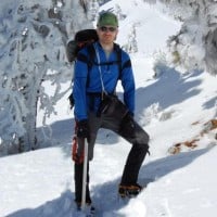
I would like to do some more self arrest practice this year as well as some glacier travel and rescue practice. I have been keeping my eyes open for some good practice slopes during the last couple of years, but haven't seen anything good and safe. I want something where you can get a bit of speed, but with a nice flat runout at the bottom.
All I can think of in the San Gabriels is the sled runs down in Manker Flats, which would only be usable for this purpose on weekdays. I doubt the Baldy Ski Area people would appreciate climbers practicing self arrest on their ski slopes.
The north side of San Gorgonio has a lot of potential, especially around the Big Draw area, but that's a winter day's hike just to get there.
Another idea I had was building some anchors on, say, the Baldy Bowl and just practicing while roped to the anchors. But you would need a lot of rope, and anyway it might not really be that safe.
I have a neighbor who used to be a mountaineering guide (he gave me that famous ice axe), and he and his buddies used to climb up to the top of a couloir on Baldy and just hurl themselves off to practice glacier rescue and self rescue. I don't yet have the skills or confidence to do that, but it might be nice to work up to that point.
Nunc est bibendum
I have went down that way many times and nobody ever said anything. I even found a ski under there once and gave it to the lift operator. He didn't say anything about not being under there.
It seems to me if you can walk down the backbone through the resort and up to Thunder Mountain to the 3 t's trail, you can walk down under the left.
It seems to me if you can walk down the backbone through the resort and up to Thunder Mountain to the 3 t's trail, you can walk down under the left.

Mitch,
i agree with Taco. just make sure it's after the rime ice missles have stopped falling and before the rockfall begins. i.e., that sweet spot a couple weeks after a storm and before warm temps make rockfall an issue. if you're not sure of your self-arrest skills i would not recommend plunge-stepping down the bowl from the summit, nor hurling yourself off a couloir , but climbing up the bowl from the hut and finding good places to glissade and practice. there are lots of decent places where the run-out keeps it safe. i'd be happy to show you if you'd like.
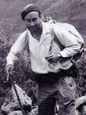
you and Cy have pretty darn cool wooden ice axes. i'm gonna have to start shopping ebay for one. it does make it more special though to have a friend hand it down to you. i look forward to seeing your axe on snow this winter.
i agree with Taco. just make sure it's after the rime ice missles have stopped falling and before the rockfall begins. i.e., that sweet spot a couple weeks after a storm and before warm temps make rockfall an issue. if you're not sure of your self-arrest skills i would not recommend plunge-stepping down the bowl from the summit, nor hurling yourself off a couloir
you and Cy have pretty darn cool wooden ice axes. i'm gonna have to start shopping ebay for one. it does make it more special though to have a friend hand it down to you. i look forward to seeing your axe on snow this winter.

The trail under the lift is used by mountain bikers who pay to have their bikes hauled up by the lift and then ride down. So, you want to watch out for bike traffic. I have never heard of any restrictions on foot traffic on that trail. We saw people going both up and down on foot last Saturday. Mt. Baldy is a pretty loose, informal, low budget operation. I can't imagine why they would care.
-
mcphersonm80
- Posts: 243
- Joined: Mon Aug 23, 2010 11:46 am
Cool, thanks for the replies. I pretty much figured it wasn't a big deal, as the ski lift operator down at the bottom saw us and didn't say anything... Will definitely watch out for those bikes next time I use it.