Trip planning, history, announcements, books, movies, opinions, etc.
mattmaxon
Posts: 1137 Joined: Mon Mar 24, 2008 12:48 pm
Post
by mattmaxon Wed Feb 17, 2010 8:08 am
Ok Ok I'll "Man Up"
it is looking east toward Dillon Divide from near Bear Divide in Pacoima Canyon
Here is a commented version of the photo
cougarmagic wrote:You only need to be 'close' on this one. Think general area. It
is in the San Gabriels.
Ze Hiker
Posts: 1432 Joined: Mon Jul 28, 2008 7:14 pm
Post
by Ze Hiker Wed Feb 17, 2010 11:59 am
strawberry
AW~
Posts: 2077 Joined: Mon Oct 01, 2007 12:00 pm
Post
by AW~ Wed Feb 17, 2010 12:49 pm
Zé wrote:strawberry
(as for the others, i don't know nothing north of sunland!)
Mt.Foxy...east side...
mattmaxon
Posts: 1137 Joined: Mon Mar 24, 2008 12:48 pm
Post
by mattmaxon Wed Feb 17, 2010 2:17 pm
AW wrote:Zé wrote:strawberry
(as for the others, i don't know nothing north of sunland!)
Mt.Foxy...east side...
AW wins! (Fox Peak)
(I figured he'd come through on this one)
mattmaxon
Posts: 1137 Joined: Mon Mar 24, 2008 12:48 pm
Post
by mattmaxon Wed Feb 17, 2010 2:20 pm
It's not a peak but where is this?
(Browne points if you can name the peak in the haze on the horizon)
AW~
Posts: 2077 Joined: Mon Oct 01, 2007 12:00 pm
Post
by AW~ Wed Feb 17, 2010 2:38 pm
Name any of the 4 named mountains pictured here...well one peak, 2 ridges and camera location.
AW~
Posts: 2077 Joined: Mon Oct 01, 2007 12:00 pm
Post
by AW~ Wed Feb 17, 2010 2:46 pm
last picture was looking northwest...this is from the same location towards the north/northeast and is a better look at the mountain on the right in the previous photo.
AW~
Posts: 2077 Joined: Mon Oct 01, 2007 12:00 pm
Post
by AW~ Wed Feb 17, 2010 2:50 pm
mattmaxon wrote:It's not a peak but where is this?
(Browne points if you can name the peak in the haze on the horizon)
Fall Creek camp trail? If so Im guessing MtPacifico in the haze.
mattmaxon
Posts: 1137 Joined: Mon Mar 24, 2008 12:48 pm
Post
by mattmaxon Wed Feb 17, 2010 3:01 pm
AW wrote:mattmaxon wrote:It's not a peak but where is this?
(Browne points if you can name the peak in the haze on the horizon)
Fall Creek camp trail? If so Im guessing MtPacifico in the haze.
Well I was going for the bridge but you've got it.....
AW~
Posts: 2077 Joined: Mon Oct 01, 2007 12:00 pm
Post
by AW~ Thu Feb 18, 2010 12:27 pm
The answer for mine was Rattlesnake peak, South Hawkins, Ross, and camera location was Iron Mtn...
Ze Hiker
Posts: 1432 Joined: Mon Jul 28, 2008 7:14 pm
Post
by Ze Hiker Thu Feb 18, 2010 1:52 pm
confusing! you took those pics from Iron mt, the peak, or like fish fork or something? first pick looks like its looking southwest?
AW~
Posts: 2077 Joined: Mon Oct 01, 2007 12:00 pm
Post
by AW~ Thu Feb 18, 2010 2:05 pm
Zé wrote:confusing! you took those pics from Iron mt, the peak, or like fish fork or something? first pick looks like its looking southwest?
It was looking northwest...from the Falls Gulch ridge of Iron Mtn..its the very beginning of the ridge that is for Iron Mtn-north route....the route joins this ridge father up...
http://mapper.acme.com/?ll=34.30392,-117.73121&z=14&t=T
Ze Hiker
Posts: 1432 Joined: Mon Jul 28, 2008 7:14 pm
Post
by Ze Hiker Thu Feb 18, 2010 2:15 pm
that first pic has rattlesnake peak, correct? that is southwest of Falls Gulch. i don't think you could see it if you were looking northwest.
AW~
Posts: 2077 Joined: Mon Oct 01, 2007 12:00 pm
Post
by AW~ Thu Feb 18, 2010 2:26 pm
Zé wrote:that first pic has rattlesnake peak, correct? that is southwest of Falls Gulch. i don't think you could see it if you were looking northwest.
hehehe..you're right
southwest it was. sorry for the confusion.
edenooch
Posts: 504 Joined: Fri Jul 03, 2009 7:42 pm
Post
by edenooch Thu Feb 18, 2010 3:11 pm
is ze still dominating every one here?
Ze Hiker
Posts: 1432 Joined: Mon Jul 28, 2008 7:14 pm
Post
by Ze Hiker Thu Feb 18, 2010 4:54 pm
ok makes sense now AW!!! my initial thought was that area but the text was indicating otherwise.
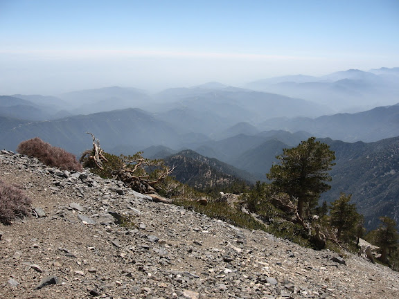
where am I standing?
Rumpled
Posts: 271 Joined: Mon Feb 25, 2008 10:57 pm
Post
by Rumpled Fri Feb 19, 2010 10:19 am
On the ground.
Ze Hiker
Posts: 1432 Joined: Mon Jul 28, 2008 7:14 pm
Post
by Ze Hiker Fri Feb 19, 2010 10:55 am
lol yes that's true.
HikeUp
Posts: 3991 Joined: Thu Sep 27, 2007 9:21 pm
Post
by HikeUp Fri Feb 19, 2010 11:11 am
Ground with a name...Earth!
Ze Hiker
Posts: 1432 Joined: Mon Jul 28, 2008 7:14 pm
Post
by Ze Hiker Fri Feb 19, 2010 1:34 pm
hint: image is looking southwest.
Taco
Snownado survivor
Posts: 6059 Joined: Thu Sep 27, 2007 4:35 pm
Post
by Taco Sat Feb 20, 2010 1:21 am
Copter Reeedge?
Ze Hiker
Posts: 1432 Joined: Mon Jul 28, 2008 7:14 pm
Post
by Ze Hiker Sat Feb 20, 2010 7:26 am
nope, but it is a ridge...
Taco
Snownado survivor
Posts: 6059 Joined: Thu Sep 27, 2007 4:35 pm
Post
by Taco Sat Feb 20, 2010 12:15 pm
A different ridge.
Taco
Snownado survivor
Posts: 6059 Joined: Thu Sep 27, 2007 4:35 pm
Post
by Taco Sat Feb 20, 2010 8:52 pm
I know that one... I just don't want to give it away...
AW~
Posts: 2077 Joined: Mon Oct 01, 2007 12:00 pm
Post
by AW~ Mon Feb 22, 2010 10:03 am
Big Horn ridge