Trip planning, history, announcements, books, movies, opinions, etc.
edenooch
Posts: 504 Joined: Fri Jul 03, 2009 7:42 pm
Post
by edenooch Thu Jan 14, 2010 3:12 pm
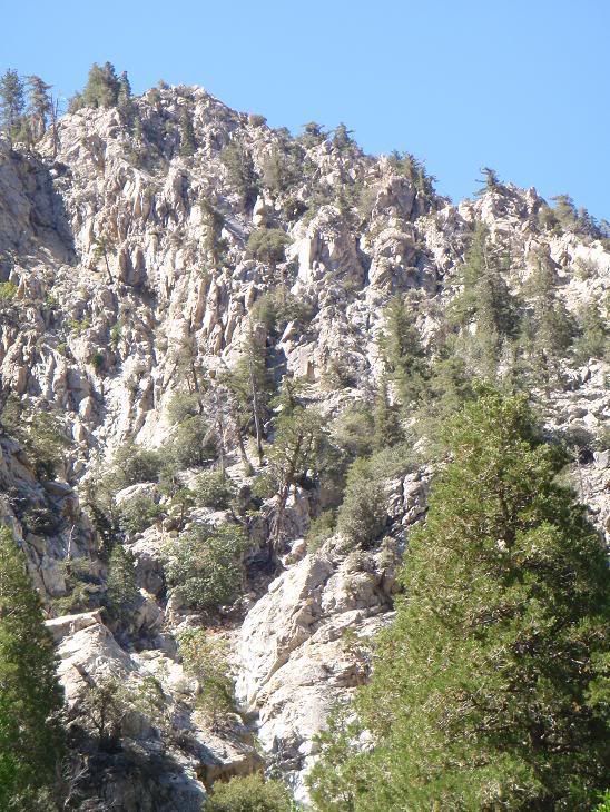
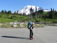
KNOWING YOU ITS FALLING ROCK or coulior
Taco
Snownado survivor
Posts: 6059 Joined: Thu Sep 27, 2007 4:35 pm
Post
by Taco Thu Jan 14, 2010 4:02 pm
AW wrote:
Mine Gulch or somewhere around Baden-Powell?
Got a picture of the drainage that this climb eminated from?
TOO EASY! 8)
lilbitmo
Posts: 1092 Joined: Tue Mar 04, 2008 9:44 pm
Post
by lilbitmo Thu Jan 14, 2010 4:10 pm
Rattlesnake or backside of it?
Taco
Snownado survivor
Posts: 6059 Joined: Thu Sep 27, 2007 4:35 pm
Post
by Taco Thu Jan 14, 2010 4:13 pm
I wish. I don't know how much of the west half of Rattlesnake isn't garbage, though there is a very steep wall on it that I tried to reach once, only to hit some suspicious activity probably involving a smokeable substance and foreign people.
Tim
Posts: 560 Joined: Tue Apr 08, 2008 8:55 pm
Post
by Tim Thu Jan 14, 2010 4:31 pm
Icehouse Canyon, probably near the Sheep Canyon headwall?
Taco
Snownado survivor
Posts: 6059 Joined: Thu Sep 27, 2007 4:35 pm
Post
by Taco Thu Jan 14, 2010 4:52 pm
Getting warmer...
Mike P
Posts: 1005 Joined: Tue Oct 02, 2007 10:48 pm
Post
by Mike P Thu Jan 14, 2010 6:07 pm
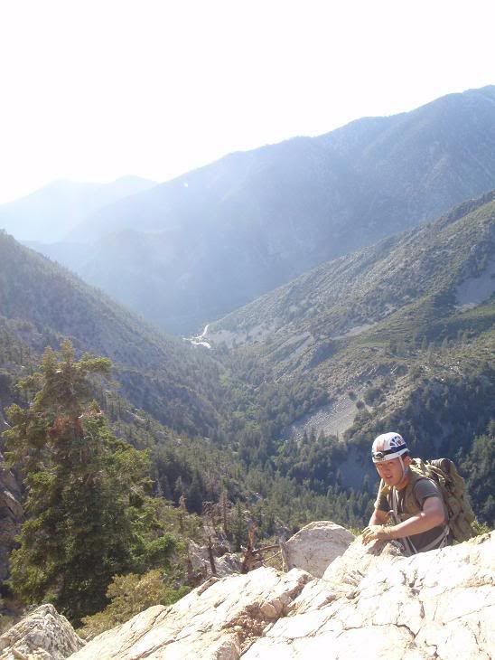
Too easy! Going up to IH Saddle from the Lytle Creek side. Middle fork of Lytle, methinks. Those are the crags above the falls... south side of the canyon.
Mike P
Posts: 1005 Joined: Tue Oct 02, 2007 10:48 pm
Post
by Mike P Thu Jan 14, 2010 6:16 pm
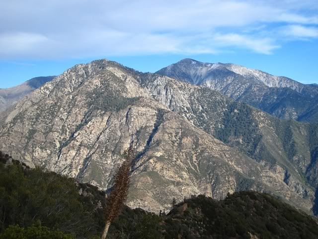
OK, all you smarty-pants and -panties. Try this:
platypii
Posts: 55 Joined: Mon Jan 26, 2009 4:58 am
Post
by platypii Thu Jan 14, 2010 6:26 pm
Mike P wrote:OK, all you smarty-pants and -panties. Try this:
...
Big Butch Wash?
Mike P
Posts: 1005 Joined: Tue Oct 02, 2007 10:48 pm
Post
by Mike P Thu Jan 14, 2010 6:37 pm
platypii wrote:Mike P wrote:OK, all you smarty-pants and -panties. Try this:
Big Butch Wash?
No, I don't think the canyon goes by that name. Hint: The peak and canyon have USGS names.
Tim
Posts: 560 Joined: Tue Apr 08, 2008 8:55 pm
Post
by Tim Thu Jan 14, 2010 7:39 pm
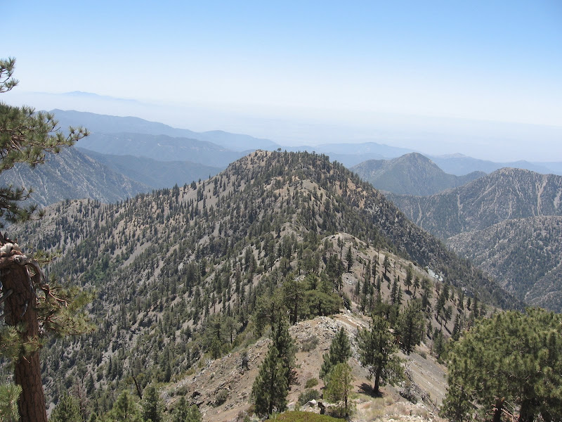
That peak looks familiar
Looks like Telegraph Peak. View is from Stockton Flats looking into Coldwater Canyon?
Mike P
Posts: 1005 Joined: Tue Oct 02, 2007 10:48 pm
Post
by Mike P Thu Jan 14, 2010 7:43 pm
Tim wrote:That peak looks familiar
Looks like Telegraph Peak. View is from Stockton Flats looking into Coldwater Canyon?
BINGO! From halfway up Stockton Flats Road...
Mike P
Posts: 1005 Joined: Tue Oct 02, 2007 10:48 pm
Post
by Mike P Thu Jan 14, 2010 7:54 pm
The peak is easy. But from where was the photo taken? (approximately)
Took the pic on last Sunday's hike.
Tim
Posts: 560 Joined: Tue Apr 08, 2008 8:55 pm
Post
by Tim Thu Jan 14, 2010 7:58 pm
moppychris
Posts: 87 Joined: Mon Sep 07, 2009 12:56 pm
Post
by moppychris Thu Jan 14, 2010 8:08 pm
Iron mt from Jackson Flat
Ze Hiker
Posts: 1432 Joined: Mon Jul 28, 2008 7:14 pm
Post
by Ze Hiker Thu Jan 14, 2010 8:18 pm
Mike P wrote:
The peak is easy. But from where was the photo taken? (approximately)
Took the pic on last Sunday's hike.
rattlesnake from Glendora mt?
Taco
Snownado survivor
Posts: 6059 Joined: Thu Sep 27, 2007 4:35 pm
Post
by Taco Thu Jan 14, 2010 8:55 pm
Mike P wrote:Too easy! Going up to IH Saddle from the Lytle Creek side. Middle fork of Lytle, methinks. Those are the crags above the falls... south side of the canyon.
Nope! It's Big Meat Pizza, in Sheep Canyon. You can see IHC parking lot in one of the pics.
Your pic is off Baldy Road/3n06. Hate walking that stretch.
Mike P
Posts: 1005 Joined: Tue Oct 02, 2007 10:48 pm
Post
by Mike P Thu Jan 14, 2010 9:10 pm
TacoDelRio wrote:Mike P wrote:Too easy! Going up to IH Saddle from the Lytle Creek side. Middle fork of Lytle, methinks. Those are the crags above the falls... south side of the canyon.
Nope! It's Big Meat Pizza, in Sheep Canyon. You can see IHC parking lot in one of the pics.
Dang it again! I didn't look close enough at the second picture
TacoDelRio wrote:Your pic is off Baldy Road/3n06. Hate walking that stretch.
Negatory! Zé is very warm.
HikeUp
Posts: 3991 Joined: Thu Sep 27, 2007 9:21 pm
Post
by HikeUp Thu Jan 14, 2010 9:17 pm
Mike P wrote:The peak is easy. But from where was the photo taken? (approximately)
Took the pic on last Sunday's hike.
Rattlesnake from Pine Mtn.? Mt. Bliss?
Mike P
Posts: 1005 Joined: Tue Oct 02, 2007 10:48 pm
Post
by Mike P Thu Jan 14, 2010 9:28 pm
HikeUp wrote:Rattlesnake from Pine Mtn.? Mt. Bliss?
Nope. Hint: the road in center right is Glendora Mtn Road (Newman Point)
Taco
Snownado survivor
Posts: 6059 Joined: Thu Sep 27, 2007 4:35 pm
Post
by Taco Fri Jan 15, 2010 2:28 am
Yay Newman Point. Good drift turn.
Mike P
Posts: 1005 Joined: Tue Oct 02, 2007 10:48 pm
Post
by Mike P Fri Jan 15, 2010 7:33 am
You got it! Glendora Ridge Motorway ~0.75 miles east of the top of Garcia Trail.
Ze Hiker
Posts: 1432 Joined: Mon Jul 28, 2008 7:14 pm
Post
by Ze Hiker Fri Jan 15, 2010 12:27 pm
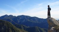
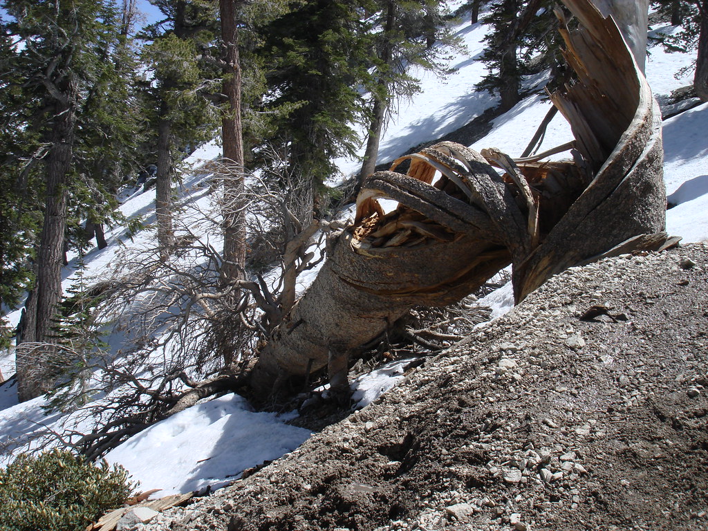
what peak is straight in front of me?
edenooch
Posts: 504 Joined: Fri Jul 03, 2009 7:42 pm
Post
by edenooch Fri Jan 15, 2010 1:31 pm
ross or lewis! dont remember cause we did both that day
lilbitmo
Posts: 1092 Joined: Tue Mar 04, 2008 9:44 pm
Post
by lilbitmo Fri Jan 15, 2010 2:16 pm
Baldy Bowl, on your way up the South Ridge where the tree expoded 4 years ago.