

After Burn: Cleaning Up After the Fire
http://www.dot.ca.gov/dist07/Publicatio ... php?id=410
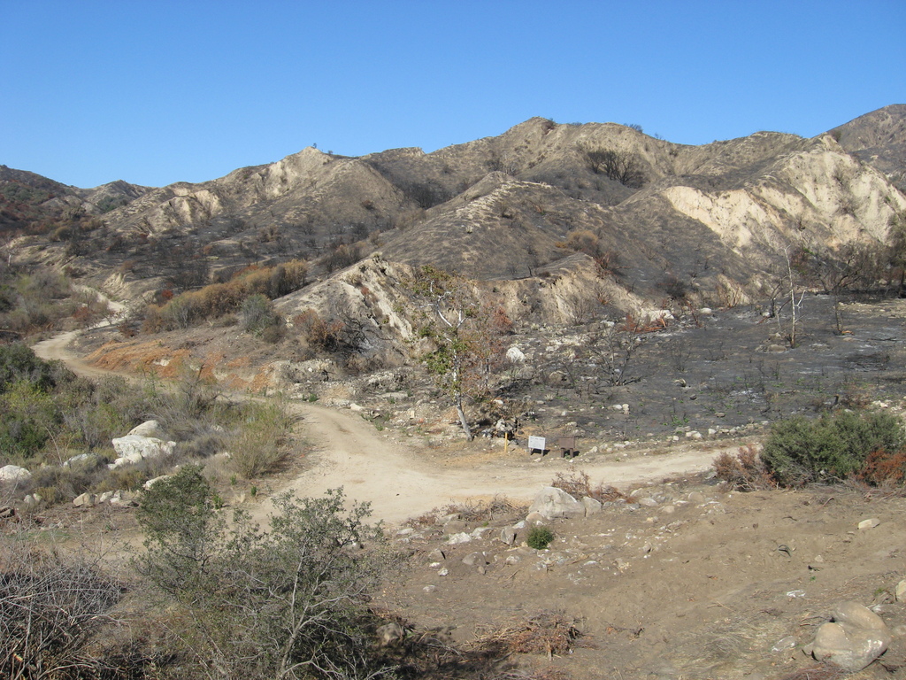
"What I worry about most is what happens this winter,” said Ed Toledo, maintenance area superintendent for North Region 3. “We’re trying to get the culverts, basins and drain inlets ready for the first rains....The goal is to have that stretch of road(ACH) open when Angeles Forest Highway, a county road, is reopened, restoring the Antelope Valley commuter route. Freeman estimates that should happen by mid- to late October. The remainder of SR-2 is scheduled to reopen by mid-November."
Governer Signs AB 110: Elsmere Canyon Heading Down The Right Path
http://santaclaritacitybriefs.com/2009/ ... ight-path/
"One of the 200 bills signed late Sunday night by the Governor was AB 110, authored by Assemblyman Cameron Smyth and supported by the City of Santa Clarita to add Elsmere Canyon back into the Rim of the Valley corridor. The bill is part of Santa Clarita’s decades-long effort to protect and preserve Elsmere Canyon, which is partially in the Angeles National Forest near the terminus of Newhall Avenue and SR 14."
Mt Baldy Ski Lifts Announces Mammoth Increase In Snow Making Capabilities
http://www.pr-inside.com/mt-baldy-ski-l ... 535431.htm
"After 15 years of negotiation with the Forestry Service we were given permission to install a new 9 million gallon reservoir,” states Keith Hunt President of the Mt Baldy Chamber of Commerce....With the reservoir and the installation of additional guns our snow making capabilities has increased almost 50% over last season."
Speaking of MtBaldy ski lifts...part 2 of the 'transportation' series
Mt Baldy Downhill Union DVD(stay tuned past 2:35)
Baldy
http://player.vimeo.com/video/5797512
Misc. News (Archive)
Trip Report – Devore Campground – Angeles National Forest(no pictures,closed area)
http://www.chayacitra.com/?p=453
"It was an older man, probably in his late 60s, with a blonde handle-bar mustache, wearing that all-too familiar puke-green Forest Service uniform. And apparently, he wasn’t too happy about my presence in the area."
Rare big-animal deaths in Angeles National Forest's fast-moving Station Fire
http://blogs.laweekly.com/ladaily/envir ... eles-fore/
"....A USFS team spent two weeks in the Station Fire area examining its effects but wasn't focused on evidence of animal deaths. However, when they stopped the vehicles, Cooper and others came upon three bears, 12 deer, two coyotes, one bobcat and a fox. (The Times said they found mountain lions, but this is not correct.). Since the animals were found by happenstance, this modest and informal survey hints at a widespread loss of big animals...."
Rare tadpoles rescued from Station Fire burn zone
http://www.sgvtribune.com/news/ci_13621141
"In a slippery, slimy rescue mission, federal workers this month scooped up and relocated 106 rare tadpoles to save them from possible fallout from the Station Fire.
When the Station Fire rolled through the mountains this August, it burned Devil's Canyon, a prime habitat for the yellow-legged frog, which is on the federal endangered species list.
So workers from the U.S. Fish and Wildlife service caught them and sent them to the Fresno Chaffee Zoo, which recently formed a partnership with wildlife service....."
Speaking of rescues....`Yuppie 911' fosters risky behavior in hikers
http://www.dailybreeze.com/latestnews/ci_13641369
also covered on several blogs....
http://blogs.thenewstribune.com/adventu ... r_grand_ca
"In the span of three days, the group pushed the panic button three times, mobilizing helicopters for dangerous, lifesaving rescues inside the steep canyon walls(Grand Canyon)....This time(third time), according to a park service report, rescuers took them out and cited the leader for "creating a hazardous condition" for the rescue teams.
Historical:
L.A. area's history lives in these unique archives
http://www.latimes.com/news/local/la-me ... 7799.story
"...The Mt. Lowe trip went up to Altadena and then to Rubio Canyon and up to Echo Mountain and then up to Mt. Lowe. . . . You should know about that. It's famous," Shidler said. From 1896 to 1936 -- the year the tavern atop the mountain burned -- it was popular: "Everyone came to Los Angeles, they went to Mt. Lowe," he said."
photo:MtLowe railway

http://bluemonocle.com/Photos/Product?itemCode=25179
History(well written) and Access to Upper Eaton Canyon (near Pasadena, CA)
http://www.lafn.org/~dave/eaton_can_hist.html
"Muir saw a potential economic use of Upper Eaton Canyon as part of a large "bee garden" to produce honey (obtained by bees from the native flowers) for beekeepers. In fact this chapter XVI, which contains this brief account of his exploration of the upper reaches of Eaton Canyon, is entitled "The Bee-Pastures" and is mostly about bee-pastures elsewhere in California...From 1915 until 1929, this was "Camp Idle Hour", a resort where one could pay to stay overnight and eat meals. Then in the 1930's it became a free public campground and remains so today... I remember seeing at least one a car parked in the "parking lot" ("Telephone Flat" per Brennen)."
Settlers had high hopes for Llano del Rio
http://www.sbsun.com/news/ci_13595163
"The dream of Job Harriman, an unsuccessful candidate for governor of California, vice president of the United States and mayor of Los Angeles, Llano del Rio Cooperative Colony started in 1914 as a model socialist community....As early as May 1914, the first families moved onto the barren site north of the San Gabriel Mountains and there was a whole lot of backbreaking work waiting for them. Water needed to be diverted from nearby Big Rock Creek, and great fields of sagebrush, creosote and rocks had to be cleared for irrigation....Hoping to get more water from Big Rock Creek, cobblestone-lined ditches were built. Unfortunately, the water flow wasn't anywhere near the amount required"
http://www.chayacitra.com/?p=453
"It was an older man, probably in his late 60s, with a blonde handle-bar mustache, wearing that all-too familiar puke-green Forest Service uniform. And apparently, he wasn’t too happy about my presence in the area."
Rare big-animal deaths in Angeles National Forest's fast-moving Station Fire
http://blogs.laweekly.com/ladaily/envir ... eles-fore/
"....A USFS team spent two weeks in the Station Fire area examining its effects but wasn't focused on evidence of animal deaths. However, when they stopped the vehicles, Cooper and others came upon three bears, 12 deer, two coyotes, one bobcat and a fox. (The Times said they found mountain lions, but this is not correct.). Since the animals were found by happenstance, this modest and informal survey hints at a widespread loss of big animals...."
Rare tadpoles rescued from Station Fire burn zone
http://www.sgvtribune.com/news/ci_13621141
"In a slippery, slimy rescue mission, federal workers this month scooped up and relocated 106 rare tadpoles to save them from possible fallout from the Station Fire.
When the Station Fire rolled through the mountains this August, it burned Devil's Canyon, a prime habitat for the yellow-legged frog, which is on the federal endangered species list.
So workers from the U.S. Fish and Wildlife service caught them and sent them to the Fresno Chaffee Zoo, which recently formed a partnership with wildlife service....."
Speaking of rescues....`Yuppie 911' fosters risky behavior in hikers
http://www.dailybreeze.com/latestnews/ci_13641369
also covered on several blogs....
http://blogs.thenewstribune.com/adventu ... r_grand_ca
"In the span of three days, the group pushed the panic button three times, mobilizing helicopters for dangerous, lifesaving rescues inside the steep canyon walls(Grand Canyon)....This time(third time), according to a park service report, rescuers took them out and cited the leader for "creating a hazardous condition" for the rescue teams.
Historical:
L.A. area's history lives in these unique archives
http://www.latimes.com/news/local/la-me ... 7799.story
"...The Mt. Lowe trip went up to Altadena and then to Rubio Canyon and up to Echo Mountain and then up to Mt. Lowe. . . . You should know about that. It's famous," Shidler said. From 1896 to 1936 -- the year the tavern atop the mountain burned -- it was popular: "Everyone came to Los Angeles, they went to Mt. Lowe," he said."
photo:MtLowe railway
http://bluemonocle.com/Photos/Product?itemCode=25179
History(well written) and Access to Upper Eaton Canyon (near Pasadena, CA)
http://www.lafn.org/~dave/eaton_can_hist.html
"Muir saw a potential economic use of Upper Eaton Canyon as part of a large "bee garden" to produce honey (obtained by bees from the native flowers) for beekeepers. In fact this chapter XVI, which contains this brief account of his exploration of the upper reaches of Eaton Canyon, is entitled "The Bee-Pastures" and is mostly about bee-pastures elsewhere in California...From 1915 until 1929, this was "Camp Idle Hour", a resort where one could pay to stay overnight and eat meals. Then in the 1930's it became a free public campground and remains so today... I remember seeing at least one a car parked in the "parking lot" ("Telephone Flat" per Brennen)."
Settlers had high hopes for Llano del Rio
http://www.sbsun.com/news/ci_13595163
"The dream of Job Harriman, an unsuccessful candidate for governor of California, vice president of the United States and mayor of Los Angeles, Llano del Rio Cooperative Colony started in 1914 as a model socialist community....As early as May 1914, the first families moved onto the barren site north of the San Gabriel Mountains and there was a whole lot of backbreaking work waiting for them. Water needed to be diverted from nearby Big Rock Creek, and great fields of sagebrush, creosote and rocks had to be cleared for irrigation....Hoping to get more water from Big Rock Creek, cobblestone-lined ditches were built. Unfortunately, the water flow wasn't anywhere near the amount required"
AW wrote:
Rare tadpoles rescued from Station Fire burn zone
http://www.sgvtribune.com/news/ci_13621141
"In a slippery, slimy rescue mission, federal workers this month scooped up and relocated 106 rare tadpoles to save them from possible fallout from the Station Fire.
When the Station Fire rolled through the mountains this August, it burned Devil's Canyon, a prime habitat for the yellow-legged frog, which is on the federal endangered species list.
So workers from the U.S. Fish and Wildlife service caught them and sent them to the Fresno Chaffee Zoo, which recently formed a partnership with wildlife service....."
Hopefully they don't all die like the pupfish in Death Valley.
Victoria Principal Charity Donation
http://www.soapchat.net/showthread.php?t=191067
"October 30, 2009: Victoria Principal joined nonprofit TreePeople and the U.S. Forest Service to announce a $25,000 gift to support TreePeople's fire restoration efforts in the Angeles National Forest. Victoria Principal's gift kicks off a fundraising goal of $250,000 to help restore the Angeles National Forest following the 2009 Station fires...."
Arroyo Seco USACE Study & Station Fire Update
http://arroyolover.blogspot.com/2009/10 ... -fire.html
"....The Angeles National Forest is closed indefinitely and USFS continue to ask hikers and others to refrain from curiosity walks along the perimeter. The extremely 'soft' footing due to erosion and ash build-up has already led to one rescue of one experienced hiker who slide deeply down a canyon when the trail unfoot literally gave way due to the post-fire conditions...."
Hiker rescued from Mt. Baldy foothills
http://www.sbsun.com/breakingnews/ci_13671258
"...The hiker, who was stuck on a small ledge around 3,200 elevation in a steep canyon near San Antonio Dam, was able to call 911 on his cell phone and ask for help..."
Body of missing Mount Whitney hiker found
http://www.visaliatimesdelta.com/articl ... iker-found
"...The body of Kenneth "Wade" Brunette, 73, of Hansville, Wash., was found at 12:45 p.m. Saturday on the eastern slope of the mountain by a search-dog team, National Park Service Spokeswoman Adrienne Freeman said"
Religious group pushes to protect San Gabriel Mountains
http://latimesblogs.latimes.com/greensp ... ction.html
"The group, Progressive Christians Uniting, is touting the proposal(NPS) to congregants of dozens of San Gabriel Valley churches near the 650,000-acre range that constitutes about 70% of Los Angeles County's open space....."
Mountain High Resort Now Open In Wrightwood(includes slideshow)
http://cbs2.com/tv/Mountain.High.Resort.2.1281612.html
Initial reports - KNX et al that ACH&AFH will open November 25.
11/06/2009 13:24 Filming ''Psychic Hollywood'' ACH 6.9 miles up the Crest
-murder sites in the forest episode
Authorities release details in case of Pomona man linked to three killings
http://www.contracostatimes.com/california/ci_13750346
"....Authorities identified the two additional victims as El Monte native David Arthur Padilla Jr., 29, whose body was found under a Chino freeway overpass, and 32-year-old Lorraine Minjarez of Covina. Minjarez's body was buried along Mt. Baldy Road in the San Gabriel Mountains....She was strangled and suffered slash wounds to her neck,....On Monday, a man who lives next to Caballero's parents in a Mira Loma senior-housing complex said he remembered Caballero(murder suspect) as a nice, pleasant person"
Nov 12: Wildfires and Their Aftermath: Assessing the Station Fire
http://cssd.ucr.edu/EMails/CSSD0911.html
"Jody Noiron, Angeles National Forest Supervisor, will discuss the aftermath of the devastating Station Fire, its effect on the watershed ecosystems, and what homeowners living near wildfire areas can do to help protect themselves"
Pasadena and activists clash over removal of non-native trees in Hahamongna
http://www.examiner.com/x-28812-Altaden ... Hahamongna
"While the U.S. Forest Service is advising Pasadena to remove non-natives, some community activists would prefer a wait-and-see approach until more is known about the effects of the wildfire. City officials fear that without native vegetation to slow their spread, non-natives may propagate in burned areas.....Tim Brick, Managing Director of the Arroyo Seco Foundation, counters, "The logic is quite the opposite of what they are saying. It doesn't make a lot of sense at all."
CresentaValley chamber hands out awards
http://www.glendalenewspress.com/articl ... 110709.txt
"Organization of the Year: Montrose Search and Rescue"
search&rescues elsewhere:
Climber recovering from long Mount Shasta tumble
http://www.google.com/hostednews/ap/art ... QD9BNMCJG0
"A climber who tumbled more than 1,500 feet down Mount Shasta escaped with only a broken hip, authorities said Monday.
Julian Lopez, 43, and a friend were taking the Avalanche Gulch route Saturday on the 14,000-foot mountain in Northern California when the mishap occurred, said Susan Gravenkamp, spokeswoman for the Siskiyou County Sheriff's Office."

Driving up Mt. Baldy Road on Saturday morning about 5:45am, I saw at least 3 or 4 cop cars cruising or on the side of the road with their spots on. Thought for sure I was gonna get stopped for questioning.AW wrote:Authorities release details in case of Pomona man linked to three killings
http://www.contracostatimes.com/california/ci_13750346
"....Authorities identified the two additional victims as El Monte native David Arthur Padilla Jr., 29, whose body was found under a Chino freeway overpass, and 32-year-old Lorraine Minjarez of Covina. Minjarez's body was buried along Mt. Baldy Road in the San Gabriel Mountains....She was strangled and suffered slash wounds to her neck,....On Monday, a man who lives next to Caballero's parents in a Mira Loma senior-housing complex said he remembered Caballero(murder suspect) as a nice, pleasant person"

See last entry for source
11/16/2009 15:14 head injury Medical Aid Mtn High West
11/17/2009 09:53 Ski Injury Medical Aid Mtn High West
11/15/2009 11:22 report of smoke on Sheep Fire- Smoke Check
Video of Sheep fire:
http://www.wrightwoodcalif.com/forum/in ... .msg225834#
Speaking of fires:
Containment(art of socal fires)
http://www.artslant.com/ny/articles/show/11607
Station Fire Review(opinion)
http://westinstenv.org/sosf/2009/11/14/ ... re-review/
Before the deluge(A trip to Sunland-Tujunga)
http://www.1134.org/blog/2009/11/15/before-the-deluge/
or skip to blog picture of area:
http://www.1134.org/blog/images2009/IMG_3905a.jpg
The Haunted Forest (Cobb Estate)
http://www.strangeusa.com/ViewLocation. ... tionid=205
"Angeles National Forest at the top of Lake avenue. Screams of people can be heard and strange lights can be seen from the flashlights they once carried."
Altadenablog reports on the Cobb Estate area as well-
"On the trail of "Ram-bro'" this morning"
http://www.altadenablog.com/2009/11/on- ... rning.html
"As stated in prior e-mails, this camo-dressed hunter has a history of poaching arrests and convictions. He can be threatening and is often armed with a hunting knife, large compound cross-bow and possibly a firearm. He is reportedly hunting bears in the closed burn areas and may be aware of recent cougar sightings, which could bring him in close proximity to residences near and in the Forest, particularly on Chaney Trail, in the Meadows (off Canyon Crest) and up in Millard Canyon."
Napping bear found in yard(no pictures found)
http://www.glendalenewspress.com/articl ... 111209.txt
"LA CRESCENTA — California Fish and Game agents Wednesday tranquilized a black bear that was caught sleeping in the backyard of a home.
A resident saw the bear snoozing in the bushes in her backyard on the 2600 block of Prospect Avenue and called sheriff’s deputies, said Los Angeles County Sheriff Lt. Angela Shepard.
“He went to sleep in the bushes, and he didn’t want to be bothered really,” she said....."
Eaton canyon & strong winds from LA Times:
"[Updated at 8:26 p.m.: Strong winds in Eaton Canyon blew down a tree in Altadena, blocking a private road off Pinecrest Drive. A car was hit by the falling tree, authorities said.]"
-Chantry Flats-Winter Creek Loop-

http://www.socaltrailriders.org/forum/r ... -loop.html
Sunrise on Baden-Powell photo:
http://www.trailjournals.com/photos.cfm ... 518&back=1
much better than Cucamonga creek/canyon graffiti
http://www.picable.com/Nature/Sunrise/C ... ti.1117391
Historical Chapman's Icehouse canyon resort elev 5280 images:
http://content.ci.pomona.ca.us/cdm4/res ... =title%7Cf
Also contains a couple of Camp Baldy(one picture above), 1 Switzer, 1 San Dimas canyon
New Legislation:
H.R. 4200: San Gabriel Watershed Restoration Act
http://www.govtrack.us/congress/billtex ... =h111-4200
Not to be confused with the San Gabriel Watershed Study Act, aka NPS study introduced in 2003 and currently under public review of the NPS brief.
Santa Ana sucker fish may get more protection
http://www.pe.com/localnews/inland/stor ... f8d88.html
"Federal wildlife officials on Tuesday proposed new habitat protections for a rare fish along its namesake Santa Ana River, which could make it tougher for Inland water providers to tap the river.
The U.S. Fish and Wildlife Service, as part of a lawsuit settlement with environmental groups, is examining 9,605 acres of river and creek terrain in Los Angeles, Orange, Riverside and San Bernardino counties for designation as critical habitat for the Santa Ana sucker, a fish threatened with extinction."
More station fire/Angeles Crest Highway pics
http://geekhiker.wordpress.com/2009/12/ ... re-photos/
http://blog.kurtlawson.com/?p=177
December 2009 News and Updates
http://www.br0nw3n.com/blog/2009/decemb ... d-updates/
"The BAER team’s plan to protect my cabin(location:Big Tujunga) and others that survived the Station Fire was shot down by Forest Service bureaucracy"
Storm report, thanks to sierraphotograhy.com
http://www.sierraphotography.com/wxnote ... 158PST.pdf
No need for the rainmaker
http://www.halfmoonbaymemories.com/2009 ... -rainmaker
Eaton canyon rescue(called in via cell phone)
4 Hikers Rescued After Being Stranded During Storm
http://www.ktla.com/news/landing/ktla-h ... 0116.story
"The hikers became stranded around 4:30 p.m. Saturday when what authorities call a "torrent of water and debris flow" made it impossible for them to move from their position......
A sheriff's helicopter was able to hoist the "cold and shaken" people out by around 7:00 a.m. Sunday when the sun rose, according to Los Angeles County sheriff's Sgt. Phil Barth"
Eaton canyon creek - http://gooddayla.blogspot.com/2009/12/e ... wells.html
JUST IN: Hiker found on Mount Badly; Copter rescue planned
http://blogs.pe.com/news/digest/2009/12 ... unt-b.html
"Helicopter crews have found a missing hiker on Mount Baldy and are making preparations to hoist him to safety, according to San Bernardino County sheriff's officials.
Tentatively identified as 57-year-old David Griffith, the hiker has been the target of a search since 6:51 p.m. Sunday, said sheriff's spokeswoman Arden Wiltshire.
A sheriff's patrol helicopter crew spotted him at 8:17 a.m. But a larger helicopter with a rescue hoist is being readied to make the rescue.
A hiking companion reported that he last saw Griffith about 3 p.m. Sunday when they accidentally got separated near the top of Mount Baldy, Wiltshire said. Griffith had food, a jacket and helmet, but was said to be low on water and inadequately equipped to spend the night on the mountain.
"We had searchers out all night, beginning about 10 p.m.," Wiltshire said.
But bad weather prevented a helicopter search until dawn today, she said."
Angeles Crest Highway Still Closed(although twas only rockslides and no major landslides from news reports)
http://www.myfoxla.com/dpp/weather/ange ... s-20091213
"A 12-mile stretch of the Angeles Crest Highway was shut down Saturday as dozens of firefighters tried to clear the scene, said county fire Capt. Frank Reynoso. No injuries were reported.
Seventy of the vehicles had been freed by night, but another 20 were forced to remain overnight, authorities said.
About 50 of the stranded motorists gathered at Newcomb's Ranch Restaurant off the highway"
More Baldy weekend pictures(mainly ski lift)
http://forum.surfermag.com/forum/showth ... 054&page=0
12/25/2009 15:40 100 pepole on ice / Medical Aid Public Assist jackson lake(Wrightwood)
12/28/2009 13:01 Fall Victim Medical Aid Inspiration Point/Mt Lowe area
http://www.altadenablog.com/2009/12/mor ... escue.html
"Altadena Sheriff’s Station received information from Los Angeles Police Department personnel about a lone hiker stranded on a ledge in the Chaney Trail-Mount Lowe area of the Angeles National Forest. The hiker slipped off of a freshly-cut trail and fell 100 feet down the side of a cliff face, injuring his right leg during the descent. He landed in a dangerously precarious position and was unable to maneuver out of it. His cell phone only had intermittent coverage, but he was able to dial 911 and relayed his location to LAPD personnel. "
Williamson Rock in Angeles Forest remains closed to protect endangered frog species
http://scpr.org/news/2009/12/22/william ... osed-prot/
"The Williamson Rock closure, which limits access to an area of about 1,000 acres north of the Angeles Crest Highway in the vicinity of Cooper Canyon, has been in place since Dec. 2005, according to the Forest Service. A new order announced by the Forest Service Monday comes into effect on Friday, Jan. 1, and extends the closure until Dec. 31, 2010. "
Replanting the forest
http://www.altadenablog.com/2009/12/rep ... orest.html
"We were asked to pass on this information from the National Forest Service about volunteer efforts to restore the trees in the forest....
'Our plan is to revamp our volunteer web page (http://www.fs.fed.us/r5/angeles/volunteering/) so that it includes a calendar of scheduled events, contacts, etc. That way, anyone who wants to volunteer could immediately get plugged in. However, that system is not in place yet. What people CAN do is go to that site and fill out a volunteer application. We then add their names to our database, and can keep them informed regarding volunteer opportunities.....'-Kathy Peterson
Angeles National Forest"
Another hiking/trails site
http://hiking-california.com/?cat=6
Sanchez proposes creating jobs by fixing forests
http://www.sgvtribune.com/news/ci_14069623
"Rep. Linda Sanchez, D-Lakewood, is pushing legislation to provide billions of federal dollars for repair and construction projects in the country's national parks and forests...... In addition to receiving a boost in the last stimulus package, regular funding for national parks in 2010 increased by $219 million - an 8 percent increase over the previous year. "
12/27/2009 12:16 Mt. Waterman Closed/No Security
http://www.mtwaterman.org/
"12-21-2009 - 6am - Mt Waterman still has a base of 8-15 inches, we need around 2-3 feet of heavy snow to get our season started"
Sierradescents.com:
http://www.sierradescents.com/skiing/20 ... candy.html
Maybe mised this one early this year
http://www.sierradescents.com/skiing/sa ... -face.html
Fish canyon falls

Sigh.... Why do we need to interfere with the forest's process of restoring its own trees on it's own time line? What a waste of time and money....AW wrote:Replanting the forest
http://www.altadenablog.com/2009/12/rep ... orest.html
"We were asked to pass on this information from the National Forest Service about volunteer efforts to restore the trees in the forest....
'Our plan is to revamp our volunteer web page (http://www.fs.fed.us/r5/angeles/volunteering/) so that it includes a calendar of scheduled events, contacts, etc. That way, anyone who wants to volunteer could immediately get plugged in. However, that system is not in place yet. What people CAN do is go to that site and fill out a volunteer application. We then add their names to our database, and can keep them informed regarding volunteer opportunities.....'-Kathy Peterson
Angeles National Forest"
Sheriff’s deputy kills himself
http://www.the-signal.com/news/article/22951/
"Deputy Silviano Orozco, 38, of Glendora, was found dead in his car Monday on East Fork Road and was the victim of a gunshot wound, said Los Angeles County Lt. Fred Corral."
Hog Wild
http://glendoramtnroad.blogspot.com/201 ... -wild.html
"This afternoon the site(Wildcad) listed an item timestamped at 14:26, "Large pig in the sun" - reported on Glendora Mountain Road at mile marker 13.71. "
California Man Pleads Guilty to Auto Insurance Fraud
http://www.claimsjournal.com/news/west/ ... 106410.htm
"Noel Perez of Azusa, Calif., has pled guilty to insurance fraud after setting his vehicle on fire at the entrance to Angeles National Forest on Oct. 27 and submitting a fraudulent insurance claim. He was sentenced Dec. 22 to 180 days in jail and three years of probation,"
Foothill city of Monrovia struggles to deal with its bear population
http://latimesblogs.latimes.com/lanow/2 ... ation.html
"According to a report from the Monrovia Police Department, the number of bear calls from residents grew from 120 in 2008 to more than 460 in 2009. Officials said they cannot explain the increase but that it doesn't necessarily mean more bears are roaming the city.
City leaders have asked their staff to look into ways to limit bear activity in neighborhoods, including possibly mandating bear-proof trash cans and limiting how long residents can leave their trash cans out. The idea of allowing electronic gates has also been talked about."
Hiker injured in Mt. Baldy(1/2/2010)
http://www.sbsun.com/news/ci_14111290
"San Bernardino County Sheriff's deputies received a call about an injured hiker at 1:30 p.m., according to a sheriff's official. The caller reported that a woman had fallen while hiking in the Ice House Canyon area"
Mountain High Ski Resort and Vans Announce Sponsorship Deal
http://www.utahskier.net/utah_skier/201 ... 05-09.html
"WRIGHTWOOD, CA – Mountain High Resort announced today that Vans is now the official terrain park sponsor"
A family's scorched dreams(BigTujunga canyon)
http://www.dailynews.com/news/ci_14113615
"Built in 1947, the Marquisses' cabin at 2320 Stonyvale Road preceded strict county fire safety regulations requiring that landowners provide access as well as water to the proposed new construction - requirements made financially unfeasible today.
A 200-foot bridge would have to be built to span the creek that separates the Marquisses' secluded cabin from the only access for emergency vehicles. That bridge and other required upgrades to the surrounding hillside and land would cost more than $3.5million, according to Marquiss. "
Station fire fieldwork(Big Tujunga...Im almost 100% sure the side canyon referred to is Ybarra canyon)
http://urbanearth.gps.caltech.edu/2010/ ... fieldwork/
"As a part of the debris flow monitoring project, we recorded the geomorphic response of several watersheds within the burn area to the storm that occurred 12 – 14 December, 2009."
Barefoot Hike @ East Fork of San Gabriel Valley river
http://consciousplanet.wordpress.com/20 ... ley-river/
Goes along with http://www.jokersupdates.com/jarticles/ ... ticle=1503 re: the TV show?
"On one heart-pounding date, Jake Pavelka and one bachelorette bungee jump off the infamous Bridge to Nowhere in the San Gabriel Mountains"
O/T: some Ojai action
Matilija Creek
http://songsofthewilderness.wordpress.c ... ija-falls/
Rose Valley Falls
http://sandiheller.blogspot.com/2009/12 ... _6027.html

I grew up in Azusa and we used to joke that we did not have the smartest criminals. Little appears to have changed over the years.AW wrote:California Man Pleads Guilty to Auto Insurance Fraud
http://www.claimsjournal.com/news/west/ ... 106410.htm
"Noel Perez of Azusa, Calif., has pled guilty to insurance fraud after setting his vehicle on fire at the entrance to Angeles National Forest on Oct. 27 and submitting a fraudulent insurance claim. He was sentenced Dec. 22 to 180 days in jail and three years of probation,"
01/19/2010 10:55 Mt Waterman - Stranded In Forest Text
Checking in on Angeles National Forest trails(1/15/10)
http://latimesblogs.latimes.com/outpost ... rails.html
"A Christmas Day hike I took on the Gabrielino Trail out of Altadena was an eye-opener. Hikers walked around a closure sign and over a big mound of dirt to continue along the trail lining the Arroyo Seco (left).
Out of curiosity, and since nothing seemed to be stopping people, I followed the crowd and continued on to Gould Mesa...After the hike, I called the forest service to find out how "closed" the area actually is."
Man rescued after spending night trapped in SUV in Angeles National Forest(Hwy39)
http://latimesblogs.latimes.com/lanow/2 ... orest.html
" A 74-year-old man was rescued this morning after spending the night trapped in his SUV, which had tumbled about 100 feet down an embankment in Angeles National Forest, authorities said"
Arcadia, Sierra Madre, Monrovia seeking to turn road over to county
http://www.pasadenastarnews.com/news/ci_14211470
"For years, Arcadia, Sierra Madre and Monrovia have shared ownership with Los Angeles County of Santa Anita Canyon Road, a winding 3-mile mountain road leading up into the Angeles National Forest.....Now those cities are close to completing a deal that would turn the road over to county control, on the condition that they do some repairs first"
Famous Frogs That Escaped California Fire Threatened by Mudslides, Red Tape
http://www.onearth.org/article/frogsfire-049
"Bureaucrats won’t move them and zoos won’t take them; now heavy rains are predicted next week"
For bears in the San Gabriel Mountains, trouble-making is in their DNA
http://www.sgvtribune.com/news/ci_14210142
"Black bears - the same ones rummaging through trash, splashing around in swimming pools and alarming residents in Monrovia and Duarte - are not indigenous to the region.
In fact, many of the black bears living in the Angeles National Forest trace their roots back to a small group of "problem bears" transplanted into the area decades ago by State Department of Fish and Game officials"
human skulls
http://watershednews.blogspot.com/2010/ ... kulls.html
"Two skulls discovered Dec. 24 and Dec. 26 in a mountain gully scorched by the Station Fire belonged to a man and a woman, respectively, a coroner's investigator said today."
Conservancy says: take a hike at Rubio Canyon
Arroyos & Foothills Conservancy is announcing a series of hikes on their new property(@Rubio canyon)...
http://www.altadenablog.com/2010/01/con ... -hike.html
Cucamonga canyon http://brendamwpictures.shutterfly.com/28

Eaton canyon artists
http://dailypaintersinternationalartgal ... anyon.html
Almost every Thursday a group of painters loosely called the "Thursday Morning Irregulars", who are mostly from the nearby San Gabriel Valley, get together to paint outdoors
Checking in on Angeles National Forest trails(1/15/10)
http://latimesblogs.latimes.com/outpost ... rails.html
"A Christmas Day hike I took on the Gabrielino Trail out of Altadena was an eye-opener. Hikers walked around a closure sign and over a big mound of dirt to continue along the trail lining the Arroyo Seco (left).
Out of curiosity, and since nothing seemed to be stopping people, I followed the crowd and continued on to Gould Mesa...After the hike, I called the forest service to find out how "closed" the area actually is."
Man rescued after spending night trapped in SUV in Angeles National Forest(Hwy39)
http://latimesblogs.latimes.com/lanow/2 ... orest.html
" A 74-year-old man was rescued this morning after spending the night trapped in his SUV, which had tumbled about 100 feet down an embankment in Angeles National Forest, authorities said"
Arcadia, Sierra Madre, Monrovia seeking to turn road over to county
http://www.pasadenastarnews.com/news/ci_14211470
"For years, Arcadia, Sierra Madre and Monrovia have shared ownership with Los Angeles County of Santa Anita Canyon Road, a winding 3-mile mountain road leading up into the Angeles National Forest.....Now those cities are close to completing a deal that would turn the road over to county control, on the condition that they do some repairs first"
Famous Frogs That Escaped California Fire Threatened by Mudslides, Red Tape
http://www.onearth.org/article/frogsfire-049
"Bureaucrats won’t move them and zoos won’t take them; now heavy rains are predicted next week"
For bears in the San Gabriel Mountains, trouble-making is in their DNA
http://www.sgvtribune.com/news/ci_14210142
"Black bears - the same ones rummaging through trash, splashing around in swimming pools and alarming residents in Monrovia and Duarte - are not indigenous to the region.
In fact, many of the black bears living in the Angeles National Forest trace their roots back to a small group of "problem bears" transplanted into the area decades ago by State Department of Fish and Game officials"
human skulls
http://watershednews.blogspot.com/2010/ ... kulls.html
"Two skulls discovered Dec. 24 and Dec. 26 in a mountain gully scorched by the Station Fire belonged to a man and a woman, respectively, a coroner's investigator said today."
Conservancy says: take a hike at Rubio Canyon
Arroyos & Foothills Conservancy is announcing a series of hikes on their new property(@Rubio canyon)...
http://www.altadenablog.com/2010/01/con ... -hike.html
Cucamonga canyon http://brendamwpictures.shutterfly.com/28
Eaton canyon artists
http://dailypaintersinternationalartgal ... anyon.html
Almost every Thursday a group of painters loosely called the "Thursday Morning Irregulars", who are mostly from the nearby San Gabriel Valley, get together to paint outdoors
Top of San Gabriels appear to 'explode'
http://www.ocregister.com/articles/-231460--.html?pic=1
"It briefly appeared this morning like a huge explosion had taken place in the upper reaches of the San Gabriel Mountains. What people actually witnessed was a couple of huge clouds that popped up because of light winds blowing offshore from the high desert."
Parking at MtBaldy
A Day on Mt. Wilson
http://www.televisionbroadcast.com/article/93554
"The mountaintop was spared, thanks to relentless efforts of an army of firefighters, but long stretches of land along area roads are blackened and bare. El Niño rains have loosened rocks and spilled mud across Angeles Crest Highway. Ice and snow has blanketed higher elevations. Access, where possible, is restricted...."I saw a guy with his windshield blown out by a rock,” Ortiz says. As we make the twisting climb, an incredible sight comes into view. A soaring red-and-white guyed tower stretches above the treetops against a perfectly azure sky.
Big Tujunga re-opened to restricted traffic
http://mayorsampressrelease.blogspot.co ... icted.html
"A 20-foot section of Angeles Forest Highway was washed away during the storms. Repairs are expected to take at least six weeks to complete.....Caltrans has also advised that Angeles Crest Highway also remains closed due to mudslides and debris. Caltrans will re-open the highway when clean-up has been completed. "
Blogsphere....mostly standard hikes including photos
http://www.hikespeak.com/los-angeles/sa ... mountains/

Really?AW wrote:Top of San Gabriels appear to 'explode'
http://www.ocregister.com/articles/-231460--.html?pic=1
"It briefly appeared this morning like a huge explosion had taken place in the upper reaches of the San Gabriel Mountains. What people actually witnessed was a couple of huge clouds that popped up because of light winds blowing offshore from the high desert."
Hiker hospitalized after fall in mountains
http://www.dailybulletin.com/ci_14312793
"RANCHO CUCAMONGA
A 22-year-old man was hospitalized after he fell about 50 feet Sunday afternoon near a hiking trail.
The man, whose name was not immediately available, fell near a waterfall in the San Gabriel Mountains north of Sapphire and Almond streets, said Donna Mueller, San Bernardino County fire dispatch supervisor.
The man was discovered unconscious and breathing at 4:21 p.m. He was airlifted by a sheriff's helicopter for treatment at Arrowhead Regional Medical Center in Colton"
Angeles Crest Highway to remain closed through late March(same for Angeles Forest Highway,etc)
http://latimesblogs.latimes.com/lanow/2 ... march.html
"A more than 40-mile stretch of Angeles Crest Highway will remain closed to the public until late March, Caltrans officials said Wednesday.
The stretch from La Cañada Flintridge to Islip Saddle (at a junction with Highway 39) has been closed since Jan. 18 when heavy rains began that caused mudslides and washed away roads along the route in the Angeles National Forest"
La Cañada presses U.S. Forest Service for cooperation to prevent debris flows
http://the818now.com/2010/02/02/la-cana ... ris-flows/
"La Cañada Flintridge Mayor Laura Olhasso said Monday that the city is pressing the U.S. Forest Service for increased cooperation in implementing debris-flow mitigation efforts in the Station fire burn areas......
Many affected La Cañada properties abut the Angeles National Forest. County engineers and residents, however, were not allowed to go on to national forest land to position sandbags or other barriers to direct runoff away from properties and into the public right-of-way.
There have been several incidents of debris running from the slopes of Angeles National Forest onto private property during rainstorms...."
Trails 101: Basic Concepts of Trail Work Class Offered by Sierra Club & Angeles National Forest (Feb 2010)
http://www.angeles.sierraclub.org/AFRP/ ... _Page.html
"first all day trail work training session will be conducted on Saturday, Feb. 27, 2010. Consisting of a half-day of classroom instruction followed by a half-day of field work on one of the trails out of Chantry Flat, the Trails 101 course will be taught by Andrew J. Fish, Non-motorized Trails Manager for the Angeles National Forest. Best of all, the class is FREE. "
Snow items:
http://www.sierradescents.com/events/20 ... -race.html
"Local climber and so-so skier Hamik Mukelyan is organizing an informal ski mountaineering race Sunday, February 21 (weather-depending), at Mount Baldy’s southeast bowl. Meet time is 10 a.m. at the ski hut. Course details are slim, but the route will be marked with wands, and Hamik expects 10-15 competitors. No sign up necessary: just appear on time at the hut, and you’re in. "
also....
Telegraph Peak: North Face
http://www.sierradescents.com/skiing/20 ... -peak.html
Snow Camping 2010(Liebre Mtn)
http://www.adventureduo.com/2010/02/sno ... -2010.html
Shooting range near Azusa leaves its mark, flourishes during recession
http://www.sgvtribune.com/news/ci_14311868
By Daniel Tedford Staff Writer
Posted: 02/01/2010 02:43:33 PM PST
AZUSA - When Joe Cavanaugh was a child, his father would shuttle him and his brothers to the Angeles Forest north of Azusa and teach them how to shoot.
Cavanaugh has fond memories of those days, which led him to a career in national security.
So it was something of a labor of love when in 1985, he and his brother helped build the Burro Canyon Shooting Park on East Fork Road off Highway 39 near the Morris Reservoir.
"In those days, our dad drove our butts outdoors and made us appreciate it," said Cavanaugh, 61. "One of those things where a avocation became a vocation."
The park opened in in 1993, but work to create it began eight years earlier when Cavanaugh and his brother approached the Angeles National Forest with their idea.
Forest officials had been interested in creating a range after issues had arisen with the open shooting law throughout the forest, which has since been changed.
Cavanaugh's brother has since left the business, but he pushed forward. It was tough at first, but eventually word of mouth and the lack of nearby shooting ranges that offered shotgun, rifle, hand gun and private ranges helped to build a solid base of customers, Cavanaugh said.
"It took quite a few years to make it profitable," he said. "My wife and I were pinching pennies for a while."
And despite the recession, the business has found a niche that allows it to be nearly immune, he said.
"It is like the movie industry in the Great Depression. That is when it took off," Cavanaugh said. "It is a form of escapism. This seems to be a good form of entertainment for a lot of folks."
The range costs $10. It is closed to the public on Tuesdays.
The cost is $20 per shooter for a private range with a minimum of four people, and $30 an hour for a sporting clay shooting range.
JPL employees Woltan Choi, 34, and Rudy Gutierrez, 33, have been to the range twice and enjoy the surroundings while having a great place to practice shooting Choi's Sig Sauer P229 handgun.
"It is a good way to just ... blow off some steam," Choi said.
The park will see as many as 300 people come through on a weekend or holiday, Cavanaugh said. Monterey Park Police keep a trailer at the park and other law enforcement agencies often use the facility for practice.
Companies, birthday parties, and other large groups come to use the private ranges available.
The atmosphere and service at the park is one thing Cavanaugh wanted to focus on when it opened. When he had gone to ranges in the past, the service wasn't customer friendly.
That isn't the case at Burro, he said.
"We wanted to run them differently - from a Nordstrom's point of view," Cavanaugh said with a grin.
Snow play leads to injuries in Mt. Baldy
http://www.sbsun.com/breakingnews/ci_14405808
http://www.sierradescents.com/skiing/20 ... verse.html
"I knew, going in, that a ski traverse linking Mount Baldy and Iron Mountain via San Antonio Ridge was definitely pushing the limits. ......When we did finally find the road, at ‘Widman Ranch’, we also found a great many NO TRESPASSING signs plus a very agitated man who apparently likes to live a long, long way from civilization...."
More sections of Angeles Crest Highway&ANF reopen(to restricted access)
http://scpr.org/news/2010/02/16/more-se ... ay-reopen/
"Angeles Crest Highway remains closed except for the area between Upper Big Tujunga Canyon Road and Mt. Wilson Road, also open to local residents, contractors and emergency vehicles only.
The remainder of Angeles Crest Highway, from La Canada Flintridge to Mount Wilson Road is not expected to reopen until late March."
Bears are all the rage in Monrovia
http://articles.latimes.com/2010/feb/13 ... -2010feb13
"....Samson might receive a different reception in Monrovia now.
The 600-pound bear became the city's unofficial mascot after appearing in the early 1990s. With a penchant for taking dips in hot tubs and eating from trash cans, Samson had neighbors congregating for glimpses of him. When he was trapped and carted away, the city rallied to save him from being euthanized.
Samson made national headlines and spent his last years at the Orange County Zoo.
But urban-curious bears are no longer a novelty. The Monrovia Police Department responded to more than 450 bear calls last summer and has taken to logging repeat offenders -- identified by size, color and mannerisms -- into its database with a photo and assigned number..."
Mile 78: road tripping with Danny "Doctor" Zapalac
http://espn.go.com/action/snowboarding/ ... st/4925087
"Mile Seventy Eight takes you on a photographic odyssey; a story of freedom and spontaneity. Three {snowboarding} friends leaving everyday life to travel into the Angeles National Forest on the heels of the biggest storm to hit Southern California in a decade."
Road To Nowhere
http://www.pasadenaweekly.com/cms/story ... here/8388/
"According to the mythology of the Native America Tongva people who lived in the Arroyo Seco hundreds of years ago, a coyote challenged a river to a race.After running as fast as he could, the coyote managed to beat the rushing water, then collapsed from fatigue. The river then roared by with laughter, taking the name “Hahamongna,” a word which in Tongva means flowing water, fruitful valley.....But on Monday night, any laughter to be heard took on an air of suspicion by critics of the controversial Hahamongna Watershed Park Master Plan — a proposal that’s been in the planning stages for years and would place a two-lane bike trail and nature center in the 1,300-acre parkland in the Upper Arroyo Seco while preserving most of the area as open space"
http://www.sbsun.com/breakingnews/ci_14405808
San Antonio Ridge Traverse(includes video)"The left over snow and beautiful weather made for a great combination Monday as people made their way up the mountain for sledding and snow play on Presidents Day. But some holiday visitors left Mt. Baldy with broken bones and kept Mt. Baldy firefighters busy.
In one hour, fire dispatchers received about 10 calls regarding injuries off of Mt. Baldy Road from "people sledding and running around," said Jaime Vilches, dispatch supervisor for the San Bernardino County fire communications.
"There's been a lot of broken bones, a lot of falls" from sledding accidents," Vilches said.
The "snow players" congregated near Manker Camp ground, below the mountain's ski area, near the snow crest lodge, Vilches said.
All of the injuries were minor, he said, and were reported between 2 and 3 p.m. "It (was) a holiday and a beautiful day," Vilches said. "Everybody (was) outside playing."
http://www.sierradescents.com/skiing/20 ... verse.html
"I knew, going in, that a ski traverse linking Mount Baldy and Iron Mountain via San Antonio Ridge was definitely pushing the limits. ......When we did finally find the road, at ‘Widman Ranch’, we also found a great many NO TRESPASSING signs plus a very agitated man who apparently likes to live a long, long way from civilization...."
More sections of Angeles Crest Highway&ANF reopen(to restricted access)
http://scpr.org/news/2010/02/16/more-se ... ay-reopen/
"Angeles Crest Highway remains closed except for the area between Upper Big Tujunga Canyon Road and Mt. Wilson Road, also open to local residents, contractors and emergency vehicles only.
The remainder of Angeles Crest Highway, from La Canada Flintridge to Mount Wilson Road is not expected to reopen until late March."
Bears are all the rage in Monrovia
http://articles.latimes.com/2010/feb/13 ... -2010feb13
"....Samson might receive a different reception in Monrovia now.
The 600-pound bear became the city's unofficial mascot after appearing in the early 1990s. With a penchant for taking dips in hot tubs and eating from trash cans, Samson had neighbors congregating for glimpses of him. When he was trapped and carted away, the city rallied to save him from being euthanized.
Samson made national headlines and spent his last years at the Orange County Zoo.
But urban-curious bears are no longer a novelty. The Monrovia Police Department responded to more than 450 bear calls last summer and has taken to logging repeat offenders -- identified by size, color and mannerisms -- into its database with a photo and assigned number..."
Mile 78: road tripping with Danny "Doctor" Zapalac
http://espn.go.com/action/snowboarding/ ... st/4925087
"Mile Seventy Eight takes you on a photographic odyssey; a story of freedom and spontaneity. Three {snowboarding} friends leaving everyday life to travel into the Angeles National Forest on the heels of the biggest storm to hit Southern California in a decade."
Road To Nowhere
http://www.pasadenaweekly.com/cms/story ... here/8388/
"According to the mythology of the Native America Tongva people who lived in the Arroyo Seco hundreds of years ago, a coyote challenged a river to a race.After running as fast as he could, the coyote managed to beat the rushing water, then collapsed from fatigue. The river then roared by with laughter, taking the name “Hahamongna,” a word which in Tongva means flowing water, fruitful valley.....But on Monday night, any laughter to be heard took on an air of suspicion by critics of the controversial Hahamongna Watershed Park Master Plan — a proposal that’s been in the planning stages for years and would place a two-lane bike trail and nature center in the 1,300-acre parkland in the Upper Arroyo Seco while preserving most of the area as open space"
Rain, Rain, Go Online
http://www.physorg.com/news186067165.html
"A new webcam at NASA's Jet Propulsion Laboratory is keeping an eye on debris and water flows that could course down nearby wildfire-stripped hillsides during a rainstorm....
The public can also watch the current state of the stream in real-time at http://ca.water.usgs.gov/webcams/jpl/ . New images appear every five minutes, and users can control the camera for up to three minutes at a time. "
Kagel Mtn to LaVerne (38 miles via hangliding -video)
http://www.hanggliding.org/viewtopic.ph ... 104#170104
some pictures only: http://www.shga.com/forum/phpBB2/viewtopic.php?t=1885
MtBaldy Zen Center video(at your own risk)
Some footage for TDR's TV hiking series included....
Earthquakes Continue to Swarm the Inland Empire
http://www.knx1070.com/pages/6405461.ph ... Id=5616406
http://landingaday.wordpress.com/2010/0 ... alifornia/
" The name Piru (originally pronounced PEE-roo) in English is derived from the Tataviam language word for the tule reeds growing along Piru Creek that were used in making baskets......Legend has it that the pronunciation was changed by conductors of Southern Pacific Railroad trains, who would shout out, “Pie-roo!” when pulling into town. Another story tells of a Piru restaurant known for good pies. The owner hung a sign proclaiming, “We Put The Pie In Piru.”"
http://www.physorg.com/news186067165.html
"A new webcam at NASA's Jet Propulsion Laboratory is keeping an eye on debris and water flows that could course down nearby wildfire-stripped hillsides during a rainstorm....
The public can also watch the current state of the stream in real-time at http://ca.water.usgs.gov/webcams/jpl/ . New images appear every five minutes, and users can control the camera for up to three minutes at a time. "
Kagel Mtn to LaVerne (38 miles via hangliding -video)
http://www.hanggliding.org/viewtopic.ph ... 104#170104
some pictures only: http://www.shga.com/forum/phpBB2/viewtopic.php?t=1885
MtBaldy Zen Center video(at your own risk)
Some footage for TDR's TV hiking series included....
Earthquakes Continue to Swarm the Inland Empire
http://www.knx1070.com/pages/6405461.ph ... Id=5616406
Piru, California(information blogpost)LOS ANGELES (CBS) -- A 2.4 magnitude aftershock hit near Redlands today(SAt 2/20/10) around 9:05 a.m., followed by a 2.3 aftershock at 10:07a.m., according to automated seismographs operated by the USGS and local universities.
A cluster of three aftershocks in the 3.4 range hit the same place at about 11:55 a.m. Friday.
The shaking activity is all epicentered about 5 miles below the surface of the earth along the San Jacinto Fault, which splits from the San Andreas Fault near Wrightwood, and runs southeast down Lytle Creek, under the interchange of interstates 10 and 215, and southeast through Redlands to Hemet and beyond.
A 4.1 earthquake last Saturday was the first indication of the quakes to come on the San Jacinto Fault. Seismologists warn that a major earthquake is feasible on the San Jacinto and it could cause major damage across the region.
The 4.1 quake was felt across California, including in Los Angeles, San Diego and Palm Springs, according to reports
http://landingaday.wordpress.com/2010/0 ... alifornia/
" The name Piru (originally pronounced PEE-roo) in English is derived from the Tataviam language word for the tule reeds growing along Piru Creek that were used in making baskets......Legend has it that the pronunciation was changed by conductors of Southern Pacific Railroad trains, who would shout out, “Pie-roo!” when pulling into town. Another story tells of a Piru restaurant known for good pies. The owner hung a sign proclaiming, “We Put The Pie In Piru.”"
Do they pronounce it pie-roo or pee-ru?TacoDelRio wrote:Now, Piru is known for Crips. Great.
Angeles Crest Highway (SR-2) Remains Closed for Repairs
http://mayorsampressrelease.blogspot.co ... mains.html
-pictures of ACH damage
Firefighters Rescue 2 Stranded Hikers Near Sylmar
http://cbs2.com/local/hikers.missing.sy ... 18506.html
" Two stranded hikers are recovering after a risky cliff rescue in the Sylmar area of the San Gabriel Mountains early Thursday morning, authorities said.....They began their hike early in the afternoon, about six hours before asking for help, Humphrey said.
Authorities reported the men were mildly hypothermic and were taken to Olive View-UCLA Medical center Thursday..."
-note:other source indicates this involved about a dozen firefighters over several hours in heavy brush/rugged terrrain.
La Cañada mudslides left 2 million tons of mud; cleanup costs could top $20 million(includes picture of damaged cars)
http://dominicstoughton.wordpress.com/2 ... 0-million/
"....But as crews have been emptying the basins, they have been running out of space to dump the muck. They have been loading the mud into areas controlled by the county flood control district, but there’s so much of it that they may be forced to begin transporting the debris to landfills, officials said.
As a result, the Los Angeles County Board of Supervisors on Tuesday approved steps that would make it easier for the county to dump mud at the Sunshine Canyon and Scholl Canyon landfills for the next 90 days."
My Own 100 Hikes - Monrovia canyon
http://myown100hikes.blogspot.com/2010/ ... falls.html
-among other recent hikes/conditions
Los Padres forest - Tar Creek Jan 2010 photos
http://www.flickr.com/photos/naturalist ... 193386462/
CA: Teen Thinks Raccoon Is Mountain Lion, Fights It Off With Samurai Sword
http://www.fieldandstream.com/blogs/clo ... urai-sword
"....Marquel Dawson, 19, was walking with Stunna, a 2-year-old pit bull-German shepherd mix, near his home on Fairview Place when the dog, which was unleashed, noticed something, darted into the bushes and started tussling with another animal, Dawson said.
Dawson said he ran back to his home and grabbed a 3-foot, two-handed samurai sword that he had recently received as a gift...."
as the comments section report this was covered by ABC news as teen kills off mountain lion
http://abcnews.go.com/video/embed?id=9824425
02/26/2010 13:03 Ski Lift Employee Fatally electricuted Mt. Baldy ski lifts
02/28/2010 11:58 Fallen from cliff into water. Medical Aid Chantry Flat area, at Hermit Falls.
03/01/2010 18:36 Report of fire/LPF Wildfire 10 miles N/O Ventura VOR near Sespe Condor Area/LPF
Boarders may have to wait to shred Waterman
http://abclocal.go.com/kabc/story?secti ... id=7300998
""It's very tough. We have lost hundreds of thousands of dollars," said Craig Stewart, owner of Mt. Waterman. "It is very unfortunate. I know a lot of people that have been customers for years would love to be up here and ski." The reasons for the closure vary. First, Angeles Crest Highway remains closed because of the damage the last series of storms did to the road. Four parts were washed out on the lower end of Angeles Crest.
According to Caltrans, it may be the end of March when it'll reopen.
And secondly, Mt. Waterman is only open on holidays and on weekends...."
Letter from Adams Pack Station appealing for financial help
http://www.adamspackstation.com/savethestore.html
"...The L.A. County Health Department has determined that we must make some changes to the store to stay in business and offer cold drinks, ice cream, Forest Adventure Passes, maps and more. These changes require modifications to the food storage area, additional plumbing fixtures and a revamp of the existing drainage system. All work must be done by licensed professionals and meet with building department requirements. Estimates for all the work range from $5,000 to $10,000. We hope the final expense will be somewhere in the middle."
Millard Falls
http://www.world-of-waterfalls.com/cali ... falls.html
"In case you're wondering why we didn't push forward past the barricades, we've posted some photos below just to show you what's going on down in the canyon. Plus, in addition to surveillance cameras, there was an active patrol vehicle by Rescue Sheriffs ready to ticket trespassers with $5000 fines. Not worth it, if you ask me.
Signs indicate the area should re-open by September 2010 (which is when the falls will surely be dry again), but there's some other optimistic signs indicating they might re-open the area when the rainy season has ended. We'll see about that..."
Hike 28: Sunset Peak and San Antonio Falls
http://myown100hikes.blogspot.com/2010/ ... tonio.html
"...Upon returning to the USFS visitor center at Mt. Baldy, I was told that Glendora Ridge Road wasn't supposed to be open; 2) "Most" poeple take the route from Cow Canyon Saddle, even though there is VERY limited parking there, and; 3) Even though there is a USFS flyer showing the route I took on 2N07 route is the way up, other maps indicate that this road crosses briefly into the San Dimas Experimental Forest, which is supposed to be limited to entry by permit, only.
Bottom line: It seems that the USFS would have no problem with you taking this route to the summit, provided they feel Glendora Ridge Road is open. This means ignoring a sign on the road that says, because of the San Dimas Experimental Forest, you shouldn't park on the left (south) side of the road in this area. It also means they prefer you to park in the tiny shoulder near Cow Canyon Saddle and taking that route up."
Trout plants stopped for many area lakes
http://www.sbsun.com/sports/ci_14474569
"Many waters normally receiving trout from Department of Fish and Game hatcheries have been absent from the weekly list of plants for the past month, with many popular fishing waters not getting trout since mid-January.
A number of waters are likely to remain off the DFG's trout plant list for a long time and others might never get planted again. It is almost certain that lakes Cachuma, Casitas, Piru, and Skinner, Castaic Lagoon, Piru Creek, Bouquet Canyon Creek, Lytle Creek and all the forks of the San Gabriel River will not be planted for at least a year.
The explanation why is complex...
Lake Cachuma, Lake Casitas, Lake Piru, Castaic Lagoon, Piru Creek, Bouquet Canyon Creek and all the forks of the San Gabriel River drain directly into historic steelhead drainages and will not be planted in the near future.
Maxwell said a possible solution for all of these waters may be for the Department to plant triploid hatchery rainbow trout. These altered fish are sterile and could not breed with the native steelhead. The DFG has only a small supply of triploids in its hatchery system at this time, but if these fish are approved for use in these waters, the state could ramp up its production and plants could resume as early as next winter.
However, approval of triploids by the U.S. Fish and Wildlife Service isn't a sure thing, and private groups could also sue the state over the use of triploids....
Today, over 1,000 waters are planted with trout and salmon from the state's 21 hatcheries, and over 10,000 waters have been planted over the years to establish wild populations of both native and non-native trout.
Total output of the state's hatcheries is 4.3 million pounds of fish per year, and production is funded through anglers' license fees and federal excise taxes paid on fishing tackle and distributed to the states for fishing recreation and management...."
Historical: Tujunga photos from the 1930s
http://museumsanfernandovalley.blogspot ... raphs.html
-
cougarmagic

- Posts: 1409
- Joined: Wed May 07, 2008 5:21 pm
I saw that post about the electrocution at Baldy - never heard anything about it on the news, and it has since been removed from the WildCAD list. Weird!