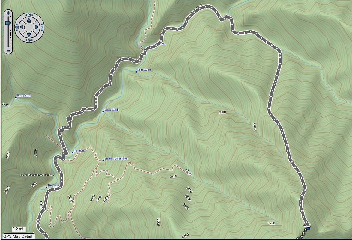
I read a trip report on SummitPost about this hike and was wondering if any of you have done it. Based on the trip report, I've attempted to map out the route. The route is pretty clear to me all the way to the south Fish Fork branch. I'm not sure about the location of the gully. Does this look right?
Alright! Part of me is intching to do it this weekend, but I'm just going to take it easy. I'm dayhiking Whitney the following weekend, so I don't want to take any risks before then.
My understanding is that there is a decent amount of class 3 climbing involved, so maybe the weekend after your San Jacinto 7 peak loop hike, weather permitting. That way we can get some climbing practice in before Iron. I'm flexible with the date though.
Good luck on that one! I look forward to a detailed trip report with pictures. It will be a butt-whooper for sure. I assume you will be coming back down the traditional route to Heaton? I might try that one as an over-nighter after you guys blaze the trail. 8)
yeah, i don't want to do it in 90+ degree weather, so i'm watching the weather forecasts pretty closely. we had fabulous weather this june. will need some luck to be able to do it in july/august/september, but maybe another cold front will roll in.
i did iron for the first time in may during an abnormally hot weekend. it was over 90 in azusa and baldy village. i really wasn't well prepared for the hike. started late, about 10am. big mistake. brought 6L of water, but no electrolyte replacement, no salty snacks or sports drinks. another big mistake. didn't bring bug repellant. another mistake. it was miserable. i made the summit, but it took forever and i finished the hike in the dark. i learned a lot though from the experience...
i'm all for new routes, so if you think we can incorporate a west route return, let's do it!
were you thinking of descending this way, or ascending this way on a separate trip? if descending, we definitely need to scout it out beforehand. there is lots of class 3 climbing, so it would be very, very challenging to come down this route. have to be sure that we could finish it before nightfall...
i would like to scout it out beforehand...which i was planning to do anyways b/c I want to check out Stanley Miller mine. Will see if its a reasonable route to descend (or even ascend). I'm quite sure Augie said that you do not want to descend the north route.
Sounds good. The SW route via Alison Gulch seemed pretty rough too, so I'm not sure it's a good route for the descent. Let me know when you'd like to scout out the mine.