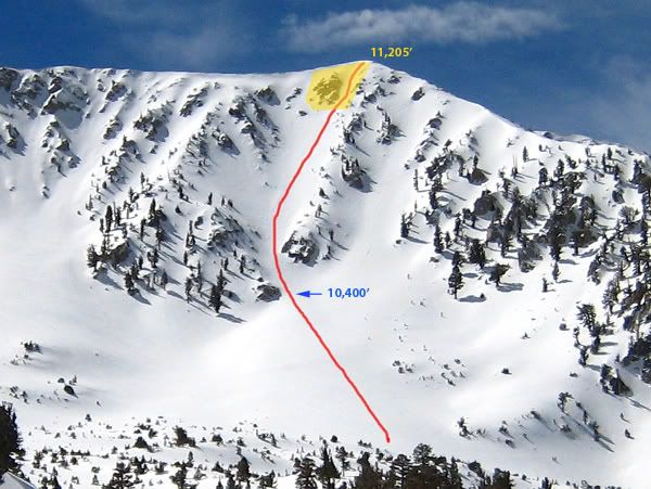
Jepson Peak via Northeast Face, 07-Mar-2009
Between the S. Fork TH and Poopout Hill the snow is melting fast so there are some bare, muddy spots. At the Dry Lake/Dollar Lake split, I went cross-country and continued up the meadow and onto the plateau that leads to Jepson Bowl. The snow was soft in spots so I put on snowshoes and used them for the rest of the approach. At 10,400' I entered the couloir and changed to ice axe and crampons.
The snow in the couloir had a hard crust about 1/2" or so thick and soft snow underneath. Some spots had a thin dusting of fresh snow over the hard crust. Most of the time I was able to drive the entire length of my axe into the snow for a solid belay. A few times the top layer was hard enough that I had to ram my axe a few times to break through. The slope angle was around 35°.
The hardest part was the last 150 ft or so where the large rock outcropping begins (highlighted area in yellow). The slope got noticeably steeper (probably around 45°) and the snow conditions were a little icier. Because of the steepness, I was now leaning into the slope with both hands on the snow. My back was killing me. It was getting a little too icy so I moved left towards the edge of the rocks where the snow was softer. I took my time and made sure I was as safe as possible. It was a great feeling to finally get past the rock outcropping and stand on top of it. The view of Jepson Bowl from here is incredible.
The only thing left now was about 30 feet of climbing and getting over the cornice. I aimed for the smallest cornice, which was about 4 feet high. It was almost vertical and seemed pretty solid. I switched to using the pick on my axe and I kicked some step in the side of the cornice. I probably could have scrambled up real quick but I backed off and decided to cut more secure steps with my axe. It would be terrible to fall here now. After I got that done, I climbed over the cornice and boom, I was on the summit. I love how on this route, when you top out you really are right on the summit.
My camera battery died just as I started climbing so not too many photos =(
Caution: These couloirs are on the wind loaded side of the ridge and are avalanche prone. The couloirs in Little Draw and the west side of Gorgonio are also prone to to significant rockfall. On my way down the ridge I witnessed a large boulder the size of a washing machine tumble down one of the couloirs on Jepson's north side.
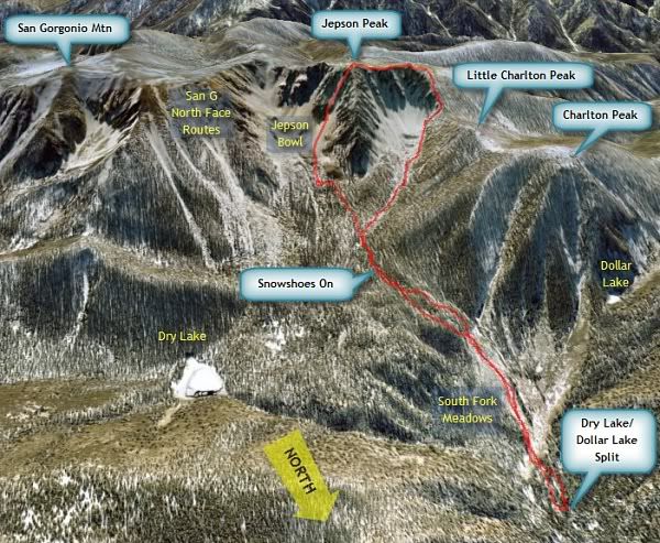
Little Draw and Dry Lake View (the saddle):
San Gorgonio west ridge:
Jepson Bowl:
Looking up the couloir:
The snow in the couloir had a hard crust about 1/2" or so thick and soft snow underneath. Some spots had a thin dusting of fresh snow over the hard crust. Most of the time I was able to drive the entire length of my axe into the snow for a solid belay. A few times the top layer was hard enough that I had to ram my axe a few times to break through. The slope angle was around 35°.
The hardest part was the last 150 ft or so where the large rock outcropping begins (highlighted area in yellow). The slope got noticeably steeper (probably around 45°) and the snow conditions were a little icier. Because of the steepness, I was now leaning into the slope with both hands on the snow. My back was killing me. It was getting a little too icy so I moved left towards the edge of the rocks where the snow was softer. I took my time and made sure I was as safe as possible. It was a great feeling to finally get past the rock outcropping and stand on top of it. The view of Jepson Bowl from here is incredible.
The only thing left now was about 30 feet of climbing and getting over the cornice. I aimed for the smallest cornice, which was about 4 feet high. It was almost vertical and seemed pretty solid. I switched to using the pick on my axe and I kicked some step in the side of the cornice. I probably could have scrambled up real quick but I backed off and decided to cut more secure steps with my axe. It would be terrible to fall here now. After I got that done, I climbed over the cornice and boom, I was on the summit. I love how on this route, when you top out you really are right on the summit.
My camera battery died just as I started climbing so not too many photos =(
Caution: These couloirs are on the wind loaded side of the ridge and are avalanche prone. The couloirs in Little Draw and the west side of Gorgonio are also prone to to significant rockfall. On my way down the ridge I witnessed a large boulder the size of a washing machine tumble down one of the couloirs on Jepson's north side.
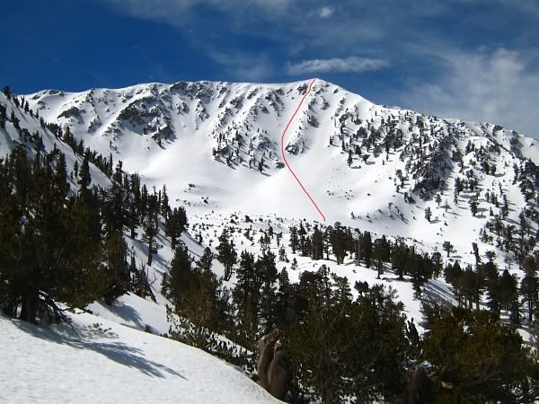
Little Draw and Dry Lake View (the saddle):
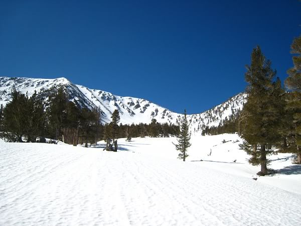
San Gorgonio west ridge:
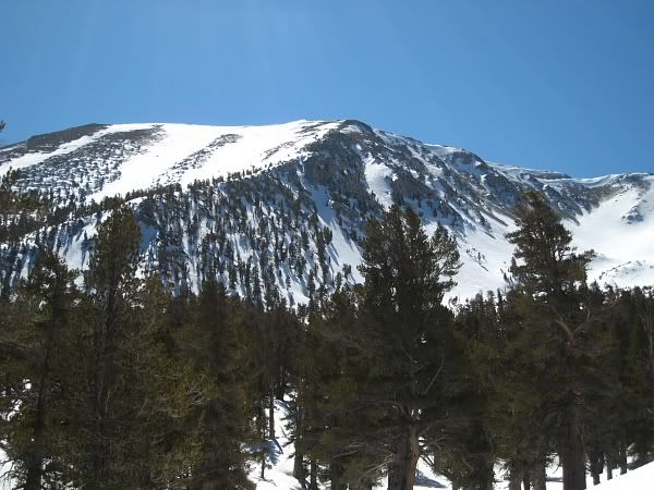
Jepson Bowl:
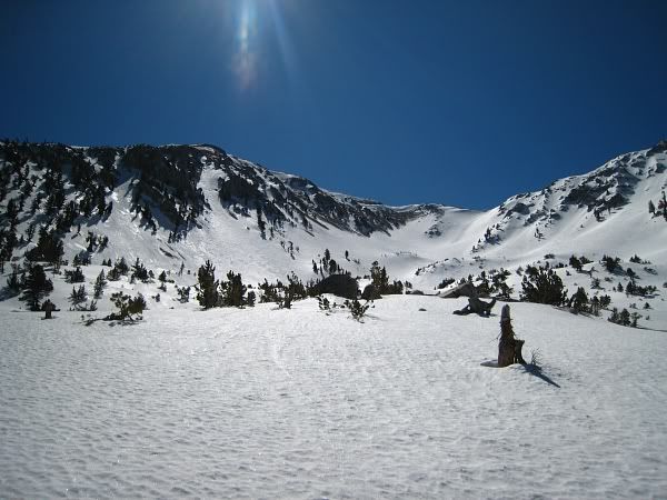
Looking up the couloir:
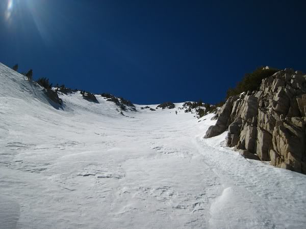
Hi Tim, it was nice meeting you in the parking lot on Saturday morning. I was with my buddy Arthur (taller guy) and we were heading to the base of Jepson for the night. Nice going climbing Jepson in a day. We arrived at camp as your were putting on your crampons for the climb. I was going to take some pictures of you climbing but I fell asleep in my tent . I did however get a picture of a climber named Johnny going over the cornice later in the day...
Arthur and I climbed the same route Sunday morning. It was a great climb and pretty darn steep at the top!
More pics: Jepson Peak 3.7-8.09
Arthur and I climbed the same route Sunday morning. It was a great climb and pretty darn steep at the top!
More pics: Jepson Peak 3.7-8.09
Wow, awesome shot, Mike! Now I wish you had gotten a picture of me right there!
It was nice meeting you and Arthur in the parking lot. It was only after talking to you two that I decided to do that face. I originally thought it was too steep (like 50° or 60°), which is beyond my ability and my equipment. Even then that last part was pretty darn steep
Hope to see you guys in the mountains again!
Thanks LD, the SGW is definitely a hidden gem. Just think, both San G and Jepson are actually taller than Mammoth Mountain!