Big Pine Creek

Archived TRs for Sierra Nevada ranges.
Post Reply
User avatar
JeffH
Posts: 1154
Joined: Sun Nov 28, 2010 7:09 am

Post by JeffH »

For what might be my last overnight in the Sierras this year I went up the North fork of Big Pine Creek. As it's just below the Palisades Glacier (southernmost in the US), it has lakes with that cool milky blue-green color, plus a few others in the area.
I battled the winds up to Lone Pine on Thursday evening, spending the night in the back of the Ranger while backed up to some rocks in the Alabama Hills. Arriving at the Interagency Visitor Center in the morning, I was really excited to draw number 1 in the daily permit lottery. It came in handy as I managed to get the last of 10 overnight permits for this trail.
Big Pine Creek has a large campground and a lodge, but the hiker parking lot is about 3/4 of a mile down the road. The trail starts out on the side of a hill and is really exposed to the afternoon sun, but the good thing is it remains high above the canyon so no elevation is lost along the way. It's not a real scenic walk until First Falls which is a little more than a mile up the trail.
I took the turnoff towards Black Lake, where I managed to avoid all the foot traffic near the numbered lakes. The wind picked up again in the afternoon, it was actually a cool breeze at that elevation. I walked past Black Lake and missed the turn near 4th Lake, but that provided me a different view of the area. Moving back on the correct route, I soon reached my intended destination of 5th Lake. Unfortunately there was a tent city near the main trail, so I headed up a steep use trail to a plateau above the lake and found a really nice camp spot. When the sun retreated behind the high ridgeline at 5:30pm it started to get cold, so a warm dinner and Johnny Walker Black was definitely in order. I woke up a couple times at night because of the wind howling in the trees, even though my spot was well-protected.
Saturday I reserved just for hiking, so I walked around 5th lake, took a side trail back to 4th Lake and then hung out for a long time at Summit Lake. Summit Lake was the highlight of the trip, at least when the wind wasn't blowing too hard. I headed towards 6th and 7th lakes but I was running out of water and couldn't see any flowing streams ahead. Since it was a up-and-down trail, I did some rock hopping back across a high ridge rather than give up any more altitude. That was pretty fun and gave me some different views.
Walking out the next morning was uneventful, I took the other part of the trail and walked past 3rd, 2nd and 1st lakes. These have the unique glacial flour coloring and are the most popular with the hordes of dayhikers in the area.
This trip was really different for me, it felt odd to have a full day without the routine of packing up, hiking and setting up camp. Just to sit around reading was nice for a change.

A few pics below


Image
Morning view of Mt Whitney from the Alabama Hills.


Image
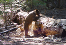
Wildlife as I arrived at the hiker parking area.


Image
Noted fisherman Lon Chaney's cabin, now owned by the FS.


Image
Looking down at 1st and 2nd lakes from the trail towards Black Lake.


Image
Black Lake. This one really did seem darker than the others.


Image
Trail junction. I was happy to see the sign, I thought I may have missed another turn at 4th Lake.


Image
Last of the sun at 5th Lake. I was filling up on water and it got cold outside real fast.


Image
Morning view over 5th Lake from my campsite.


Image
Summit Lake and Palisade Glacier. If you want to see it you better plan soon, it won't be around too much longer.


Image
Meadow somewhere below 6th Lake.


Image
2nd Lake, Temple Crag in the background.


Image
1st Lake, 3.5 miles from the overnight trailhead, less than 3 from the Lodge.


Image
Fall color happening now.


Image
New winner of the most boring trail I've hiked, over a mile of this terrain. Around every little bend was just more of the same.
"Argue for your limitations and sure enough they're yours".
Donald Shimoda
User avatar
Hikin_Jim
Posts: 4686
Joined: Thu Sep 27, 2007 9:04 pm

Post by Hikin_Jim »

JeffH wrote: Palisade Glacier. If you want to see it you better plan soon, it won't be around too much longer.
:cry:

Other than that, nice TR. I need to get up that way soon.

HJ
User avatar
Sean
Posts: 3749
Joined: Wed Jul 27, 2011 12:32 pm

Post by Sean »

Thanks for another great report and pictures. You always find amazing places to document. By the way, the NPS gives the glaciers another 250 years of life at their present retreat rate.
User avatar
tekewin
Posts: 1194
Joined: Thu Apr 11, 2013 5:07 pm

Post by tekewin »

Awsome lake photos.
User avatar
RichardK
Posts: 727
Joined: Sun Sep 30, 2007 12:33 pm

Post by RichardK »

We never got to the upper lakes. Thanks for the pictures. I thought the Palisade Glacier hike was harder than Whitney. The last half mile of boulder scrambling up a 28% grade was tough.
User avatar
JeffH
Posts: 1154
Joined: Sun Nov 28, 2010 7:09 am

Post by JeffH »

Sean wrote: By the way, the NPS gives the glaciers another 250 years of life at their present retreat rate.
250 years? That seems too much. I know there has been some retreat from the "Glacier National Park will be dry by 2030" talk, but just looking at photos of the Palisades the current ice field looks really small compared to 50-100 years ago.
"Argue for your limitations and sure enough they're yours".
Donald Shimoda
User avatar
Uncle Rico
Posts: 1394
Joined: Thu Mar 20, 2008 7:48 pm

Post by Uncle Rico »

Image
New winner of the most boring trail I've hiked, over a mile of this terrain. Around every little bend was just more of the same.
Funny thing is I'd take this any day of the week. :D

Nice report Jeff. Beautiful pics as usual.
User avatar
Sean
Posts: 3749
Joined: Wed Jul 27, 2011 12:32 pm

Post by Sean »

JeffH wrote: 250 years? That seems too much. I know there has been some retreat from the "Glacier National Park will be dry by 2030" talk, but just looking at photos of the Palisades the current ice field looks really small compared to 50-100 years ago.
A geologist from this group compared historical images of a few glaciers in SEKI in order to arrive at the 250 number. Of course, such predictions come along with ridiculous error rates. This one has an error rate of plus or minus 200 years!

The study (Basagic, 2013) uses data from 2008. So maybe the SEKI glaciers will be gone by the year 2058. Or maybe we have until 2458 to see them.

Or we could admit the obvious, established by the astronomical error rates that always accompany such "scientific research": that climate change predictions are junk science intended to frighten people into anti-industrial sentiments.

But perhaps that's an argument for another thread.
User avatar
RichardK
Posts: 727
Joined: Sun Sep 30, 2007 12:33 pm

Post by RichardK »

Image

Image

Image

Image

Image

Image

Image

Image

Image

Image

Image
User avatar
JeffH
Posts: 1154
Joined: Sun Nov 28, 2010 7:09 am

Post by JeffH »

Sean wrote: Of course, such predictions come along with ridiculous error rates. This one has an error rate of plus or minus 200 years!


But perhaps that's an argument for another thread.
Definitely another thread.... :?
All we know for sure is that they are smaller than 100 years ago, I get that it's nearly impossible to predict with any accuracy.

Still, no one should delay on heading up to visit them, they tend to be in really great places!
"Argue for your limitations and sure enough they're yours".
Donald Shimoda
Post Reply