
remains of Hocumac Mine?
I went up Hardwood (Register) Ridge Saturday with my dogs. There was a big pine tree newly fallen along the use trail. Detouring left around the tree, I came across a half-buried pipe that looked old. I'm guessing that it's a remnant of the Hocumac Mine. Anyone have more info? My only knowledge of this is written out in this section, which I wrote, of the Wikipedia article on Baldy: https://en.wikipedia.org/wiki/Mount_San ... _resources . The source is a book by Osborne, which I think I must have borrowed somewhere. My understanding is that hydraulic mining was tried in this area, but it didn't turn out to be profitable both because the ore was low grade and because supplies of water for hydraulic mining were unreliable. The old pipe would presumably be from hydraulic mining. Can't imagine any reason for putting a pipe in that spot.


ftp://ftp.conservation.ca.gov/pub/dmg/p ... /39_08.pdf
Seems to be pretty definitive that the water was sourced from San Antonio Creek and brought via pipeline to a reservoir, which then flowed to the mining at Miners Bowl. The only thing missing is a supposed eye witness who claims the mining discharge was flowing through Icehouse canyon vs Big Butch Wash....but based on the picture of the mining Id say Big Butch Wash is where the discharge was and there was no further development to get it over or around Thunder Mountain.

Fascinating stuff -- thanks, Sean and AW!
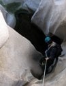
The pipe in photo 4 in the geology article does look very much like my memory of what I saw. It's impressive that they would run a pipe over such a long distance, through such difficult terrain. Where does the ski resort at the notch get its water today? Do they bring it in by truck?
It sounds like it would be a really fun project to do the traverse that Pavel did, following the pipe. It would be interesting to hear from Pavel whether there were sections of that hike that were sketchy. Some of it looks pretty steep, and I'd be a little worried about sliding down into a canyon and being unable to extricate myself. Might be wise to bring a rope, which could provide an option of bailing out downhill with trees as anchors. Some of the ridges probably cliff out at the bottom at the road cut, but it ought to be possible to get down to the road somehow in a pinch, if you had a rope.
Again I don't have the details, but at least some (maybe all) of the Notch's water supply comes from the San Antonio Falls down below.
If you go through meeting minutes (found online) for the San Antonio Water Company, they talk about diverting water for snow making at the Notch. I believe it is pumped to the Big Butch Wash reservoir, then pumped to the Notch reservoir. They might also tap springs up there. I've actually witnessed the pumping into the lower reservoir, so I know that much happens.
As for following the Hocumac pipeline, the crossing of upper Manker might be dicey. I've twice scrambled all the way up that canyon to the Backbone. It gets pretty gnarly.
Good to know, although I'm not sure what exact area you're referring to. Does it have trees, or is it just a blank scree chute with nothing that could be used as an anchor?