Crystal Lake (& vicinity) Report

TRs for the San Gabriel Mountains.
Post Reply
User avatar
Hikin_Jim
Posts: 4686
Joined: Thu Sep 27, 2007 9:04 pm

Post by Hikin_Jim »

1. Headed up to first the Valley of the Moon for a little re-forestation this weekend. They were basically re-planting the old Penny Pines type tree plantation that took a pretty big hit in the Curve Fire (if I've got my story straight). They hope to one day put the trees to good use by creating a picnic area here.

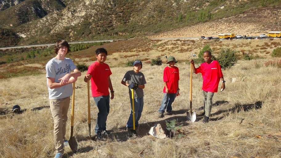
Boy Scouts from Troop 141 Monrovia and their handiwork.
Image

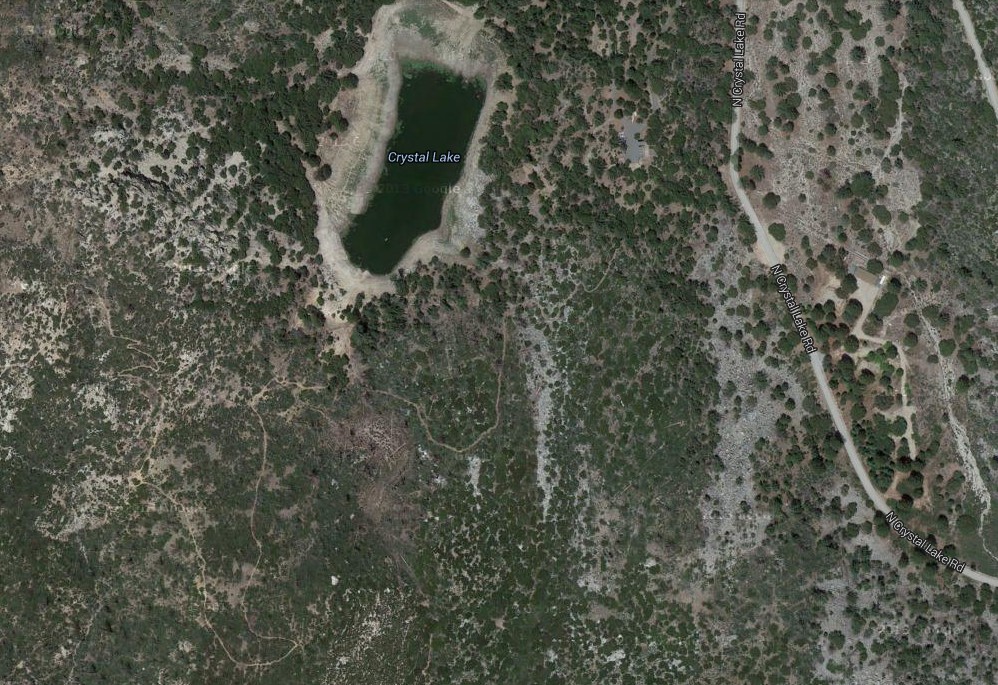
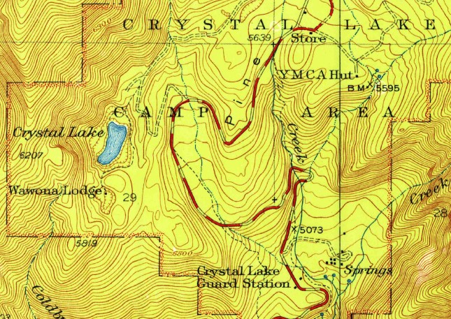
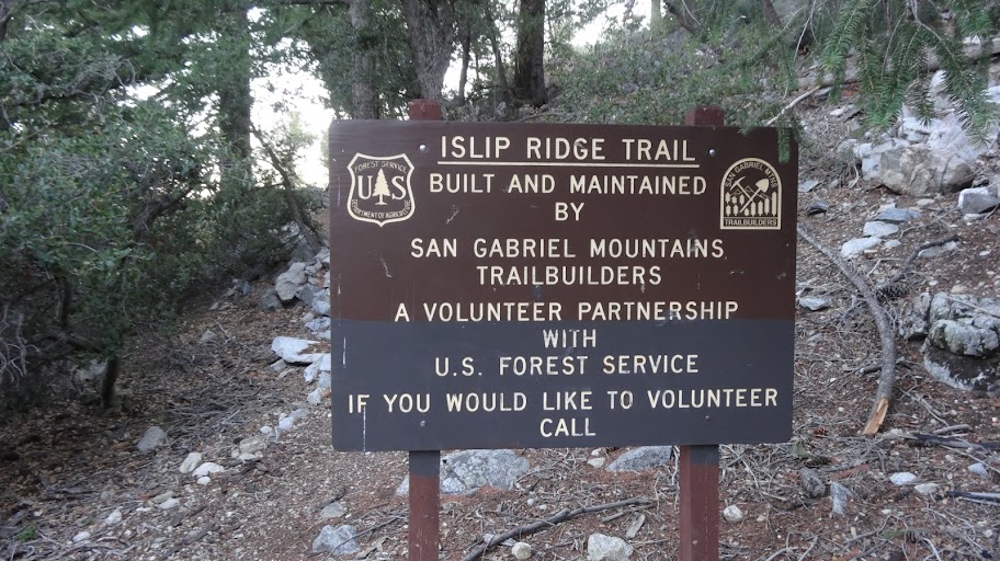
2. Headed up to Crystal Lake for some lunch and then over to the Islip Ridge Trail for a quick hike.
Image

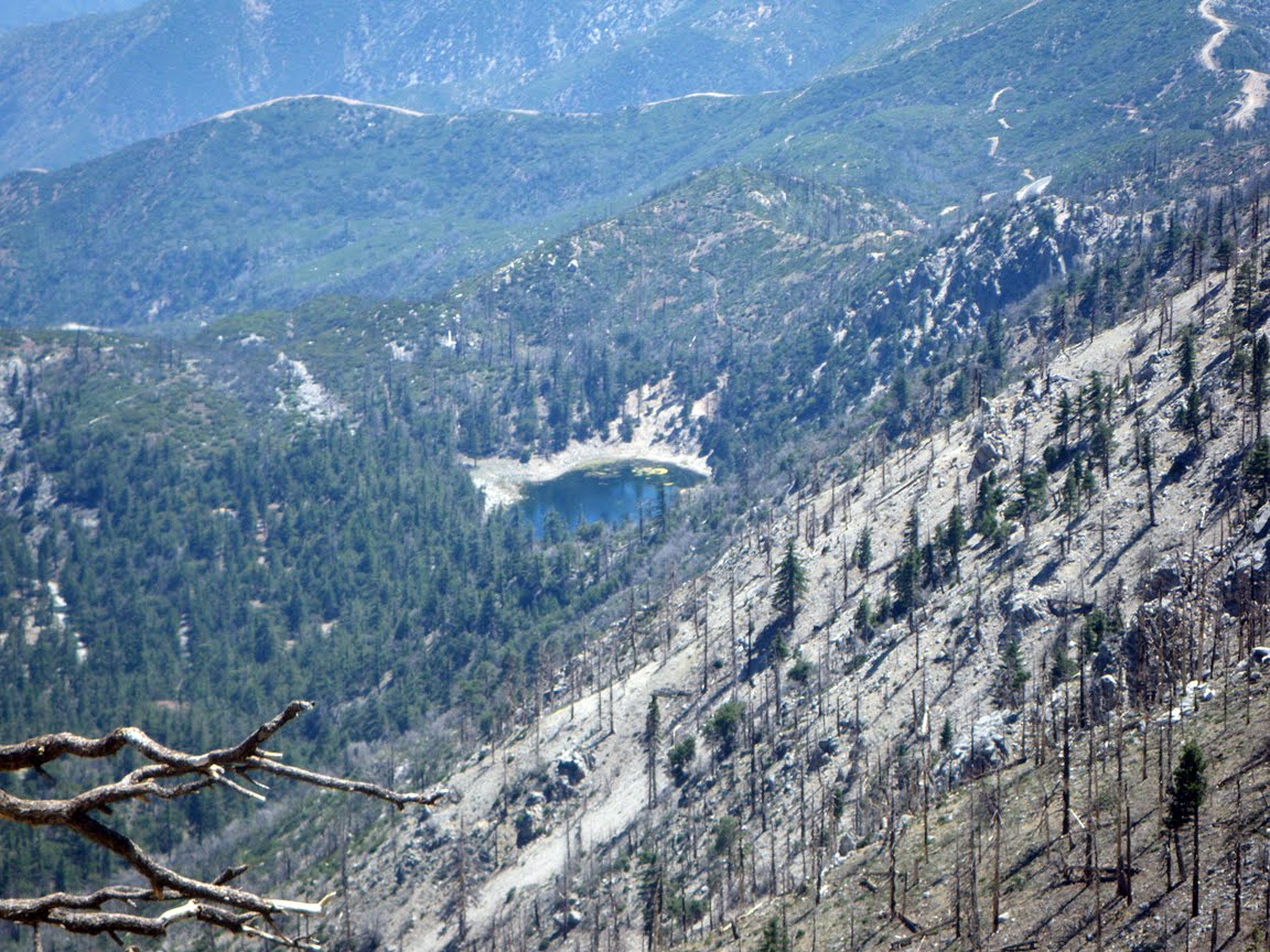
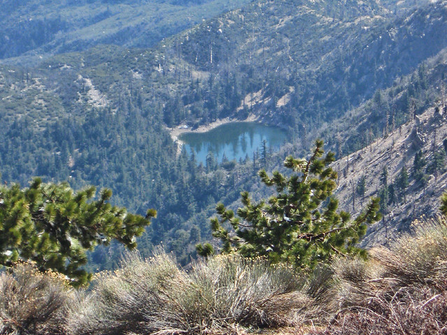
The lake itself is looking a little sad these days. The water level seems to get lower and lower every time I see it.
Image

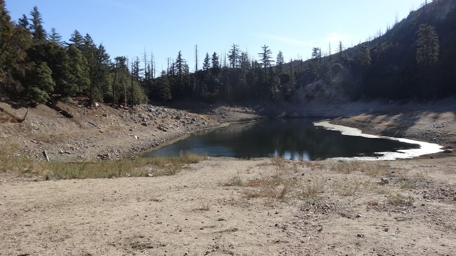
With the low water level, I spotted something I hadn't seen before.
Image

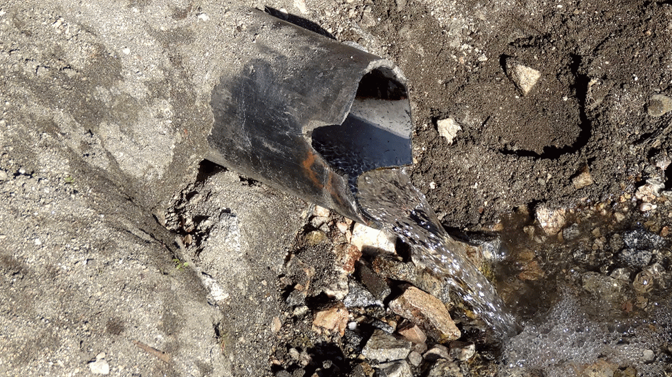
I asked some of the San Gabriel Mtns Trailbuilders and was told that this was the overflow from the springs that fill the water tanks for the campgrounds around Crystal Lake Rec Area. I wasn't aware that water was still being piped to the lake.

We just went a little ways up the Islip Ridge Trail because of time constraints. We saw this relatively bad obstruction on the trail approximately here.
Image

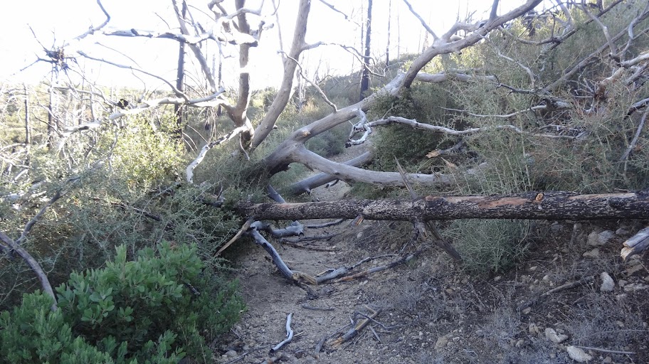
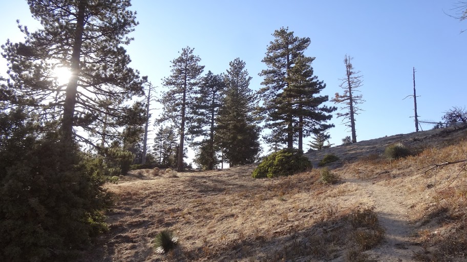
The rest of the trail is in decent shape (as far as we went). We went up to the ridge top just to take in the views.
Image

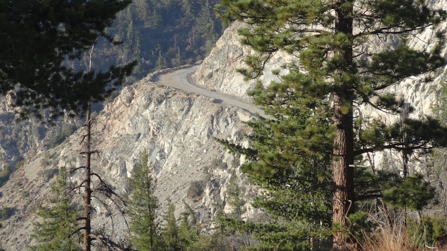
Like the closed section of Hwy 39.
Image

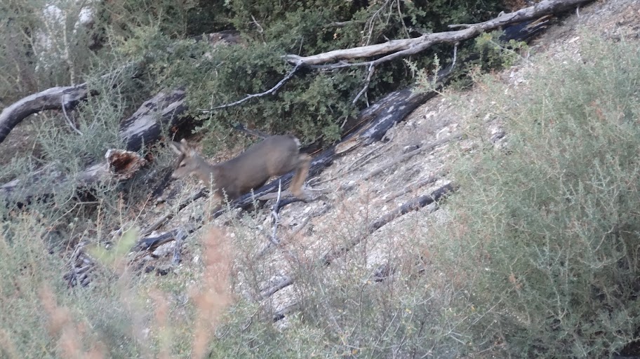
En route, we got a glimpse of "Bambi".
Image

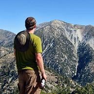
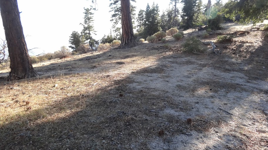
Up on the ridge, I'm always surprised at just how many flat spots that would be suitable for camping that there are.
Image

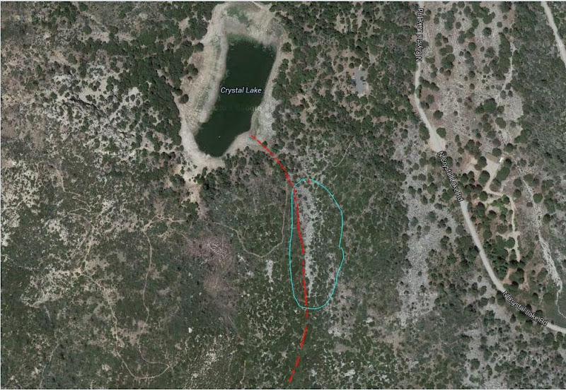
Lastly, does anyone know what caused this:
Image

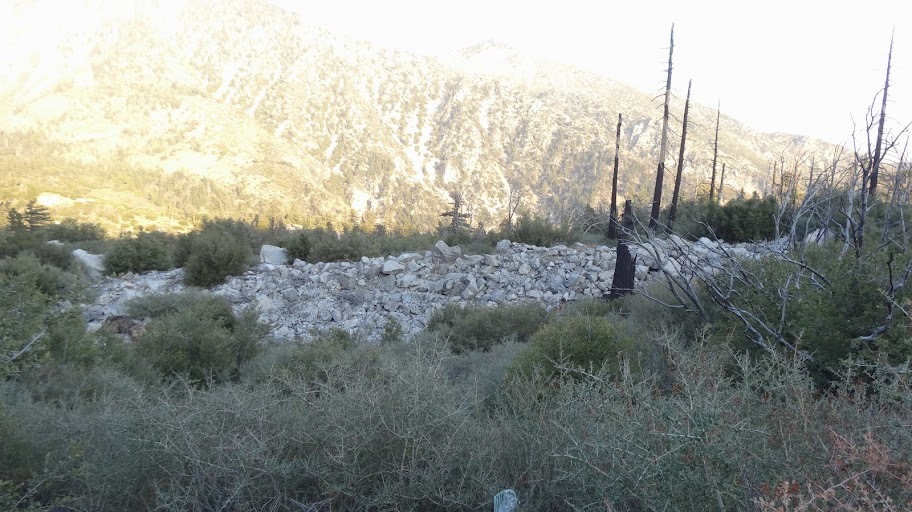
It's a line of stones all piled up. I'd say it was a drainage except that it cuts across the slope (drainages pretty reliably run downslope). It could be a moraine, but in Crystal Lake? Don't think so. Maybe it's a fault of some type. It's quite extensive.

HJ
User avatar
Taco
Posts: 6001
Joined: Thu Sep 27, 2007 4:35 pm

Post by Taco »

I've seen moraines up there, and honestly I think there used to be some sort of small glacier up there. Nobody agrees with me though.
User avatar
Hikin_Jim
Posts: 4686
Joined: Thu Sep 27, 2007 9:04 pm

Post by Hikin_Jim »

A moraine up in the Crystal Lake area wouldn't be as recent as, say, the moraines in the San Gorgonio Wilderness, but there might be some ancient ones.

The pile of rocks I took a photo of sure does remind me of a moraine although I'm partial to the fault line theory in this case.

HJ
User avatar
Sean
Posts: 3749
Joined: Wed Jul 27, 2011 12:32 pm

Post by Sean »

If you're talking about the rock piles in this aerial that appear SE of the lake,

Image

then perhaps they are debris deposits from road construction. Also, I think the Wawona Cabin was over there somewhere. Maybe it has something to do with that.

Image
User avatar
Hikin_Jim
Posts: 4686
Joined: Thu Sep 27, 2007 9:04 pm

Post by Hikin_Jim »

Interesting about that cabin. One of the names for the Islip Ridge Trail is the Wawona Trail. I had always wondered where that name came from. Anyone got a better idea where that cabin was?

As far as the rock piles are concerned, they're pretty far uphill from the road. There's a sort of channel that leads along the face of the rock pile into the depression that holds Crystal Lake which is one of the reasons I suspect it's some kind of fault or something. I've show the "channel" in red and I've circled the rock pile in green.
Image

HJ
User avatar
Sean
Posts: 3749
Joined: Wed Jul 27, 2011 12:32 pm

Post by Sean »

The lodge was directly south of the lake.

Image

After giving the rock pile some more thought, I now suspect it's a natural formation created by overflow from the lake. In flood years, the lake probably spills out to the SE, exposing rocks and pushing them into a pile.
User avatar
Hikin_Jim
Posts: 4686
Joined: Thu Sep 27, 2007 9:04 pm

Post by Hikin_Jim »

Sean wrote: The lodge was directly south of the lake.
Interesting. I wish there were a map symbol so I could see the exact placement. I wonder if it's in the little "valley" SE of the lake, the little valley where the trailhead sign is, just S of the southern parking lot.

It looks (just based on the placement of the text) like the lodge is in the depression south of Crystal Lake which seems like an odd place to construct a building. I would be afraid of water pooling up in wet years.

HJ
User avatar
Sean
Posts: 3749
Joined: Wed Jul 27, 2011 12:32 pm

Post by Sean »

The symbol is easier to see on this one.

Image
User avatar
Hikin_Jim
Posts: 4686
Joined: Thu Sep 27, 2007 9:04 pm

Post by Hikin_Jim »

Ahh. Much easier to read. So it is (was) in fact in the depression. Interesting.

HJ
User avatar
lilbitmo
Posts: 1092
Joined: Tue Mar 04, 2008 9:44 pm

Post by lilbitmo »

I suspect that Sean is right, when you view the lake from North to South on Google Earth the lake has a drainage that lines up directly with that debris field and continues on a straight line up and over to the next lower canyon.

If you look closely at the east side of the lake there's similar washed away hill side with similar rocks there as well, it's conceivable that when the lake was real full in the past it would have drained in both the south east corner of the lake and the south west corner. And when you look super close at the southwest corner it has a higher hillside so gravity and pressure would have taken the easy exit on that southeast corner once the level of the lake was high enough, thus gorging away at the dirt rather quickly leaving behind the exposed rocks, just my humble view.
User avatar
Uncle Rico
Posts: 1394
Joined: Thu Mar 20, 2008 7:48 pm

Post by Uncle Rico »

Sean- where are you pulling those topos that show the location of the Wawona Lodge?
User avatar
Hikin_Jim
Posts: 4686
Joined: Thu Sep 27, 2007 9:04 pm

Post by Hikin_Jim »

From the Wayback machine of course.
http://www.youtube.com/embed/NdPURdzSb74

HJ
User avatar
Sean
Posts: 3749
Joined: Wed Jul 27, 2011 12:32 pm

Post by Sean »

Uncle Rico wrote: Sean- where are you pulling those topos that show the location of the Wawona Lodge?
The USGS National Map.

1. At the main page there is a menu on the left. Click on "Download Maps (Map Store)".

2. Search for the area using the map features. Then left-click on the map to create a marker.

3. Click on the marker to open a pop-up of available historical topos.

4. You then have the option to download any of the topos for free.

I use this tool all the time to search for old trails and such. I downloaded the Crystal Lake topos for 1936 and 1941.
User avatar
Uncle Rico
Posts: 1394
Joined: Thu Mar 20, 2008 7:48 pm

Post by Uncle Rico »

Much appreciated Sean. I generally use Caltopo because its so user friendly and has the Forest Service topo option. As you know, it also has historical maps, but the map from the 1915-1945 time frame doesn't show the location of the Wawona Lodge.
User avatar
outwhere
Posts: 323
Joined: Sun Jan 25, 2009 5:40 pm

Post by outwhere »

lilbitmo wrote: it's conceivable that when the lake was real full in the past it would have drained in both the south east corner of the lake and the south west corner. And when you look super close at the southwest corner it has a higher hillside so gravity and pressure would have taken the easy exit on that southeast corner once the level of the lake was high enough, thus gorging away at the dirt rather quickly leaving behind the exposed rocks, just my humble view.
Great TR and Crystal Lake info here !! Crystal Lake revelations are always fun to hear and this is a good one...

I've seen some [relatively] recent photos of the lake impressively full but never woulda guessed it would flow over and create that line of rocks... Sure would be wild to see that thing spilling over :shock: :!: And wouldn't it have to be flowing over the top at a decent clip to move rock like that ??

Funny seeing the line of those rocks like that, like the lake almost spit them out...

Just found this on a Crystal Lake web/image search search... another angle never hurts :wink:

Image
User avatar
Hikin_Jim
Posts: 4686
Joined: Thu Sep 27, 2007 9:04 pm

Post by Hikin_Jim »

That must be and OLD photo.

HJ
User avatar
mcphersonm80
Posts: 243
Joined: Mon Aug 23, 2010 11:46 am

Post by mcphersonm80 »

Hikin_Jim wrote: That must be and OLD photo.

HJ
I'm curious when that was taken, also. Interesting to compare the water level from this shot I took in April 2011 (after our last decent winter):

Image


Any idea on the date of that photo, Outwhere?

**EDIT** Found it, looks like 6/5/2010:

http://hikingforhope.blogspot.com/2010/ ... ummit.html

Water level seems pretty low.... if I remember correctly, winter 2010 was above average. :?
User avatar
Hikin_Jim
Posts: 4686
Joined: Thu Sep 27, 2007 9:04 pm

Post by Hikin_Jim »

Your 2011 one looks great. Wish it was always like that.

HJ
User avatar
Taco
Posts: 6001
Joined: Thu Sep 27, 2007 4:35 pm

Post by Taco »

Cool info on the cabin. I always walk through that meadow and it figures someone would put a cabin there. 8)
Post Reply