After some delicious pizza in town, we headed up the ridiculous Horseshoe Meadow Rd. Lots of rock and slides on the road due to the recent storms that passed through. Don't look down.
Horseshoe Meadows campground was more wide open that I imagined, and there were a ton of cars but hardly anybody around. We grabbed a site, set up camp and kind of just sat around. Langley can be seen from camp, but overall it has a more Western Sierra feel to it... not a bad thing, but I ended up taking hardly any pictures here. ::shrug::
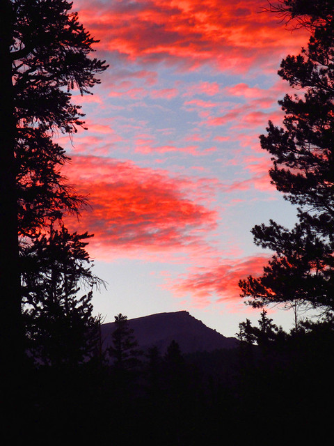
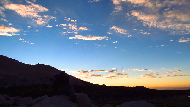
Sunset from Horseshoe Meadows
We got up at 2:00am and broke camp and ate some oatmeal, coffee, etc. No moon, so the stars were incredible, I don't know if I've ever seen the Milky Way so clearly. We then hit the trail about 3:20am, hoping to get to the lakes by sunrise.
The trail starts out virtually flat and stays that way for several miles through dense forest with a couple easy stream crossings. By the time we reached the lakes basin, the sun started hinting at a new day on the horizon.
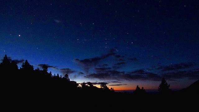
Orion and a New Day
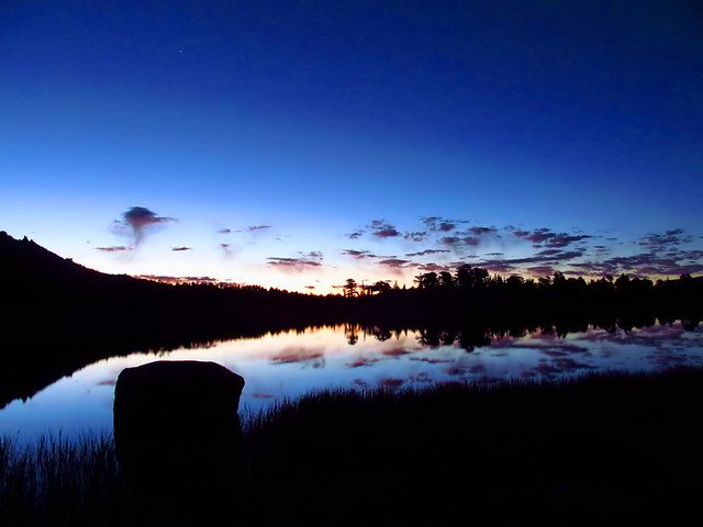
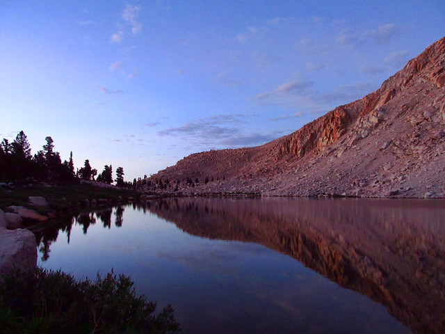
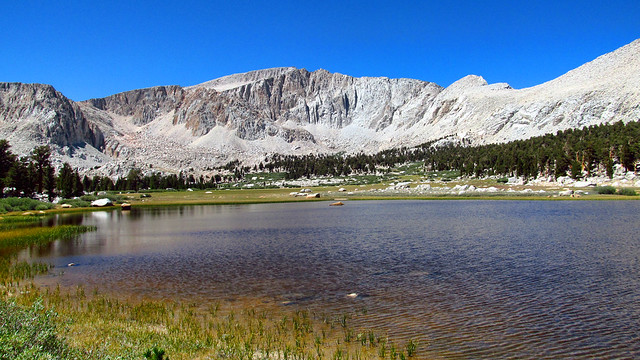
Dawn at Cottonwood Lake #1
The temperature was nice and low, particularly by the lakes, and the trail stayed nice and easy. Despite all of the permits apparently being taken, we didn't see a single campsite or human in the area. Not a complaint, just an observation.
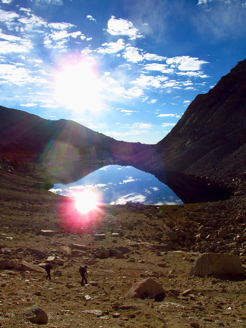
We were a bit ahead of schedule, as those first 6 miles or so fly by, so we got to the hill between lakes 3 and 4 and decided we'd wait for the photo ops. We climbed up to the top of the hill and waited, admiring the incredible reflections and surreal landscape around us.
Waiting for the Sun
Blue and Gold
Enjoying the Show
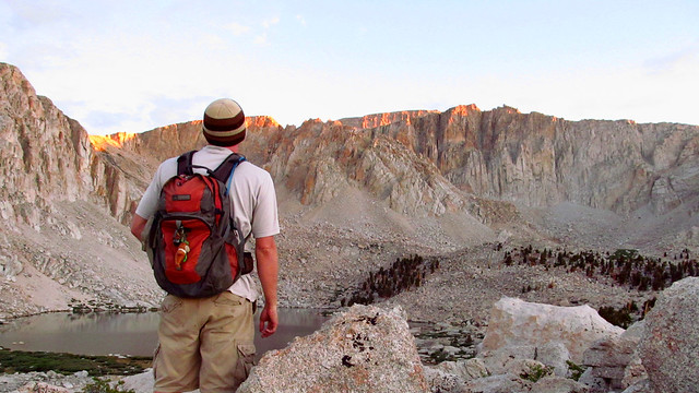
When the sun finally did rise, we filtered from Lake 4 and scratched our heads, wondering how the hell we'd manage to get up over Army Pass. From below, you can see the final ramp leading up and over, but to get to that ramp is extremely unclear from that vantage point.

Old Army Pass
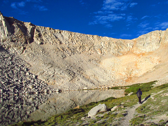
Rounding the Lake
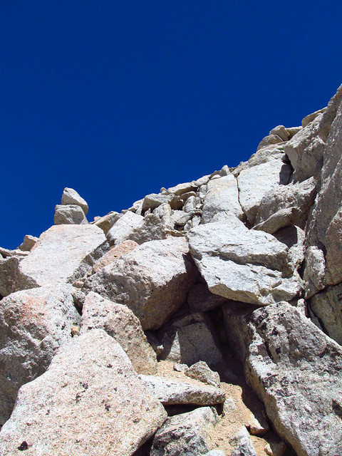
Even though it looks impossible, just follow the use trail. It eventually switchbacks up through the talus, disappearing in a couple spots but remaining easy enough to follow the whole way. There are a couple sketchy spots, as the trail hasn't been truly maintained in decades, and it's easy to see and somewhat sobering knowing that several people have fallen from here. Lacking snow or ice, a little vigilance gets you through.
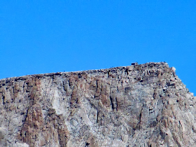
Is that an arch? On Tatooine?

Ascending Army Pass
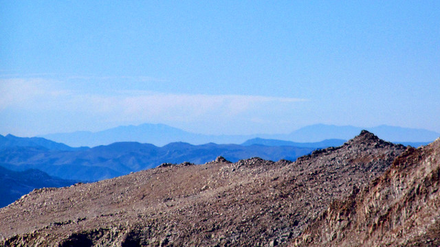
Once over the pass and into Sequoia National Park, things level out on the plateau and clear use trails and a ridiculous number of cairns will lead you most of the way. Other than the high altitude and the grizzly marmots, there's nothing difficult about this stretch. The views west are awesome, too.
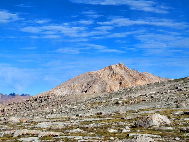
Joe Devel Peak
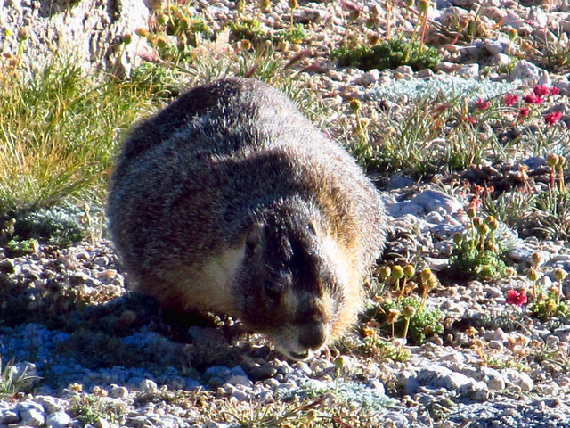
7 feet tall, approx 1500 lbs. Do not piss him off.
Walk that Way
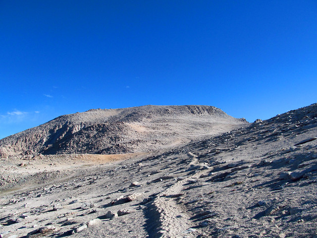
It's not boring by any stretch, but between the top of the pass and the base of the Langley summit plateau, there's really not much to say. Enjoy the views and marvel at how easy it is, if you've acclimated properly.
Whoever said Langley was tougher than Whitney is messing with you. It's not even close, if you ask me.
Eventually, the path will lead you to some fun Class 2 (or higher if you want) stuff. Choose your own adventure. Those books were fun.
Class 2 Party Time
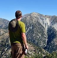
Well would you look at that... The San Gabriels!
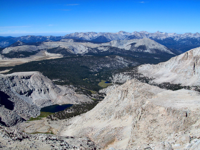
Great Western Divide and Sequoia NP
Soon, the rocky stuff gives way to sand, and you pick one of a gazillion use trails to finish the climb. It takes a little while, but soon you'll top out at 14,042'. Again, whoever said this is tougher than Whitney should be removed from your friends list.
The views are extremely cool and that drop to the north.....
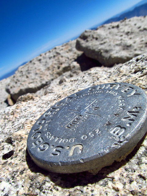
Southernmost 14er in CA (and I'd assume the US, right?)
People Summiting Whitney. Congrats, you little pixels!
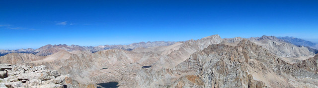
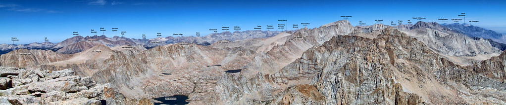
Panorama from Mt Langley
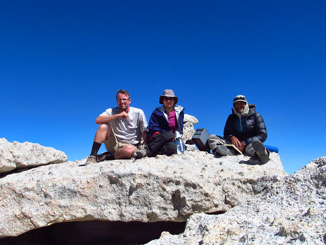
They thought it was cold up there....
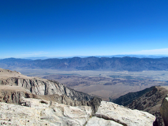
Lone Pine from the Top
The hike down was quick and easy, although that forested 5 miles between the lakes basin and Horseshoe Meadows seemed WAY longer than it should have.
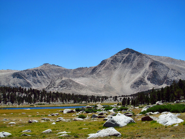
Langley above Lake 1
Trail and Cirque Peaks
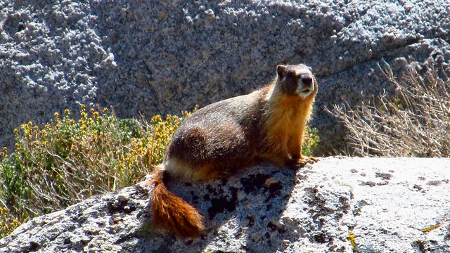
Never thought I'd say this, but there might be too many marmots up here.
More photos here:
http://www.flickr.com/photos/wattifoto/ ... 969240795/
PS - So much easier than Whitney. Don't climb OAP if there's snow/ice.