Attempted Hike of the White Mountains Traverse
We arrived in the White Mountains on Sunday night the 7th of June at around 7 PM, unloaded the car and headed out on the highways to get my wife familiar with the “Drop off” spot and the “Pick up” spot for the attempt of the New Hampshire White Mountains Presidential Traverse – this is the 9 to 11 summits that make up the White Mountains.
Been looking forward to this hike for 3 months – it took the wife and I two hours to find both spots and another hour back at the “Condo/hotel” to draw precise maps and directions (the wife thinks a map is something you use to get confused, not to find your way so I have to give her hand drawn maps with “Left here at this landmark, go straight past this landmark, count the number of streets you pass” etc, etc, etc…. I’m not bagging on her, she will be the first to admit that maps make her nuts) anyways we got to bed early as the weather for the entire week was supposed to be rainy except for Monday so I was willing to try the hike with only 5 hours sleep. At 3 AM the alarm went off and I got up put the last of my stuff together, only to get one of those bad feelings that said something like “I’m pushing it here and this is way to soon”, with not enough sleep and the worry that my wife may get lost, I decided I would feel bad so I put off the hike and prayed for better weather.
Monday turned out to be perfect (Murphy’s Law) so we did some sight seeing and stopped by the ranger station for updates on the weather – bad news, one front was coming in on Monday night, with a strong one following closely behind for the remainder of the week. My hopes had been dashed, but I kept holding out for a break and that did come Thursday when they indicated on all the weather reports that Saturday had the least possible amount of rain possible and it would come in later on Saturday – only problem with this was that we were do to check out of our room Saturday morning, so my wife would have to find something to do before picking me up at the exit spot – this turned out to be good for her, she went shopping for used books, toys for our grandson and gifts for the two graduations we would be attending in Michigan the following week. So Friday became the prep day, packed everything and got ready to go early. The weather reports for Tuesday, Wednesday, Thursday and Friday were only half right, it did rain, but only slightly, the high country was covered in clouds so visibility would have been difficult had I decided to risk it and go anyways and the pictures would likely have been smeared from the dampness, so Saturday became the “Go Day”.
Knowing that it had been two weeks since I had done any hiking, I needed to do a warm up hike, so on Friday afternoon I did a prep hike of 6.2 miles to the top of Kearsarge Peak North, with the summit housing a “Fire overlook” with outstanding views in all directions. The weather in the afternoon was cloudy but most of that was “High Clouds” and it was sunny in-between, making for a great backdrop for the pictures – see pictures of that hike here - http://s728.photobucket.com/albums/ww2 ... slideshow It always nice to see other hikers on the trial and I ran into two young men with their dog at the top of the summit, we chatted about the local area and the informed me that they lived locally but had only driven to the summit of Mount Washington and could not give me any good details for my attempt the following day and/or any particular things to look out for.
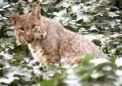
Come 2 AM on Friday night/Saturday morning the wife and I were up and ready to go at 2:15 AM only to discover that my water bladder hose had come loose in the night and soak everything in my pack, lucky for me that the “Condo” had a washer and dryer, 20 minutes later after repacking and getting everything dry enough to go we set out. At exactly 3 AM the wife dropped me off at “Webster Cliff Trial” – she say’s to me “You are crazy and aren’t you afraid the bears will get you in the dark?” I laughed and said they were busy sleeping and that I would be just fine. She headed back to the condo to get some sleep, I went about a quarter mile before the same “Hose Broke” a second time soaking everything in the pack on the bottom side and getting me wet all the way down to my boots. Knowing that the wife was long gone the only thing I could do was “Suck it up and keep moving” after wrenching out the clothing that I would need near the summit of Mount Washington, draining the pack of all the excess water and get back to enjoying the wilderness and the hike, I always carry a Nalgene bottle and it was full of premix that long distance runners/biker racers use, so I was good to go. I filled that bottle up at every other creek on the way up.
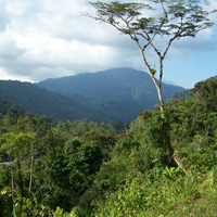
By 4:20 AM I turned off my headlamp as it was “Light” enough to see, by 5:10 AM I reached the first summit with a stop 30 minutes before that on the “Ledge” they call the “Last Open Ledge” with a view of the whole state park below “Crawford Notch State Park” – it’s a valley with a road and railroad running through the bottom, completely covered in Pine Forrest. Webster Summit proper did not have much to speak off, you could still see most of the “Notch” below and the trail itself is marked in multiple “Cairns” and blazes so finding your way was fairly straightforward even in the dark.
By 5:55 AM I was able to summit Mount Jackson, stopped to take more pictures, getting closer to the first of three “Huts” that the “Appalachian Mountain Club” run for the National Forest Service – when I pictured these I was thinking they were similar to the ones in the West that you see on Baldy and Mt. San Jacinto – I couldn’t have been more wrong, they are huge structures that can handle 50 to 100 people at a time if need be. I arrived at the first one (Mizpah Hut) at 6:50 AM and the first two people up were surprised to see someone come in that early from the Webster Summit direction, most folks do the “Traverse” in the opposite direction. They were super nice and offered coffee and donuts but I like to keep moving so I said maybe next time and asked to wash off the mud from taking a spill on the walkway planks that cover the “Bog Mud” that is between Jackson Summit and Mizpah Hut. The Appalachian Mountain Club puts down “Planks” to protect the environment and to keep people on the trail, I hit one in full stride and it was covered in a thin layer of “Moss” which sent me flying through the air only to land up to my shoulder in mud so I was looking to clean up my little spill.
From the hut to the summit of Mount Clinton/Mount Pierce as its now called, was fairly steep, the trial winds up a creek bed slash water drainage area that is slow going as its very slick granite slabs and every step is an adventure. I was able to reach the top by 7:40 AM – getting close to tree line ending and I can see further and further into the distance. One of the most important lessons I’m learning is that high speed hiking is next to impossible as the terrain is so slick, rock covered and the roots of trees stick out everywhere that it takes all your attention on every step or getting hurt from a fall is going to happen.
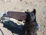
Mount Washington is visible in the distance the weather is holding and my hopes are abounding, I next reached Mount Eisenhower, it’s above tree line and has nothing but rocks on its summit. There’s signs’ that they are about to do some work up there with some logs that were cut and laying around, see pictures for that – it’s now 8:35 AM.
Mount Franklin is next and you only know you are on its summit by the fact that the map tells you so. The trial goes right over the top and its part of the trial itself. I went over that summit around 9:20 AM and pushed onto Mount Monroe. Mt. Monroe is much more work because it has bigger rocks and a steeper approach from the South to North approach. I was able to make it there by 9:50 AM even though there are a few false summits leading you to believe you have reached it only to find out its further on.
Next, you have a 400 foot drop on the north side of Monroe that puts you at the “Lake of Clouds Hut”, that drop is fairly steep in less than a half mile, it’s here that I refilled my “Nalgene Bottle” with water as I had been doing at various streams since my “Bladder Hose” was not holding water. I also made a donation to the cause and was rewarded with two of the best “Brownies” I’ve ever eaten on a hike in my life – those volunteers do great work. It was here that the hiking circus began, being a Saturday and the first good day of hiking weather all the folks that wanted a short hike were coming down off Mount Washington and hiking to this “Hut” as it’s only 1.6 miles down and 1.6 back up to Mt. Washington. I must have passed 100 people coming and going.
I ventured up the trail to the top of Mount Washington (the grand daddy of the area at 6,288 feet) and it took another 1 hour 20 minutes to cover that 1,276 feet over 1.6 miles. I was able to drop my pack at 11:45 AM at the summit and start taking pictures. I ventured into the restaurant and filled my bladder with water, I borrower a plastic bag out of the trash and fixed my hose once-and-for-all. I changed into warmer clothing as the clouds had moved in and it began to rain on and off again, the wind picked up and I thought staying warm was important so after 20 minutes of being a tourist like everyone else I hit the trail again.
At 1:20 PM I was on top of what I thought was Mount Clay only to realize that I was on another of those “False Summits” so I quickly headed over to next big “Rock Pile” as I started calling all of the summits as that’s exactly what they were. At 1:35 PM I hit Clay and quickly started heading for Mt Jefferson, I stopped briefly on the false summit to call my wife to say that I thought I would make the next summit and be at the trailhead at the designated exit time 4 PM and that I would come back some day to do the last two (Mt. Adams and Mt. Madison) but when I reached the Loop trail that takes you to the top of Mount Jefferson I realized that it was going to take way to long to get to that summit and make it to the trail head where my wife would be, so I made a bee line for the last hut – Madison Spring Hut. It took me from 1:20 PM until 4:20 PM to cover the 4.35 miles between Clay and Madison Hut – I was exhausted my feet hurt from walking on uneven rocks for hours, boulder hopping and slick granite. I was able to get a signal on one of the Hut guest cell phones and reach her at the trailhead to let her know I would be late; I didn’t make the exit point until 6:30 PM.
The total day was 23.25 miles, 8 summits, 6,233 feet in elevation gains and 6,145 in elevation losses and 15.5 hours with two short breaks at Lake of the Clouds Hut and Washington Summit and a few minor breaks to take pictures.
See pictures here – http://s728.photobucket.com/albums/ww28 ... =slideshowthis is a great hike and I will go do it again, only next time I will go from North to South, carry less water and hardly any food and put better insert in my boots for comfort.