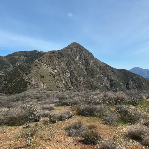
Mt Lukens stands as one of the most sprawling and prominent mountains around Los Angeles, and at 5,074 feet, the highest point within the city limits. It is visible to 5-6 million residents on a daily basis, including myself. Mt Lukens holds the special significance of being one of the very few mountains visible from my backyard, and I know there exist thousands of backyards throughout Los Angeles that also feature a view of this antennae-studed mass of granite.
By my own personal definition, I consider it the western end of the San Gabriel front range, as it lies to the south of the San Gabriel fault, which 5 million years ago was the active plate boundary between the Pacific and North America until it jumped north to Wrightwood and became the San Andreas. (These days the Tujunga Creek, Clear Creek, Arroyo Secco, West and primary Fork of the San Gabriel River follow that former break in the earth's crust.)
Mt Lukens been on my to-do list for years, and the way I wanted to summit was starting at the Kill 'em Quick trail from Tujunga Creek on the far west end, and following the bumpy ridge that features intriguing bits of rock exposure that are visible from all over the city below. When I saw Jeff mention it was a mountain he wanted to bag as well, I reached out.
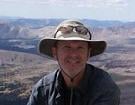
First, there was much appreciated shade as we made the steep ascent up 'Kill 'em Quick" trail. Despite the usual alarmist AllTrails reviews, it was an excellently-constructed trail and only mildly overgrown. Jeff told me apparently firefighters in training once timed themselves carrying a chainsaw up it in 30 minutes as part of their training. It took us closer to an hour and we forgot our chainsaws, but it was plenty of a workout.
The ridge greeted us with hot sunshine, and the views of the city below opened wide, lasting all day. The trail became more of an informal ridge scramble but nonetheless continued, and a bit of class 3 climbing (perhaps the most intense of the day) got us to within view of the famed Tujunga Flagpole and its accompanying exposure that is visible from the Crescenta Valley below.
What you see in that photo wasn't actually too difficult to climb, and that got us to the narrow pile of ledge with the impressive flagpole itself, placed by a very determined and patriotic individual.
The trail now turned south back down the mountain, but we activated pirate-mode and continued instead along the ridge. No trail, but the going wasn't particularly difficult, with gravel between yuccas, buckthorn and various other less-murderous brush allowing us safe passage. Long pants a very good idea but no cutting was necessary.
One north-facing slope held a grove of resilient Douglas or White Firs which had somehow escaped the Station Fire, and continued to hang on despite the no longer hospitable climate of the elevation. One younger specimen grew proudly right on the ridge itself, and was miraculously flush with brand new growth. This remarkable tree Jeff declared his favorite, and I feel similarly.
Alongside the grove we descended sharply into a narrow eroded notch, being careful to not plunge over the north side's edge.
The ridge/firebreak continued to meander in the form of a Z winding around a beautiful but terrifying forest of buckthorn covered in spring flowers and buzzing with swarms of honey bees. I remarked the only thing more fun than crawling through buckthorn is crawling through buckthorn full of bees. Full of spring flowers, the plants are as beautiful right now as they are evil. We then had a steep ascent, one of those unrelenting firebreak scrambles where you have to get into a bit of a zen state in order to accomplish, giving us a good 500 feet of gain quickly and putting us within striking distance of the summit.
 Viewed 199 times")
After resting at a metal triangle sign so many of us love, we made the final push to the summit, intersecting with the Haines Canyon and Stone Canyon trails. Haines Canyon was in rough shape but Stones Canyon looked like it had received a lot of love recently. The final bit was a road walk which we covered deliberately, resting in the shade, until reaching the somewhat underwhelming summit, highpoint of the city of angels, covered as it is with numerous antennas.
We were lean and mean on this trip with none of Jeff's trademark grilled cheese - just punctured cans of victory fish and the crunch of granola enjoyed beneath the shade of some sort of giant concrete spindle, sheltered from the mid day sun.
The hike down to Haines Canyon ended up being a road walk, as we were lost in idle chatter and missed the not well-advertised Haines Canyon trail fork. I collected some mother's day wildflowers for my wife, and we admired the grand humpy ridge we had thoroughly conquered stretching before us.
We reached the city thousands of feet below, and big bad Lukens was crossed off of both our lists! Thank you Jeff for being an excellent hiking partner during quite a big day.
 10.8 Miles
4,458 ft of gain