Mount McKinley

TRs for the San Gabriel Mountains.
Post Reply
User avatar
davidwiese
Posts: 88
Joined: Mon Jul 30, 2018 4:00 pm

Post by davidwiese »

I moved into the foothills of the San Gabes two years ago and McKinley has been taunting me ever since. I've bagged every visible named peak I can see from my house (mostly the Mendenhall Ridge and Little Tujunga areas) but had yet to make my way there.

Three years ago my wife and I backpacked the entire Mendenhall Ridge from Mill Creek Summit to Kagel Mountain as an overnight trip. I peak bagged along the way (Gleason and Iron #2 are highlights). Initially we had planned to make the side trip to McKinley but we were short on water and energy on the final push of our hike.

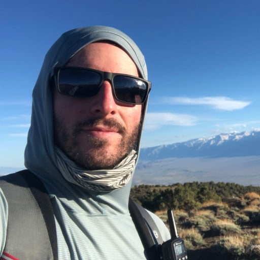
This past weekend, me and a friend went up from Gold Creek and made a ~12 mile figure-8 hike out of it (standard route up, SW ridge down from the summit, and an unnamed ridge along the south side of Gold Creek below Slaughter Canyon back to Gold Creek). It's pretty steady until you get to the turn off at Gold Creek Saddle. From there it is noticeably steeper, with the final scramble up to the summit along game trails:

https://caltopo.com/m/E15BL

The register looks like people sign in every 2-4 weeks. We were the first ones up since the new year.

PXL_20230107_151518985.jpg
Looking up Center Creek. Yerba Buena ridge on the right.


PXL_20230107_155649975.jpg
Looking east from Gold Canyon Saddle down into Big Tujunga Creek.


PXL_20230107_170203117.jpg
Looking south toward Lukens and Sunland/Tujunga.

PXL_20230107_171544836.jpg
View west down into Slaughter Canyon - some older conifers still live here and the trail takes you through a small grove of them.

PXL_20230107_175508512.jpg
Making the true summit looking east. Condor peak/point on the right. Iron #2 barely peeking out just left of summit.


PXL_20230107_175623917.jpg
Interesting marker...


PXL_20230107_175801416.jpg
Summit view looking east.


PXL_20230107_175804487.jpg
Summit view looking south.


PXL_20230107_175807370.jpg
Summit view looking west.


PXL_20230107_175812891.jpg
Summit view looking north (trail up to Mendenhall Ridge/Iron Saddle visible).
User avatar
davidwiese
Posts: 88
Joined: Mon Jul 30, 2018 4:00 pm

Post by davidwiese »

PXL_20230107_175819591.jpg
Better view of Mendenhall Ridge looking NE from summit.


PXL_20230107_181246302.jpg
Heading down the SW ridge from the summit.


PXL_20230107_191707439.jpg
Final ridge descent below Slaughter Canyon. Center Creek on our left, Gold Creek on our right. Our route up is visible on the left.
User avatar
Anthony
Posts: 322
Joined: Mon Jun 05, 2017 11:53 am

Post by Anthony »

Ha, I was up there on the same day. My buddy and I heard you and your partner coming down the use trail as we were going up the established trail. We hiked from Trail Canyon. I ran into another user from here on nearby Iron Mountain (I'm forgetting his name right now).
User avatar
davidwiese
Posts: 88
Joined: Mon Jul 30, 2018 4:00 pm

Post by davidwiese »

Anthony wrote: Ha, I was up there on the same day. My buddy and I heard you and your partner coming down the use trail as we were going up the established trail. We hiked from Trail Canyon.
Hah! We heard you guys when we were coming down the ridge. I was able to spot you and your buddy hiking up briefly before you disappeared into the Whitethorn.
User avatar
Anthony
Posts: 322
Joined: Mon Jun 05, 2017 11:53 am

Post by Anthony »

We plan on doing Condor Peak before summer if you wanna join!

It's great to hit the front range after months of blazin heat
User avatar
davidwiese
Posts: 88
Joined: Mon Jul 30, 2018 4:00 pm

Post by davidwiese »

Actually yea I probably will be down for that depending on the day (I have a 10 month old so getting out is tougher than it used to be). I've made it to Condor Peak before but Condor Point is my white whale of the San Gabes.
User avatar
Sean
Cucamonga
Posts: 3769
Joined: Wed Jul 27, 2011 12:32 pm

Post by Sean »

Thanks for the report.
Anthony wrote: I ran into another user from here on nearby Iron Mountain (I'm forgetting his name right now).
Was it Matt Maxon? He was up there on Saturday working on the trail.
User avatar
tekewin
Posts: 1194
Joined: Thu Apr 11, 2013 5:07 pm

Post by tekewin »

Have you considered doing Condor Point from Trail Canyon?

I think it's a lot of gain (~5k), but I've read a couple of trip reports on it.
User avatar
davidwiese
Posts: 88
Joined: Mon Jul 30, 2018 4:00 pm

Post by davidwiese »

tekewin wrote: Have you considered doing Condor Point from Trail Canyon?

I think it's a lot of gain (~5k), but I've read a couple of trip reports on it.
Last time I tried was in 2018 or 2019 and it was impassable (in my opinion) beyond the remains of Tom Lucas camp. I spent an hour making about 1/4 mile progress before turning around.

I think the only viable routes are from Mendenhall Ridge or from the standard Condor Trail that goes past Fox Mountain.
User avatar
davidwiese
Posts: 88
Joined: Mon Jul 30, 2018 4:00 pm

Post by davidwiese »

tekewin wrote: Have you considered doing Condor Point from Trail Canyon?

I think it's a lot of gain (~5k), but I've read a couple of trip reports on it.
Last time I tried was in 2018 or 2019 and it was impassable (in my opinion) beyond the remains of Tom Lucas camp. I spent an hour making about 1/4 mile progress before turning around. Unless you are talking about going up the ridge directly to Condor Point just beyond Trail Canyon Falls. I had considered that but haven't felt masochistic enough.

I think the only viable on-trail routes are from Mendenhall Ridge or from the standard Condor Trail that goes past Fox Mountain.
User avatar
tekewin
Posts: 1194
Joined: Thu Apr 11, 2013 5:07 pm

Post by tekewin »

davidwiese wrote:
tekewin wrote: Have you considered doing Condor Point from Trail Canyon?

I think it's a lot of gain (~5k), but I've read a couple of trip reports on it.
Last time I tried was in 2018 or 2019 and it was impassable (in my opinion) beyond the remains of Tom Lucas camp. I spent an hour making about 1/4 mile progress before turning around. Unless you are talking about going up the ridge directly to Condor Point just beyond Trail Canyon Falls. I had considered that but haven't felt masochistic enough.

I think the only viable on-trail routes are from Mendenhall Ridge or from the standard Condor Trail that goes past Fox Mountain.
This is a report from 2019, not sure about the conditions now. They left the trail just above the falls.

https://www.trvrsoutdoors.com/blogs/tra ... west-ridge
User avatar
davidwiese
Posts: 88
Joined: Mon Jul 30, 2018 4:00 pm

Post by davidwiese »

tekewin wrote:
davidwiese wrote:
tekewin wrote: Have you considered doing Condor Point from Trail Canyon?

I think it's a lot of gain (~5k), but I've read a couple of trip reports on it.
Last time I tried was in 2018 or 2019 and it was impassable (in my opinion) beyond the remains of Tom Lucas camp. I spent an hour making about 1/4 mile progress before turning around. Unless you are talking about going up the ridge directly to Condor Point just beyond Trail Canyon Falls. I had considered that but haven't felt masochistic enough.

I think the only viable on-trail routes are from Mendenhall Ridge or from the standard Condor Trail that goes past Fox Mountain.
This is a report from 2019, not sure about the conditions now. They left the trail just above the falls.

https://www.trvrsoutdoors.com/blogs/tra ... west-ridge
Yea that's the one I've looked at before but haven't quite got the will-power to go up that way.
User avatar
tekewin
Posts: 1194
Joined: Thu Apr 11, 2013 5:07 pm

Post by tekewin »

davidwiese wrote: https://www.trvrsoutdoors.com/blogs/tra ... west-ridge
Yea that's the one I've looked at before but haven't quite got the will-power to go up that way.
I was considering it, only because the route was proven, though that was a few years ago. I would not have considered blazing it. Not sure I want to attempt it, but it is a novel way to get to the Point.
User avatar
Anthony
Posts: 322
Joined: Mon Jun 05, 2017 11:53 am

Post by Anthony »

I went to Tom Lucas in Fall 2021 and it was pretty overgrown, but I could've kept going. I've done worse. I saw a guy on the trail who was wearing shorts and his legs were sliced up pretty bad. Pant zone for sure. Now I'm curious how far one could reasonably go...
User avatar
davidwiese
Posts: 88
Joined: Mon Jul 30, 2018 4:00 pm

Post by davidwiese »

Would love to have someone go back there soon and take some pics of the current conditions to see if it is possible to loop up and behind Condor again.
User avatar
David R
OG of the SG
Posts: 531
Joined: Sun Jun 12, 2011 10:28 pm

Post by David R »

User avatar
davidwiese
Posts: 88
Joined: Mon Jul 30, 2018 4:00 pm

Post by davidwiese »

Whoa awesome! I'll have to go back. I pulled 20+ ticks off my pants during my 2019 attempt...
Post Reply