Iron Fork (not a bike thing)

TRs for the San Gabriel Mountains.
Post Reply
User avatar
dima
Posts: 1336
Joined: Wed Feb 12, 2014 1:35 am

Post by dima »

Alternative title: two old men go for a hike

MtGoatMan just posted about his trip to Iron Fork. Purely coincidentally, Taco and I just went there too. We made a big loop: started at Crystal Lake, summited South Hawkins, dropped into S. Fork Iron Fork, took that down to the East Fork, then up to Vincent Gap, and then to Windy Gap and back down to the start. The plan was to take two days, or maybe two-and-change, depending on how we feel.

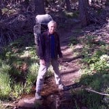
I just got a new camera that's fun to play with, so this will be well-documented. As usual, click for a preview, and click again for the full-size original. Here's Taco at the start,when we're still clean and happy and our legs work:

Image

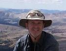
We quickly hiked the easy trail and old road to the summit of South Mount Hawkins. The views from the toilet are grand, as usual

Image

Image

It was a clear-ish day: Catalina and San Clemente Islands were clearly visible:

Image

To the East were Baldy, Iron Mt, and Iron Fork, where we're going:

Image

This guy posed for me, and I took a photo

Image

We descended the ridge a bit

Image

And dropped in here:

Image

It was steep, and Taco complained about bringing the wrong shoes for this. Terrain was mixed. Soft in places, firm in others. It took a lot of work. There're a few tricky downclimbs towards the bottom, but nothing we couldn't handle:

Image

Near the bottom we pushed through a sea of poison oak, and then we were at the bottom of South Fork Iron Fork, at 4800ft.

Image

Image

Image

Surprisingly, there was a lot of water, even here. There were also lots of mosquitos, biting brown flies, biting black flies and stinging nettle. This guy lives here too:

Image

Image

There were a few dry sections along the way downstream, but there was lots of flow in most places. Terrain was mostly stone and small waterfalls falling into pools. Lots of trees, both dead and alive. Not a ton of brush. Taco approves:

Image

Descent was slow going, and very pretty. You're downclimbing a lot of rock. And you're wading in the water most of the time. I tried to keep my feet dry initially, but it's a losing battle.

Image

Image

Image

Image

Image

Image

After hours of effort, the main branch of Iron Fork flowed in from the left

Image

The pools deepened...

Image

Then Taco's bag floated away ...

Image

And he went after it!

Image

Image

Image

This all took a lot of effort, and we finally called it a day after 11 miles.

Next morning we continued downstream, trying to keep as dry as possible, which involved some interesting bypasses

Image

Image

Eventually we were out, in the main branch of the East Fork. The canyon is wider here, but it's still wild and there's lots of water:

Image

Image

Travel is a bit easier. There's an intermittent trail on the banks here and there, but it's still very much a wading situation.

These bugs really like it here:

Image

And we saw the great stalactites of the East Fork

Image

This place feels wild

Image

Then we got to the Fish Fork confluence and Fish Fork Camp

Image

Image

This weevil lives here

Image

Above here the river is green

Image

There's a cool boulder to climb

Image

which probably fell down from this dihedral

Image

Lots and lots of cool rock here

Image

Image

Image

Image

Image

Around Alder Gulch the canyon opens up, and you can walk in drier areas to make faster progress

Image

Image

Vincent Gulch was dry, and we got water in Prairie Fork, next to this old sign. This would be the last reliable water before Little Jimmy, so we got a LOT of water, and left with heavy packs. It was getting late, and we talked about camping, but Taco really wanted to be able to rest the following day, so we decided to just push through, and to finish late.

Image

Past this point is a consistent trail: in the riverbed initially, and then on the right bank. These bugs were doing their thing as we walked by

Image

We slowly climbed up the trail to Vincent's cabin and then Vincent Gap

Image

The sun set just as we hit Vincent Gap. We were both feeling pretty beat up at this point. Especially Taco, who did his usual 250-bike-miles work wee right before this trip. We wanted to finish this night, though, so we altered the plan: instead of climbing Baden-Powell, and walking the PCT to Windy Gap, we'd walk the highway instead. Similar distance, but 2000ft less gain. And easier to mindlessly walk at night. We saw strange light in the grass next to the road. It turned out to be some sort of glow worm

Image

We entertained ourselves by trying to flag down cars driving by, to hitch a ride to Windy Gap. Apparently we looked too threatening though, and nobody picked us up. Well, one guy did stop right after we signalled, but apparently he just wanted to take a break, and had no interest in talking to us. Legs barely functional, we got to Windy Gap, climbed over the pass, and very slowly descended to the car, finishing at 3:30AM at the end of a 23 mile day. With the heat and the tough terrain this was too much, and we probably should have camped. We talked about how jfr probably has more fun on his trips because of a slower pace. Oh well.

We saw 4 rattlesnakes, one of those snakes with the two yellow stripes (garter snake?), a deer, and lots of bear sign. I was hoping to see some sheep, and if it wasn't so hot, we maybe would have. A solid type-2-fun trip. Right now I'm not thinking of coming back, but if you ask me in a week, I'd probably be down.
User avatar
Taco
Posts: 6010
Joined: Thu Sep 27, 2007 4:35 pm

Post by Taco »

An excellent trip. My legs sort of work tonight. I only took a few photos and they're almost all the same as Dima's. I kept my camera in my drybag as I didn't want it to get wet, and later when it wouldn't get wet I just didn't wanna deal with it. I don't have a strap setup yet for wearing while hiking with a pack. Got it dialed in pretty well for bike stuff.

This was my third time down Iron Fork, fourth time in there at all. The hot weather made for fun swimming, as you weren't freezing your ass off whenever you got out. It's a beautiful place, and being far away keeps most people out, so there's no trash or tagging or any of that crap.

I wore the lightest approach shoes La Sportiva makes, the TX2, because pretty much everything else I have is worn out or made for bikes or technical climbing. I wish I had a relatively light leather boot with a mid-ankle top, very minimal lining, sticky rubber sole with smooth ball of foot region and lugs elsewhere, gel insole, and not much else. That would be good. Dries out sorta fast, long lasting, can be resoled. Anyway, I might make a pair soon out of an old pair of issue Altama boots, if I can find some stealth rubber resoles.

I had a pack that weighed less than 50lbs probably. That is hard in this terrain, and without a heavier shoe or boot, and with thin socks. Tradeoffs. The light shoes made creek walking, swimming, climbing, and delicate work easy and natural where most boots would be clumsy and I feel I could get a real injury.

It was so warm at night that I laid on top of my sleeping pad and light bag in my underpants with my shirt pulled up until it eventually cooled a little. Much warmer night than I'm used to.

The glow worm we found was probably a female California Pink Glow Worm, Microphotus Angustus. I've never seen one before so that was a real trip. Very very cool.

I'm real beat. I rode 266 miles this week for work/commuting, 75 miles the night before we left. Not ideal, and in an ideal situation I woulda done an easier hike before doing this, but that's all blah blah blah. Doing big hard bike things has highlighted how you can be very tired and sore and just keep going. I was real sore the first night when we bivied, and sore the next day, and very sore today. Let's see how work is tomorrow, 60 miles in the humid heat we've been having. All about hydration and taking care of yourself in little ways here and there.

Here are a few pics of your favorite admin doin' a jump.
IF1.JPG
IF2.JPG
IF3.JPG
User avatar
Sean
Cucamonga
Posts: 3769
Joined: Wed Jul 27, 2011 12:32 pm

Post by Sean »

Thanks for the report. I think we have Iron Fork well-documented now. Almost as well as Middle Fork.
User avatar
jfr
Posts: 153
Joined: Sat Dec 12, 2009 3:01 pm

Post by jfr »

dima wrote: We talked about how jfr probably has more fun on his trips because of a slower pace. Oh well.

A solid type-2-fun trip.
Ha ha! Yer crackin' me up. That was quite the epic! But, yes, it was Type 2 fun. You guys went 34 miles in two days! Impressive! My wife and I would've taken four or five days. But I'm not sure that there were a whole lot of camping spots to choose from down in there, and keeping it strictly on a Type 1 Fun level may not have been possible.

Just the same, you guys are my current heroes, able to do the things that I am no longer able (or willing) to do. Keep up the good work! I'll still be here, awaiting reports of your next adventure...
My hiking trip reports: https://hikingtales.com/
User avatar
dima
Posts: 1336
Joined: Wed Feb 12, 2014 1:35 am

Post by dima »

Went back last weekend. Saw a bear, a few snakes and a scorpion. No flying, biting bugs at all this time. Below the bridge, right where the river leaves the narrows are these ruins on the W side of the canyon:

Image

Image

I walked up there, and there isn't anything there other than what's visible in these photos. Anybody know anything about these?
User avatar
Sean
Cucamonga
Posts: 3769
Joined: Wed Jul 27, 2011 12:32 pm

Post by Sean »

I believe there are ruins of old miner's cabins that don't appear on USGS maps. Mining started in the East Fork around 1850 but I don't think the area was officially surveyed until decades later.
User avatar
tekewin
Posts: 1194
Joined: Thu Apr 11, 2013 5:07 pm

Post by tekewin »

Wild trip in wild country! San Gabriel rough is a special kind of rough. Pretty areas hidden in there. Well done!
User avatar
Lukens
Posts: 3
Joined: Tue Oct 26, 2021 6:57 am

Post by Lukens »

Sweet report. Wow, so much water! Also, the people want to know: when are we getting another epic bike ride report?
User avatar
Taco
Posts: 6010
Joined: Thu Sep 27, 2007 4:35 pm

Post by Taco »

Lukens wrote: Sweet report. Wow, so much water! Also, the people want to know: when are we getting another epic bike ride report?
Dima has some ideas for an epic ride to write up later. I have a possible big one coming up in the fall.
User avatar
Hikin_Jim
Posts: 4686
Joined: Thu Sep 27, 2007 9:04 pm

Post by Hikin_Jim »

Nice trip; nice TR. Haven't been up there in a while. I've yet to make it to lower Fish Fork, a definite "to do" on my mental list. Those wild canyon trips are always hard, dirty work, but those trips are the most memorable. Hiking crowded trails really doesn't feel like wilderness, ya know what I'm sayin'? Not sure how much longer I can do the hard stuff though now that I'm in my 60s and all. Sigh. But I ain't stopping hiking. Stopping = dying.

HJ
User avatar
Lukens
Posts: 3
Joined: Tue Oct 26, 2021 6:57 am

Post by Lukens »

Taco wrote:
Lukens wrote: Sweet report. Wow, so much water! Also, the people want to know: when are we getting another epic bike ride report?
Dima has some ideas for an epic ride to write up later. I have a possible big one coming up in the fall.
Awesome. Looking forward to it!
User avatar
JeffH
Posts: 1166
Joined: Sun Nov 28, 2010 7:09 am

Post by JeffH »

Hikin_Jim wrote: ....... Not sure how much longer I can do the hard stuff though now that I'm in my 60s and all. Sigh. But I ain't stopping hiking. Stopping = dying.

HJ
I agree, also in my 60's and still hiking.
"Argue for your limitations and sure enough they're yours".
Donald Shimoda
User avatar
JoeHardway
Posts: 1
Joined: Wed Oct 12, 2022 10:56 am

Post by JoeHardway »

Speakin'a Mine Gulch...

Saw your writup on Ropewiki. Had my eye on this 1 for awhile, n had planned to havago at'r, back in late May/early June, but life had other ideas.

Realize we're gettin cock-blocked, at some point, but, what'r your thoughts on tha prospects of determined, but non-technical canyoneers, comin up fr tha bottom? Imagery looks like there's alotta potential, b4 sh*t gits REAL, but I'm wonderin what potential it has, to still hava respectable trickle, this late in tha yr. Seems to have prettygood exposure to tha bowels of Baden Powell, and tha setup bears'a strikin resemblance to Slide Cyn, over in tha SB Range. Did that 1, bout this time, last yr, and was very pleasantly-surprised w/tha flow.
User avatar
HikeUp
Posts: 3851
Joined: Thu Sep 27, 2007 9:21 pm

Post by HikeUp »

Random thought that just popped into my head...Wouldn't it be easier to type if you used real words?

Screenshot 2022-10-12 at 14-23-04 EisPiraten.com-Iron Fork (not a bike thing).png
User avatar
Uncle Rico
Posts: 1395
Joined: Thu Mar 20, 2008 7:48 pm

Post by Uncle Rico »

User avatar
Taco
Posts: 6010
Joined: Thu Sep 27, 2007 4:35 pm

Post by Taco »

Hehehe

You can go up mine gulch a lil from the bottom, but you'll encounter a waterfall before long and I don't know how far you can go before you can't bypass the falls.
Might be worth a hike without a rope etc, might not. I'd pass, personally. I tried climbing up it in winter from the very bottom once. Didn't work out. Falls weren't frozen. Wasn't real cool looking that far down.
Post Reply