As an aside, forum-wise, I've always been amazed at the coincidence that both Elwood and I have an Evil Twin Brother named Jake. The odds are almost astronomical that this could happen in real life, and yet, here we are.
Here, then, in his own words, is Jake's Trip Report:
"I borrowed my brother's car and drove up Highway 2 from Glendale late Sunday evening. There was almost no traffic at that hour, especially since the ACH was still closed due to snow from Vincent Gap to Islip Saddle. I thought about parking at Cloudburst Summit, but it was too windy up there, so I drove down the hill to the larger spot near the Buckhorn Campground. The pavement was dry, but there was plenty of snow on the surrounding hillsides, and it was shining bright under a big moon. Very pretty. I crawled into the back of the car and slept just fine in my 20 degree down bag. It's a lot nicer to be inside a car on a cold, breezy night. And "Stealth Camping" where no camping is allowed really makes me smile.
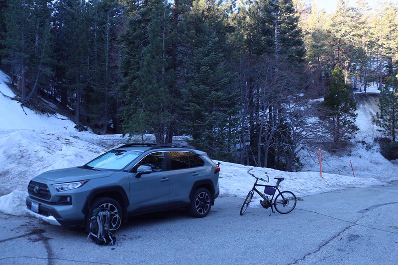
I spent the night just outside the Buckhorn Campground, then got on my eBike shortly after dawn.
It was 42 degrees out there, but at least the gusty winds of last night were gone. It was supposed to get into the upper 50's later on, which sounded like perfect hiking weather to me.
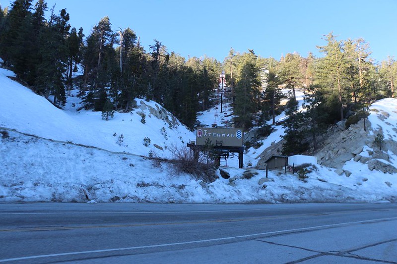
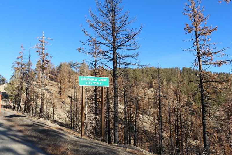
I headed west, uphill, toward Cloudburst Summit, and passed by the Waterman Ski Area, which was closed.
When was it last open? Simonov told me that he once skied there back in the 70's...
It was a fast 700 ft ascent on the eBike. The motor is 450 watts and it took the grade at 20 mph! Zero effort on my part.
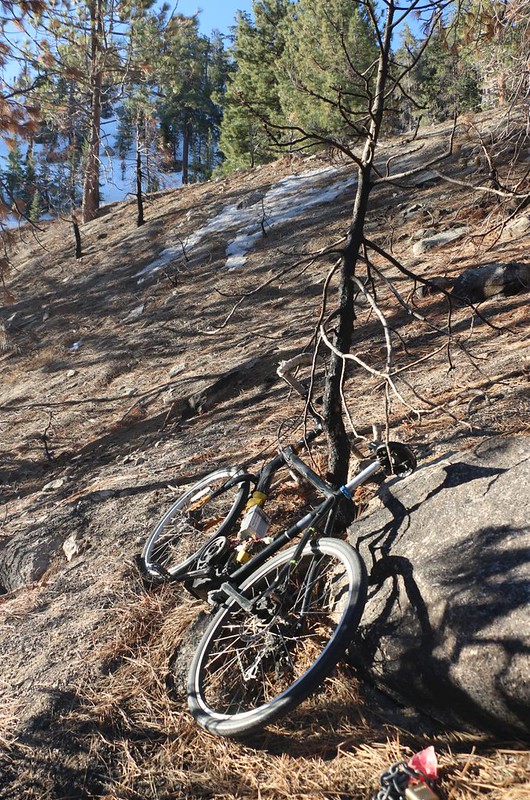
I found a spot below the highway, just beyond the first switchback.
I locked the eBike to a tree, and hid the battery behind a big rock. There was nobody around anyway, on a cold Monday morning, but why take chances? Other (truly) Evil Twins might be lurking nearby...
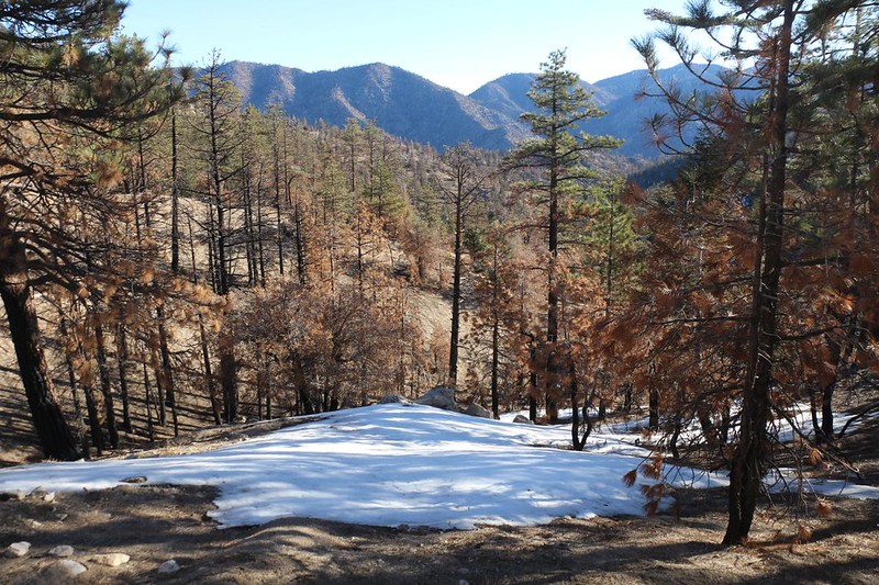
In early March 2022, there was still residual snow on north-facing slopes at 7000 feet elevation
For a closed area, there sure were a lot of footprints in the snow on the PCT near Cloudburst Summit!
[How many twins named Jake can one forest take? It boggles the mind.]
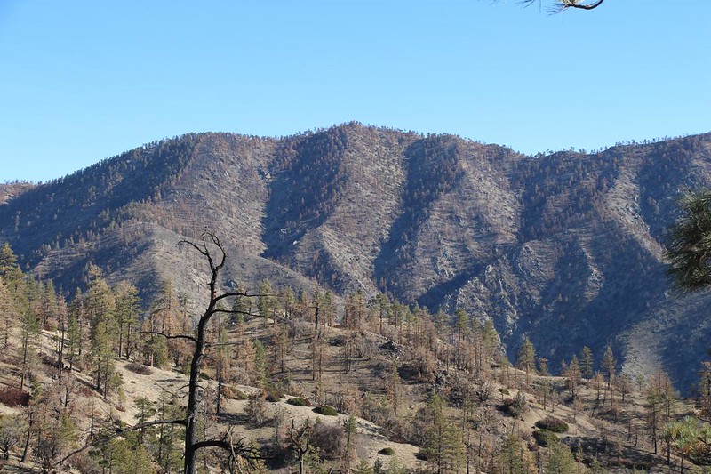
Looking north toward Pleasant View Ridge - you can see where the Bobcat Fire, back in 2020, did and didn't burn
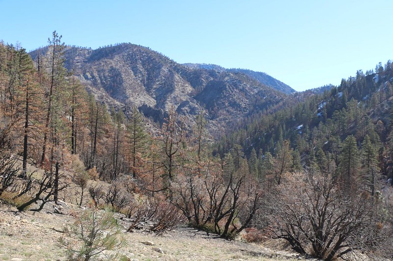
Looking east, down Cooper Canyon, with Mount Williamson and Goodykoontz Peak on the left, Mount Baden Powell, Throop Peak, and Mount Hawkins in the distance, and what I think is Bobcat Knob (Peak 6709 on the old topos) in the foreground, center
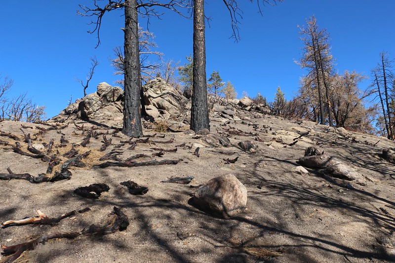
The Bobcat Fire really torched everything on this uphill slope. In other places it avoided "crowning" the pines, and stayed low along the ground like we wish all wildfires would.
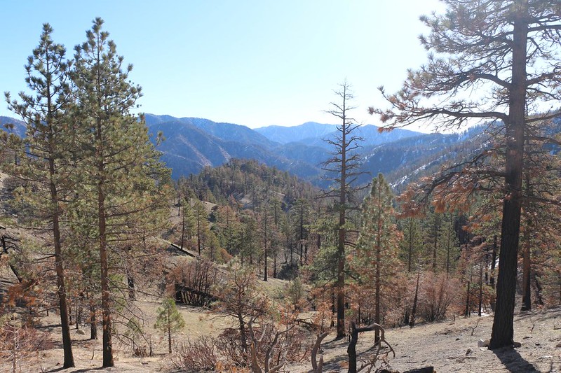
Looking down at Cooper Canyon Trail Camp. PCT hikers often use this. The creek was flowing fine.
The pit toilet was locked with a sign saying that the pump-out truck couldn't get down there because the road was damaged. Yet I saw fresh tire tracks nearby. Maybe they fixed the road?
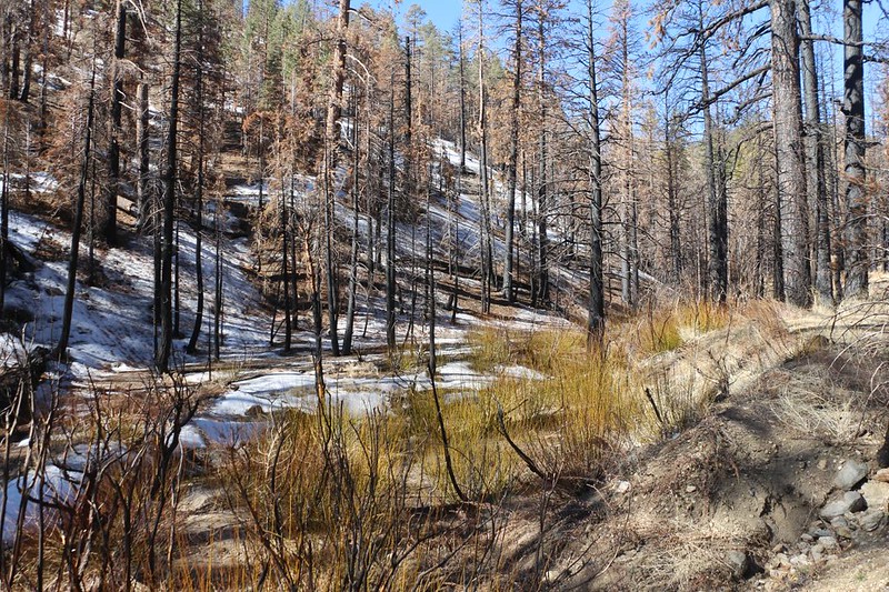
Looking back up Cooper Canyon. There were new willow branches springing up from the roots below the burnt trunks, and they were just beginning to bud.
Goodykoontz Peak (left) and Mount Williamson (distant center). Not all the trees burnt up there.
A bit further on, there was a freshly fallen cedar tree across the creek, and it obscured the trail crossing. It took me a while to figure out where it went, but I eventually found a wooden trail sign up above on the opposite shore, so I rock-hopped across the creek and climbed up the steep canyonside to get back on the main trail.
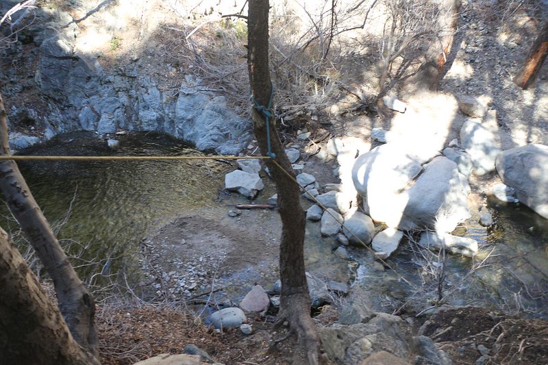
I decided to head further downstream to check out Cooper Canyon Falls, and found a fixed rope leading downward
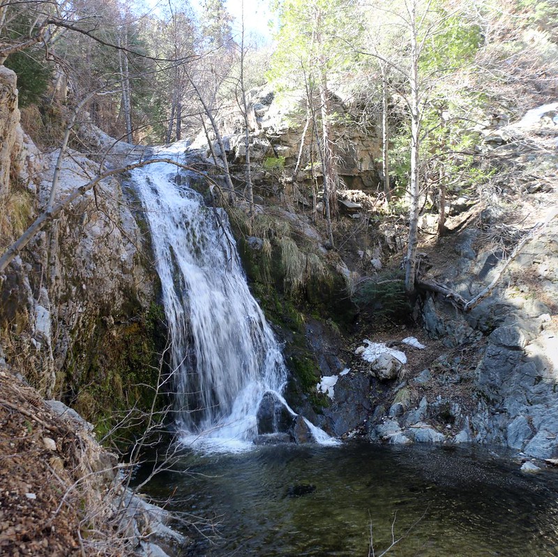
Cooper Canyon Falls was flowing well thanks to snowmelt coming from upstream
I continued a bit further down-creek on the PCT, hoping to reach the trail junction at Little Rock Creek where the official "Frog Closure" ended, but the trail hadn't been maintained at all, and the fun was gone. So I turned back. I had expected this, as the Guthook PCT App on my phone had comments from last year [written by other hikers named Jake, no doubt] describing how miserable it was to bushwhack on that overgrown trail.
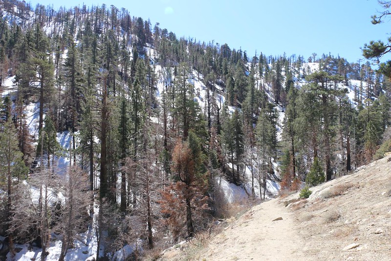
This was the lowest elevation point of the day, and after that I headed uphill on the Burkhart Trail (10W02). Technically, northbound PCT hikers are asked to hike a few miles along the highway west of Islip Saddle until they reach the Buckhorn CG and the Burkhart Trail, which has now been designated as a "PCT Alternate" by the PCTA.
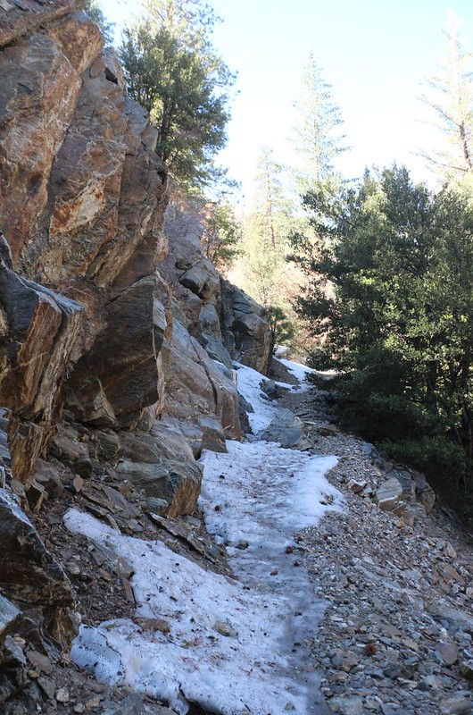
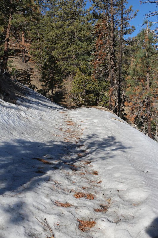
The Burkhart Trail was still icy with residual snow down in the canyon thanks to a north-facing slope
I was glad I waited a week after it snowed before hiking - there was good footing along the edge
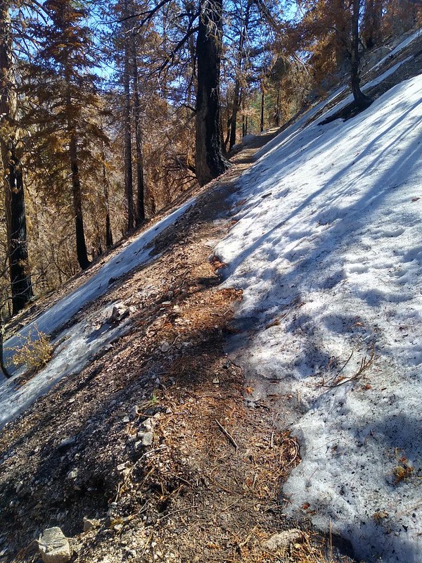
The northern slopes still had plenty of snow and appeared largely unburned by the fire
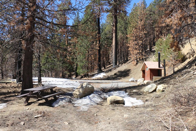
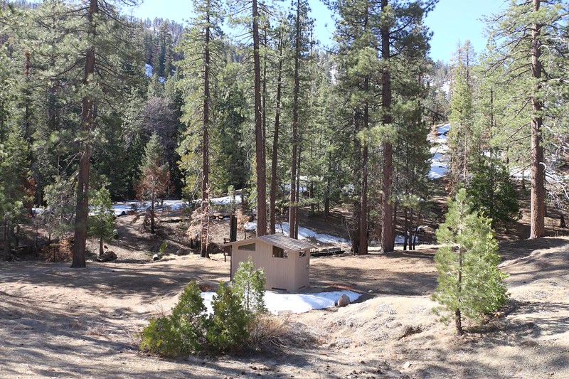
I made it to the Burkhart Trail trailhead in the Buckhorn Campground - this area was obviously still closed for Winter
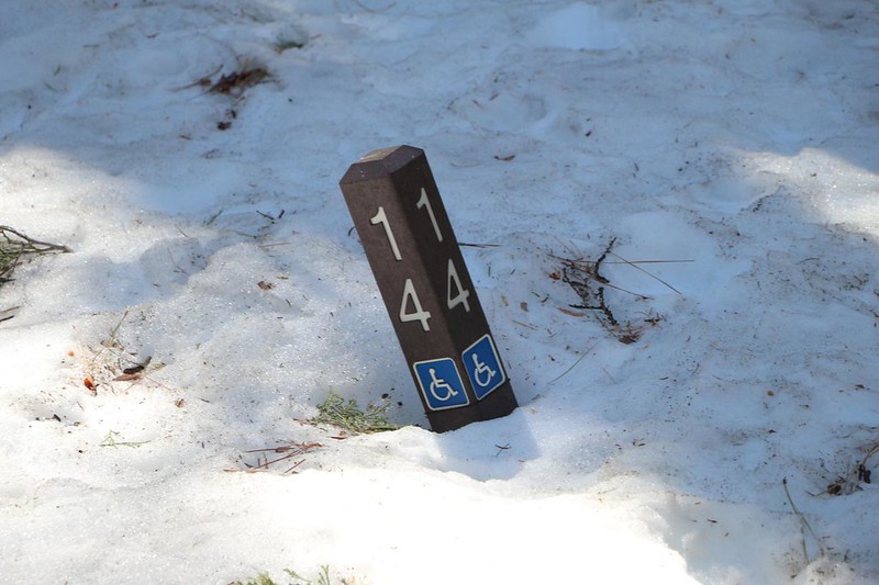
Site 14 in the Buckhorn Campground was for handicapped access, but only with custom wheelchair chains and/or 4WD due to snow!

The central kiosk and pay station was still covered in snow
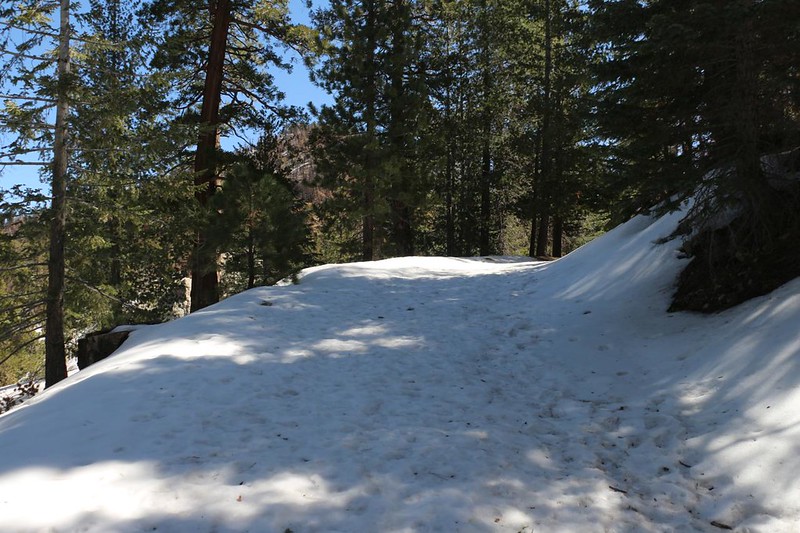
Snow-covered road out of the Buckhorn Campground.
Luckily it was warm and the snow was softening so the footing was fine. I had brought microspikes just in case, but I never needed them, even though the snow had been crunchy and glazed in the early morning.
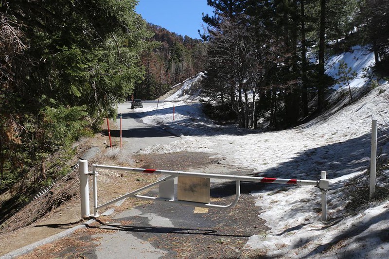
I made it to the locked gate of the campground and was able to see the car parked just outside
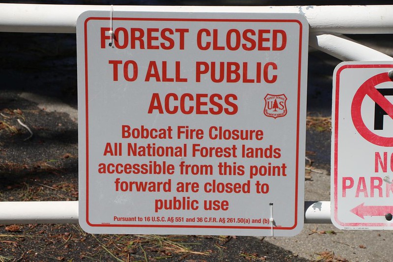
Now that it was too late, I realized that the area of forest I just hiked through was still closed due to the Bobcat Fire! How could this have happened?
Just as I reached the car, an official Angeles National Forest pickup truck drove by, heading east. He looked at me, but he didn't stop. I was quite glad he hadn't seen me a minute earlier, on the wrong side of the gate! And it's also a good thing that I don't wear a hat that says "JAKE" in big letters.
Just the same, I got in the car and headed west right away, back to retrieve the eBike.
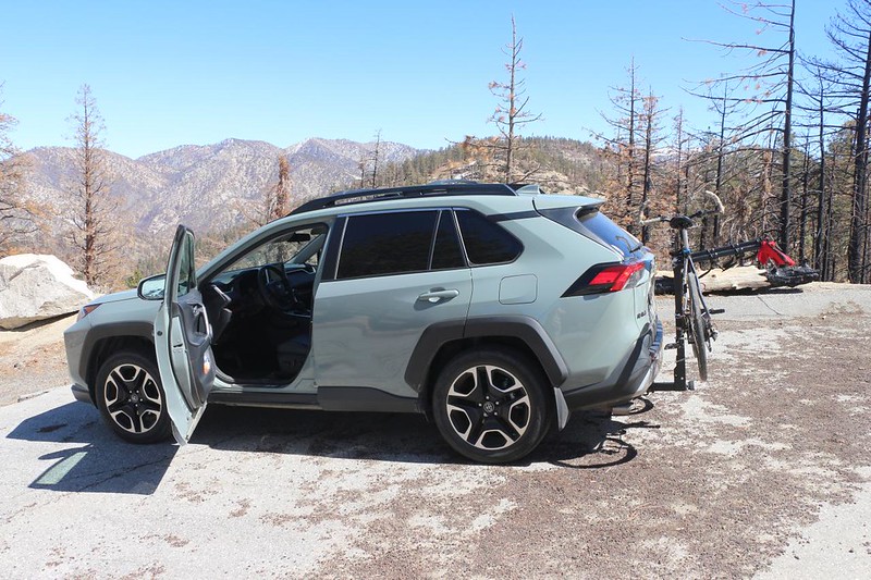
I loaded the eBike onto my car's bike rack up at Cloudburst Summit
It had been a successful hike thanks to the bike, and the weather had been perfect all day. This little stretch of PCT was one of the last sections of "PCT CA Section D" that I hadn't finished, so I was pretty happy. I also hadn't been hiking in the San Gabes in over a year, and it was good to be back," said Jake. He's quite a tale teller.
I read here on the forum that the Bobcat Fire Closure Order was set to expire on April 1st, in less than three weeks, and when I told Jake about it he scowled at me. He likes to live life dangerously, and learning that none of the authorities really cared about him being there really took the wind out of his sails. I laughed and told him that he needed to up his game. Maybe he should hike the "Frog Closure" next time! Ha ha! Jake was not amused.
GPS Tracks on my Caltopo Page
More photos and videos on my Flickr Album Page.
Happy Hiking!