I set foot on the boat traveling to Scorpion Harbor which departs Ventura Harbor at 8am sharp!

The crew from the Island Packers which is the company that takes you to the Santa Cruz Island, informed us that weather conditions might force us to find an alternative route & hike.
So far the weather was looking great and the Sea lions seem to agree.

FYI, the pier at Scorpion Harbor was damaged a couple years ago and so we had to transfer over to a skiff boat (6 people per skiff) and were dropped off on the beach.


This was the view from the boat when we were approaching the island but it soon cleared up.

After a quick snack and change of shoes, we finally headed up the access road to the bluff which contours around and meanders along the cliffs towards the Scorpion Canyon Loop Trail sign.

There are two ways to approach Montanon Ridge where the trail splits, we elected to take the scenic route through Smugglers Cove where we hiked through an Olive Grove and stopped for lunch at the beach.

Sign on the beach


We continued ascending up the ridge and traversing through a use faint trail through some light brush. The ridge is clearly visible at this point.

At one point from the Ridge you could get awesome views of the Olive Grove down below.

Another awesome view of Anacapa Island, which is my next destination.

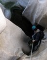
The Steep uphill climb up the Montanon Ridge is made up of volcanic rock. Some areas are loose and crumbly. There is a number of false summits, in which you are climbing up and down. You end up climbing about 3000 ft gain to reach and 1800 ft summit.


I just couldn't resist climbing these rocks on the ridge!

Point 1800' just before the the 800 ft climb to the summit of El Montanon, which is the high point of El Montanon Ridge.

A glympse of El Montanon before the final push to the summit.

The High Mount Bench Mark is at the summit. There is a register with the cutest, smallest, register box I have ever seen. The register book seems to be missing but there are tons of loose papers with signatures.

I found a copy of a map and signed it.

I was so excited to find Reference Marks 1 & 2 and a Triangular Station BM


After bagging this peak, we headed down the ridge passing by Prisoners, and headed towards the Scorpion Canyon Loop Trail.

On the descent we passed a very scenic route, an old oil rig, some white rocks along the trail and at the tail end of the hike a campground on the way back to the beach.


We started boarding the skiff boats at 4:15pm, as we were told because the last boat departing Santa Cruz back to Ventura was at 5pm.

The sunset on our departure.

Overall, it was an awesome day! This was my first hike on one of the Channel Islands and it was well worth the boat, skiff ride, and the never ending steep ridge climb with scenic views surrounding the island. It was an 11 mile hike
I failed to find Pt 1532' BM that I read about. I couldn't find it on the descent from the summit and there weren't many TR's on this hike. The earliest TR I found was written in 2012.