
It took some time to plan this hike. The biggest problem, logistically, was water. The PCT Water Report said that there were only a couple of spots with minimal water along the entire stretch, and they weren't in a very convenient place for us. So we decided to cache our own water along the way, driving down dirt roads when needed. Also, our son helped us out and we were able to leave our car at the far end. No hitchhiking required!
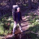
He dropped us off at Onyx Summit on Highway 38 in the early morning and we started hiking. Ten miles to go with a drop of 2000 feet. Nice!
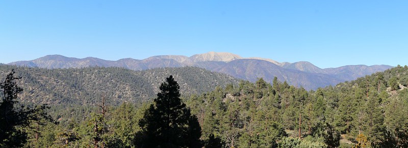
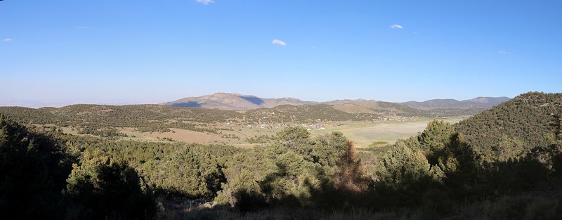
View of the San Gorgonio Mountain Range from the PCT at Onyx Summit. The snow was long gone. That's Ten Thousand Foot Ridge to the left of San G.
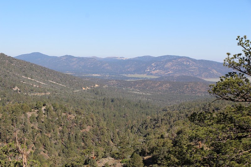
Initially, the trail had some expansive views out over Big Bear City and Baldwin Lake, but they didn't last. It then proceeded to head down into the Arrastre Creek Valley. It was shady and cool down there. At the Arrestre Trail Camp we found the "official" trickle of water that we didn't need, it being way too far from our first night's campsite.
Looking Northwest toward Big Bear City
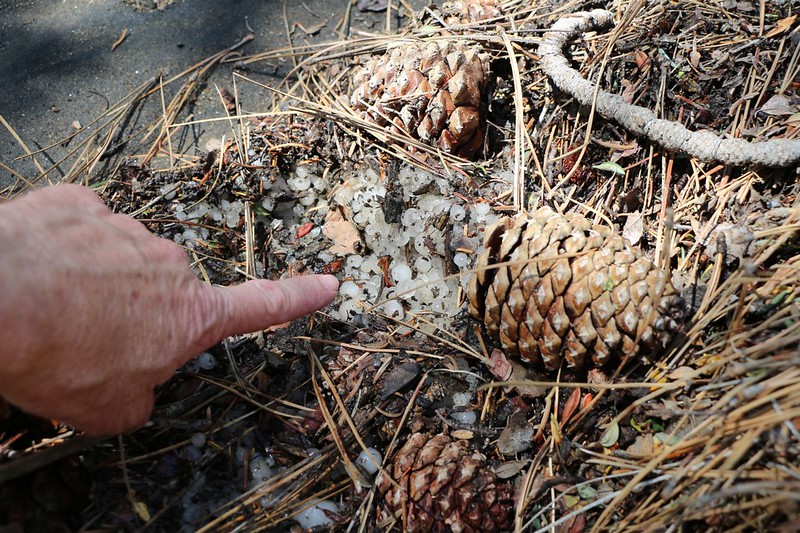
Hailstones and pinecones along Arrastre Creek, from a big thunderstorm the day before
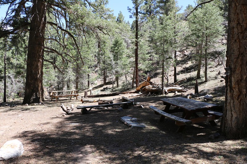
Arrastre Trail Camp on Arrastre Creek
The trail climbed above Arrastre Creek as we watched cumulus clouds growing while refusing to give us shade.
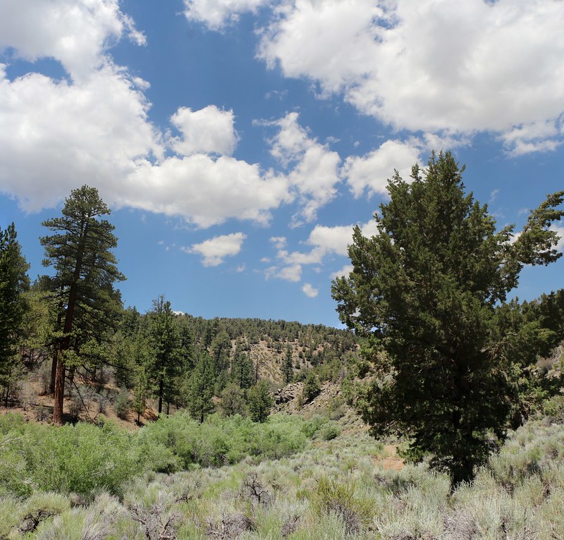
Meanwhile, Arrastre Creek continued downhill without us, eventually emptying into the Mojave Desert, so we really didn't want to follow it anyway. The trail climbed up and we found ourselves on a high rolling plateau with minimal shade but plenty of views, alternating from the west to the east side of the Pacific Crest.
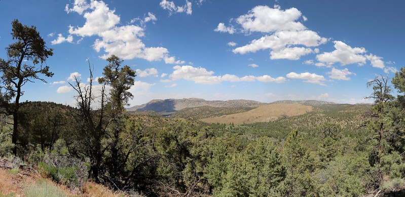
Panorama view northeast toward the Granite Peaks
View west looking toward Big Bear City
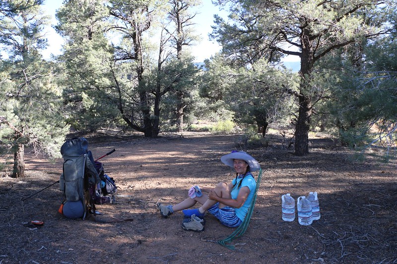
We made it to the first day's campsite near Road 2N02 (Burns Canyon Road) and got out of our hot shoes.
We had cached three gallons of water here but only used two of them. We ended up leaving the other gallon along the trail for future hikers. Normally, I would have dumped it out and carried the empty jug rather than leave plastic litter behind, but we'd already seen more than one water cache left by Trail Angels for the late-season through-hikers, so we figured that we could at least pretend to be temporary Trail Angels, and hope that the recipient had the self-respect to carry it out with them.
There weren't any views down by the road that night, but we didn't really care because we'd woken up around midnight in order to drive all the way here from San Diego. The only thing we wanted to do at this camp was eat and sleep. And we did.
We woke up early the next morning and started hiking right away, first uphill, then up and down along the crest east of the town of Baldwin Lake.
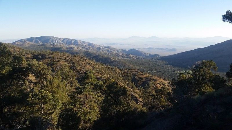
Looking out toward Silver Peak and the Mojave Desert
The Mojave Desert in the distance - We were sure glad not to be roasting down there!
We crossed Highway 18 and continued onward to Holcomb Valley Road, where we picked up our second day's cache of water. Unfortunately, this cache wasn't as optimally placed, as we really wanted to hike a couple more miles that day. So we headed on over to the nearby Doble Springs Trail Camp and set up our tent in the shade. This would be our siesta spot for the rest of the afternoon, and we wanted a bug-free environment for snoozing. We napped and read books for a few luxurious hours.
The view of Doble Spring from the PCT. The spring was dry when we got there.
We cooked dinner at the camp in order to use up some more water, and then we started climbing 500 feet or so to a saddle on the northeast ridge of Gold Mountain.
Wide panorama view over Baldwin Lake as we head up the shady side of Gold Mountain
We found a few small campsites that previous PCT hikers had made up there on the saddle. None of the sites were all that great, but at least there was a nice view if you walked a hundred feet back down the trail. We enjoyed the sunset after setting up camp and headed to bed. Our plan was to get up early and hike the remaining eight miles in the morning, if possible, so that we could beat the traffic out of the mountains.
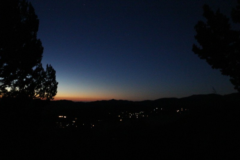
Pre-Dawn Lights of the town of Baldwin Lake
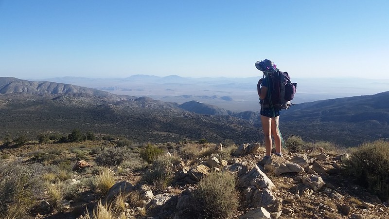
We started hiking, and the trail gave us some fine views north over the Mojave Desert, then swung southwest for awhile, across another plateau region with grassy meadows and tall pines. Then it dropped down into Van Dusen Canyon and crossed a well-maintained dirt road (Road 3N09).
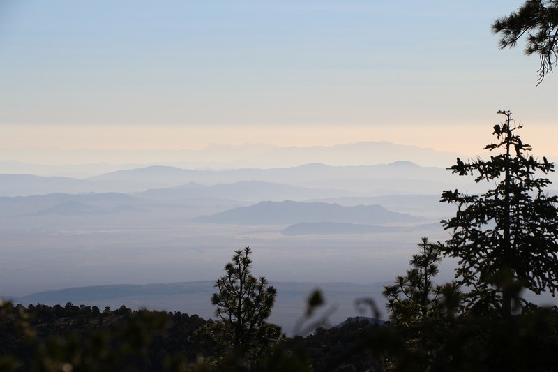
Zoomed-in view over the Mojave Desert as the morning haze begins to form
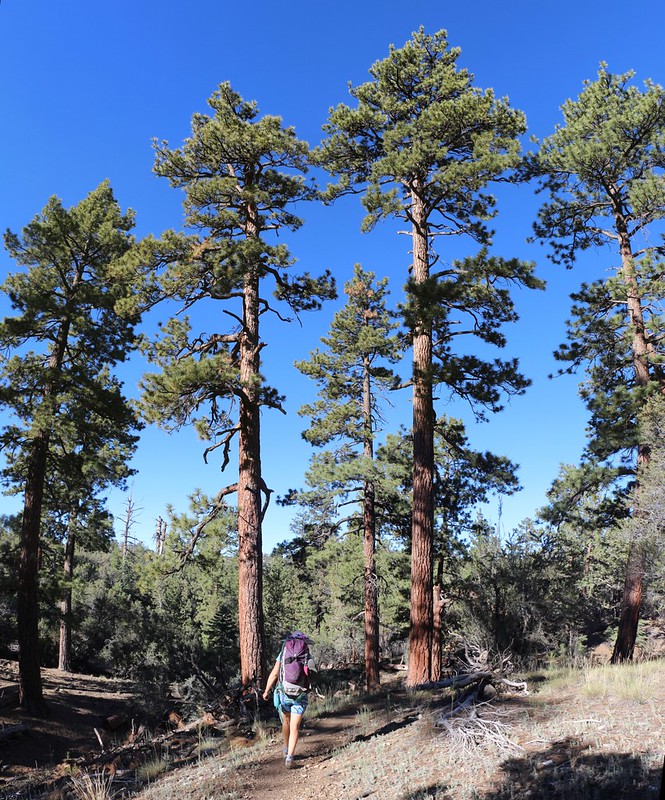
Tall stately pines on the Pacific Crest Trail
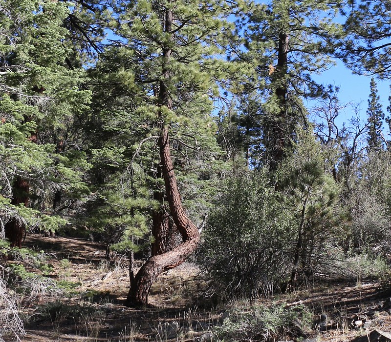
We looked up and there it was - a twerking tree!
There was a large PCT-Hiker campground at Van Dusen Canyon Road, due to the water that was typically flowing in Caribou Creek. But it had dried up by the time we arrived. Just the same, some Trail Angels had left a few gallons of water there. We didn't need it, but it was heart-warming to see people caring for each other like that. After crossing the road, the trail began climbing steadily again. Only three and a half miles to go!
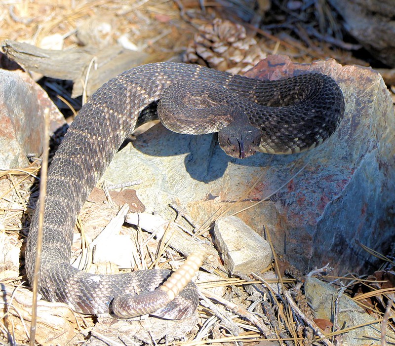
Almost immediately I ran across a rattlesnake who was NOT happy to see me
Can anyone identify it? I tried looking on the internet, but I wasn't sure.
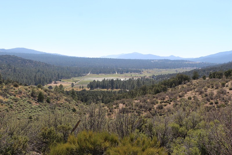
The trail climbed high again and yielded views north over Holcomb Valley. After that it crossed back over the crest and gave some awesome views south over Big Bear Lake and the high peaks including San Gorgonio Mountain.
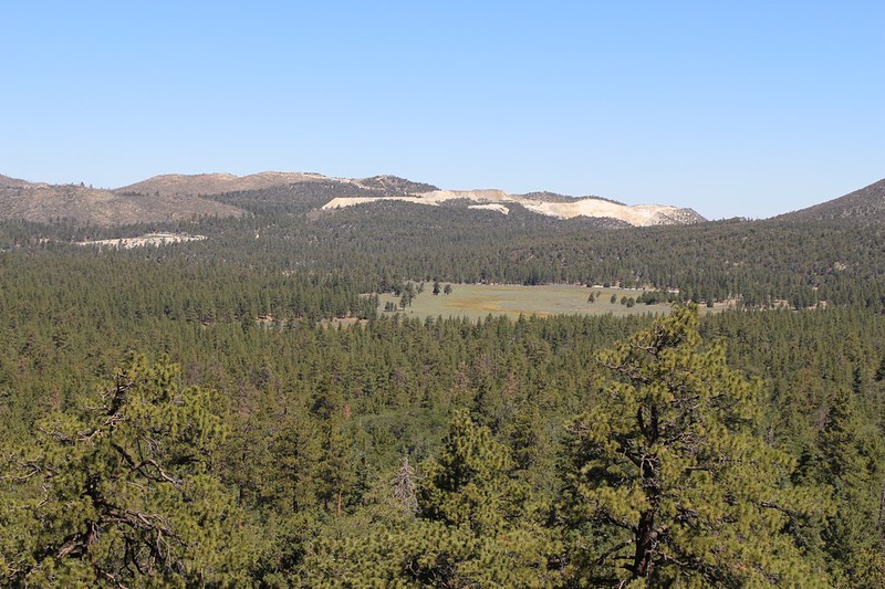
The meadow in Holcomb Valley and the cement strip mine just beyond it
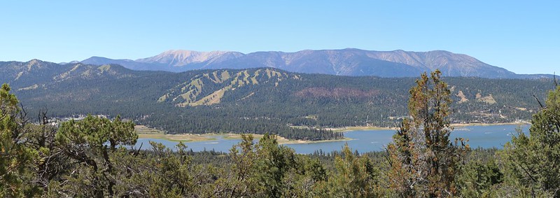
The PCT tops the ridge, providing great views of Big Bear Lake, ski slopes, and the San Gorgonio 9 Peaks
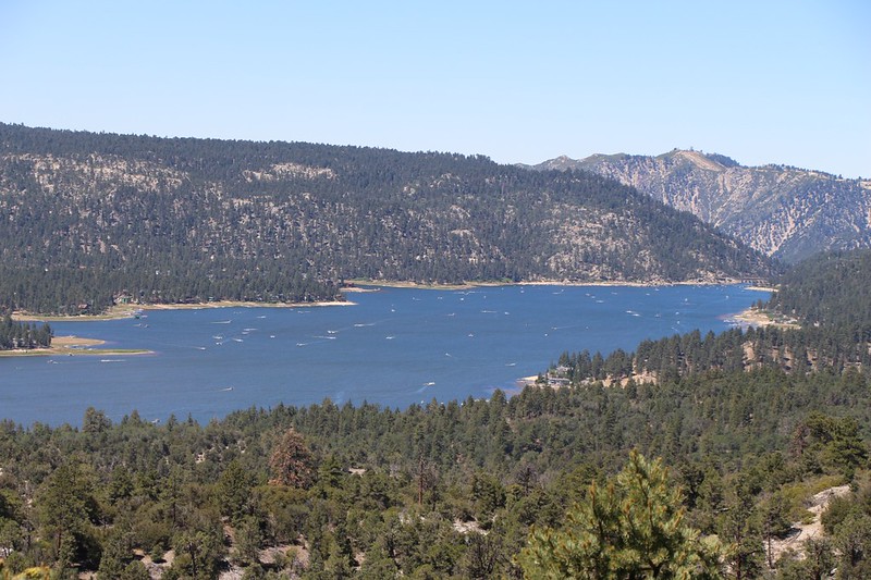
Fourth of July Weekend boating madness on Big Bear Lake - everyone is out there having fun!
It turned out that we made a good decision to head back a bit early! While driving home from the trailhead we discovered that Highway 38 had become a veritable madhouse of cars and pedestrians visiting the hiking paths along the lake. Every parking lot was full, and there were happy people everywhere. All in all, whether hiking, driving, or boating, it was a great weekend to be up in the mountains!
For a longer trip report with even more photos check out my website.
For a topographic map please check out my CalTopo Page.

