Navigation
- Left click and drag to pan around (or use arrow keys)
- Spin your scroll wheel up and down to zoom in/out (or use + and - keys)
- Right click to set a marker or center the view
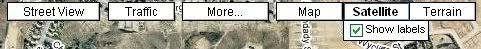
- Street View: Actual photos at street level. Very useful for determining what side of the street that sushi place is on.
- Traffic: Live freeway speed maps. They've added road work and accident notices. Some sections don't have data so I still use Sigalert.com and a few other sources. None of them are 100% accurate.
- Satellite: Click on "Show labels" to overlay roads.
- Terrain: Really nice looking shaded relief terrain maps. 200' major contours and 40' minor contours. Not as many labels as a USGS topo, though.
Searching
- I love this feature. It works so well. Want to find every Del Taco in town? Type "Del Taco in Los Angeles." You can search for addresses, roads and intersections, places, businesses, coordinates, even geographical features. To learn more: http://maps.google.com/support/bin/answ ... swer=68474
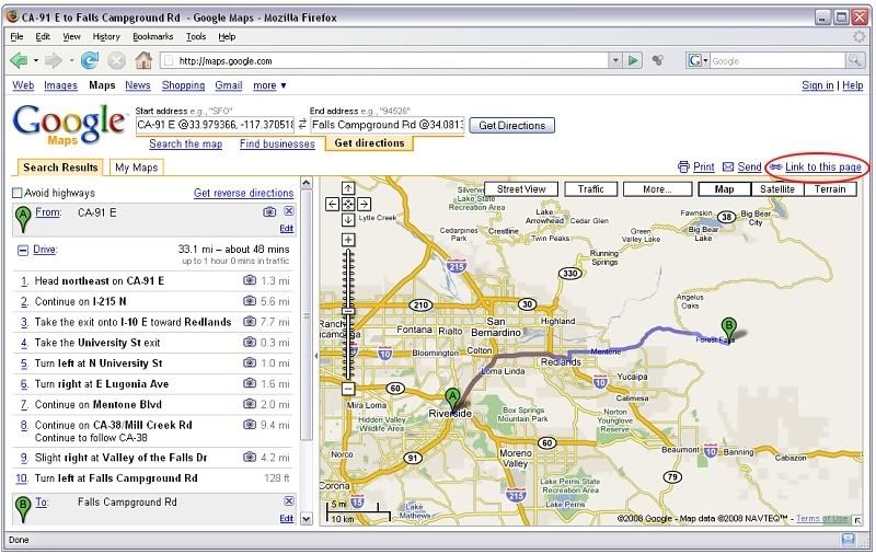
- To make driving directions, search or type in the starting and end points.
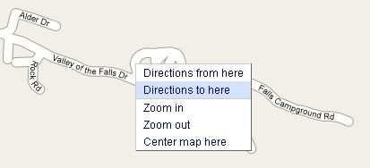
- Or set markers by right clicking and selecting "Directions from here" or "Directions to here". It doesn't have to be exact since you can drag the marker after you set it.
- If you set a marker on a road, make sure it's on the side of the road that you want.
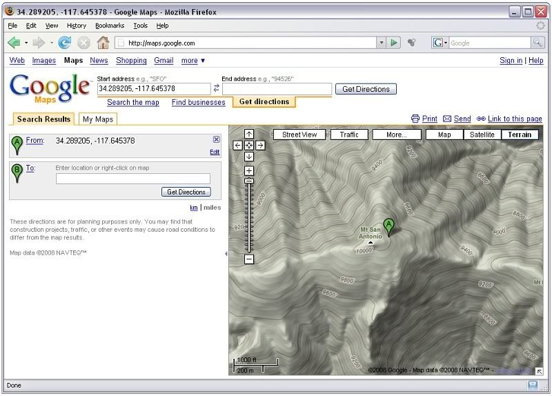
- You can get the lat/long coordinates for any position by setting a marker or dragging the marker to where you want to get coordinates.
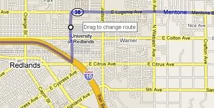
- After Google calculates the route, you can change it by clicking anywhere on the route and dragging it as desired. This works really well.
Change the route by clicking and dragging:
Getting coordinates:
Sharing
- To share your map and/or driving directions, click on "Link to this page" in the upper right. Copy the URL in the box that pops up and paste it to your email, IM, forum post, etc.