
There are many discussions about great fighters and many discussions turn to not who was the greatest fighter or with the best record but who is the best pound for pound. Similarly when you do hikes, you can most certainly have great elevation gain and long mileage, however I can't think of a peak like Granite that packs so much in such a short hike. The mileage is only 6.5 miles but you get over 3,000 feet elevation gain and oh yeah almost all the gain is in a 2 mile stretch.
I haven't seen any extensive write-ups on this beaut so here it goes. I parked my car on the side of the road on S2 as the dirt road leading to the TH was recommended for 4WD, adding an extra two miles to the hike. The reality is that all cars especially with some clearance could drive to the trailhead. On starting up the dirt road I surprised the only wildlife I saw that day a jack rabbit bounding along. The desert in this area is quite bountiful with all sorts of prickly plants growing all along the route.
The route begins innocuously enough by entering a cool sandy wash. There are many small dry waterfalls to negotiate that are noticeable only in the fact that they exist. The first crux of the hike is to find your way out of the wash. The reality is any ridge heading in an easterly direction will get you on to the main ridge however the most direct route to the ridge is between the second and third drainage areas (read HPS guide for more details). The way to note when you are at this point is that the wash will take a sharp jog north, narrow, and you will have to negotiate an easy 15 foot dry waterfall. Look to your left as the wash widens again and you will see a gentle sloping section coming down from the ridge, this is the easiest access point.
Begin climbing this gentle ridge that gets steeper and steeper. You will reach a saddle where you can either jog to the left to access the main ridge or continue straight up through a boulder wonderland. Obviously scrambling through the boulders and brush is the way we hike so up I went. You work your way through a maze, sometimes laterally looking for open space to continue upwards until you hit the main ridge just before peaklet 4,624. From here you want to follow the flat-like plateau in a NE direction staying on the west side until you hit a saddle.
This is the next crux of the hike and the steepest section. Ahead of you will be a boulder strewn ridge that looks like you're going to need some serious clambering to get over it. I eyed it carefully and came to the conclusion that staying as close to the spine of the ridge afforded the cleanest route up. Sure enough about halfway up I encounter my first duck and from there ducks help you thread the needle of climbing through the car sized boulders. After this climb you think you're there but oh no, there are two more rocky peaklets you need to negotiate before you get to the third which is the true summit. All of these sections require bouldering and weaving through some brush. Finally you reach the summit which has a similar feel to Rabbit with a large sloping rock that you clamber up on. The top had some drilling into the rock that had been done, not sure why. The top was blustery so I only took a couple of pics, signed the register that went back at least as far as 1999, and dropped to a sheltered spot in the rocks.
From there it is almost as slow descent as your way up as there is little hiking but more rocks and steep climb downs until you get back to the wash. It was quite a relief to get back down into the sandy wash and have some normal walking to do. The whole hike took just under 5 hours which appears fast compared to the 7-8 hours in the HPS guide. I had no expectations for such a work-out and the mountain did have the last laugh as my left arch started bothering me just as I reached the summit and was quite painful by the time I reached the bottom so I had to postpone my Whale climb that was planned for the next day. This hike had it all route finding, bouldering, some brush, off-trail, and steep climbs, great stuff.
Granite Mtn. #2-Anza Borrego

what's up guys. great TR David, I enjoyed reading that as it brought back memories.
Here are some pics of when I did it:
https://picasaweb.google.com/1086639589 ... teMountain
Here are some pics of when I did it:
https://picasaweb.google.com/1086639589 ... teMountain
Almost a year ago, I commented that Granite was on my list and I finally got it last week.
I took the Rodriguez Canyon route along the south ridge instead of the more frequent east ridge. There is an old mining road on the south side that ends at two mine shafts. We entered and explored both, but rat droppings turned us around before we found the end to either one. Lots of cactus and some scrambling but I think this route is easier than the east ridge. Here are a few pics and a link to a photosphere from the summit. The photosphere is a Google invention and came out first on android phones, but there is now an app for iphones.
Full report
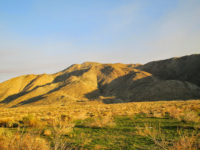
Granite from the south
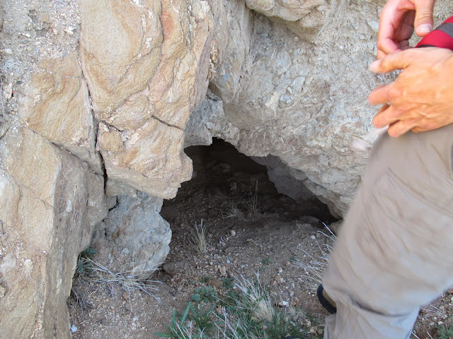
First mine entrance
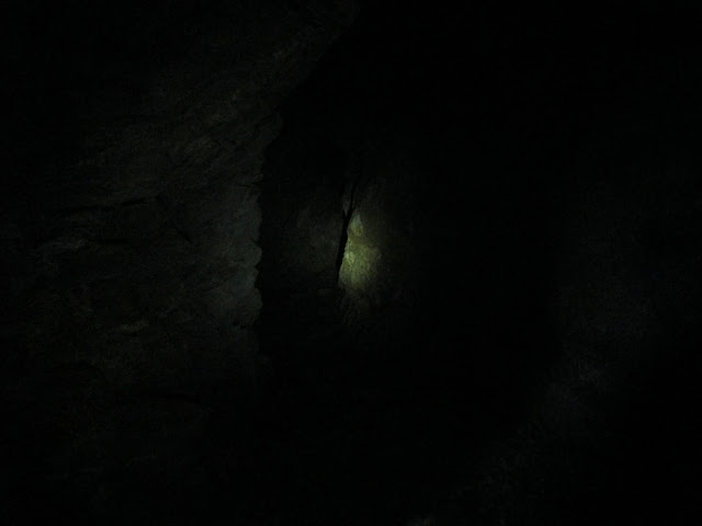
The mine keeps going
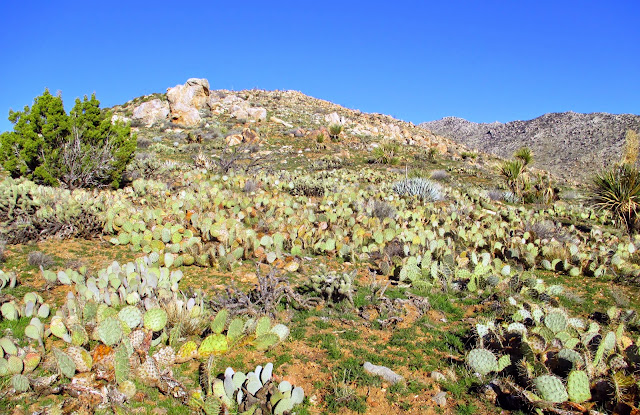
Sea of cactus
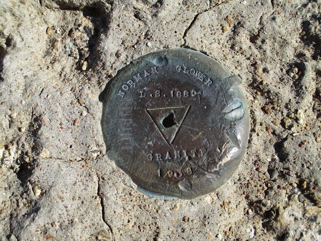
Benchmark
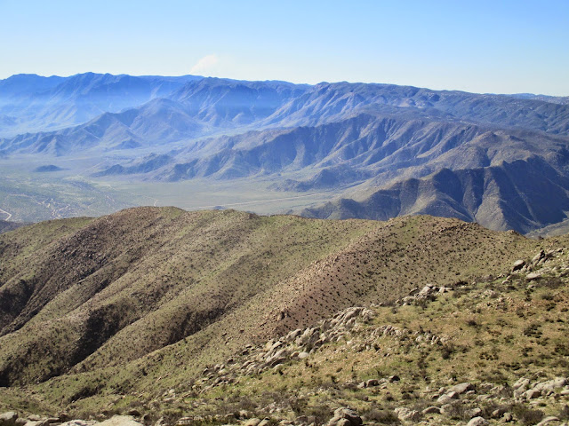
Looking back at the south ridge
Photosphere from the summit
I took the Rodriguez Canyon route along the south ridge instead of the more frequent east ridge. There is an old mining road on the south side that ends at two mine shafts. We entered and explored both, but rat droppings turned us around before we found the end to either one. Lots of cactus and some scrambling but I think this route is easier than the east ridge. Here are a few pics and a link to a photosphere from the summit. The photosphere is a Google invention and came out first on android phones, but there is now an app for iphones.
Full report
Granite from the south
First mine entrance
The mine keeps going
Sea of cactus
Benchmark
Looking back at the south ridge
Photosphere from the summit