
Took a cloudy/rainy hike up the Trabuco canyon trail to the Main Divide Truck Trail, this is part of a few very popular Mountain biking loops so the rain kept them away and left me the trail to myself.
The Trailhead Is past the popular Holy Jim's parking area another 1/4 mile down the Rough Trabuco canyon road. the trail starts out relatively flat in the Trabuco creek bed under 80ft sycamores and alders. after about 1.7 miles the trail splits and the West Horse Thief trail rises out of the canyon via switchbacks to the main divide truck trail. I continued along the Trabuco Canyon Trail which rises 2.7 miles high up on the canyon wall 100ft above the large pines, sycamores, and alders below. Great views of Yaeger Mesa a large meadow of the side of Los Pinos Peak. Climbing out of the canyon Reveals the Massive amount of large pine trees on the north side of los pinos peak, probably the highest concentration of pines in the range.
As I neared the Main Divide the Clouds caught up to me and soon I was looking at clouds in all directions, but I pretended I was in the Pacific northwest hiking in the fog and rain amongst the Large Pines. when I reached the main divide junction I decided not to hike the extra mile up to Los Pinos peak because it was shrouded in clouds and I had been there plenty of times with the full view. I ended my hike and walked back down the Trabuco Canyon Trail in the clouds.
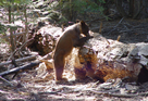
Pictures- http://www.flickr.com/photos/98779591@N ... 896831145/
Trabuco Canyon Trail 11/20

Thanks for the write up. Looks like your route was something like this. Nearby Holy Jim Falls is one of the few places that I have been to in the Santa Ana Mountains, and that was probably back in the 90's. I'll definitely have to head back up this way.
The terrain looks pretty similar to the front range of the San Gabriels. Lots of Douglas Firs -- I assume that's the mountain you were referring to.
HJ
The terrain looks pretty similar to the front range of the San Gabriels. Lots of Douglas Firs -- I assume that's the mountain you were referring to.
HJ
When the trail splits I went right up the Trabuco canyon trail instead of right up the switchbacks on the west horse thief trail. the Trabuco canyon trail has all the big trees and shade, Horsethief has unshaded chaparral switchbacks on the way up to the main divide.
The Trabuco canyon road is pretty rough especially once you pass the National forest boundary. I have seen plenty of smaller cars make it all he way to the trail heads, you should just have to be cautious to avoid the big bumps and potholes and you'd be fine. Rain could make the road impassible for lower profile cars but after a day of sun it dries out.
Thanks, guys, that's about my memory. Should be good stuff.
So, any decent places for a quick overnighter* over that way? Something like what Hoegees is in the San Gabriels. Something with water. Ideal is something fairly short so I can carry my daughter in.
HJ
*Quick overnighter: Head in on a Friday night after work, head out Saturday morning or afternoon. "Low impact" backpacking (still have Saturday evening and all day Sunday for other things).
Backpacking in the Santa Ana's is pretty limited dispersed camping is only allowed in the san mateo wilderness. Either you hike to bluejay campground which is a drive in campsite off the main divide road with 55 sites, fire pits, bathrooms(gross), and water, Or your other option is the San Mateo canyon wilderness where dispersed camping is legal.
bluejay has a few trails that connect, but the other "end" of the trails are 10+miles away they have great views and a few smaller waterfalls along the way but are probably more strenuous than you are looking for.
The San Mateo Canyon Wilderness has a few good spots to camp near water sources.
Fisherman's camp 1.5mi car to campsite if you hike a mile or so farther there are some good sites in San Mateo canyon near the bluewater trail junction by the creek.
There is also a nice site at he top of tenaja falls about a mile from the tenaja trailhead under some large oaks 30ft from the top of 150ft multi tiered falls great relaxing spot. if you start at the fishermans camp trailhead you could extend this hike to 3 miles.
Longer Option about 6 miles from the candy store trailhead go bear canyon trail-verdugo trail-oak flats. large meadows, oak trees, and sometimes a small herd of cows(1 bull). nearby short "peak" 2616 has decent views. water found at serrano spring or 2 unnamed springs.