Went to Vogelsang high camp thursday. Started at home at 438am (Yosemite valley next to the Ahwahnee hotel) and took the Mist trail up to top of Nevada falls,, then past little yo' valley, to Merced lake, to Lewis creek trail, up over Vogelsang pass (got to top at noon) and down to Fletcher creek trail, back to merced lake and then Nevada falls again, to jmt n back down to my place. a little over 41 miles, Started at 438am, got home about 8 (was a 2 mile walk home from where i stopped my garmin mapping) 13hrs 9 min of moving-time, 15hr -somethin total. Im posting my garmin link as always, right below here, it has the map, speed time etc. elevation change was a lil over 27000ft 13+ up. 13+ down...Anyways, was really fun! hadnt done 40 yet this year, ide only been doing 25-30mile runs every thursday or friday these last few weeks (those are my days off work, so i do my long run of the week one of those 2 days), even runnin to tuolumne was only like 35mi. so getting in a 40+ finally was nice, anyways, note to other runners, the 2nd half of Fletcher creek trail sux ass for making any kind of good time, the trail's a mess, if ide known i woulda run back on Lewis tr. It took me a long time to get 2 miles on that stoopid trail it was so bad, not runable at all. Walkin it sucked too.
heres the Garmin map link
http://connect.garmin.com/activity/344975962
and heres some bad pics taken with a cheap old camera

looking down at Merced lake. see that furthest mtn, its the back of Half dome, i started on the other side of that at dawn. looks far. doesnt feel far though.

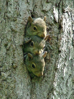
marmot


yay, i hafta go over that


waterbottle filling station, 9000ft


looking down from halfway up Vogelsang pass, lewis creek side still, so ...south-east? maybe galison, or bernice lake...


lil pond at top of pass

lake at top, Vogelsang lake ide guess


Melvin! at top

Emeric lake maybe?

headin into the camp


on Fletcher trail now


23 down....and made it over the 10,800ft pass durring that time too.

only 18 left! and a 2 mile walk home...i left the fly there


Red peak? im guessing that cause it looked reddish and it is in that direction somewhere...


snow! ha


still think the one on the right is Red peak, if someone knows different lemme know. I am running to Red peak next thursday though, so ill find out then

coming back around to Merced lake, half dome there in the distance too.


deer at merced lake

baby birds on the trail!

Mom bird!

more babies!


back at the river


Yay! the mile long sandy stretch befor lil yosemite valley! cause after running 36 miles over 10000ft mountains, i loooove running in deep sand.

stoopid sand