
The Sespe River is one of the only undamed, undiverted waterways in all of Southern California. The Sespe is protected as a National Scenic Waterway and its 65 mile length has proven to be full of surprises. The aim of this project is to walk every inch of it. I've completed the vast majority of the route and thought I'd share.
Stage I: Cherry Creek to Tule Creek
http://davidstillman.blogspot.com/2012/ ... 81512.html
Stage II: Tule Creek to Piedra Blanca
http://davidstillman.blogspot.com/2012/ ... 82712.html
Stage III: Piedra Blanca to Goddenough Rd, Fillmore CA
http://davidstillman.blogspot.com/2012/ ... lanca.html
Project Sespe Connect: walking the entire river.
-
mangus7175

- Posts: 148
- Joined: Wed Oct 12, 2011 3:03 pm
I've been reading a lot of your trip reports...thanks for sharing them.
How was the water level from Piedra Blanca to Willett Hot Springs? I am planning on doing this hike this November. Were the water crossings fairly easy?
How was the water level from Piedra Blanca to Willett Hot Springs? I am planning on doing this hike this November. Were the water crossings fairly easy?
-
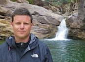
David Stillman
- Posts: 42
- Joined: Wed Sep 05, 2012 5:33 pm
Thanks for the nod. Creek crossings out to Willet are few, and those crossings are dry. However, there is good water at Willet. Enjoy yourself, and don't mind my dis of south land hot springs. My problem is that I first discovered hot springs in places like Mammoth and Couer d'Alene and Elko.
-
mangus7175
- Posts: 148
- Joined: Wed Oct 12, 2011 3:03 pm
No problem at all...I've never been so it's just a place I want to explore. Any reliable water sources before reaching Willett? Or do you suggest hauling in water for the 9.5 mile hike from Piedra to Willett?David Stillman wrote: ↑Thanks for the nod. Creek crossings out to Willet are few, and those crossings are dry. However, there is good water at Willet. Enjoy yourself, and don't mind my dis of south land hot springs. My problem is that I first discovered hot springs in places like Mammoth and Couer d'Alene and Elko.
-
David Stillman
- Posts: 42
- Joined: Wed Sep 05, 2012 5:33 pm
Most of the way out to Willet is set back from and above the Sespe, so getting down to the parts that do have water is an enormous pain. Best place to top off is at Bear Cnyn, there's decent flow of good water there. You can get to water basically right off the trail at Bear, which is an interesting canyon, steep though. -Stillman
-
David Stillman
- Posts: 42
- Joined: Wed Sep 05, 2012 5:33 pm
Howdy and thanks. I try to think outside the map. As to your question, the short answer is "no". This watershed doesn't have any significant drop-offs and certainly nothing real enough to justify hauling gear all the way back there. Near-by Alder Creek has an adventurous descent, but its been a long while and 2 biblical floods since I went through there. -Stillman
i was reading this on your website yesterday, fantastic trip!!
im also planning on doing some backpacking there in late nov if it rains by then. was planning on going from johnson ridge trail to sespe hot springs to piedra blancas and up the gene marshall peidra blanca trail, but only if it rains becuase its dry up the gmpb trail.
what is the sespe hot springs like? is willette the place to go if you want to soak in the hot springs?
-
David Stillman
- Posts: 42
- Joined: Wed Sep 05, 2012 5:33 pm
As for the Sespe hot springs, it's just a hot creek with a couple pots in it. It's not very developed and isn't really a garden spot. Willet has shade, access to Sespe water, is more developed, and quite popular.
As to your route, I'd personally reverse you direction. Reyes and Bear Trap canyons are beautiful places and going UP Piedra Blanca is a hot, super steep climb. Trust me when I say you'd rather go down it. And that way you end your route with 2 hot springs and a straightforward climb up Johnston Ridge to Mutau. Luck.
-Stillman
ive been thru the gmpb trail from reyes creek to the pb's. i was going to go for the challenge of going up it this time. i went in april and may, it was hot in may going down! will consider reversing though. you are right that part of the trail is awesome i love it up there!
would you have any information about water flow at bear trap and the creek along the trail? ive read reports that 3 mile and haddock are dry and a report in sept there was a little water at pine mountian lodge. hoping it will rain up there so i can go.
thanks
would you have any information about water flow at bear trap and the creek along the trail? ive read reports that 3 mile and haddock are dry and a report in sept there was a little water at pine mountian lodge. hoping it will rain up there so i can go.
thanks
-
David Stillman
- Posts: 42
- Joined: Wed Sep 05, 2012 5:33 pm
Sorry bro, no recent news on Reyes/Bear Trap. Both those canyons are on the north side and I'd suspect that there would be water in Beartrap at least. Haven't been through since last spring though.
-
David Stillman
- Posts: 42
- Joined: Wed Sep 05, 2012 5:33 pm
Beantown,
Here's a link to a site that has some recent info on at least Piedra Blanca and Pine Mountain Lodge. The site is written by a veteran Los Padres hardman and his info is legit.
http://www.emwalker.net/wordpress/2012/ ... r-18-2012/
-Stillman
Here's a link to a site that has some recent info on at least Piedra Blanca and Pine Mountain Lodge. The site is written by a veteran Los Padres hardman and his info is legit.
http://www.emwalker.net/wordpress/2012/ ... r-18-2012/
-Stillman
hey dave thanks for the link. I read his report a few weeks ago, cool story.
fyi the other report i found was on a face book page Condor Trail, this was mid september
http://www.facebook.com/#!/CondorTrail?fref=ts
"PINE MTN - A friend of the CT recently took a quick backpacking jaunt from Reyes Peak to Piedra Blanca along the Condor Trail (technically Gene Marshall & Reyes Peak Trails). Temps were in the mid 80's along the mountain and upper 90's at
the trailhead. Two downed trees (see photo) between Haddock Camp and 3 mile. No water at 3 Mile or Haddock, a trickle at Pine Mtn Lodge and some water about 1/4mile below Haddock. Nice water at both Twin Forks and Piedra Blanca. Did not see another person while out there. Its almost time......"