Info on the Wetwater trail (to the Stanley-Miller mine)?
Posted: Sun Mar 10, 2019 9:47 pm
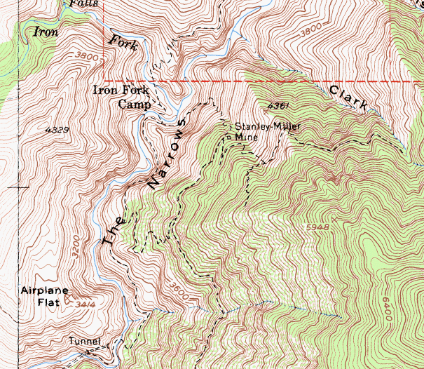
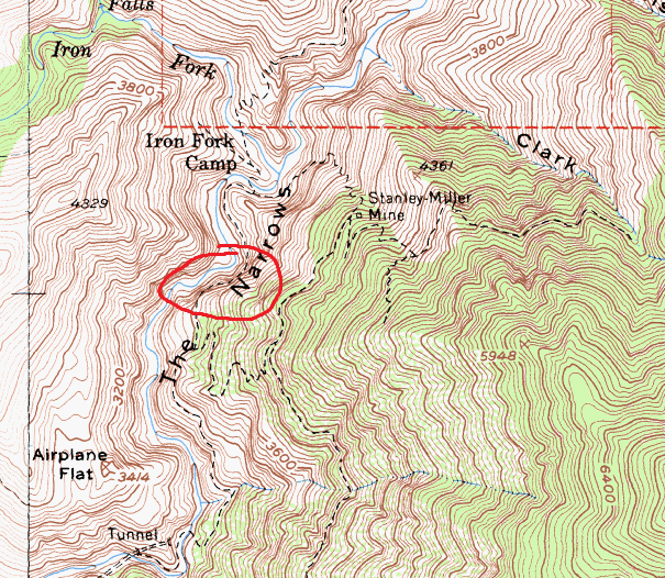
John Robinson, in his 'San Gabriels II' writes, "The airy Wetwater Trail, terror of the pack mules with its dripping water, was hacked out of the cliffs above the Narrows to gain access (to the Stanley-Miller mine)."
I remember reading in the 'Mines of the San Gabriels' (also written by Robinson) that the trail was some 600 feet above the narrows. It was also briefly mentioned in this report on the Stanley-Miller mine (https://www.summitpost.org/northwest-ri ... ine/622907).
There's also this photo from AllTrails. I wasn't able to find any other info on it.
Does anyone have more info on this trail? Is it still a passable route? Where does the trail go?
I would assume it's really exposed, is it even there anymore?
I remember reading in the 'Mines of the San Gabriels' (also written by Robinson) that the trail was some 600 feet above the narrows. It was also briefly mentioned in this report on the Stanley-Miller mine (https://www.summitpost.org/northwest-ri ... ine/622907).
Does anyone have more info on this trail? Is it still a passable route? Where does the trail go?
I would assume it's really exposed, is it even there anymore?