Rim Trail -> Shortcut Road 08-DEC-2018
Posted: Sun Dec 09, 2018 1:32 pm
After 3 days off the bike to sit out the storms and do some housework, I managed to get out earlier than my usual 'alpine brunch' and headed to Red Box. My half-arsed plan: ride in a big, vaguely circular path until I run out of daylight. Within a few minutes of my leisurely start, I came across the aftermath of dumb-ass-ery...one car with broken rear suspension spun halfway across the outside berm of the road, and another parked next to it to warn/block traffic until recovery could be completed. This is the second similar incident I've seen on the Wilson Road recently. The previous was a Dodge Charger sitting balanced on the edge of a collection basin where the road crosses a small canyon. Am I evil for hoping we'll hit $10/gallon fuel prices?
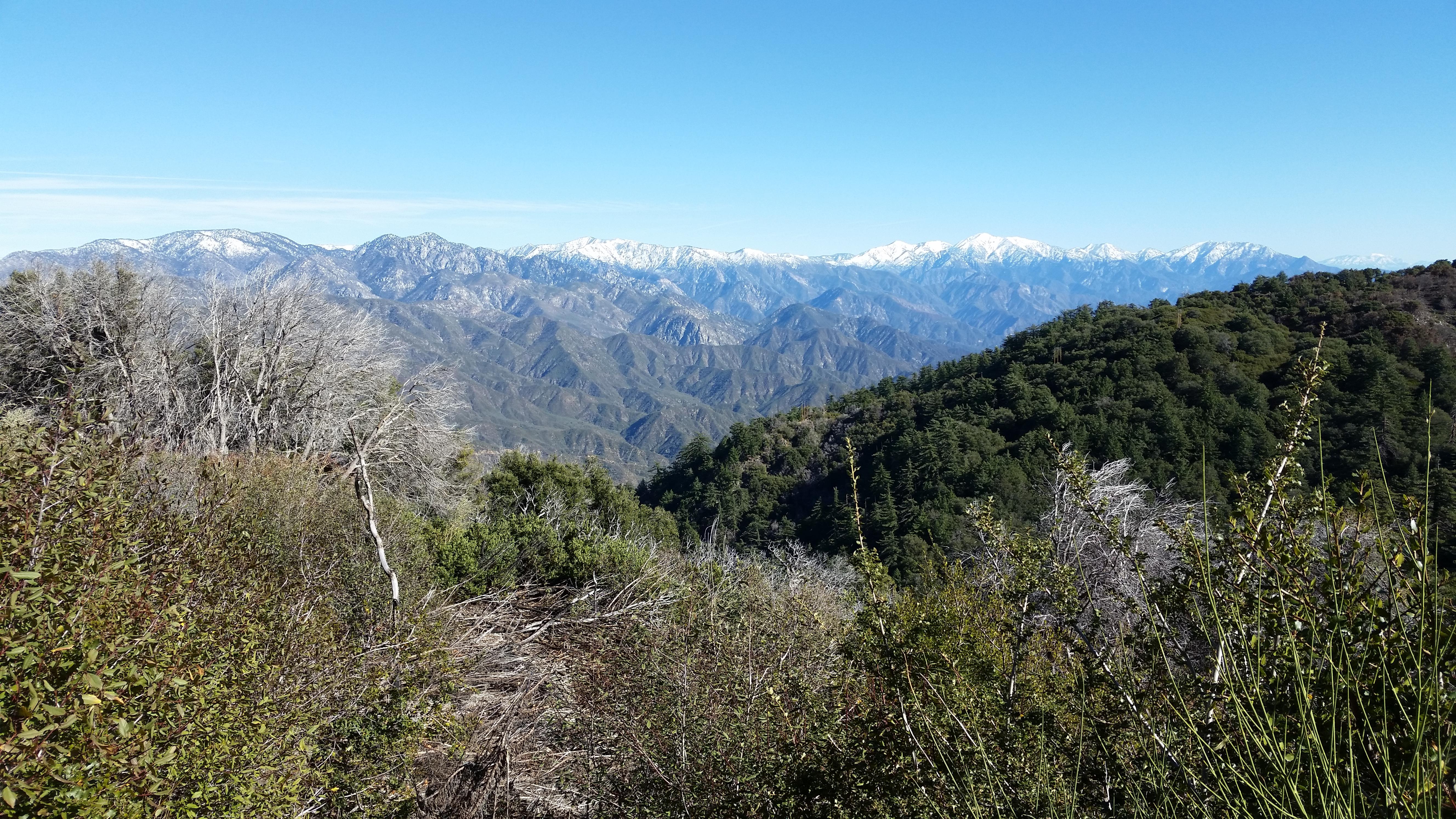
Above Eaton Saddle I encountered frosty road conditions at about 5400' (1640m) at 11:30 AM. There was no snow on Wilson, but plenty on the higher peaks of the range. The following shot shows (L to R) Mt. Waterman, Twin Peaks, Mt. Burnham, Mt. Baden-Powell, Mt. Tom Ross, Blue Ridge, Wright Mtn, Pine Mtn, Dawson Peak, Mt. Baldy, Thunder-Telegraph massif, Timber Mtn, Bighorn Peak, Ontario Peak, and finally San Gorgonio in the distance at far right. The view is from the Wilson Road prior to crossing to the south side near the road maintenance yard.
I did my ritual upper- and lower-loop laps of the antenna summit, then headed over to the Rim Trail. Conditions on the Rim Trail were actually quite good despite the storm. There are some washouts, but nothing very serious, and a few deadfalls. The big surprise for the day was encountering a fairly large guided group coming up the trail about a mile (1.5km) from the summit. They were spread out over the next half mile (1km), and the tail was an older couple, the lady trailing and looking tired but not unhappy. I gave what encouragement I could, and bid them happy-happy.
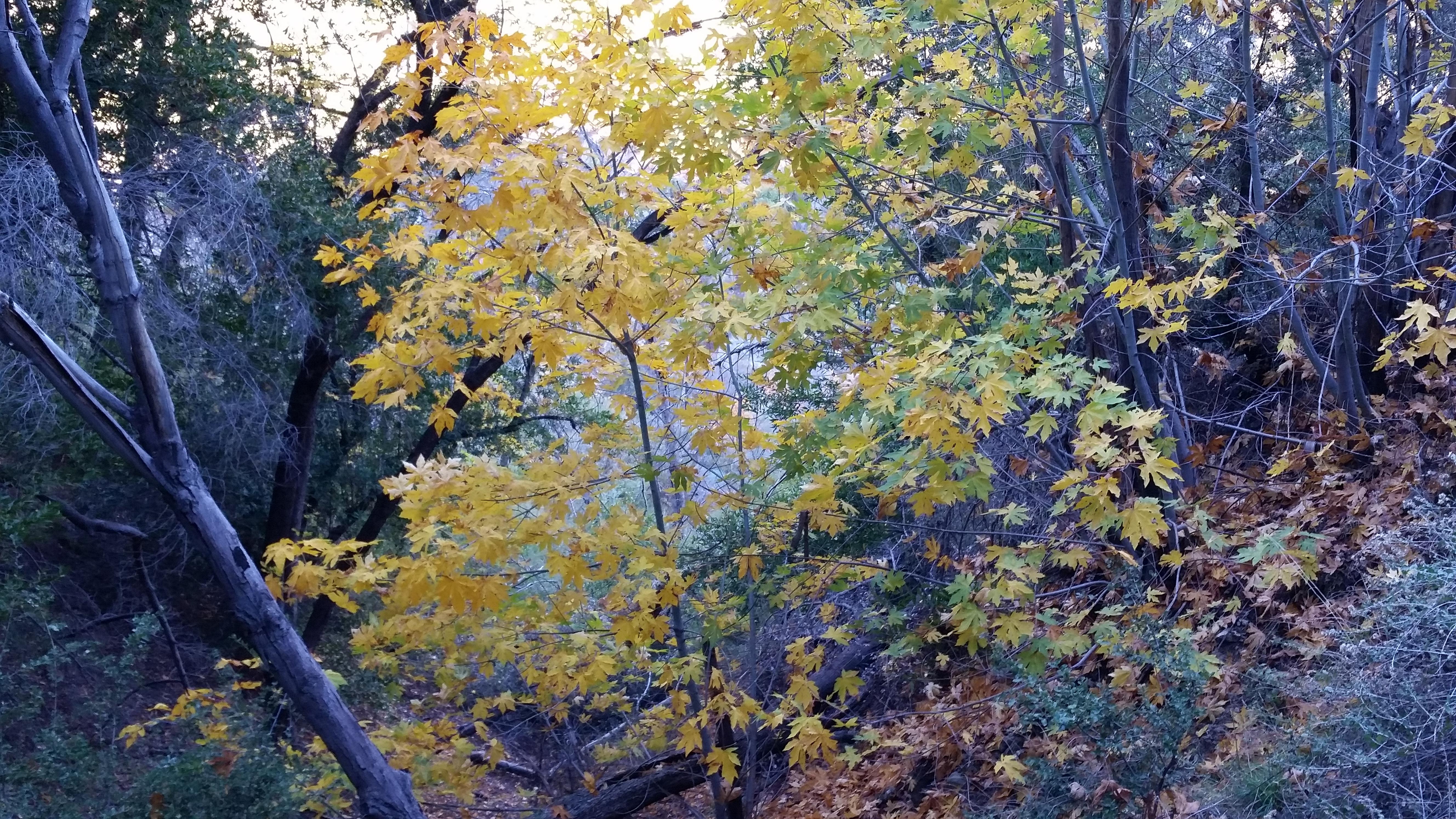
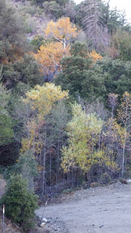
I took a break near Newcomb Pass. The Rincon Road seems to be still open at CA-39. I heard a motorcycle pass as I was taking my lunch (I was a short ways off the road). I then descended the Shortcut Road, and was pleased to find some fall color hidden in the side canyons. There are many of these maples, but most were in the shade and my crappy phone cam couldn't get the color.
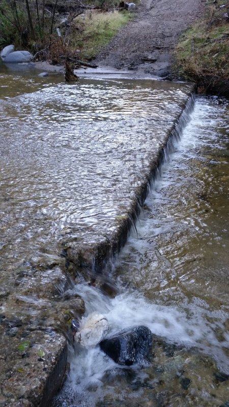
And here's a shot of the flow in West Fork San Gabriel River at the Shortcut crossing:
On my way up Shortcut, I was passed just after sunset by a couple in a vehicle. I made it up to CA-2 just after dark to find this couple parked inside the gate, with news that the FS had given them the wrong gate code. My money is on some ranger coming by at sunset for the daily code change, and this couple had been about 30 minutes late. Fortunately there was a plow truck across the highway from the gate, and he managed to assist.
I finished the highway grind and returned to the car, tired but happy after another generally peaceful adventure. Soundtrack for my drive home: The Aristocrats: Boing, We'll Do It Live!
SNOW LEVEL OBSERVATION: Snow level appears to be about 6800' (2100m), possibly lower on north-facing slopes. There was no appreciable melt out on south slopes during the day. I could see snow on Pacifico Mtn, but could not capture with a pic. In my top-most pic, you can see that there is snow down to Twin Peaks Saddle.
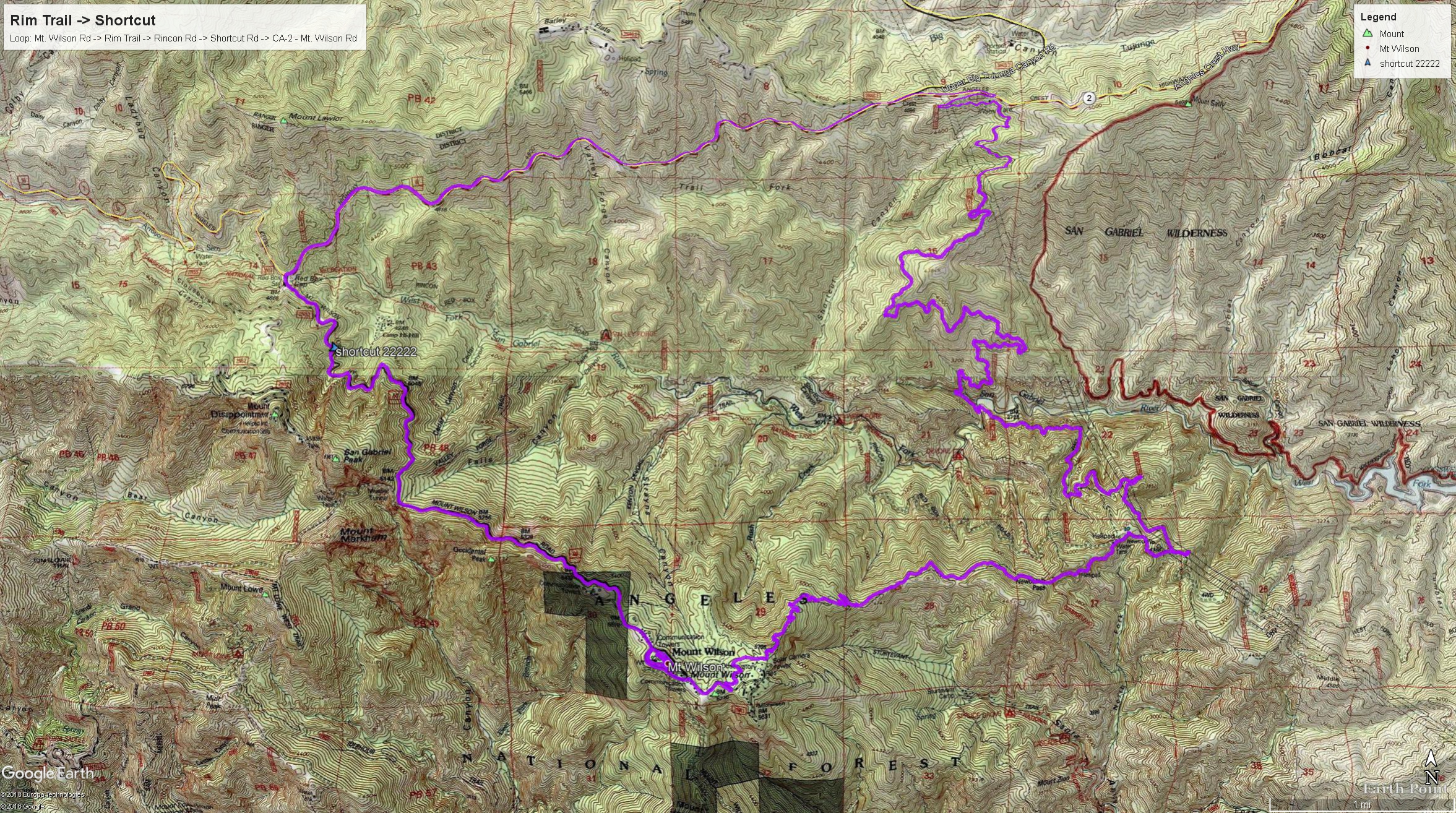
Also, here's a pic of my route on-map:
Above Eaton Saddle I encountered frosty road conditions at about 5400' (1640m) at 11:30 AM. There was no snow on Wilson, but plenty on the higher peaks of the range. The following shot shows (L to R) Mt. Waterman, Twin Peaks, Mt. Burnham, Mt. Baden-Powell, Mt. Tom Ross, Blue Ridge, Wright Mtn, Pine Mtn, Dawson Peak, Mt. Baldy, Thunder-Telegraph massif, Timber Mtn, Bighorn Peak, Ontario Peak, and finally San Gorgonio in the distance at far right. The view is from the Wilson Road prior to crossing to the south side near the road maintenance yard.
I did my ritual upper- and lower-loop laps of the antenna summit, then headed over to the Rim Trail. Conditions on the Rim Trail were actually quite good despite the storm. There are some washouts, but nothing very serious, and a few deadfalls. The big surprise for the day was encountering a fairly large guided group coming up the trail about a mile (1.5km) from the summit. They were spread out over the next half mile (1km), and the tail was an older couple, the lady trailing and looking tired but not unhappy. I gave what encouragement I could, and bid them happy-happy.
I took a break near Newcomb Pass. The Rincon Road seems to be still open at CA-39. I heard a motorcycle pass as I was taking my lunch (I was a short ways off the road). I then descended the Shortcut Road, and was pleased to find some fall color hidden in the side canyons. There are many of these maples, but most were in the shade and my crappy phone cam couldn't get the color.
And here's a shot of the flow in West Fork San Gabriel River at the Shortcut crossing:
On my way up Shortcut, I was passed just after sunset by a couple in a vehicle. I made it up to CA-2 just after dark to find this couple parked inside the gate, with news that the FS had given them the wrong gate code. My money is on some ranger coming by at sunset for the daily code change, and this couple had been about 30 minutes late. Fortunately there was a plow truck across the highway from the gate, and he managed to assist.
I finished the highway grind and returned to the car, tired but happy after another generally peaceful adventure. Soundtrack for my drive home: The Aristocrats: Boing, We'll Do It Live!
SNOW LEVEL OBSERVATION: Snow level appears to be about 6800' (2100m), possibly lower on north-facing slopes. There was no appreciable melt out on south slopes during the day. I could see snow on Pacifico Mtn, but could not capture with a pic. In my top-most pic, you can see that there is snow down to Twin Peaks Saddle.
Also, here's a pic of my route on-map: