Eaton Saddle CCW Lollipop via Switzer
Posted: Mon Oct 22, 2018 1:37 pm
Things have been busy and I haven't been able to get out on trail as much as I would like recently. I decided to rectify that by doing a lollipop out of Eaton Saddle. The plan was to go CCW from Eaton Saddle, past SG Peak & Disappointment, down Bill Riley to the road, road to Gabrielino, Gab down through Switzers, pick up Bear Canyon to Tom Sloan Saddle, then to check out the work done on the newly reopened Tom Sloan trail, back up the hill and back to Eaton Saddle and the car. Preliminary sptiballing had the route at around 15 miles give or take. Sounded like a great plan. I did mention that I haven't really been out much in the last few months, and nothing over 5 or 6 miles in that time frame. More on that later..
Here's a link to a strava widget of my run/hike since I cant embed an iframe.
Got up at zero dark thirty on Sunday 10/21 and got all my crap together and drove from home in San Gabriel to Eaton Saddle. Got there right about 6:15. A few minutes later of getting everything sorted and futzing around I was off at 6:35
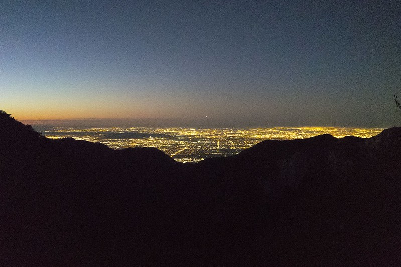
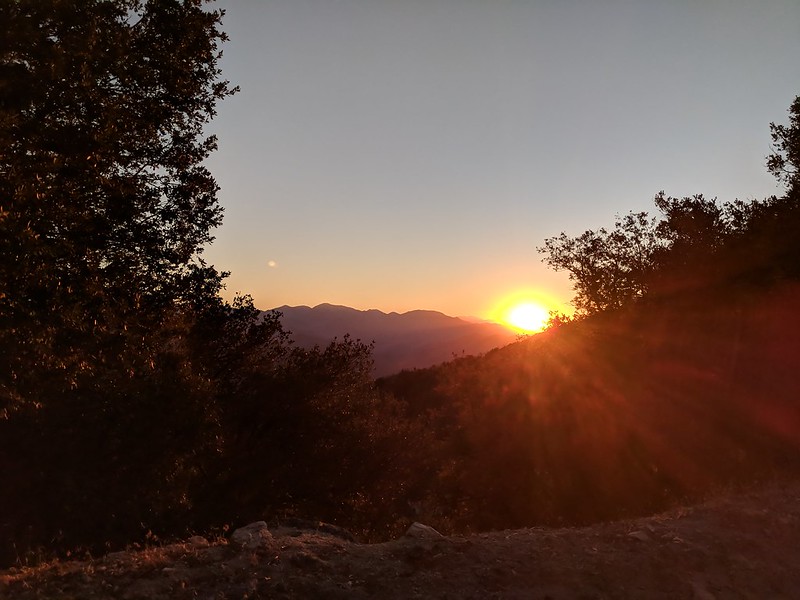
First light creeping in over the LA basin from Eaton Saddle.
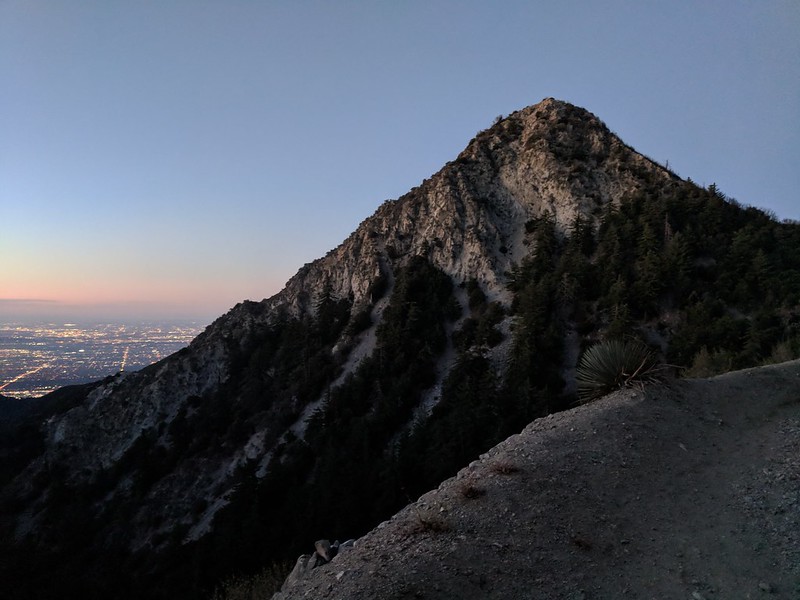
Markham in the early light
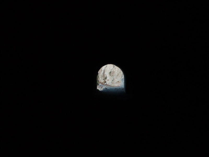
Meuller Tunnel was pitch black, didn't want to bother carrying a headlamp for a couple hundred feet of dark
Weather was great, a light breeze was blowing but I was comfortable in running shorts and a t-shirt. Made it up to the saddle between Markham and SG Peak and headed up the trail towards Disappointment.
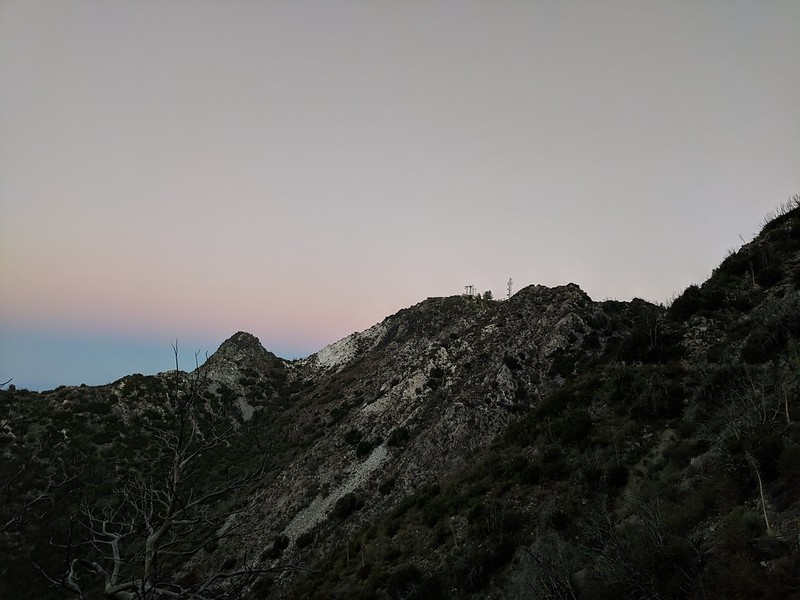
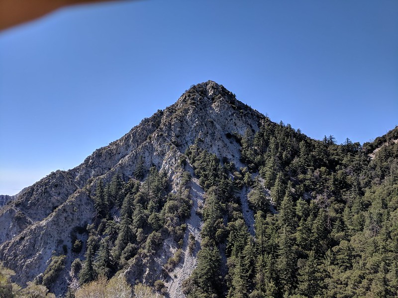
Disappointment from the flank of San Gabriel Peak.
Sunrise from Just before the Bill Riley trail
Up to this point I was just warming up and hiking briskly. As I hit the Bill Riley Trail I was 30 min in and it was time to turn it up a notch - running downhill trying to keep it at around a 12:00/mile pace as long as conditions allowed. I moved quickly, making good time down Bill Riley, the road section then hitting the Gabrielino Trail at Red Box. The Gabrielino trail was in great shape, was able to keep my pace in my target range except in a few spots towards the bottom of the canyon where there some downed trees you had to scramble over or under. I kept it up all the way through Switzers until I hit the short climb before you come to the junction in the trail that takes you to the falls and Bear Canyon. I finally relented and walked the section to the junction. I hit the junction at 8:45, 2 hours 10 minutes and 8.5 miles after I had started.
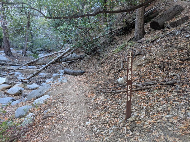
Bear Canyon Junction at the Gabrielino Trail.
Sign at the bottom pointing you the right direction
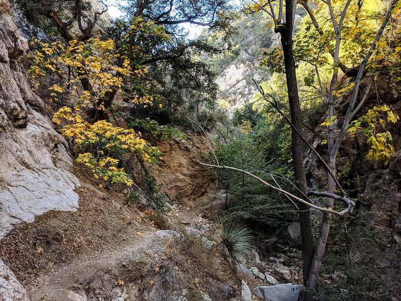
From this point the trail is in pretty good shape as it gets a lot of foot traffic. There are a few sections that are pretty cruiser so I ran those in between hiking the uphills and trickier parts. The canyon closes in and slows down progress. It wasnt a bad thing though as there was a little fall color to take in
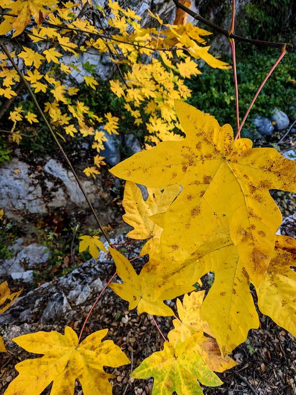
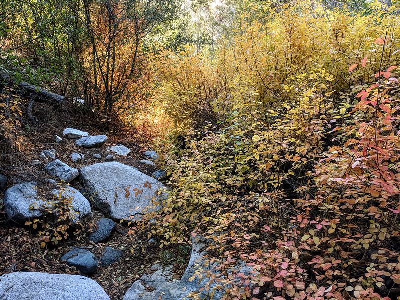
No mistaking the copious amounts of poison oak along the trail as it turns red and orange this time of year.
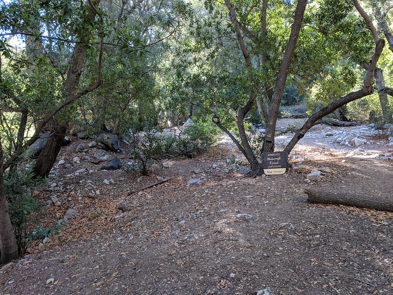
I arrived at Bear Canyon Trail camp at 9:35 and decided to sit for about 20 minutes to take a break and consume some calories. I hadn't really seen a lot of traffic on the trail thus far. One person between the Eaton Saddle and Switzers, a dozen day hikers around the Switzer Falls and one group of 5 boy scouts from Long Beach hiking out from the trail camp. When I got to the trail camp it was pretty busy with another boy scout troop and another group off to the side. After I snacked and re-hydrated I was back on the trail.
From this point the trail is a mess, a lot of bushwhacking. I regretted not tossing my pruners in my pack as I had obviously forgotten how over grown and just generally crappy condition the trail is in between the trail camp and the little stone building. I make decent time on most trails. The mile between these two points took me about 45 min. This section of trail definitely needs some love.
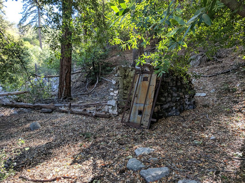
The old stone building that marks the end (or beginning if you're going towards Switzers) of what I like to call the Bear Canyon Green Hell..
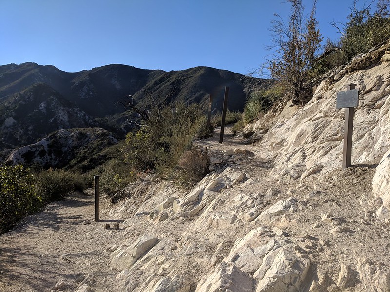
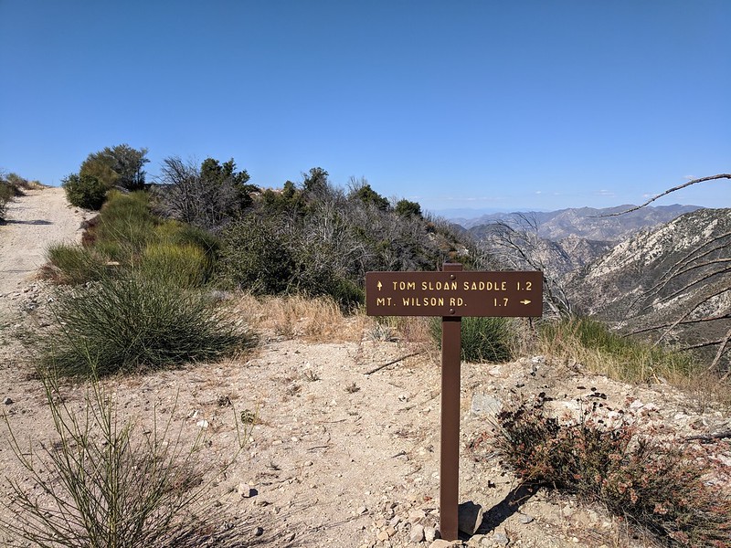
From this point the trail is in decent shape again all the way up to Tom Sloane Saddle. A few small downed trees here and there and some tread that needs a little maintenance in some spots. I was making better time, but in hindsight I was running out of gas. I reached the Tom Sloan saddle at 11:00 and I had a decision to make. My original intent was to take the Tom Sloan trail and check out all the work that had recently been put into re-opening it. But it was getting later in the day and since the trail hugs the south side of the ridgeline and would leave me with a climb back up to the Markham/Lowe saddle I decided to take the shorter remainder of the Bear Canyon Trail to it's junction with the Mt. Lowe road. This trail trends towards the north side of the ridge so I would have more shade as well.
You know that lack of recent activity I spoke about at the beginning? It decided to rear it's ugly head with a big ol hitting the wall epic style bonk. In hindsight I should have done something in the 8-10 mile distance. Coulda, shoulda, woulda oh well as it was irrelevant at this point. I had 3 miles to make it back to the car. At this point I just put one foot in front of the other and trudged up hill to the Mt. Lowe road and then back to the car at Eaton Saddle. This 3 mile section ended up taking me about an hour and a half after it was all said and done.
Decisions...
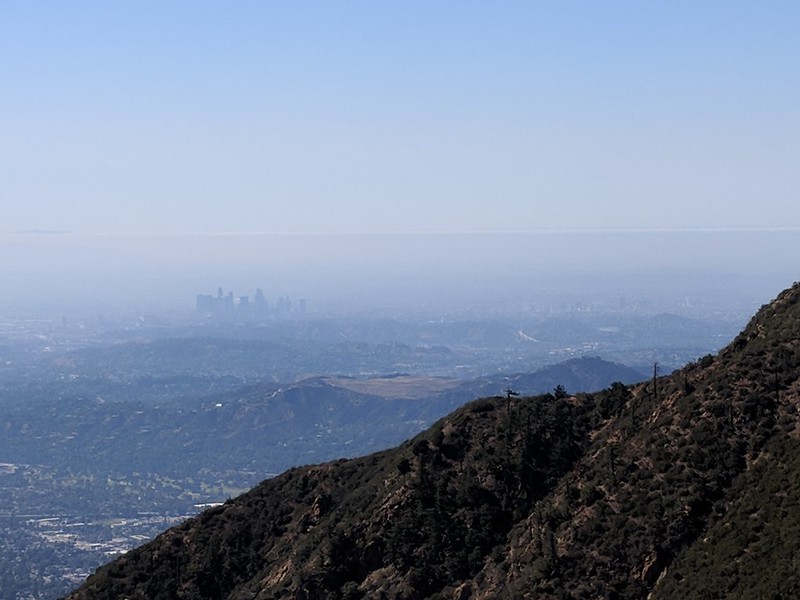
Hazy LA Basin from the ridge line.
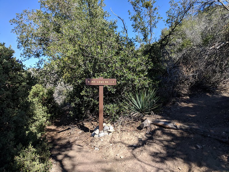
Finally at the Mt. Lowe road.
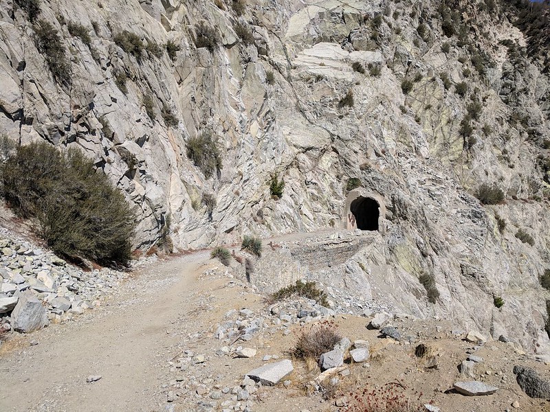
Meuller Tunnel on the way back
Markham again just before getting to the car.
Overall a good day on the trail. Could have done without the bushwhacking and the big ol fat bonk near the end. Happy that I was able to keep my pace while I was running at around a 12 min/mile. In my head I had planned on being done in 5 hours total, ended up being 6 and some change after the bushwhacking and bonk... In hindsight if I haven't been out logging good mileage I should use some common sense and just stick to a shorter route. Oh well, my body will remind me of my folly this week as I hobble around with sore quads and calves the next few days.
What my body is saying to my head today:

Here's a link to a strava widget of my run/hike since I cant embed an iframe.
Got up at zero dark thirty on Sunday 10/21 and got all my crap together and drove from home in San Gabriel to Eaton Saddle. Got there right about 6:15. A few minutes later of getting everything sorted and futzing around I was off at 6:35
First light creeping in over the LA basin from Eaton Saddle.
Markham in the early light
Meuller Tunnel was pitch black, didn't want to bother carrying a headlamp for a couple hundred feet of dark
Weather was great, a light breeze was blowing but I was comfortable in running shorts and a t-shirt. Made it up to the saddle between Markham and SG Peak and headed up the trail towards Disappointment.
Disappointment from the flank of San Gabriel Peak.
Sunrise from Just before the Bill Riley trail
Up to this point I was just warming up and hiking briskly. As I hit the Bill Riley Trail I was 30 min in and it was time to turn it up a notch - running downhill trying to keep it at around a 12:00/mile pace as long as conditions allowed. I moved quickly, making good time down Bill Riley, the road section then hitting the Gabrielino Trail at Red Box. The Gabrielino trail was in great shape, was able to keep my pace in my target range except in a few spots towards the bottom of the canyon where there some downed trees you had to scramble over or under. I kept it up all the way through Switzers until I hit the short climb before you come to the junction in the trail that takes you to the falls and Bear Canyon. I finally relented and walked the section to the junction. I hit the junction at 8:45, 2 hours 10 minutes and 8.5 miles after I had started.
Bear Canyon Junction at the Gabrielino Trail.
Sign at the bottom pointing you the right direction
From this point the trail is in pretty good shape as it gets a lot of foot traffic. There are a few sections that are pretty cruiser so I ran those in between hiking the uphills and trickier parts. The canyon closes in and slows down progress. It wasnt a bad thing though as there was a little fall color to take in
No mistaking the copious amounts of poison oak along the trail as it turns red and orange this time of year.
I arrived at Bear Canyon Trail camp at 9:35 and decided to sit for about 20 minutes to take a break and consume some calories. I hadn't really seen a lot of traffic on the trail thus far. One person between the Eaton Saddle and Switzers, a dozen day hikers around the Switzer Falls and one group of 5 boy scouts from Long Beach hiking out from the trail camp. When I got to the trail camp it was pretty busy with another boy scout troop and another group off to the side. After I snacked and re-hydrated I was back on the trail.
From this point the trail is a mess, a lot of bushwhacking. I regretted not tossing my pruners in my pack as I had obviously forgotten how over grown and just generally crappy condition the trail is in between the trail camp and the little stone building. I make decent time on most trails. The mile between these two points took me about 45 min. This section of trail definitely needs some love.
The old stone building that marks the end (or beginning if you're going towards Switzers) of what I like to call the Bear Canyon Green Hell..
From this point the trail is in decent shape again all the way up to Tom Sloane Saddle. A few small downed trees here and there and some tread that needs a little maintenance in some spots. I was making better time, but in hindsight I was running out of gas. I reached the Tom Sloan saddle at 11:00 and I had a decision to make. My original intent was to take the Tom Sloan trail and check out all the work that had recently been put into re-opening it. But it was getting later in the day and since the trail hugs the south side of the ridgeline and would leave me with a climb back up to the Markham/Lowe saddle I decided to take the shorter remainder of the Bear Canyon Trail to it's junction with the Mt. Lowe road. This trail trends towards the north side of the ridge so I would have more shade as well.
You know that lack of recent activity I spoke about at the beginning? It decided to rear it's ugly head with a big ol hitting the wall epic style bonk. In hindsight I should have done something in the 8-10 mile distance. Coulda, shoulda, woulda oh well as it was irrelevant at this point. I had 3 miles to make it back to the car. At this point I just put one foot in front of the other and trudged up hill to the Mt. Lowe road and then back to the car at Eaton Saddle. This 3 mile section ended up taking me about an hour and a half after it was all said and done.
Decisions...
Hazy LA Basin from the ridge line.
Finally at the Mt. Lowe road.
Meuller Tunnel on the way back
Markham again just before getting to the car.
Overall a good day on the trail. Could have done without the bushwhacking and the big ol fat bonk near the end. Happy that I was able to keep my pace while I was running at around a 12 min/mile. In my head I had planned on being done in 5 hours total, ended up being 6 and some change after the bushwhacking and bonk... In hindsight if I haven't been out logging good mileage I should use some common sense and just stick to a shorter route. Oh well, my body will remind me of my folly this week as I hobble around with sore quads and calves the next few days.
What my body is saying to my head today: