AFH Benchmark Hunts (Cole, Falcon, and Alimony)
Posted: Thu Sep 22, 2016 1:06 pm
Another Wednesday, another adventure in the Gabes. This time Cecelia joined in the fun. We drove along the Angeles Forest Highway, between Clear Creek and Aliso Canyon, searching for old benchmarks.
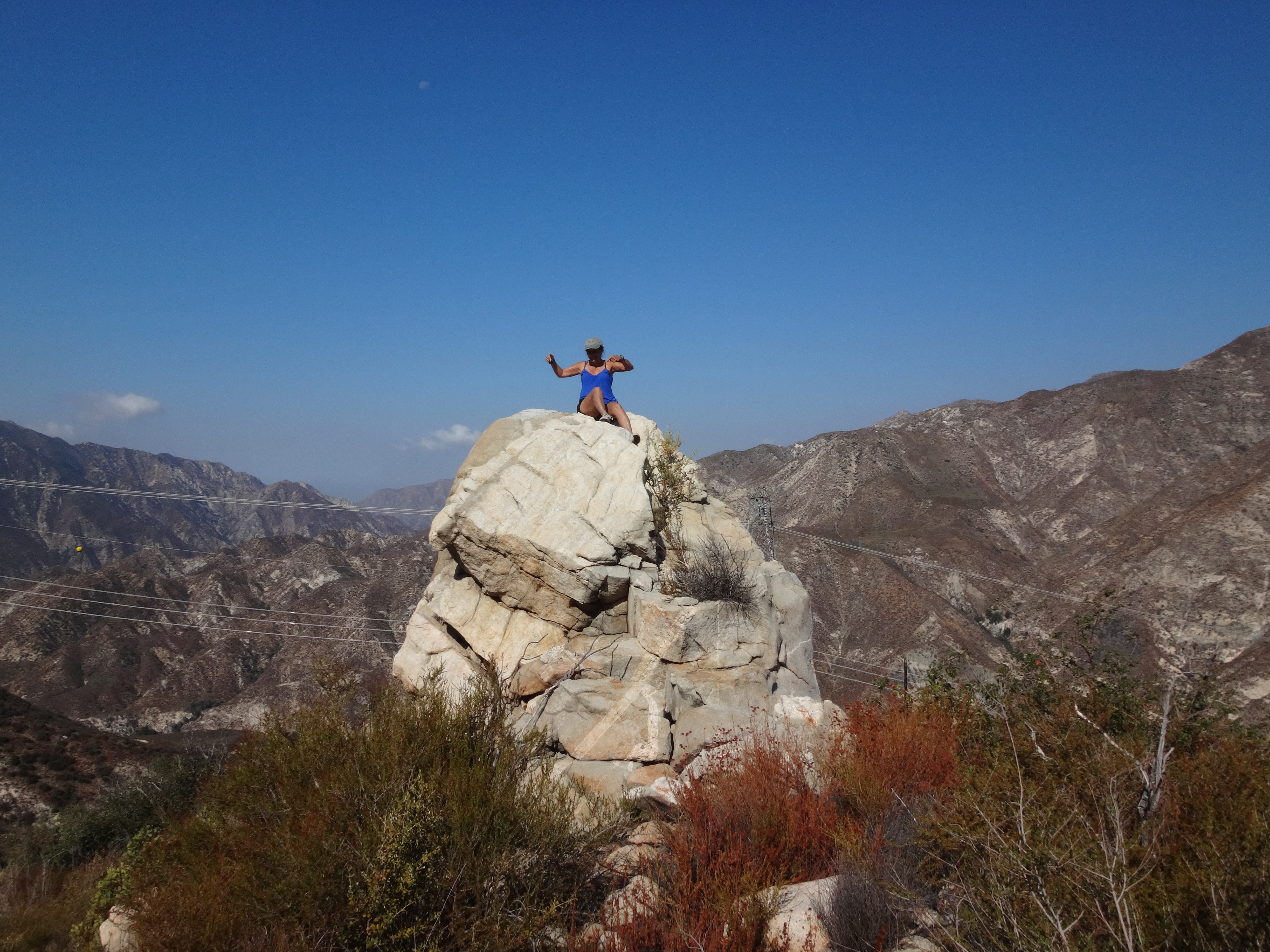
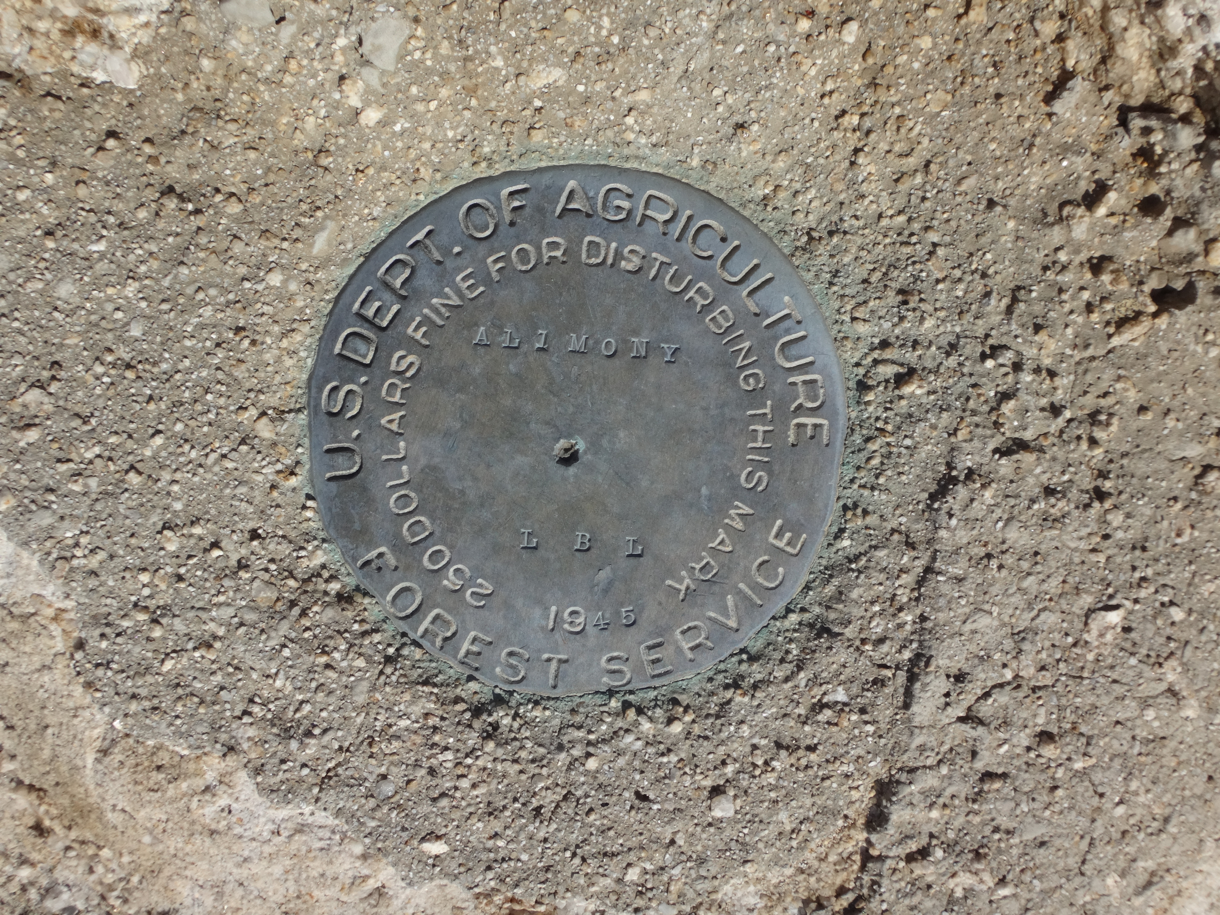
First up was a relatively easy one: Alimony (3462'). It lives on top of a big rock next to a roadcut, a little before the Josephine Creek crossing.
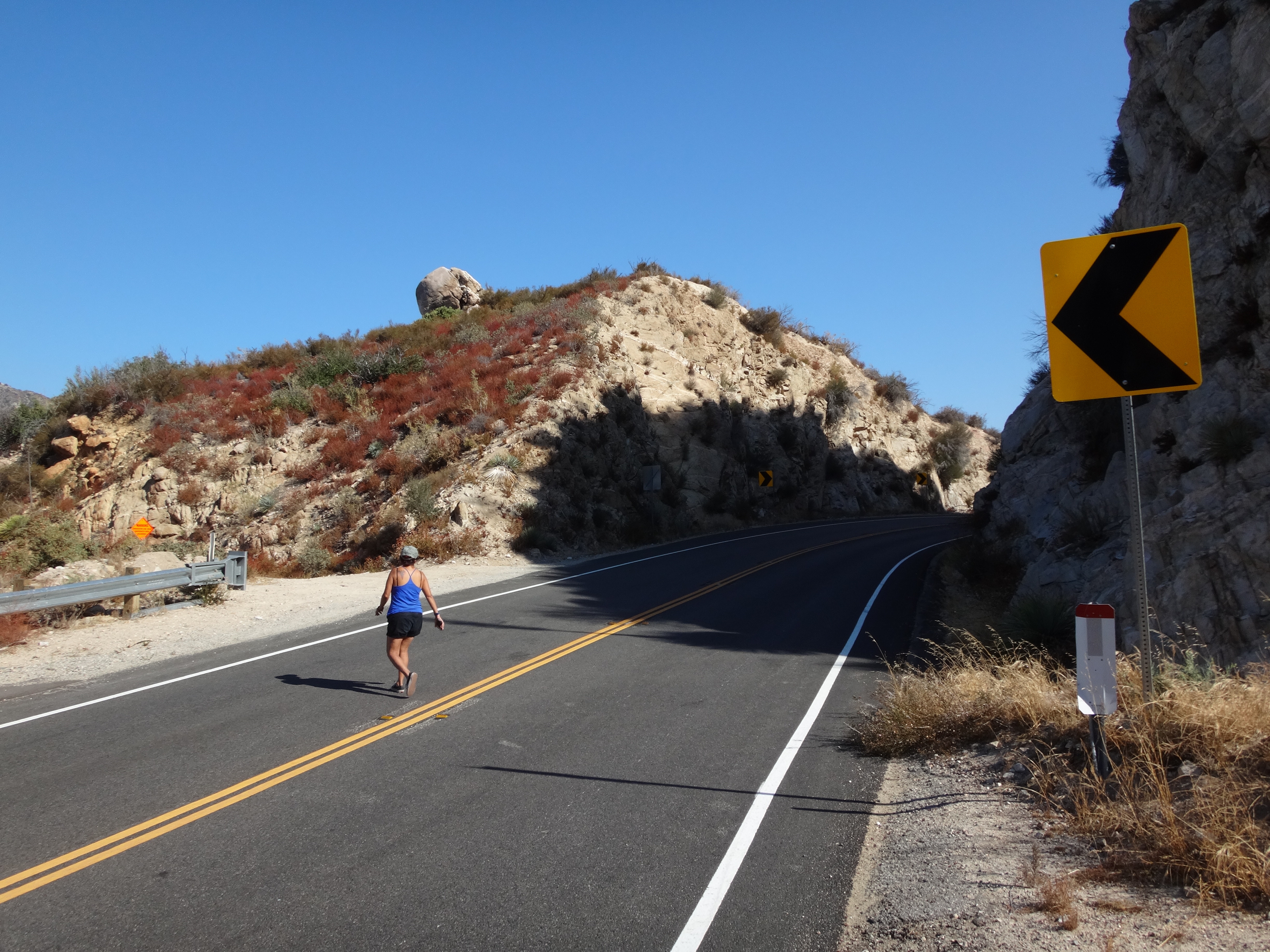
To reach it we did some stupid scrambling in inappropriate footwear. The easiest way, however, would be to follow a service road around to the west of the bump and walk up the lightly brushed ridge from that side. Then there is a short class 2 climb to the mark.
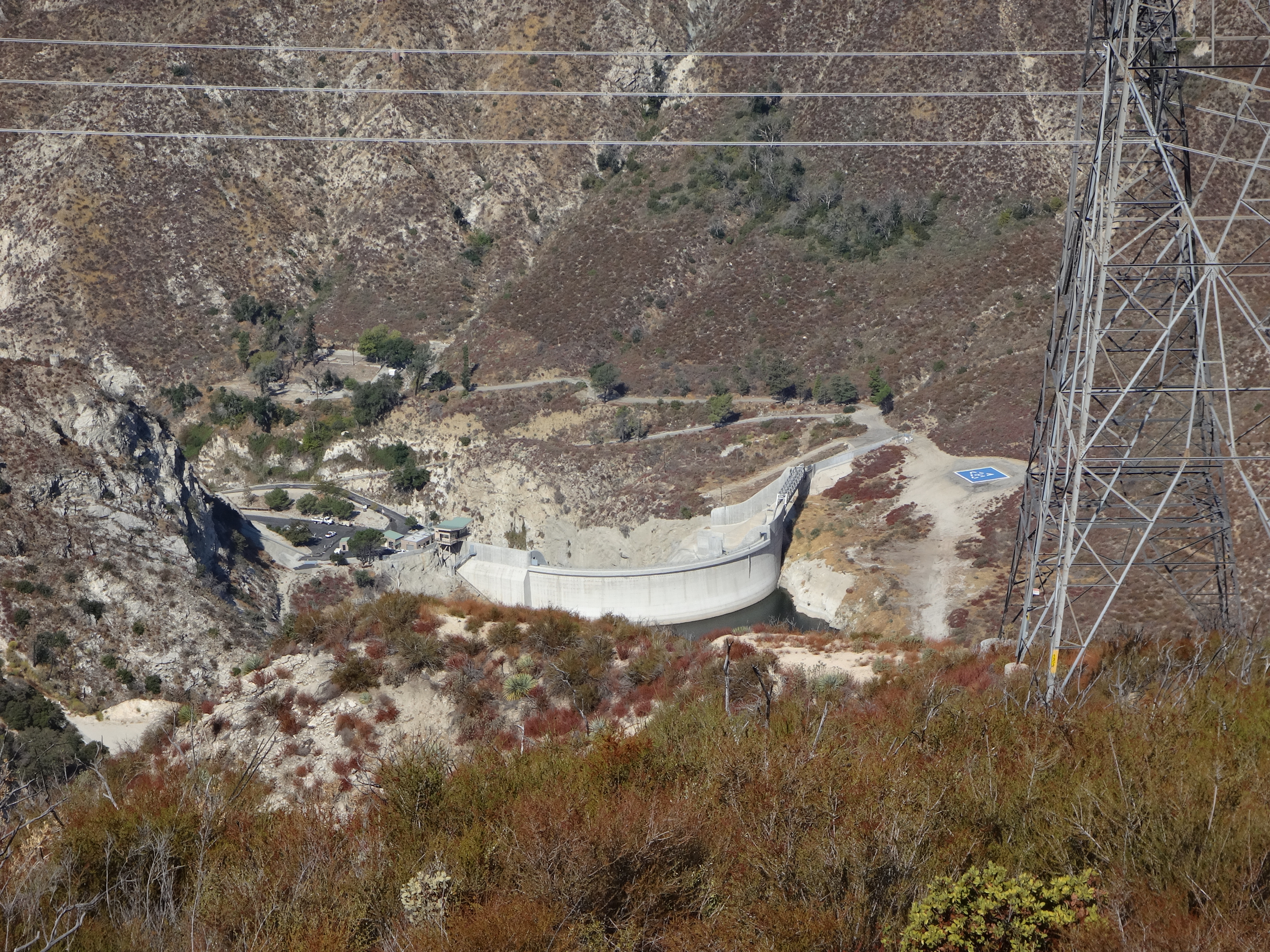
While up there, you might as well check out the view of Big Tujunga Dam.
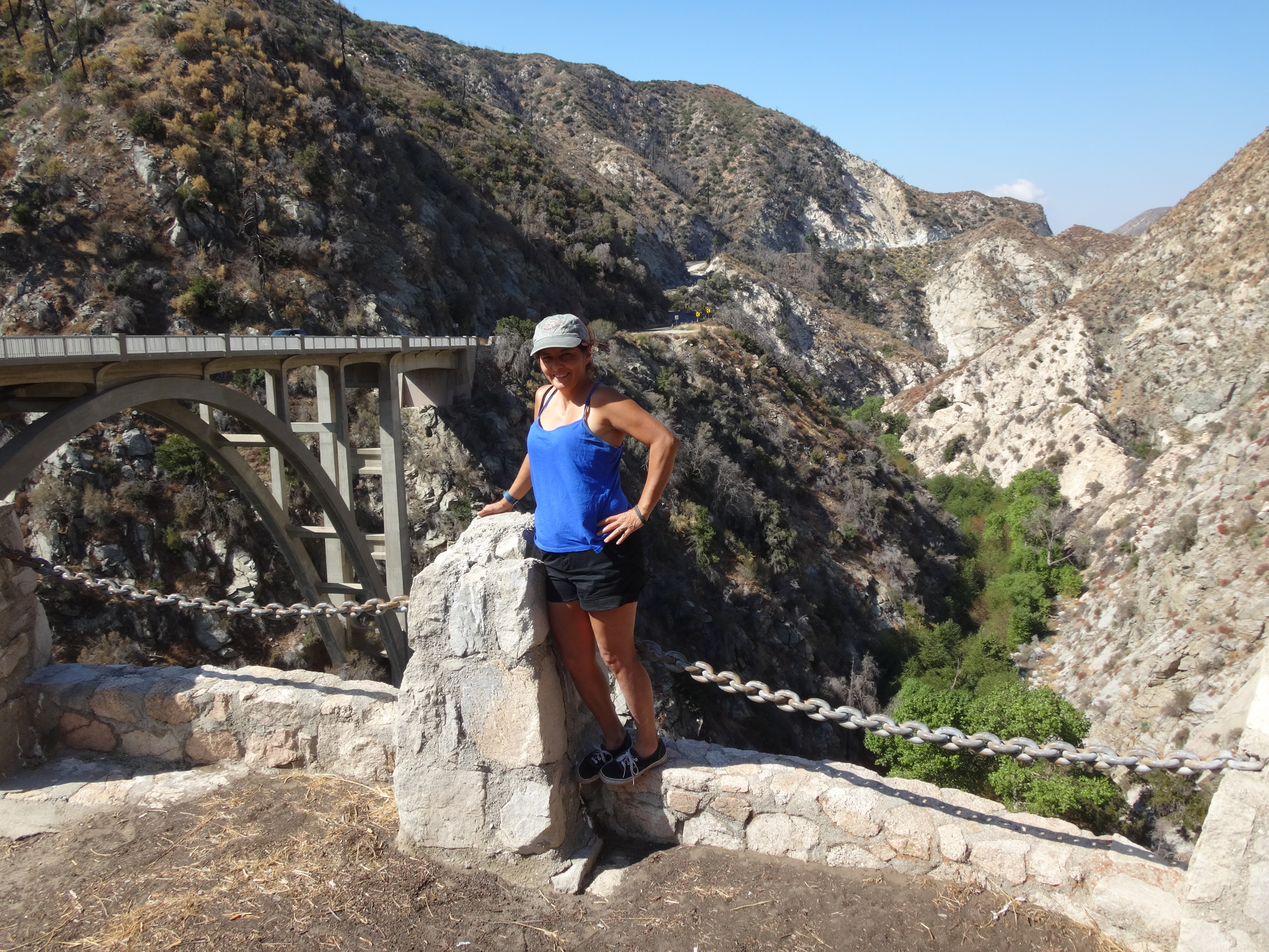
We continued up the highway, stopping briefly at an old, Big Tujunga Narrows overlook,
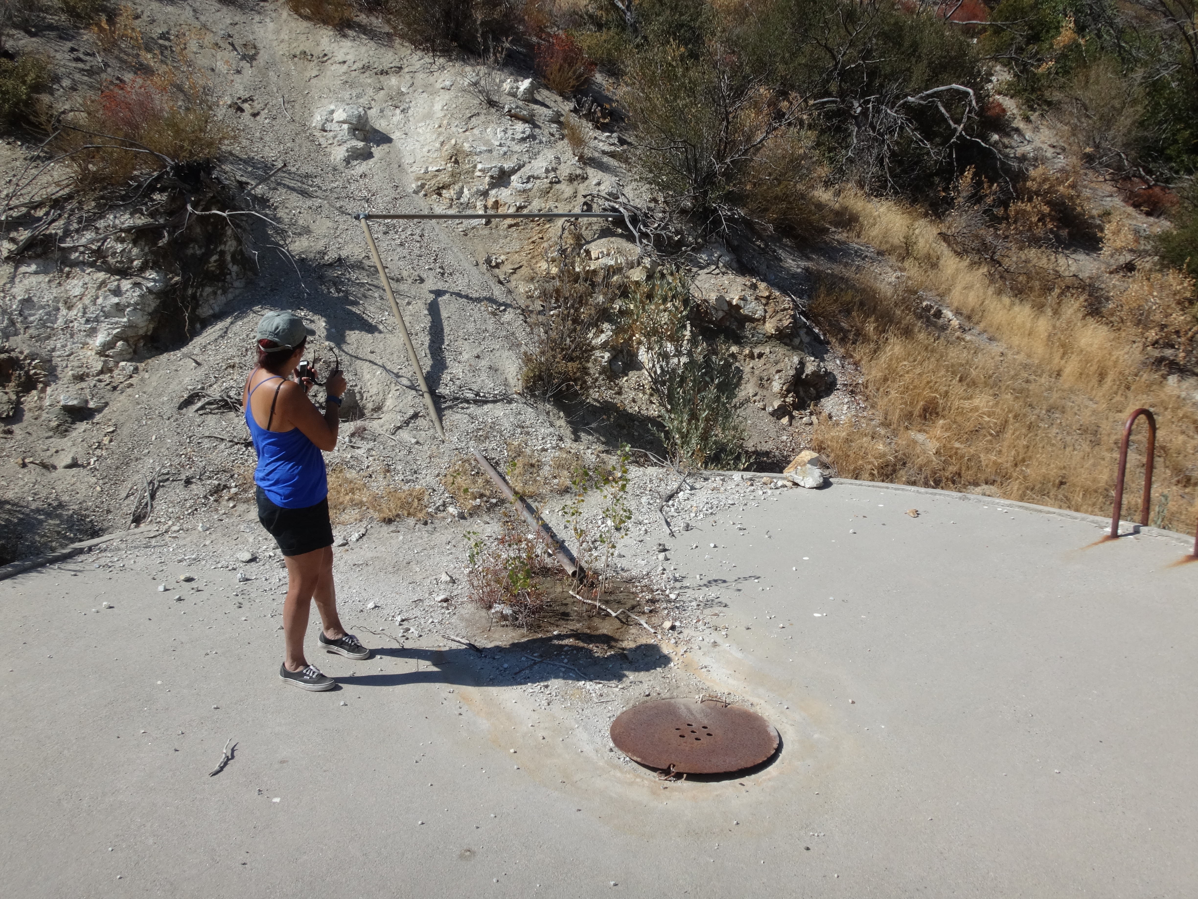
and also at the Baughman Springs ruins and water tank.
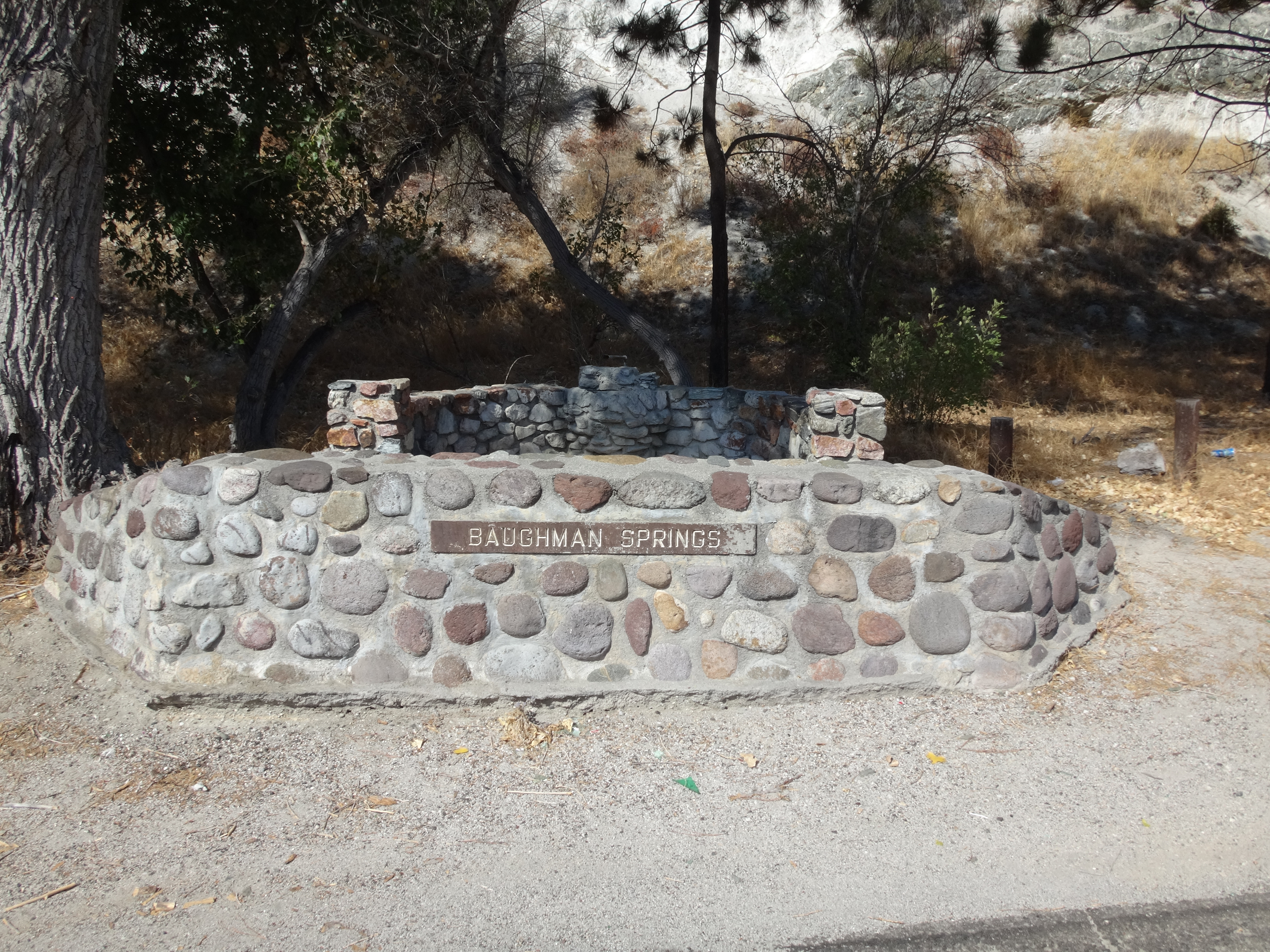
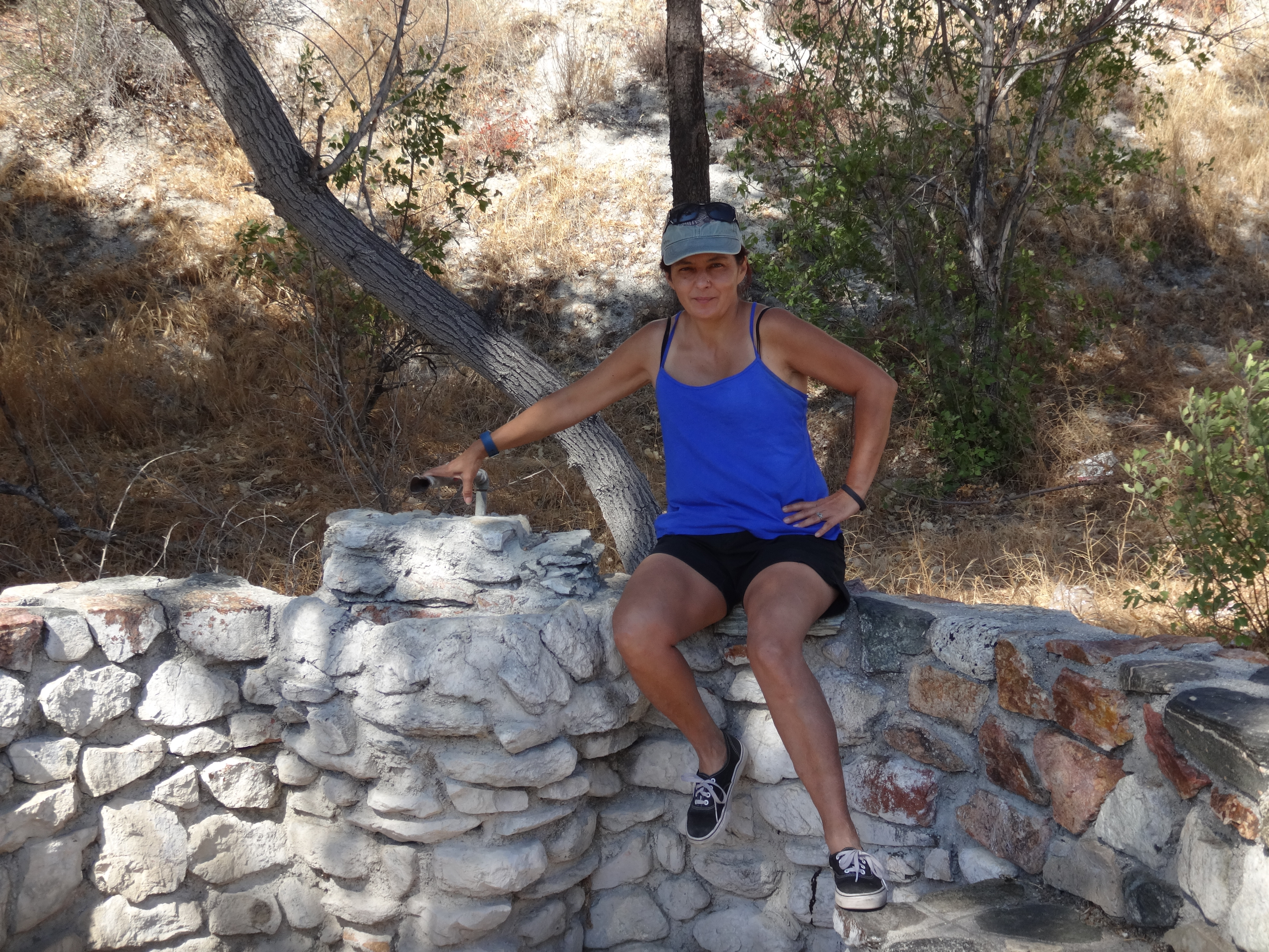
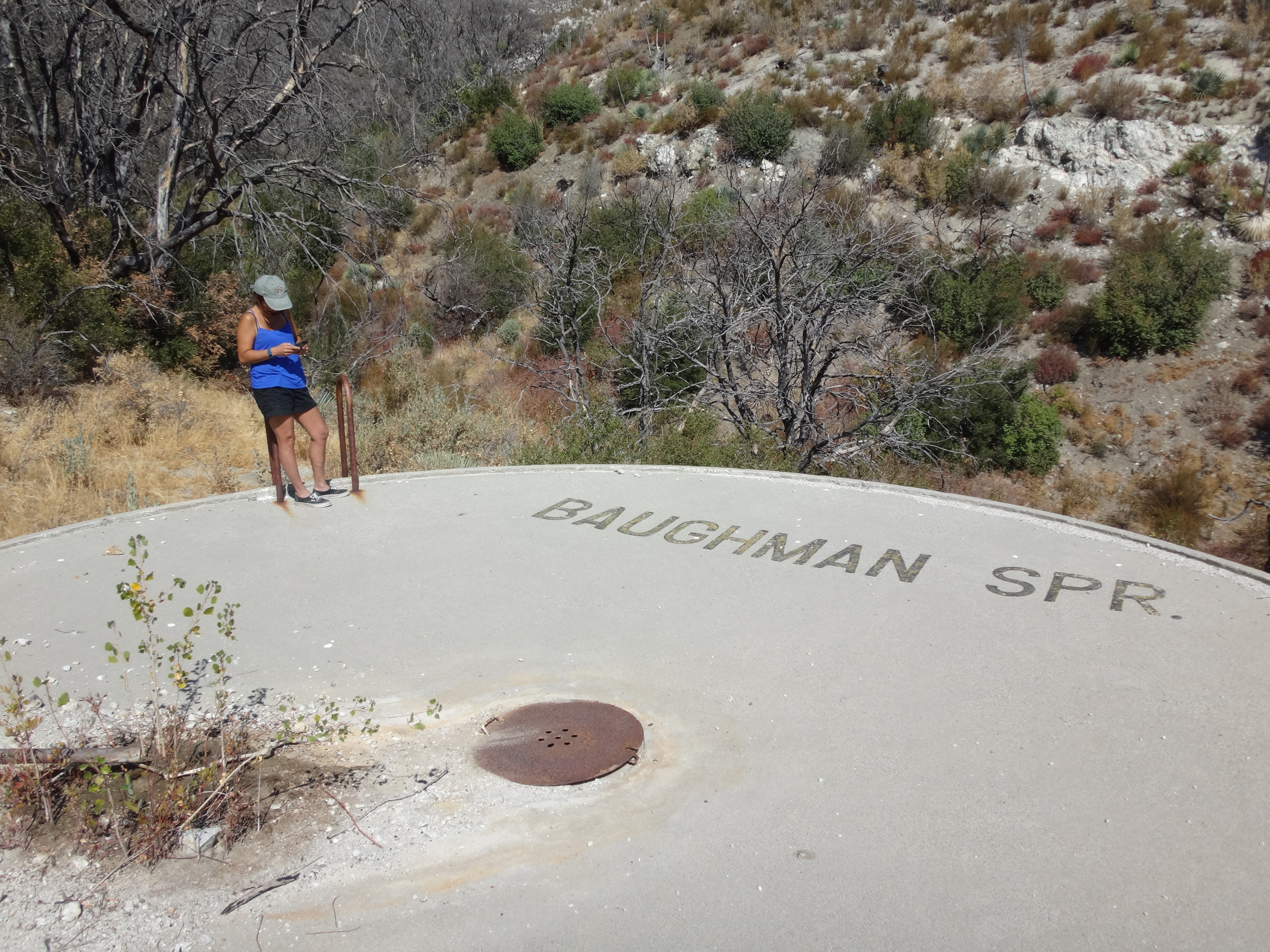
This tank is somewhat unique in that the pipe, which presumably once spring-fed the roadside fountain, now flows into the top of the cistern.
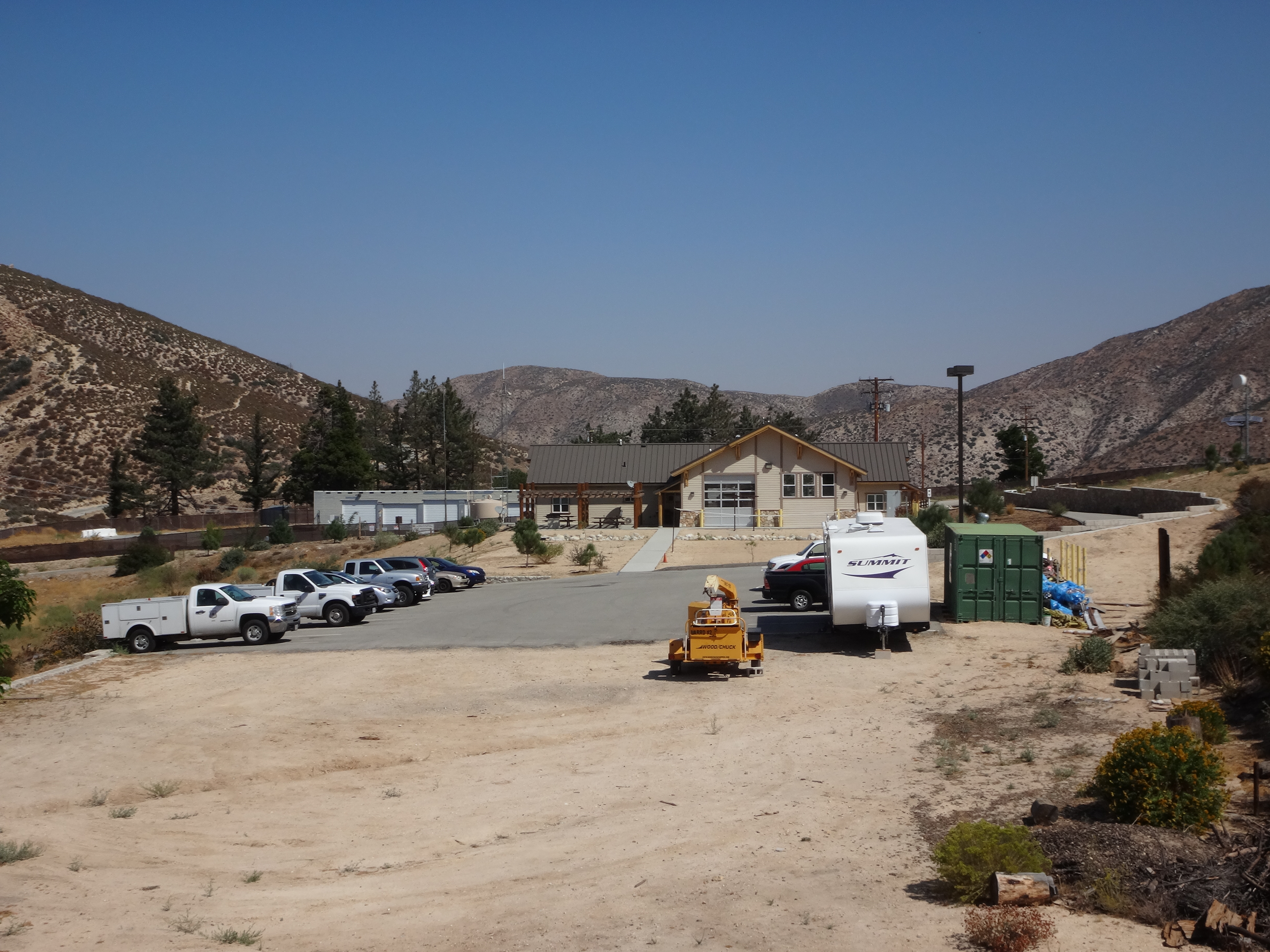
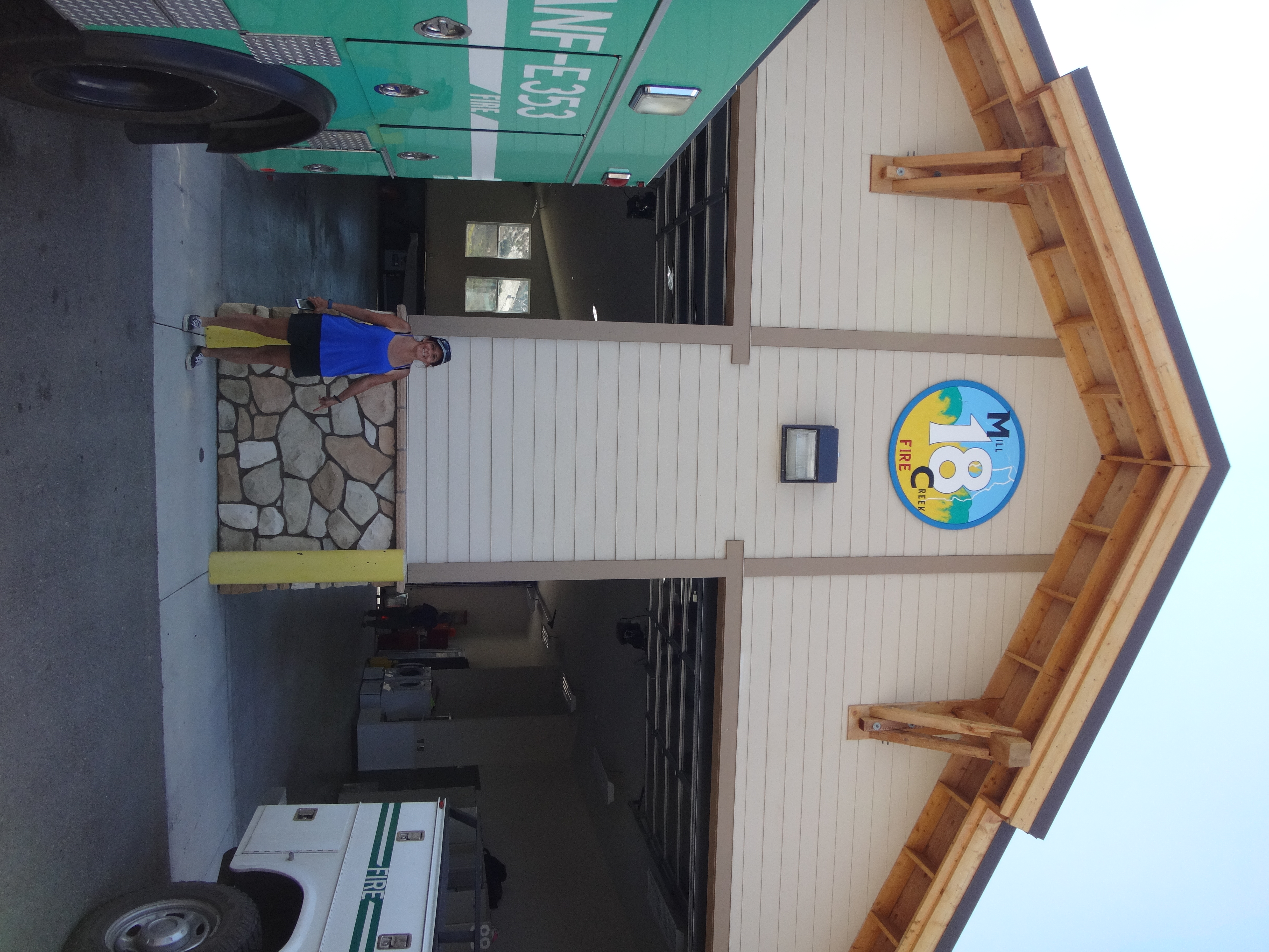
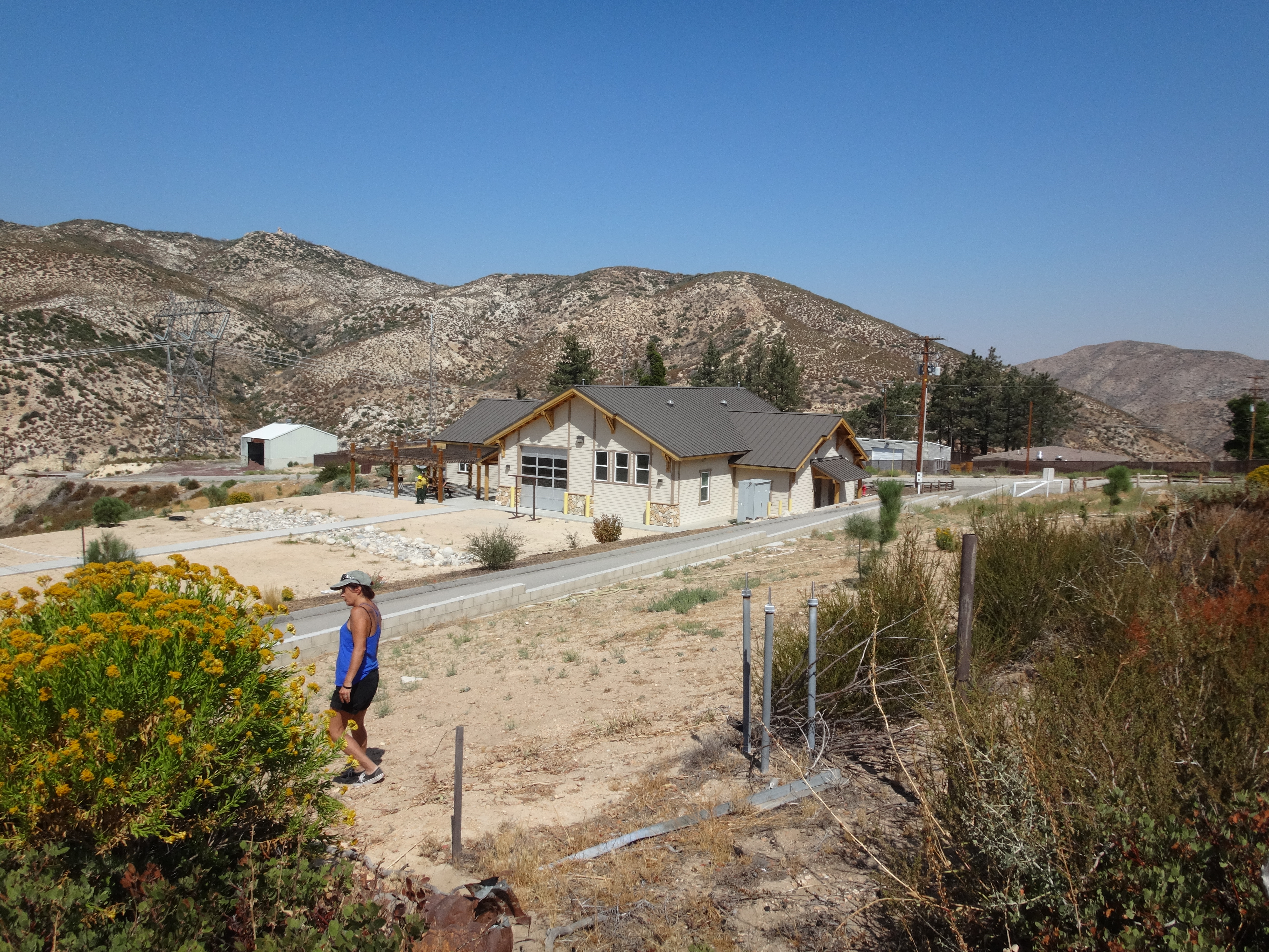
Our next stop was Mill Creek Fire Station. The 1995 topo shows 4999 Benchmark sitting along a road (4N19), directly behind the main building.
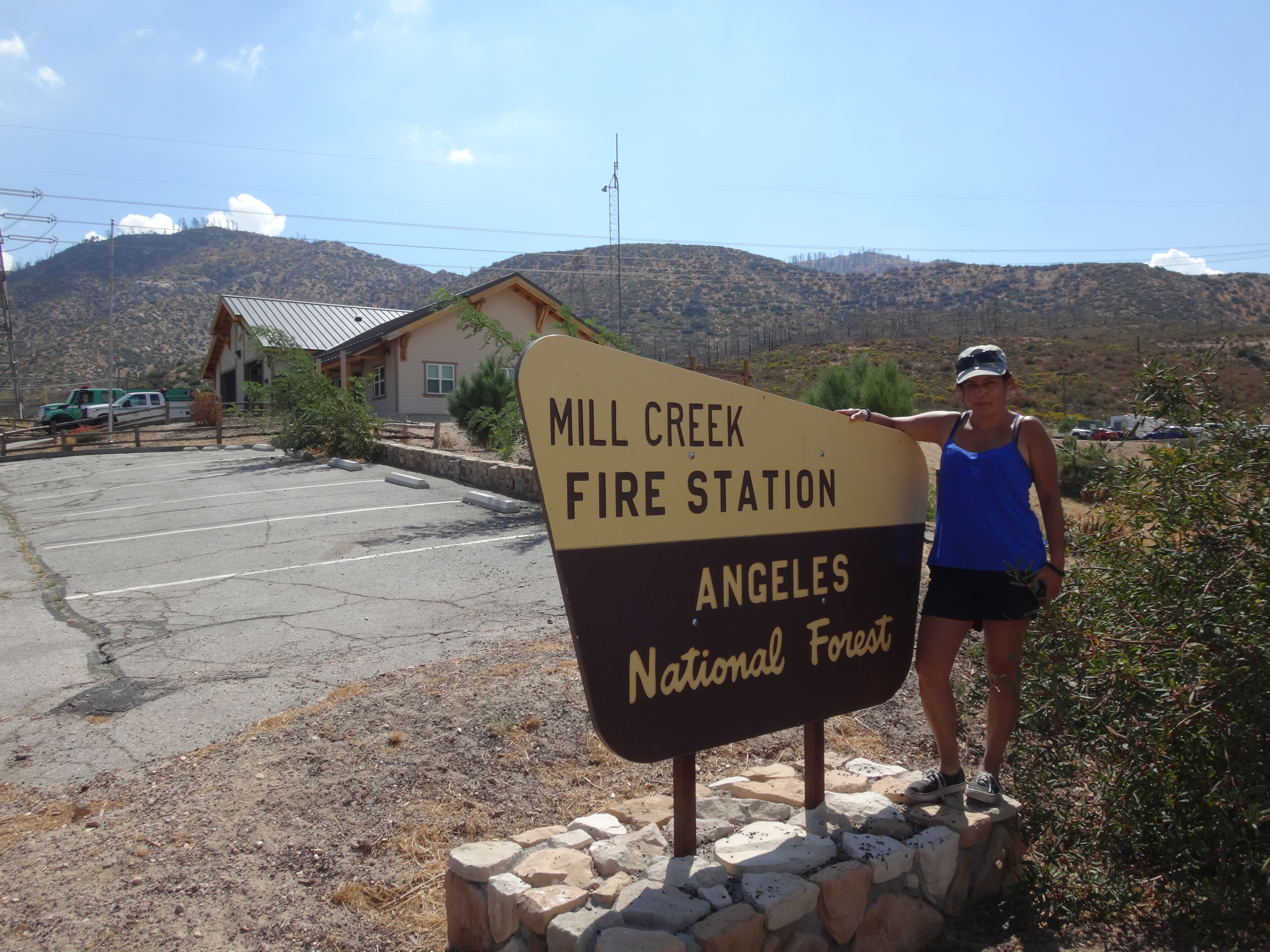
We spent some time wandering around the outskirts of the station, but could not locate the benchmark. Much of the area had changed since the Station Fire. It appeared that 4N19 no longer existed.
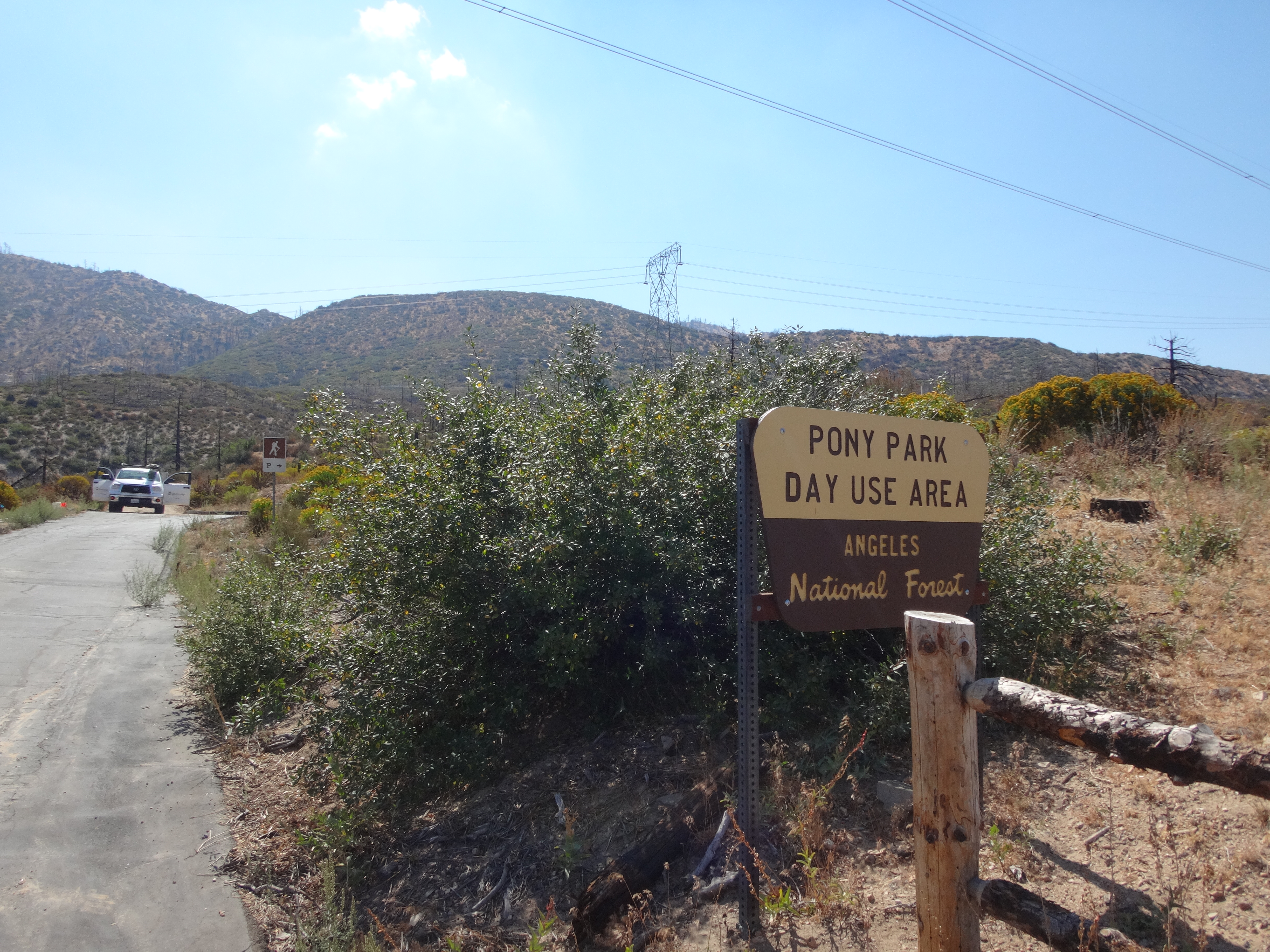
At the new Pony Park Day Use Area, next to the station, we talked with some construction workers, and they suggested asking the firefighters about the mark.
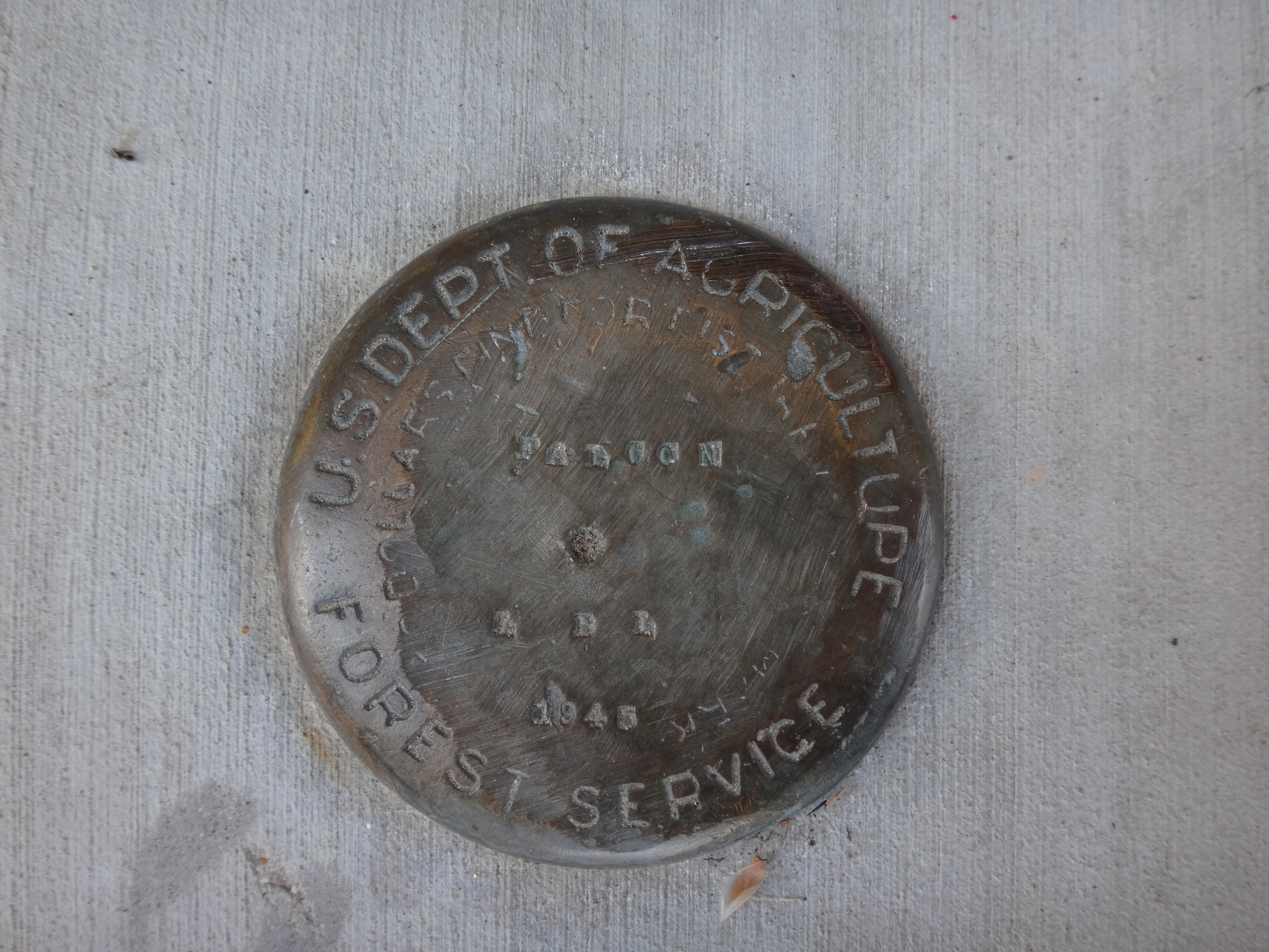
This, of course, was an excellent idea. We flagged down a young firefighter, who had only recently transferred to Mill Creek Summit and did not know about the benchmark. He was about to ask another firefighter, when Cecelia shouted excitedly. She located the mark, which had somehow found its way to the front driveway of the garage. It was set into the concrete floor, and was stamped "FALCON 1945."
Later we spoke with Linda, who appeared to be in charge of things at the station.
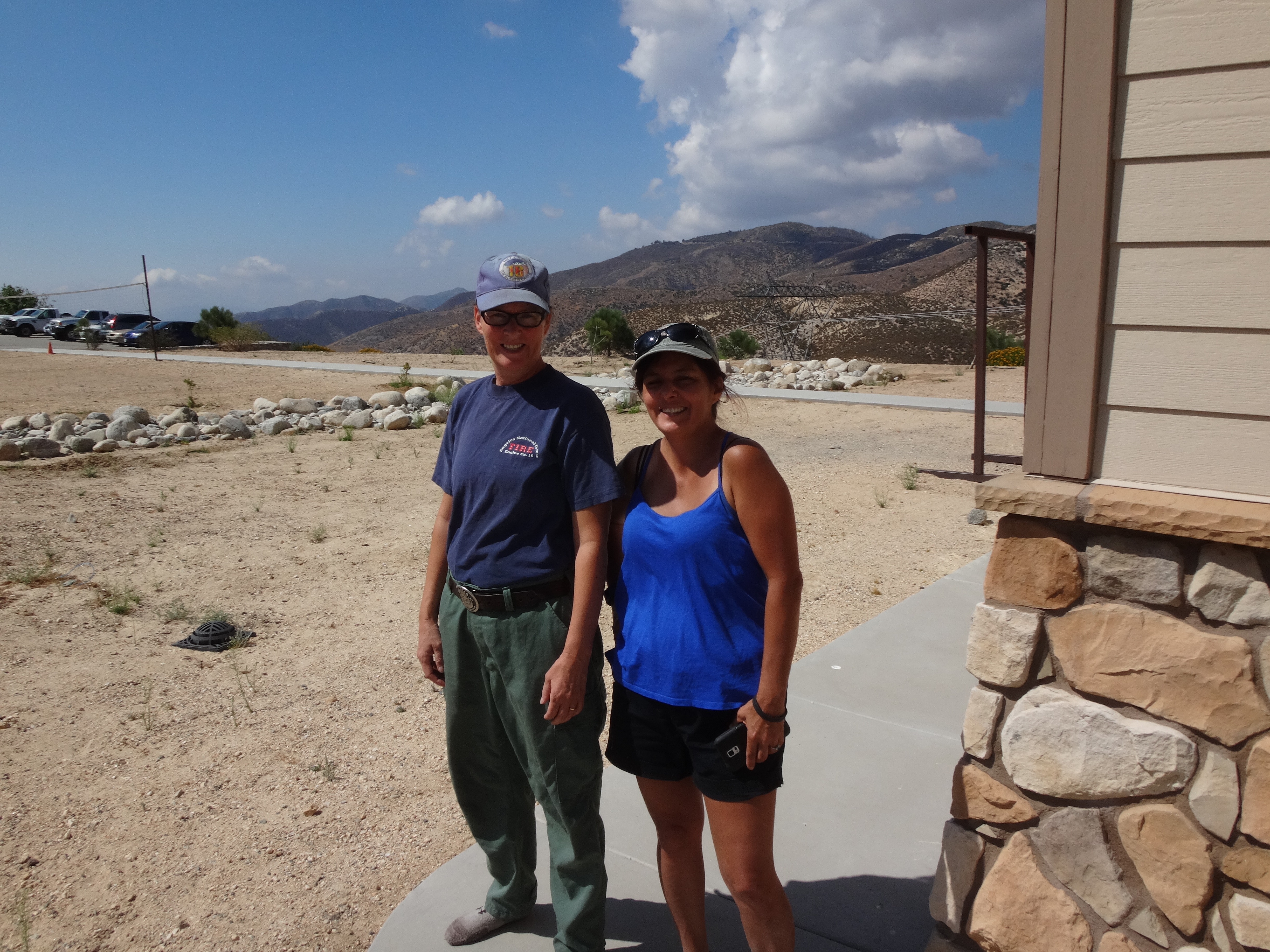
She told us a story, explaining how the original building had burned down in the Station Fire, and how the property was then regraded and redeveloped for construction of a new station. Having an appreciation for benchmarks, Linda rescued the disc from certain doom and had it permanently embedded in the new foundation of the station's garage. She was very nice and full of information, including the approximate original location of the defunct fire road and monument.
We thanked Linda for all the help and moved on to the next hunt, which would be Cole BM, known to Sierra Club folk as Cole Point (5607').
Less than half a mile after the junction with Aliso Canyon Road, there is an ungated service road on the right.
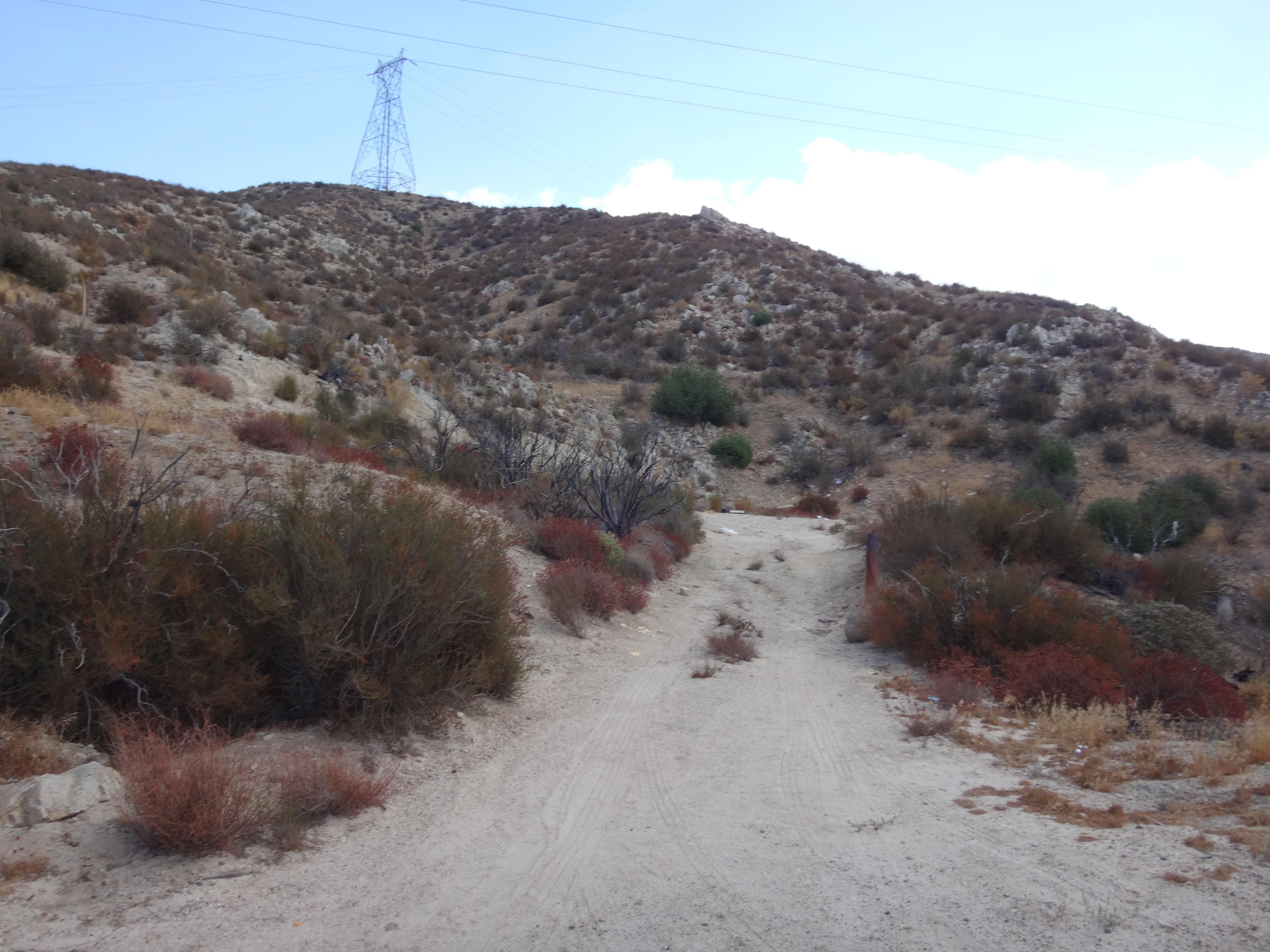
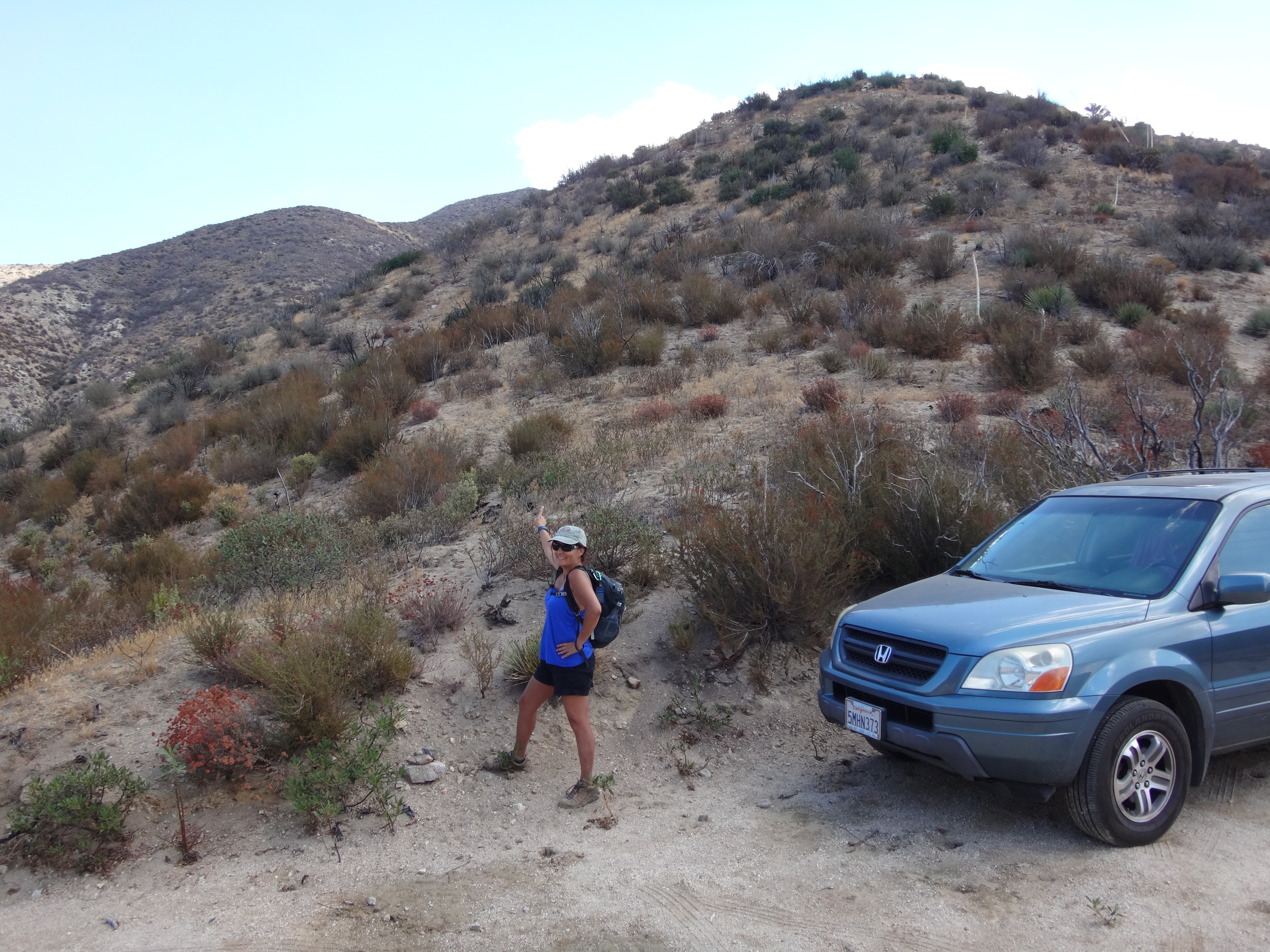
We turned onto this decent, but slightly overgrown, dirt road and drove it for about 0.4 miles to a saddle junction, where we parked. A small rock cairn marked the beginning of the steep ridge route to Cole.
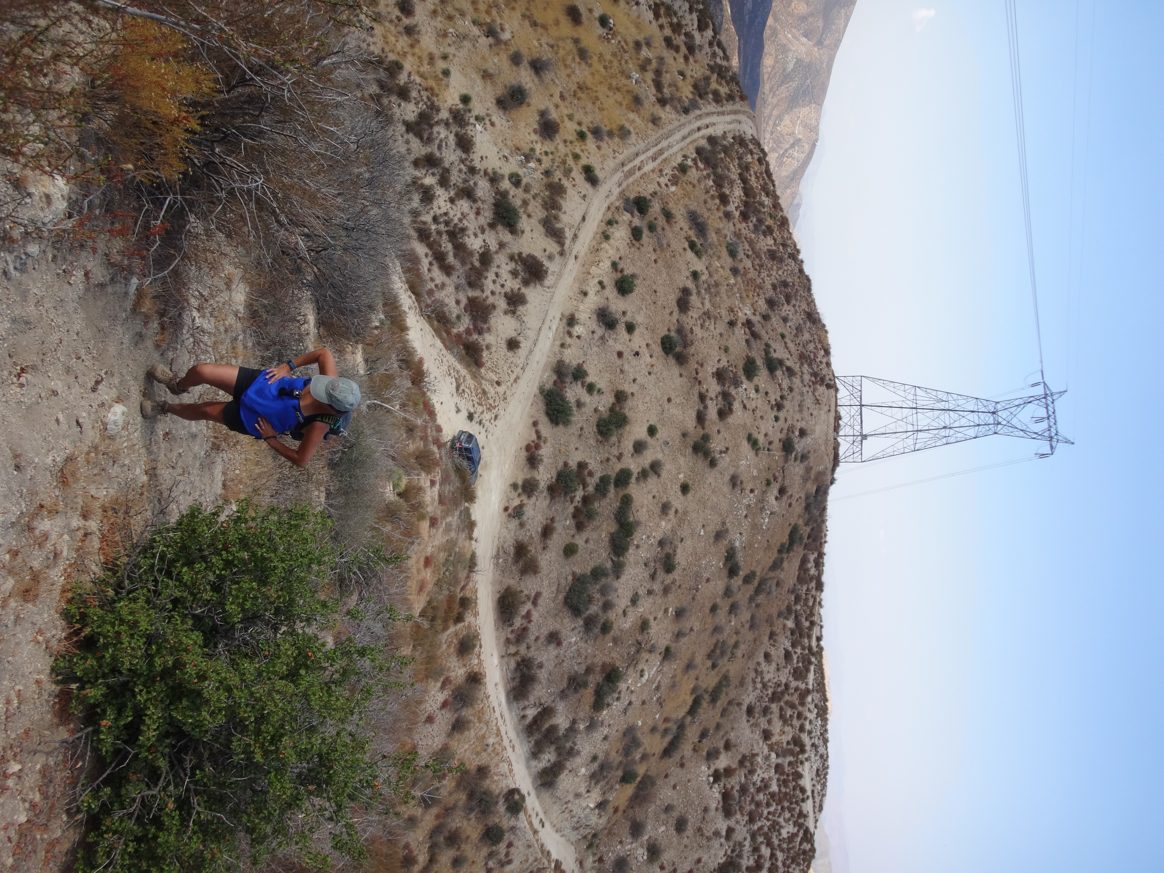
With a few clouds forming overhead, providing periodic relief from the sun, we took on the ridge, climbing 1300' in about one mile. Initially there is a pretty steep stretch. Enticing deer paths lured us away from the main use trail a couple times. Basically, it's best to stick to the spine and grind out the ascent, even where the trail becomes faint.
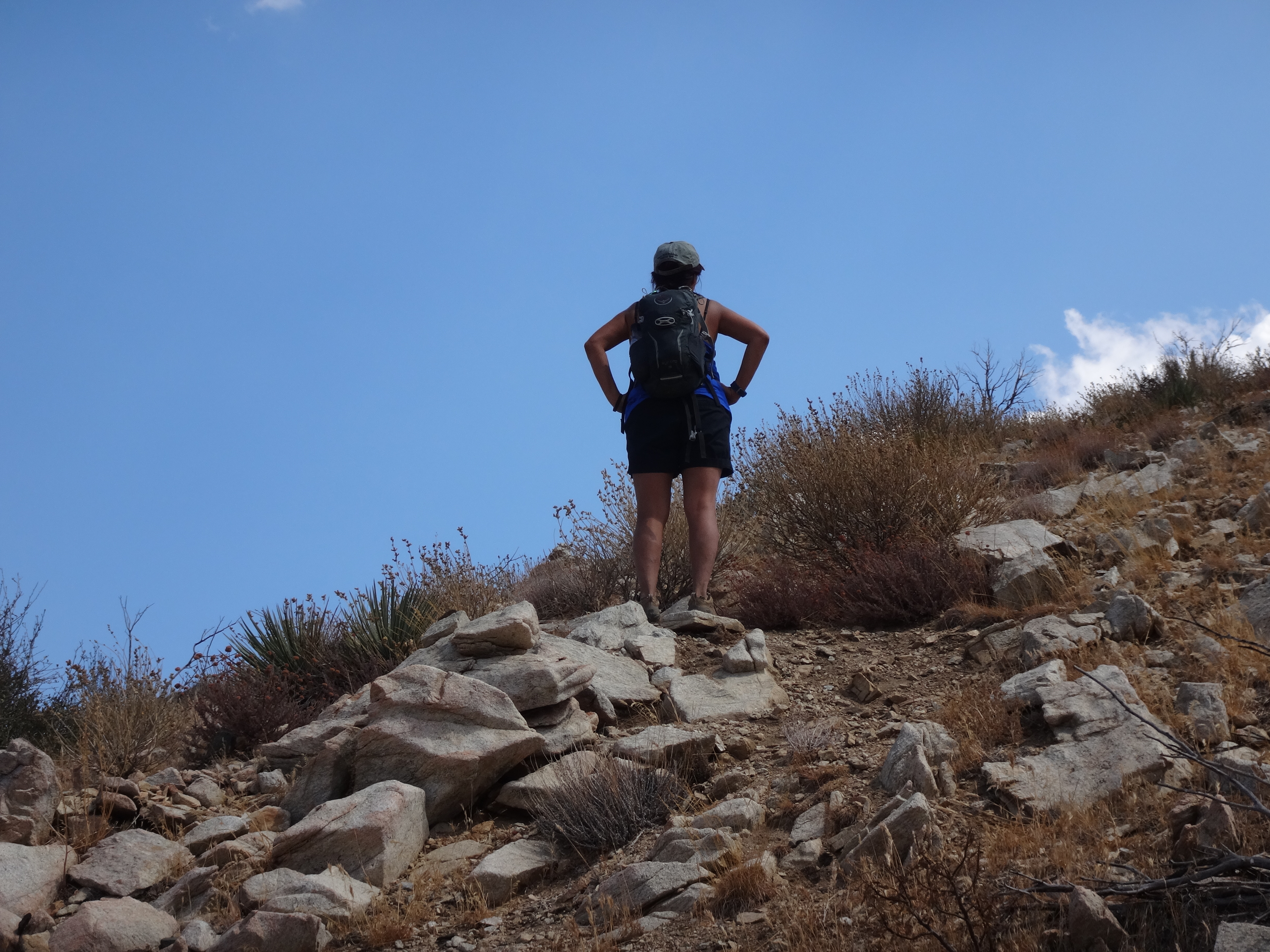
The view looking back into Aliso Canyon...
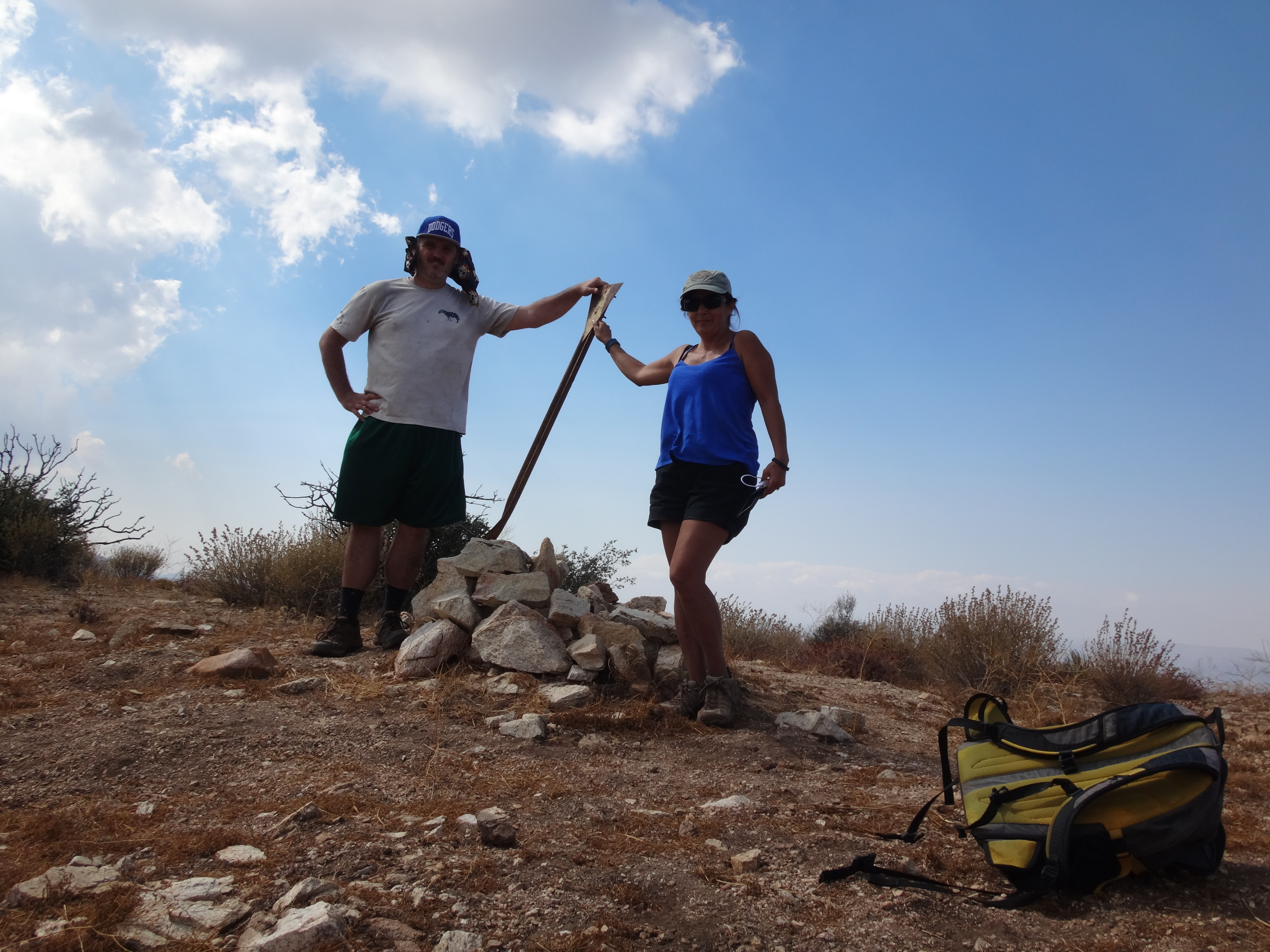
On the summit we found a register in a rock pile. But Cecelia was more interested in looking for the benchmark. She started carefully examining the area, including all of the large rocks. I was happy to let her do the work, while I goofed off and picked out the nearby peak names.
A reference mark was located, its boulder having been tipped sideways.
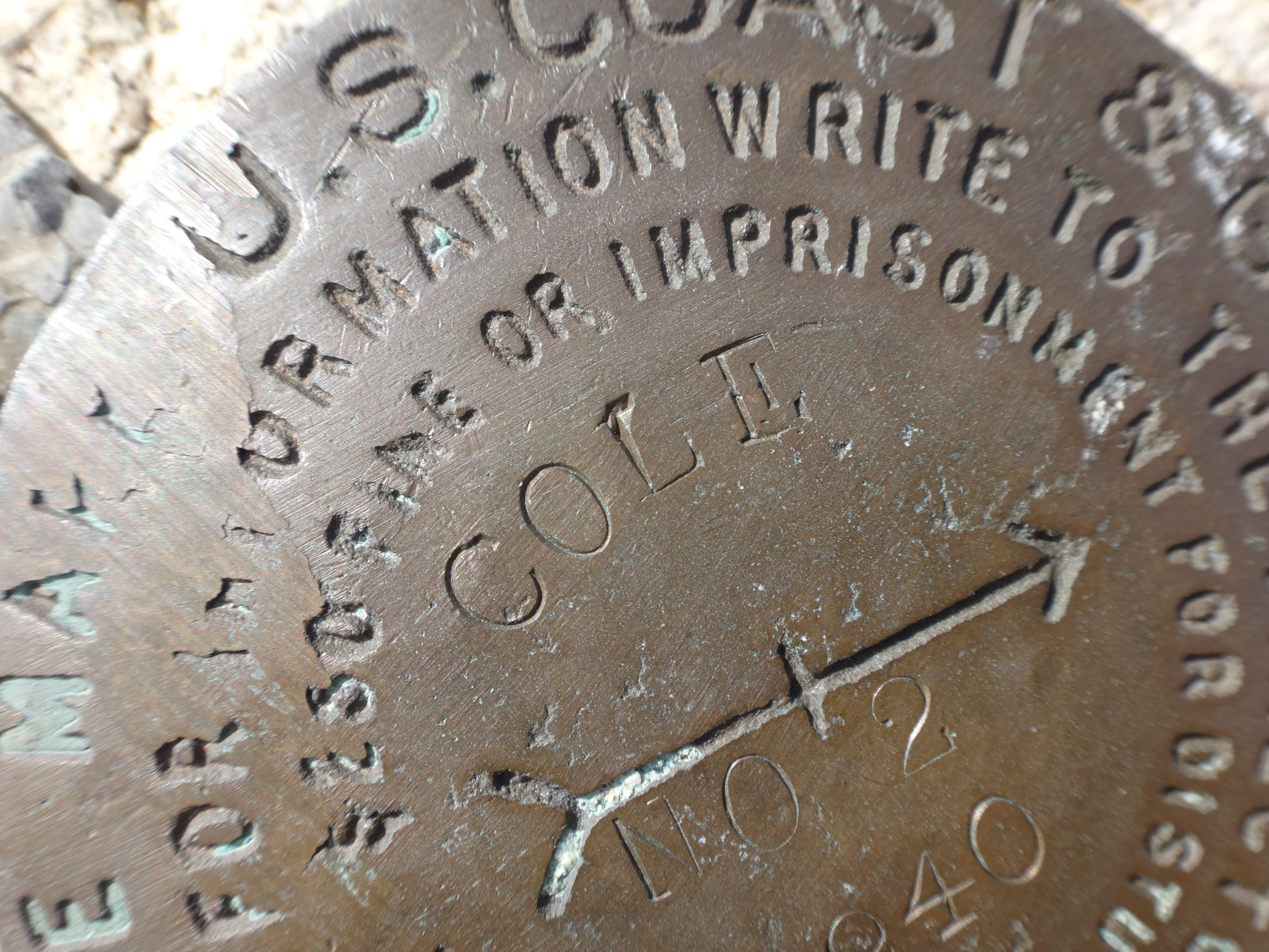
I uprighted the heavy rock, but couldn't turn it so that the mark's arrow pointed in any direction other than the most probably wrong one. It didn't much matter anyway, since we failed to locate the actual benchmark and therefore didn't really know which way the arrow should be pointing.
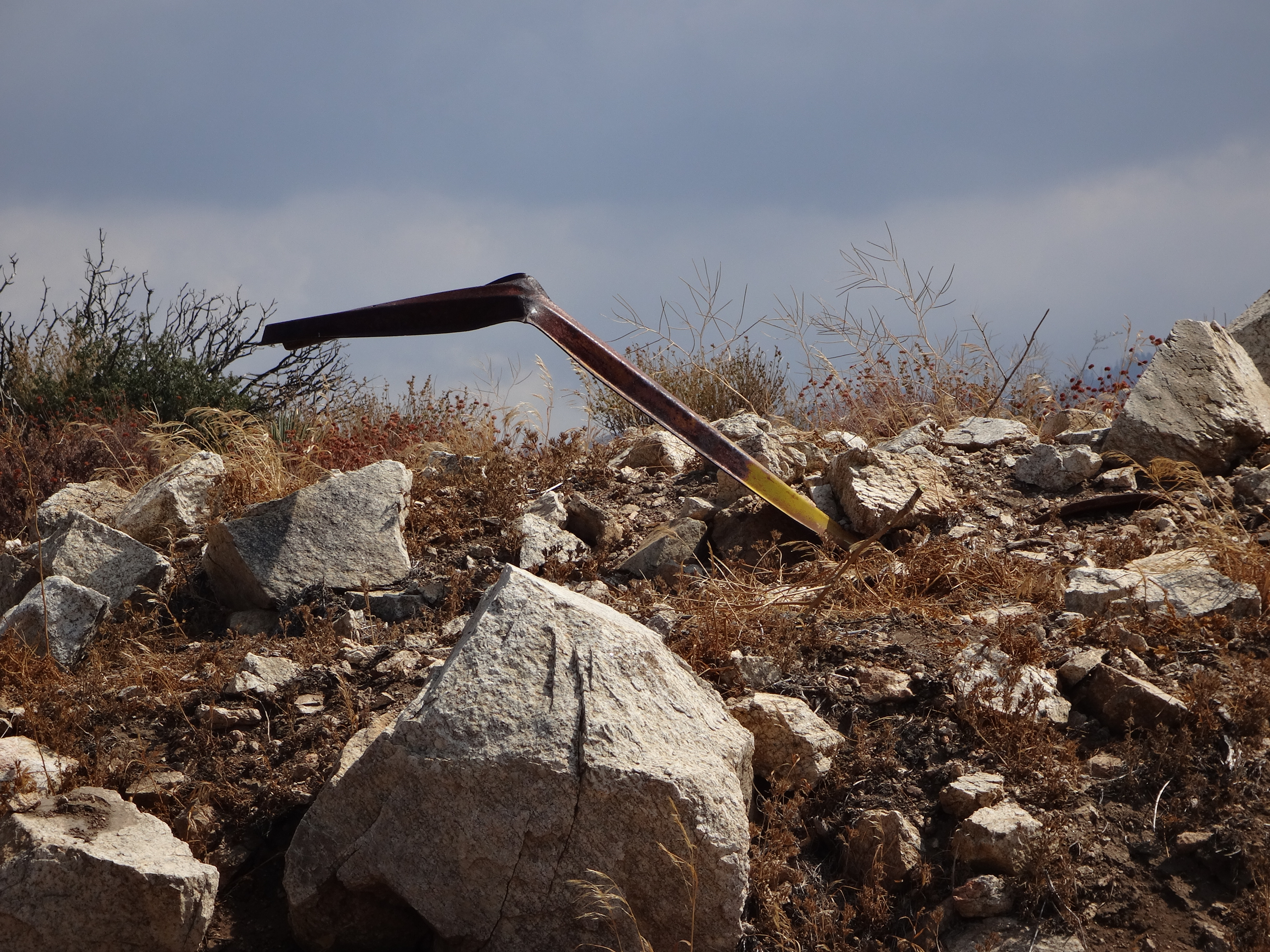
I retrieved one of those triangular signs from an old, firebreak debris field and set it up by the summit register.

The register contained entries going back to 1993, with appearances by well-known Sierra Club members like Frank Goodykoontz and Erv Bartel, who have local landmarks named after them.
After lunch, Cecelia and I searched again for the Cole benchmark, but still had no luck. We finally abandoned the search and headed back down after spending an hour on the summit.
First up was a relatively easy one: Alimony (3462'). It lives on top of a big rock next to a roadcut, a little before the Josephine Creek crossing.
To reach it we did some stupid scrambling in inappropriate footwear. The easiest way, however, would be to follow a service road around to the west of the bump and walk up the lightly brushed ridge from that side. Then there is a short class 2 climb to the mark.
While up there, you might as well check out the view of Big Tujunga Dam.
We continued up the highway, stopping briefly at an old, Big Tujunga Narrows overlook,
and also at the Baughman Springs ruins and water tank.
This tank is somewhat unique in that the pipe, which presumably once spring-fed the roadside fountain, now flows into the top of the cistern.
Our next stop was Mill Creek Fire Station. The 1995 topo shows 4999 Benchmark sitting along a road (4N19), directly behind the main building.
We spent some time wandering around the outskirts of the station, but could not locate the benchmark. Much of the area had changed since the Station Fire. It appeared that 4N19 no longer existed.
At the new Pony Park Day Use Area, next to the station, we talked with some construction workers, and they suggested asking the firefighters about the mark.
This, of course, was an excellent idea. We flagged down a young firefighter, who had only recently transferred to Mill Creek Summit and did not know about the benchmark. He was about to ask another firefighter, when Cecelia shouted excitedly. She located the mark, which had somehow found its way to the front driveway of the garage. It was set into the concrete floor, and was stamped "FALCON 1945."
Later we spoke with Linda, who appeared to be in charge of things at the station.
She told us a story, explaining how the original building had burned down in the Station Fire, and how the property was then regraded and redeveloped for construction of a new station. Having an appreciation for benchmarks, Linda rescued the disc from certain doom and had it permanently embedded in the new foundation of the station's garage. She was very nice and full of information, including the approximate original location of the defunct fire road and monument.
We thanked Linda for all the help and moved on to the next hunt, which would be Cole BM, known to Sierra Club folk as Cole Point (5607').
Less than half a mile after the junction with Aliso Canyon Road, there is an ungated service road on the right.
We turned onto this decent, but slightly overgrown, dirt road and drove it for about 0.4 miles to a saddle junction, where we parked. A small rock cairn marked the beginning of the steep ridge route to Cole.
With a few clouds forming overhead, providing periodic relief from the sun, we took on the ridge, climbing 1300' in about one mile. Initially there is a pretty steep stretch. Enticing deer paths lured us away from the main use trail a couple times. Basically, it's best to stick to the spine and grind out the ascent, even where the trail becomes faint.
The view looking back into Aliso Canyon...
On the summit we found a register in a rock pile. But Cecelia was more interested in looking for the benchmark. She started carefully examining the area, including all of the large rocks. I was happy to let her do the work, while I goofed off and picked out the nearby peak names.
A reference mark was located, its boulder having been tipped sideways.
I uprighted the heavy rock, but couldn't turn it so that the mark's arrow pointed in any direction other than the most probably wrong one. It didn't much matter anyway, since we failed to locate the actual benchmark and therefore didn't really know which way the arrow should be pointing.
I retrieved one of those triangular signs from an old, firebreak debris field and set it up by the summit register.
The register contained entries going back to 1993, with appearances by well-known Sierra Club members like Frank Goodykoontz and Erv Bartel, who have local landmarks named after them.
After lunch, Cecelia and I searched again for the Cole benchmark, but still had no luck. We finally abandoned the search and headed back down after spending an hour on the summit.