Page 1 of 4
Triangular peak markers in the San Gabriels
Posted: Mon Oct 05, 2015 2:32 pm
by dima
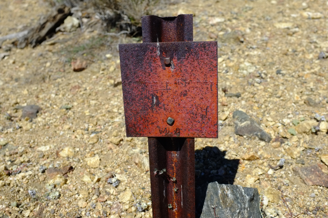
Some peaks in the San Gabriels have metal signs on them with some sort of code written on an inverted triangle, like this W15 on top of Iron Mountain:

There's a W5 on top of Lookout Mountain, and I've seen a number of others I can't recall right now. Does anybody know what those signify? Is there a list?
Re: Triangular peak markers in the San Gabriels
Posted: Mon Oct 05, 2015 2:57 pm
by Sean
They are witness posts. They are used to locate benchmarks. Witness posts come in different shapes and sizes. It appears the two you mentioned were used by survey teams in the '20s and '30s.
Re: Triangular peak markers in the San Gabriels
Posted: Mon Oct 05, 2015 4:43 pm
by dima
Sean wrote: They are witness posts. They are used to locate benchmarks
Oh that's interesting. So they live next to the USGS markers in the ground? I feel like I've seen at least one markerless one before: Iron Mt south ridge, off to the side of the trail. Wonder what that one was for, then. Will try to find it again next time I'm up there.
Re: Triangular peak markers in the San Gabriels
Posted: Mon Oct 05, 2015 7:03 pm
by Sean
Well sometimes the marks are long gone or buried, so don't kill yourself looking for them.
Re: Triangular peak markers in the San Gabriels
Posted: Sun Jun 12, 2016 12:13 pm
by dima
So I found another of these yesterday, and now I want to have a full list. The ones I know of:
- W1: junction of the ridge North of Lookout mountain and the one carrying Bear Canyon Trail to Baldy
- W5: Lookout Mt
- W15: top of Iron Mt
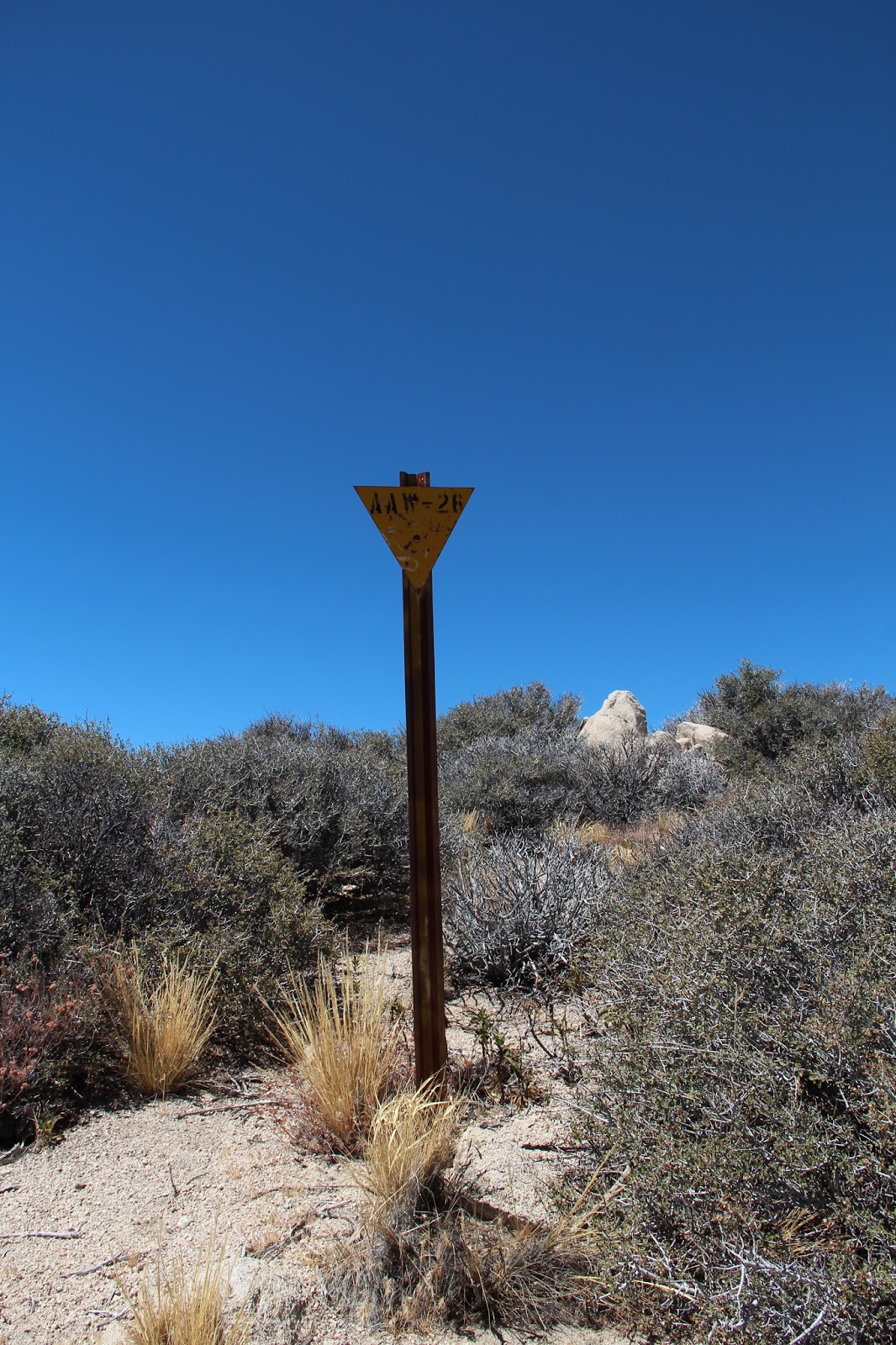
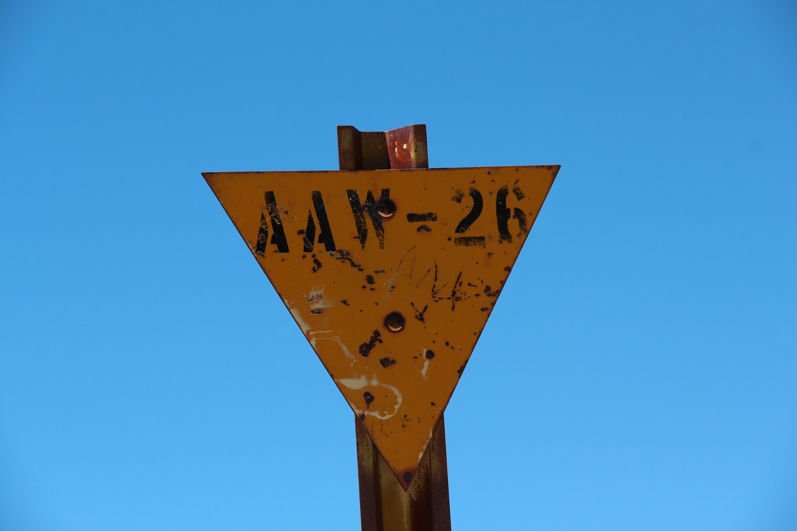
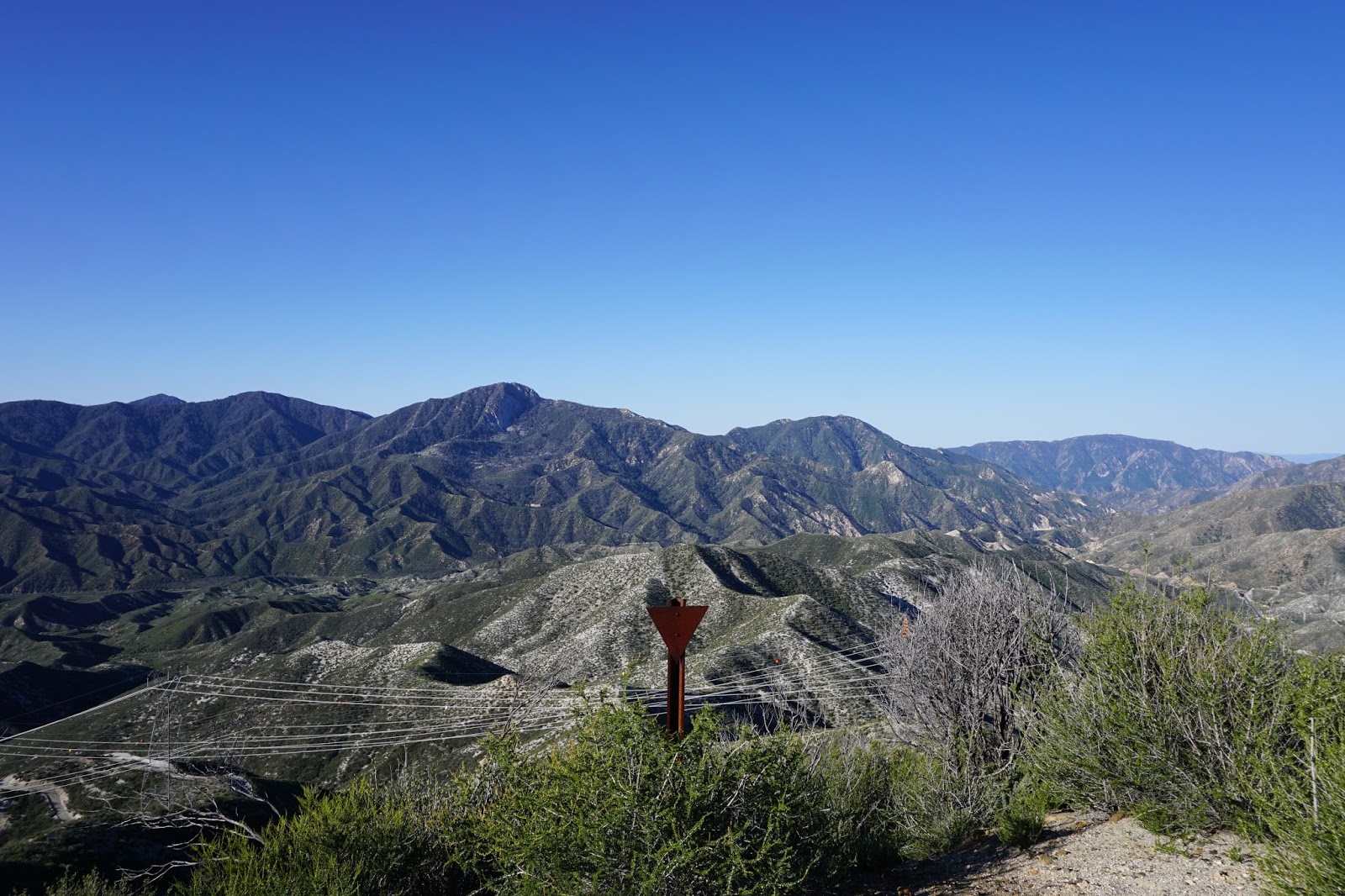
- 26: Burro Peak (
or so says Sean)
- 6: Sunset Peak (or so says tekewin)
- [blank]: top of ridge near the Pallett Benchmark
- [blank]: somewhere on Iron's South ridge, just West of the trail. I didn't make a note of exactly where I found it.
- G2B: above Adams Falls
I'm pretty sure I saw one on the firebreak below Clamshell Peak, but it was a while back. What others do people know of?
Re: Triangular peak markers in the San Gabriels
Posted: Sun Jun 12, 2016 4:44 pm
by Uncle Rico
I'm pretty sure I saw one on the firebreak below Clamshell Peak, but it was a while back. What others do people know of?
There's one on the south edge of the summit of Iron #3.
Wow. Don't know why that image is so big. Sorry.
Re: Triangular peak markers in the San Gabriels
Posted: Mon Jun 13, 2016 9:16 am
by Sean
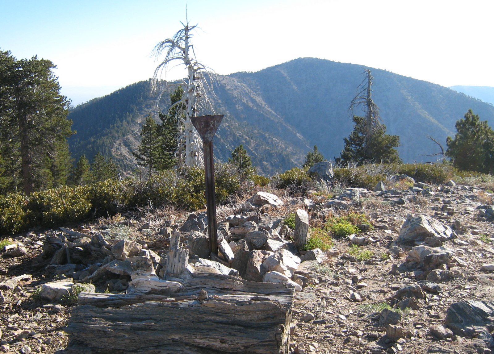
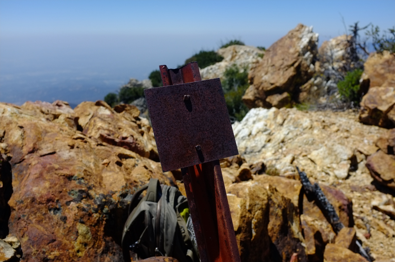
The ones with numbers on them interest me the most. There are probably many dozens without numbers, mostly found on old firebreaks. I'm not sure if they were witness posts for benchmarks or not.
Re: Triangular peak markers in the San Gabriels
Posted: Mon Jun 13, 2016 1:56 pm
by JeffH
Marker V 12 on top of Stoddard Peak. This was in Dec 2014 so I don't know if it's still there.

Re: Triangular peak markers in the San Gabriels
Posted: Mon Jun 13, 2016 10:34 pm
by HikeUp
There is one on the "typical" route to Rattlesnake...I think at the 4080'+ point.
Huge photo bomb (mine's bigger than yours Rico

)...
 12 Metal posts at bump ~4100'
 by
HikeUp_Pasadena, on Flickr
Re: Triangular peak markers in the San Gabriels
Posted: Tue Jun 14, 2016 8:42 am
by Sean
I have documented at least 24 witness posts with triangular plates throughout the Gabes.
I'll list them in two groups by Tom Harrison map.
For the more obscure ones I won't give exact locations on the forum.
If you want pics or more precise location info, message me privately.
Front Country
Blank, near Brown Mtn
Probably blank, near Mt. Lukens
Blank, near Mt. Muir
Blank, near Yale Peak
Blank, near Mt. Emma
Blank, near Roundtop
High Country
Blank, near Clamshell Peak
Probably blank, Etiwanda Peak
45, near Rattlesnake Peak
39, Rattlesnake Peak
W15, Iron Mountain
2-?, Winston Ridge
W 5, Lookout Mountain
FBH1 F21, Circle Mountain
Blank, near Ralston Peak
Blank, Ralston Peak
26, Burro Peak
Blank with graffiti, Chalk Peak
Blank, Lower PVR
Blank, Upper PVR
6, Sunset Peak
V 12, Stoddard Peak
Blank, near Bare Mountain
Another blank, near Bare Mountain
Re: Triangular peak markers in the San Gabriels
Posted: Tue Jun 14, 2016 11:43 am
by Sean
One more thing about these metal posts: perhaps the triangular plate is intended to associate them with triangulation survey stations. Some of these stations were permanent, like the one on Lookout. While others may have been temporary, like those along firebreaks with apparently no history of a benchmark in the vicinity. That's just a guess though.
Re: Triangular peak markers in the San Gabriels
Posted: Tue Jun 14, 2016 9:27 pm
by dima
That is a great list, Sean! I don't see any obvious pattern in the codes, but it looks like the 3 known Ws are all in the same rough area. How do you feel about visiting Bighorn Ridge?
Re: Triangular peak markers in the San Gabriels
Posted: Wed Jun 15, 2016 8:06 am
by Sean
dima wrote: How do you feel about visiting Bighorn Ridge?
I wouldn't go up it looking for posts. While the old Highline Trail crossed the lower part of the ridge, I can't find evidence of a trail or firebreak going up it. Nor can I find a history of any benchmark along the ridge.
Still, I'm looking at Big Horn for other reasons. Email me.
Re: Triangular peak markers in the San Gabriels
Posted: Wed Jun 15, 2016 3:44 pm
by Sean
Found one more from a pic I took on Throop in Sep. 2011. Something happened to the letters, but it looks like maybe W 28.

Re: Triangular peak markers in the San Gabriels
Posted: Thu Jun 16, 2016 3:57 pm
by David R
On Bighorn Ridge there is a post, see below from the Ze write-up from 2009.
There is an old bent sign labeled "W12" at Pt. 6388, presumably a relic from the days when a trail ran up the ridge.
https://eispiraten.com/s ... .php#14354
Re: Triangular peak markers in the San Gabriels
Posted: Sat Jun 18, 2016 1:10 pm
by JeffH
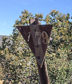
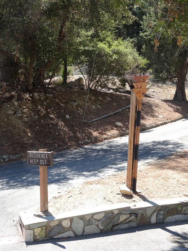
Claremont Hills Wilderness Park, I walked around there this morning since my sister is visiting from chilly Portland.
V79 on the marker, it's just before the 2.5 mile marker on the Burbank Canyon side. Up above the road and below the use trail on the ridge, I couldn't get a good angle for a clear picture.

Shot of the triangle.

Where it is on the 'trail'.
Re: Triangular peak markers in the San Gabriels
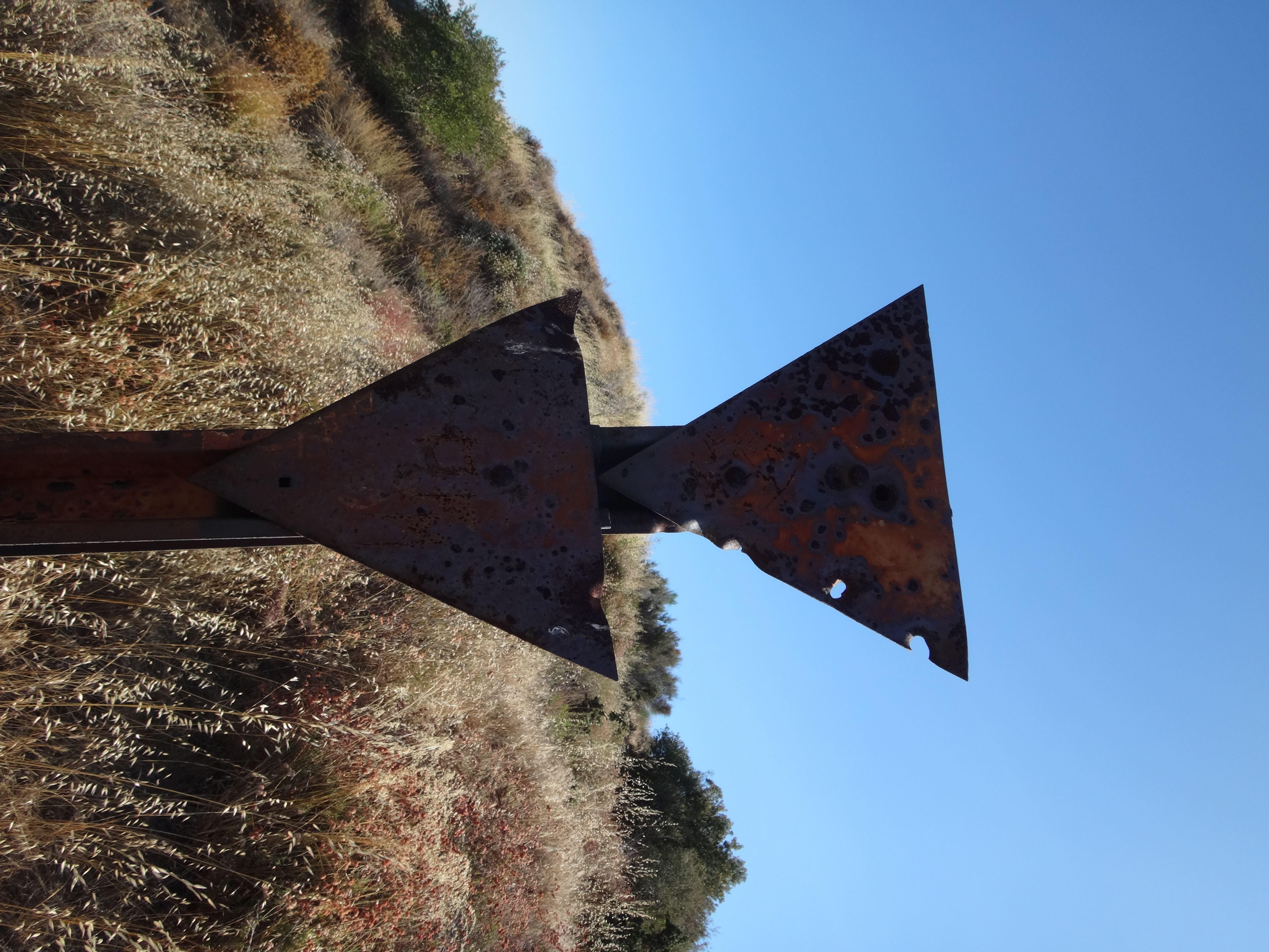
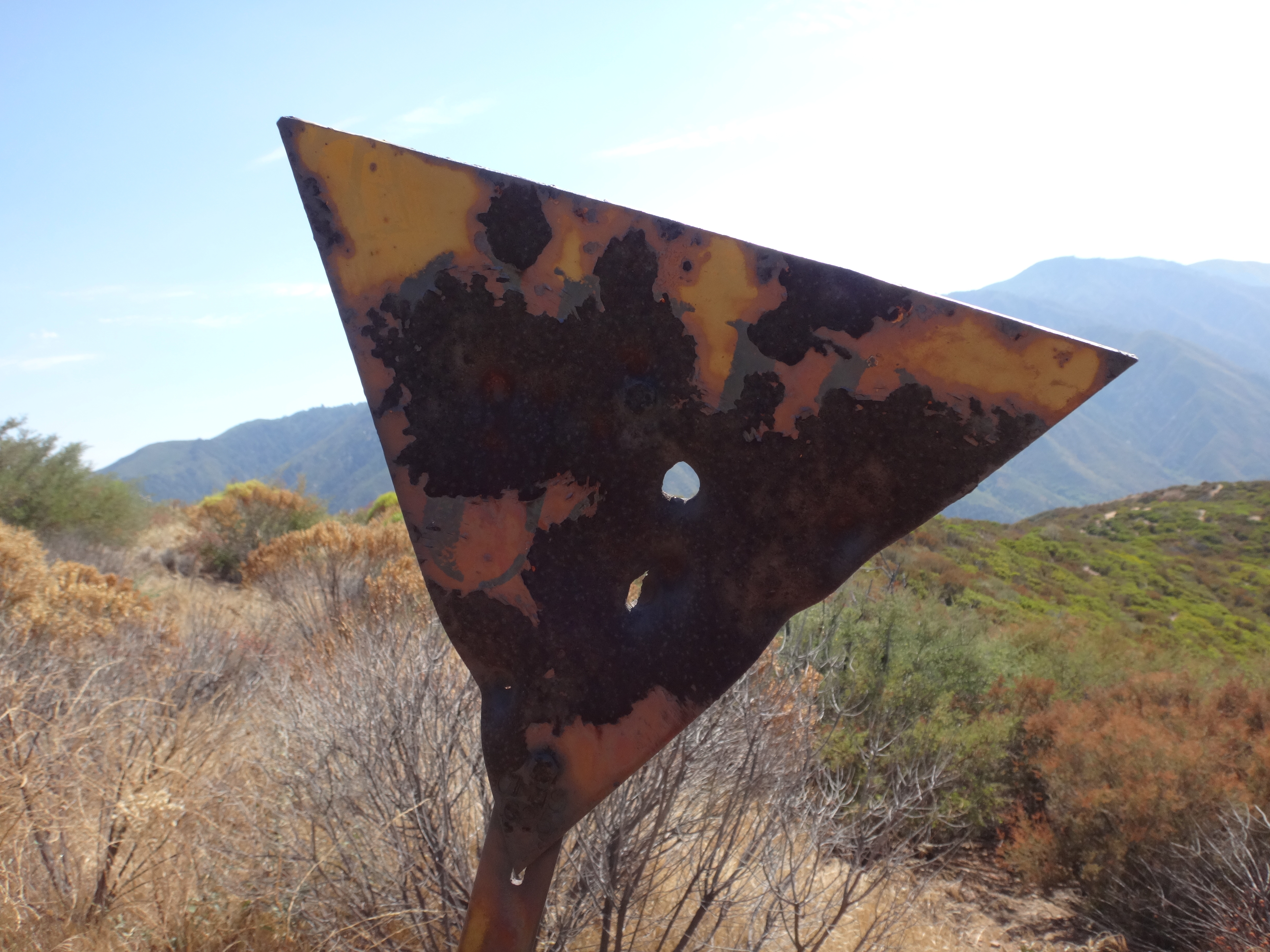
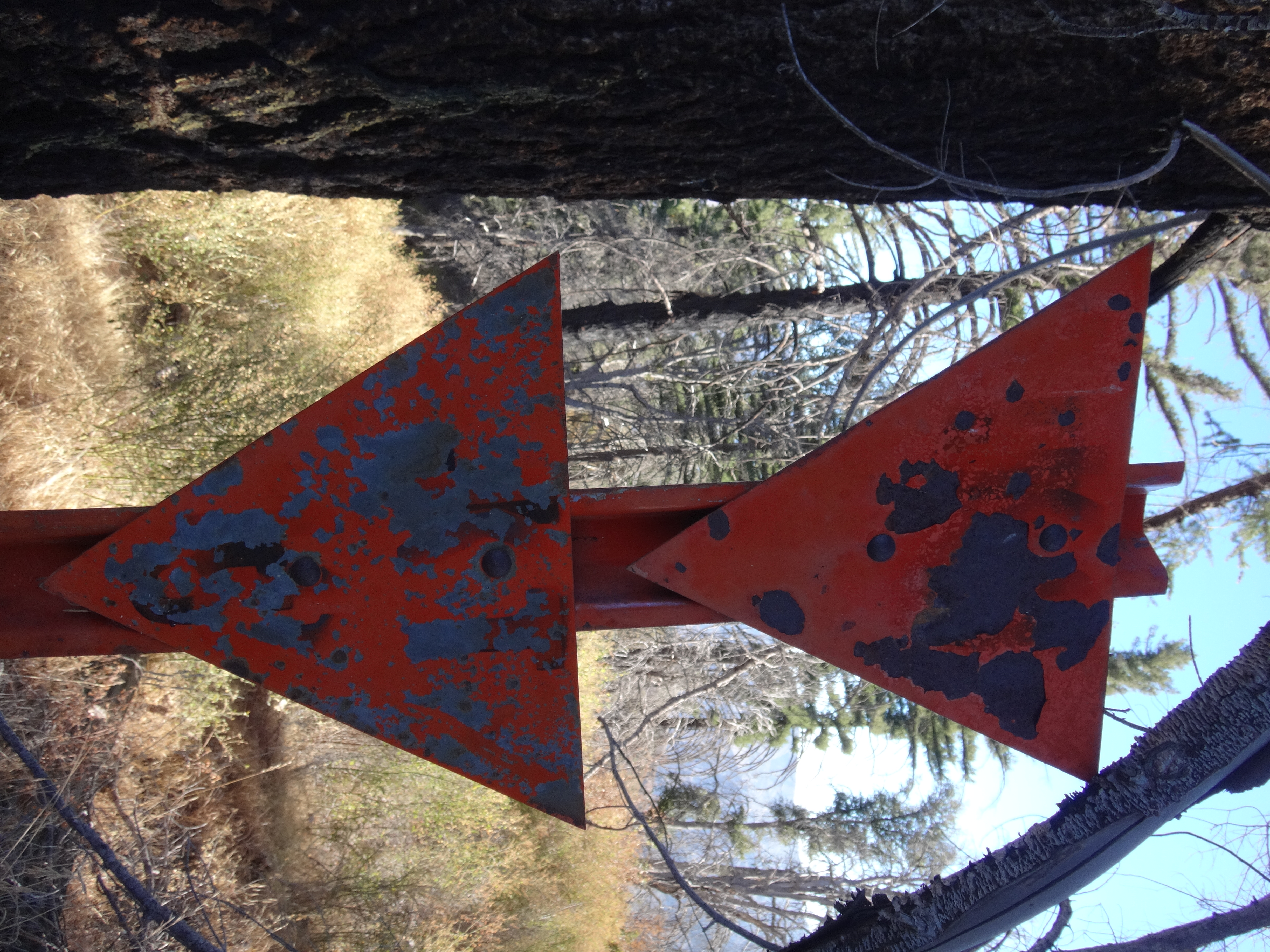
Posted: Sat Jun 18, 2016 2:47 pm
by RichardK
Here is the triangle showing the number:
Re: Triangular peak markers in the San Gabriels
Posted: Wed Jul 06, 2016 7:35 pm
by Cyberbear
Similar yellow angle iron post with inverted steel triangle were used on the San Bernardino National Forest. The Forest was divided into blocks A-Z, AA-ZZ. Each block had a hard copy folder with map showing numbers. Most peaks were shown with the ridges for dozer fire breaks. Water sources, hellispots, & Fire Camps. Dozer lines were assessed for accessibility to a dozer and estimates were made on time to construct a line. It would be my guess that the Angeles National Forest had the same.
This was done before GPS, Computers, Cell Phones.
Re: Triangular peak markers in the San Gabriels
Posted: Thu Jul 07, 2016 6:51 am
by HikeUp
Cyberbear wrote: Similar yellow angle iron post with inverted steel triangle were used on the San Bernardino National Forest. The Forest was divided into blocks A-Z, AA-ZZ. Each block had a hard copy folder with map showing numbers. Most peaks were shown with the ridges for dozer fire breaks. Water sources, hellispots, & Fire Camps. Dozer lines were assessed for accessibility to a dozer and estimates were made on time to construct a line. It would be my guess that the Angeles National Forest had the same.
This was done before GPS, Computers, Cell Phones.
Interesting.
Re: Triangular peak markers in the San Gabriels
Posted: Sun Jul 10, 2016 3:35 am
by dima
Two more numberless markers found today:
1. On the ridge between Tom Sloane Saddle and Brown Mountain.
2. At red box saddle. Next to the parking lot.
Re: Triangular peak markers in the San Gabriels
Posted: Fri Jul 15, 2016 8:33 am
by Sean
Cyberbear wrote: Similar yellow angle iron post with inverted steel triangle were used on the San Bernardino National Forest. The Forest was divided into blocks A-Z, AA-ZZ. Each block had a hard copy folder with map showing numbers. Most peaks were shown with the ridges for dozer fire breaks. Water sources, hellispots, & Fire Camps. Dozer lines were assessed for accessibility to a dozer and estimates were made on time to construct a line. It would be my guess that the Angeles National Forest had the same.
This was done before GPS, Computers, Cell Phones.
"Pre-attack markers"? Is that the official name for them? Any public resources available with info about them? Thanks.
Re: Triangular peak markers in the San Gabriels
Posted: Mon Jul 25, 2016 4:41 pm
by Sean
Found alongside the Mt. Baldy Road.

Re: Triangular peak markers in the San Gabriels
Posted: Thu Jul 28, 2016 11:20 am
by Sean
Found a couple more yesterday:

(Dora BM 4547', Glendora Ridge)
(Near entrance to Tanbark Road, Glendora Ridge)
Re: Triangular peak markers in the San Gabriels
Posted: Fri Aug 05, 2016 9:31 pm
by Sean
This one was found on Lower Lytle Creek Ridge near Keen BM. You can see in the close-up that there used to be some letters and numbers, but they are unreadable now.

Re: Triangular peak markers in the San Gabriels
Posted: Sun Aug 07, 2016 2:31 pm
by dima
These aren't triangular, but they're the same sort of thing. The far end of Ontario ridge has at least two markers:
VH16 (Turtle's Beak):

VH8(somewhere about point 7792)
Re: Triangular peak markers in the San Gabriels
Posted: Sat Aug 27, 2016 4:30 pm
by Slowest_Hiker
Three for the price of one at Cogswell Dam!
 DSC00476
 by
moore91024, on Flickr
Re: Triangular peak markers in the San Gabriels
Posted: Sat Aug 27, 2016 4:32 pm
by Slowest_Hiker
Plus one along Blue Ridge Rd. between Inspiration Point and Blue Ridge CG.
 DSC00394
 by
moore91024, on Flickr
Re: Triangular peak markers in the San Gabriels
Posted: Fri Sep 09, 2016 2:13 pm
by Sean
JeffH wrote: Claremont Hills Wilderness Park, I walked around there this morning since my sister is visiting from chilly Portland.
V79 on the marker, it's just before the 2.5 mile marker on the Burbank Canyon side. Up above the road and below the use trail on the ridge, I couldn't get a good angle for a clear picture.
It's probably U 79, because I found U 77 further up the ridge yesterday.

Re: Triangular peak markers in the San Gabriels
Posted: Fri Sep 09, 2016 2:20 pm
by Sean
Barley Flats had some triangular signs near the entrance gate.
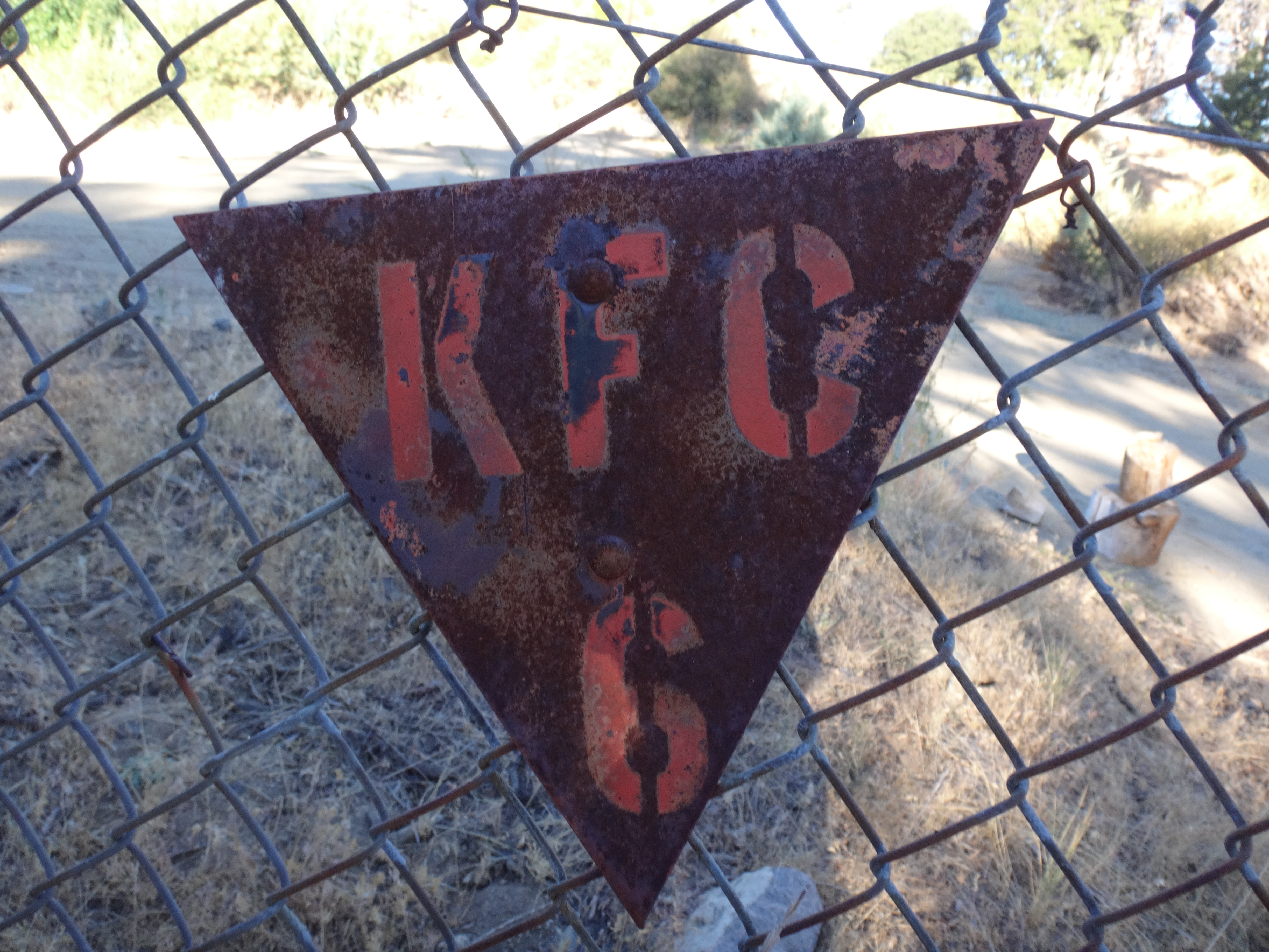
And then there was the one at Thorn BM.

Re: Triangular peak markers in the San Gabriels
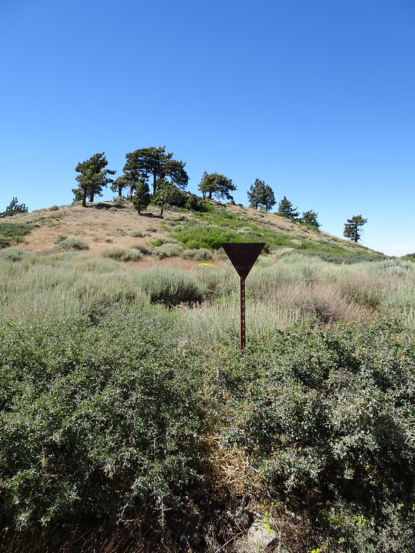
Posted: Sun Sep 11, 2016 7:27 am
by Uncle Rico
Here's the marker along Winston Ridge near Pt. 6850