Page 1 of 1
Eastern High Country from Afar
Posted: Sun Dec 15, 2013 7:57 pm
by Hikin_Jim
I was out in the Santa Ana Mountains yesterday and snapped this photo of the Eastern High Country of the San Gabriels:
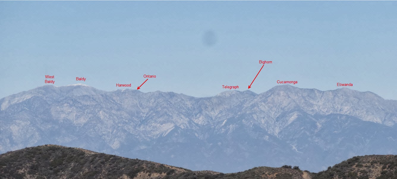
I always like seeing the peaks from afar and seeing if I can identify them.
HeyWhatsThat is an excellent resource for checking if you're right.
HJ
Re: Eastern High Country from Afar
Posted: Mon Dec 16, 2013 4:22 pm
by Augie
Cool.
Re: Eastern High Country from Afar
Posted: Mon Dec 23, 2013 4:25 pm
by tekewin
You must have been in the very northern part of the Santa Anas.
I also try to identify peaks I see on the horizon, then I try to figure out how I would attempt to climb them

It can be very distracting while driving.
Re: Eastern High Country from Afar
Posted: Mon Dec 23, 2013 5:27 pm
by Hikin_Jim
tekewin wrote: You must have been in the very northern part of the Santa Anas.
Maple Springs Road
It can be very distracting while driving.

I'm the same way.

HJ
Re: Eastern High Country from Afar
Posted: Mon Dec 23, 2013 6:25 pm
by tekewin
Hikin_Jim wrote: tekewin wrote: You must have been in the very northern part of the Santa Anas.
Maple Springs Road
HJ
Doh! I forgot you have high powered cameras. I have to stop thinking through my limited phone camera lens.
Funny that you also think about climbing routes of distant objects. I feel a little less weird now.
Re: Eastern High Country from Afar
Posted: Mon Dec 23, 2013 9:40 pm
by Hikin_Jim
At the very least I'm trying to put the pieces together. My mental map is my constant double check against nav errors. Gotta keep the big picture in mind.
HJ