Page 1 of 1
East Barton Flats to Grinnell Ridge Camp
Posted: Tue Apr 30, 2013 12:19 am
by Hikin_Jim
Some parts of the San Gorgonio Wilderness don't get no love.

The Lost Creek Trail has that reputation, but I think it's worth a look.
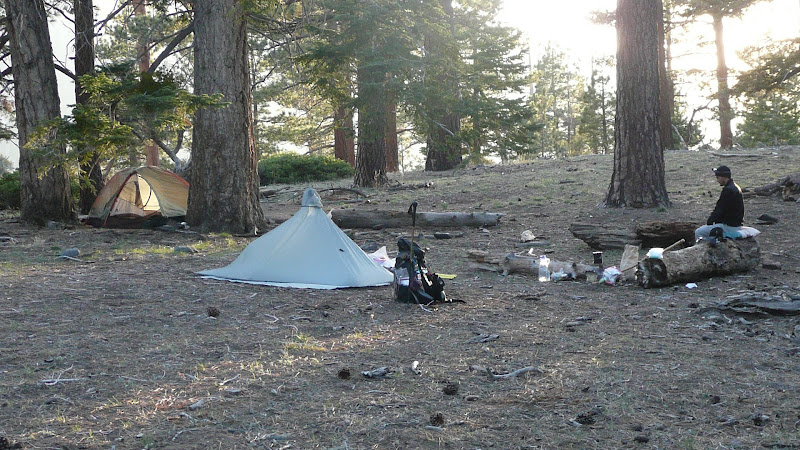
Grinnell Ridge Camp is a lovely spot to spend the night and you're likely to have it all to yourself.
I've worked out a new route that cuts off a couple of miles (round trip) over the standard routes. The new route starts in East Barton Flats.
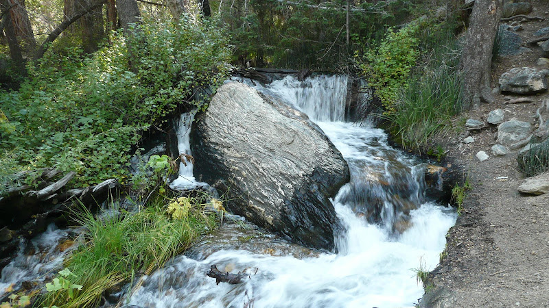
You do have to cross the S. Fork of the Santa Ana River, but this year, it's no challenge at all.
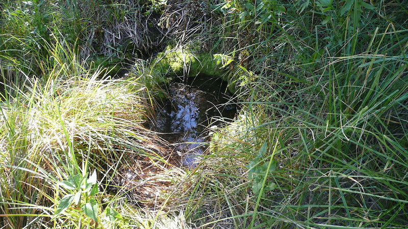
Oh, and did I mention there's a nearby spring, perhaps 1/4 mile from Grinnell Ridge Camp, a spring that nobody seems to know about?
If this sounds at all interesting, please see my trip report:
East Barton Flats to Grinnell Ridge Camp
HJ
Re: East Barton Flats to Grinnell Ridge Camp
Posted: Tue Apr 30, 2013 10:26 am
by HikeUp
Nice TR. Thumbs up!!!
Re: East Barton Flats to Grinnell Ridge Camp
Posted: Tue Apr 30, 2013 4:18 pm
by JeffH
Nice, I like the hidden spring.
Re: East Barton Flats to Grinnell Ridge Camp
Posted: Tue Apr 30, 2013 4:51 pm
by yobtaf
Any time you or Mitch post about San G area, I just want to get out there. Nice report on your blog there Jim
Hey Mitch where are you?
Re: East Barton Flats to Grinnell Ridge Camp
Posted: Tue Apr 30, 2013 8:55 pm
by Hikin_Jim
HikeUp wrote: Nice TR. Thumbs up!!!
Thanks, man
JeffH wrote: Nice, I like the hidden spring.
Yeah, I was pretty jazzed when I saw it on an old map and then was able to find it. Everyone thinks it's a dry camp, when in fact there's a spring only 1/4 mile away.
yobtaf wrote: Any time you or Mitch post about San G area, I just want to get out there. Nice report on your blog there Jim
Thanks. It really is a great area -- if for no other reason that there is a fair amount of water there. If you know where the springs are, you can do quite well. We'll see how it goes though since we're now in a multi-year drought.
HJ
Re: East Barton Flats to Grinnell Ridge Camp
Posted: Wed May 01, 2013 9:53 am
by mangus7175
Is that a Gatewood Cape Jim?
Amazing report as usual

Re: East Barton Flats to Grinnell Ridge Camp
Posted: Wed May 01, 2013 10:45 am
by Hikin_Jim
Hi, Angus,
Yep, that's a Gatewood Cape. Nice piece of gear, but gets a lot of condensation when it's cold. Never have found a single wall shelter yet that does well in cold in terms of condensation.
HJ
Re: East Barton Flats to Grinnell Ridge Camp
Posted: Wed May 01, 2013 10:50 am
by mangus7175
Hikin_Jim wrote: Hi, Angus,
Yep, that's a Gatewood Cape. Nice piece of gear, but gets a lot of condensation when it's cold. Never have found a single wall shelter yet that does well in cold in terms of condensation.
HJ
I always thought that the cape did well in that department since there are gaps on the bottom that you think would eliminate condensation. Still...I wouldn't mind trying one.
Re: East Barton Flats to Grinnell Ridge Camp
Posted: Wed May 01, 2013 11:34 am
by Hikin_Jim
Don't get me wrong. I generally like my Gatewood Cape. I'm certainly not thinking about getting rid of it or something, but it has condensation problems in cold weather. I've yet to find a system that doesn't have condensation problems in cold, although I haven't tried a fully open at the sides tarp type system.
HJ
Re: East Barton Flats to Grinnell Ridge Camp
Posted: Wed May 01, 2013 12:16 pm
by palmeredhackle
Very cool trip report. I was actually looking in this general vicinity for trips last year!
Re: East Barton Flats to Grinnell Ridge Camp
Posted: Wed May 01, 2013 1:10 pm
by Hikin_Jim
Lots of nice stuff over that way. If you're looking for a good overnight trip, go back to my blog post and look in the "Route Alternatives" section. I've got a two or two-and-a-half day route laid out that includes Grinnell Ridge Camp.
HJ
Re: East Barton Flats to Grinnell Ridge Camp
Posted: Wed May 01, 2013 10:41 pm
by palmeredhackle
Thanks will do! I need to pick up a Tom Harrison for San Gorgonio. I have a general recreational map for the area but the topo on it sucks, it's non waterproof, and it only lists car campgrounds, not trail camps!
How do you like your gatewood? I keep getting tempted to pick one up. Do you use a bivy or net tent or just on its own?
Re: East Barton Flats to Grinnell Ridge Camp
Posted: Thu May 02, 2013 5:46 am
by Hikin_Jim
palmeredhackle wrote: Thanks will do! I need to pick up a Tom Harrison for San Gorgonio. I have a general recreational map for the area but the topo on it sucks, it's non waterproof, and it only lists car campgrounds, not trail camps!
The 2006 Harrison map for the San Gorgonio area has a few errors, but is generally worthwhile. I can tell he hasn't spent much time in the area.
Big Tree Camp is mis-positioned.
The trails around Aspen Grove and points north are wrong.
The Lodgepole-Fish Creek Saddle Trail is incorrectly positioned.
Alger Creek Camp is mis-positioned.
Dry Lake Camp is mis-positioned.
The trail to Dobbs camp is grossly wrong as is the position of the camp.
Saxton trail camp is a bit off.
Mine Shaft Flats camp is off.
palmeredhackle wrote: How do you like your gatewood? I keep getting tempted to pick one up. Do you use a bivy or net tent or just on its own?
In Southern California, I frequently don't use a bivy or a bug tent, and it works fine. Overall, I like it very much.
If I were expecting rain, I'd carry my bivy.
I don't have a bug tent, but I'd like to get one for use in the Sierra. Need some $$'s first though.
HJ
Re: East Barton Flats to Grinnell Ridge Camp
Posted: Tue Jun 10, 2014 11:54 am
by Sewellymon
Did a variation of Jim's hike listed above and it's a perfect loop.
Park at the start/ top of the abandoned dirt road West of Lost Creek. Ez descent to Lost Creek, then about 30- 40 minutes x-c up to Lost Creek Trail, Grinnell Ridge Camp, Slushy/ S Fork Meadows trail and down to Poopout Hill. Key here is to take East Poopout Hill trail back to the web of dirt roads and eventually the car.
I am also told the abandoned dirt road to Lost Creek accesses a trail that descends Lost Creek and can continue to South Fork Campground for a non- XC alternative that also allows for a loop hike.