Page 1 of 1
Hikemageddon - Smith Ridge Fail
Posted: Mon Jul 18, 2011 8:12 am
by Elwood
I was looking for an interesting way to hike to Joe Elliot Campground, then Etiwanda Peak on Saturday. Two years ago, I did this via the Etiwanda Ridge. Topographic maps show where a trail once ran up Smith Ridge to Cucamonga Truck Trail (1N34) so I figured I'd give it a try.
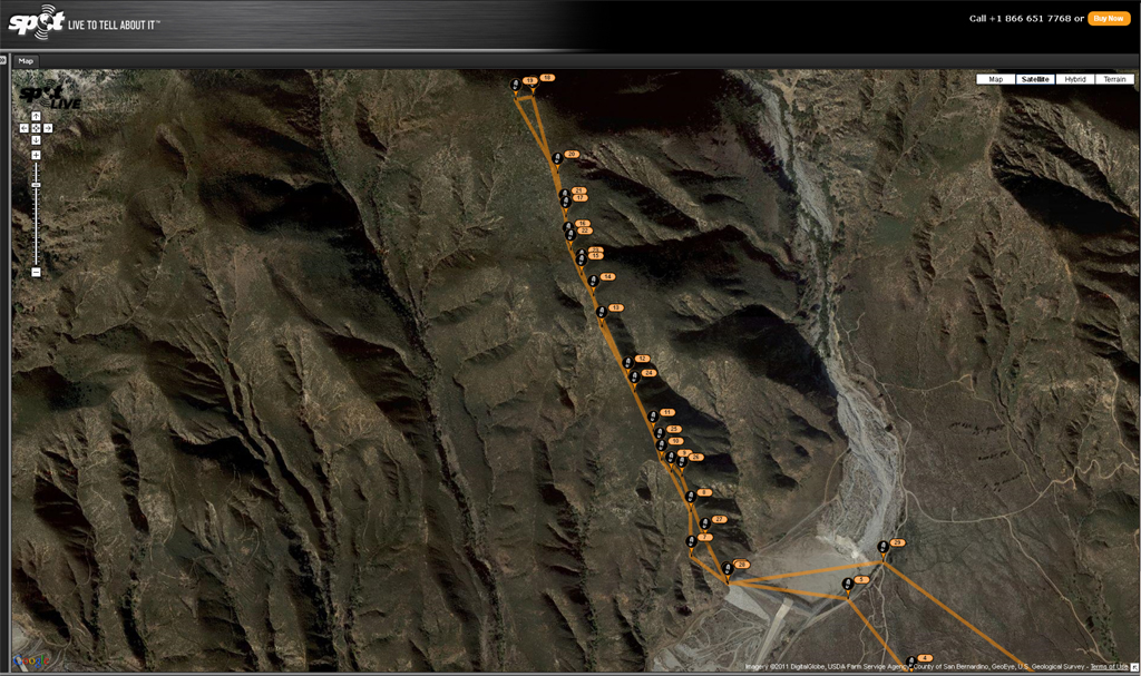
I parked in the lot adjacent to the entrance of the Etiwanda Nature Preserve, and was on the hoof at 0555. I followed the preserve hiking trail to the edge of the Day Canyon debris basin, crossed the basin and picked up a light use trail at the west edge of the dam. The ridge isn't excessively steep, but the trail is intermittent at best, traces an active game trail, then disappears entirely. Brush density varies from irrelevant, to shoulder-high Ceanothus, Arctostaphylos, and other interlocked delightful species. As an added bonus, much of the Buckthorn was wet with fragrant, sticky resin. I made it as far as the 4412 foot bump before admitting defeat and bashing back down. The delightful vegetation also managed to snag my GPS somewhere between just south of the steel ridge marker and the white PVC marker. If any of you brave souls feel like finding it, It's yours to keep. Regardless, a bad day hiking is still better than a good day working, so it's time to find another way up here; maybe via Day Canyon.
Original destination: Etiwanda Peak.
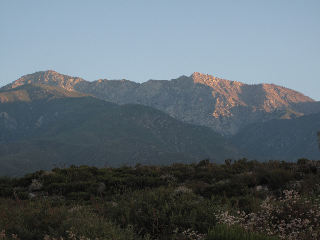
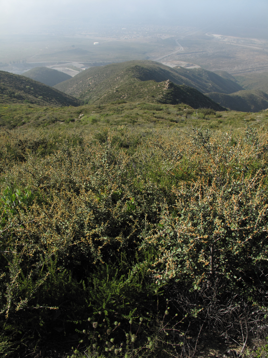
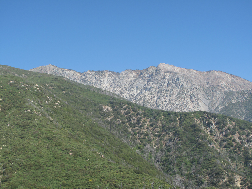
Looking across the Day Canyon debris basin at the lower portion of Smith Ridge.
Beehives and other stuff in the wash area west of Day Canyon.
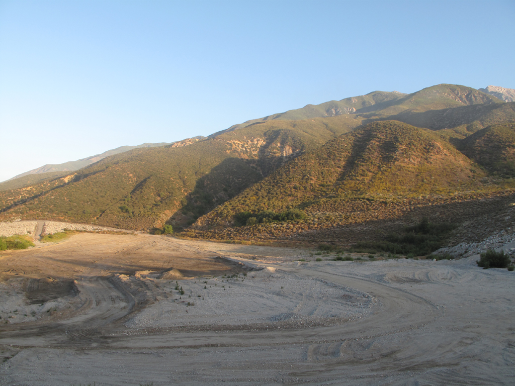
Lower, easier portion of the ridge.
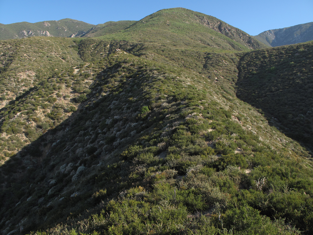
Looking down Smith Ridge, in some fairly heavy brush.
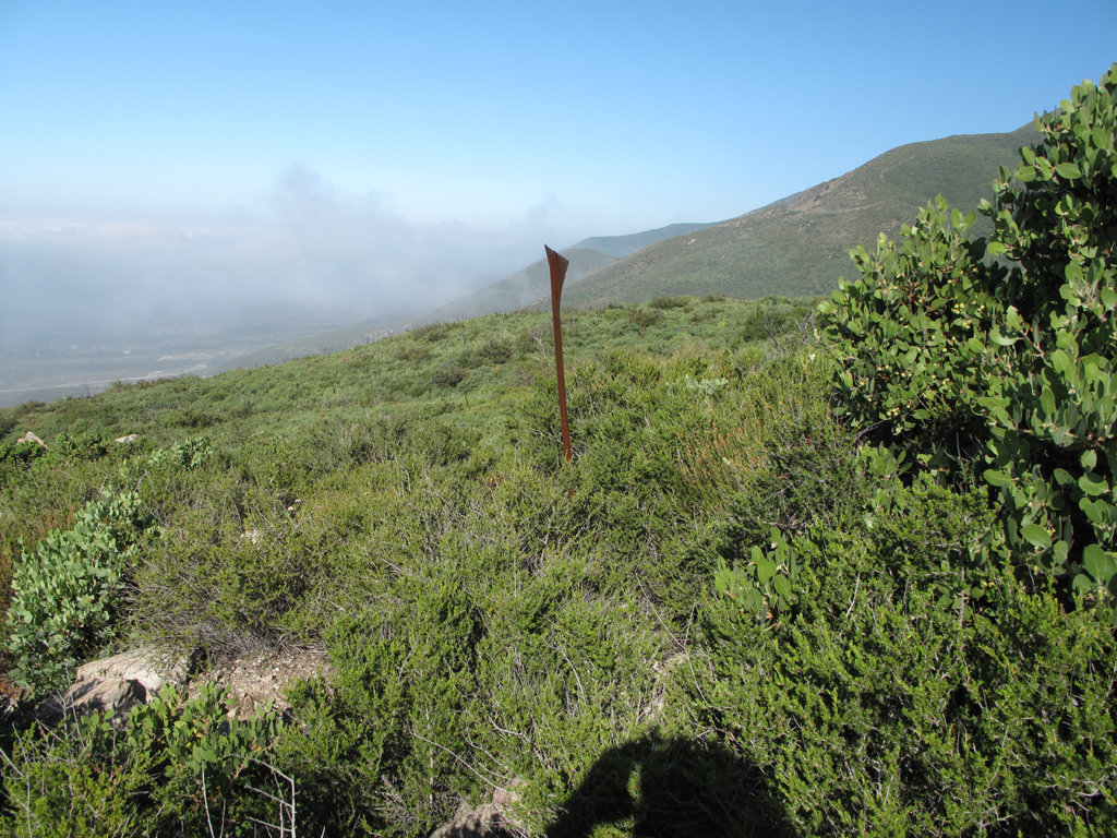
Marker on Smith Ridge. GPS is in the brush around here somewhere.
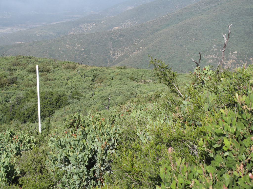
PVC marker of some sort. Fairly sparse Manzanita around here.
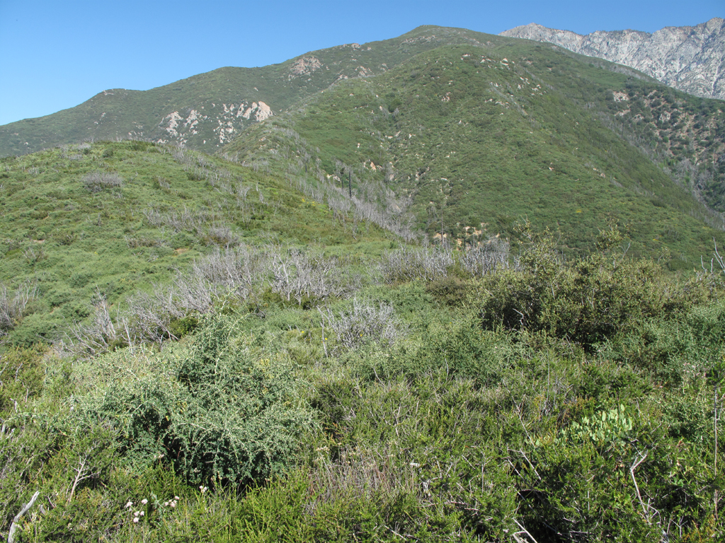
Retreat point. With more than 1000 feet to gain before reaching the brushy fire road it was time for me to turn back.
So close, but oh so far away.
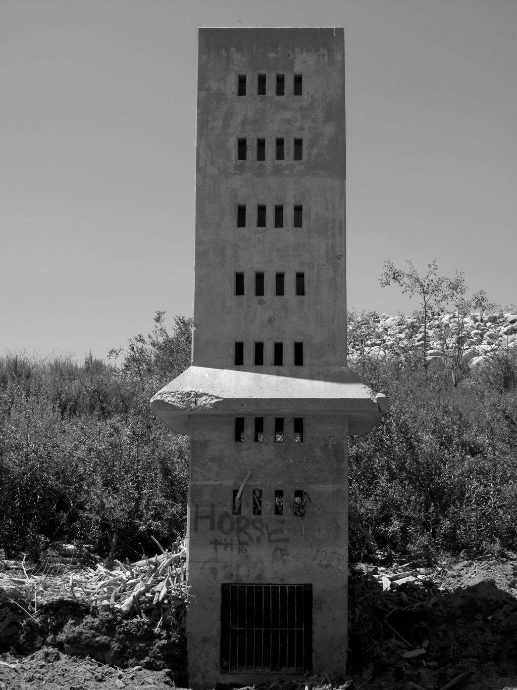
Debris screen / Intake structure for the Day Canyon dam.
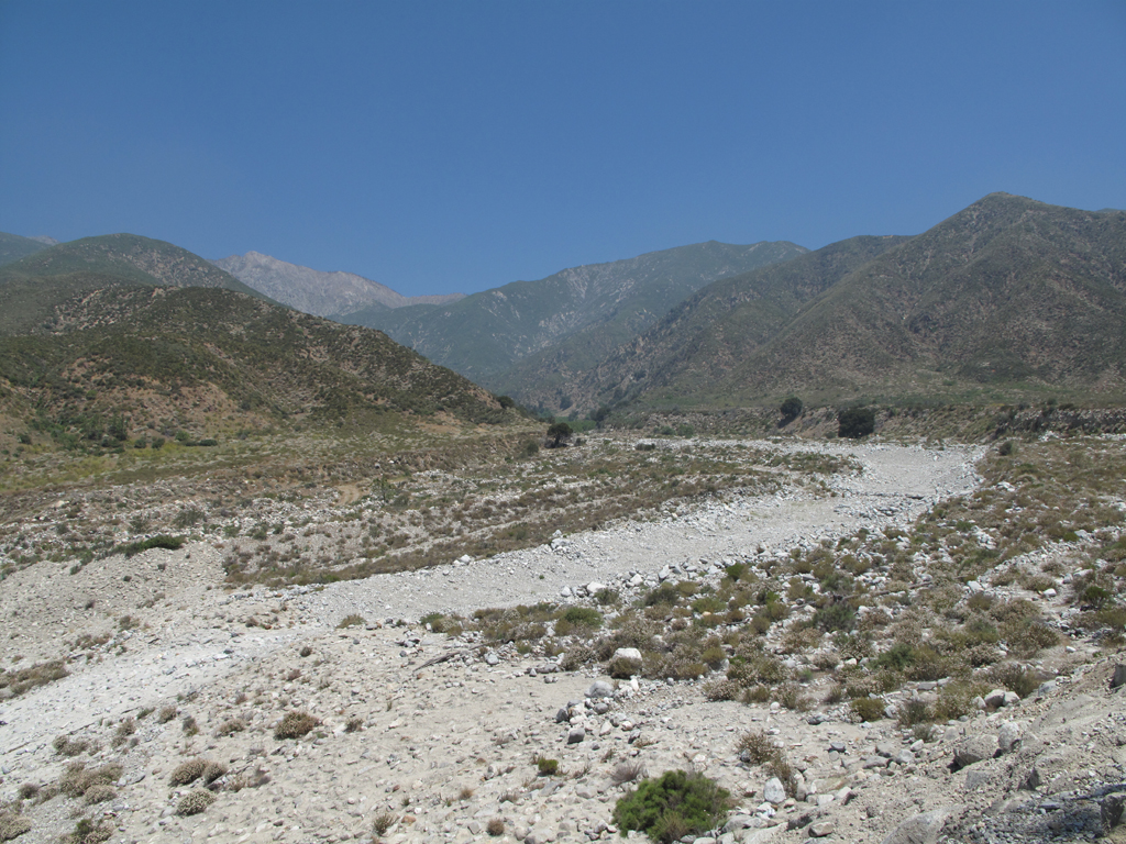
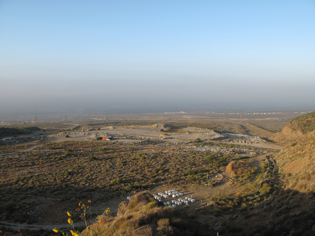
View from the bottom of Day Canyon.
Re: Hikemageddon - Smith Ridge Fail
Posted: Mon Jul 18, 2011 10:10 am
by cougarmagic
Better to have hiked and lost than never to have hiked at all!
That is some mean lookin brush.
Re: Hikemageddon - Smith Ridge Fail
Posted: Mon Jul 18, 2011 10:28 am
by HikeUp
I wonder if you could take a surfboard kind of thingy and just ride over the top of all that brush. Brush-boarding. Hmmm...
Nice attempt Elwood. Day Canyon looks interesting. Didn't someone write about coming down Deer Cyn from 1N34?
Re: Hikemageddon - Smith Ridge Fail
Posted: Mon Jul 18, 2011 10:42 am
by Elwood
I've been up and down Deer Canyon several times. Day and Deer were kind of my fallbacks if I'd hadn't wasted so much time on Smith Ridge.
Re: Hikemageddon - Smith Ridge Fail
Posted: Mon Jul 18, 2011 11:06 am
by TracieB
No hike is a bad hike or a fail....unless you don't ever make it back.
Nice pix as usual Elwood!
Re: Hikemageddon - Smith Ridge Fail
Posted: Mon Jul 18, 2011 12:42 pm
by lilbitmo
Great work Elwood, too bad we couldn't get 100 people with clippers to make our own trail up that ridge.

Re: Hikemageddon - Smith Ridge Fail
Posted: Mon Jul 18, 2011 1:55 pm
by Taco
I'm surprised to see Manzanita at such a low elevation.
Did that stretch of Smith Ridge get hit during the Grand Prix fire?
Cheers on an excellent day out, despite the outcome.

Re: Hikemageddon - Smith Ridge Fail
Posted: Mon Jul 18, 2011 3:37 pm
by Zach
would have been useful if the gps had a tracking function that uploaded online... coulda had the EXACT coordinates
Re: Hikemageddon - Smith Ridge Fail
Posted: Tue Jul 19, 2011 7:21 am
by Elwood
How about the next best thing?
Re: Hikemageddon - Smith Ridge Fail
Posted: Tue Jul 19, 2011 10:17 am
by AW~
Elwood wrote:
Marker on Smith Ridge. GPS is in the brush around here somewhere.
Whats that trail on the hill over yonder?...and yeah, I dont think your GPS will be taken anytime soon
What clothes material are you wearing to get through all that brush?
Re: Hikemageddon - Smith Ridge Fail
Posted: Tue Jul 19, 2011 11:39 am
by Elwood
There is a small web of trails indicated on USGS Topo maps that cross that ridge east of Bull Canyon, though the map doesn't have them making it up to 1N34.
I was wearing a previously intact (now torn) pair of Saharas and tee-shirt. There are still a few Ceanothus thorn-tips in my legs.
Re: Hikemageddon - Smith Ridge Fail
Posted: Tue Jul 19, 2011 7:34 pm
by Tom S
I also went up Smith Ridge earlier in the year, but turned back at 3400' when I found it unproductive. Same for Day Canyon. But the firebreak between Day Canyon and East Etiwanda Canyon is doable, and I went to 4100'. I'll do the rest of it next winter or spring.
http://www.sovinec.net/html/san_gabriel ... ted_p.html
Re: Hikemageddon - Smith Ridge Fail
Posted: Tue Jul 19, 2011 10:04 pm
by HikeUp
Hmmm...I'm surprised that Day Cyn. was "unproductive". You guys have gotten me interested in this area. I'm in.
Re: Hikemageddon - Smith Ridge Fail
Posted: Wed Jul 20, 2011 7:46 am
by Marty
I'm interested in this area as well, particularly the Joe Elliot Tree Campground. What would be the easiest way to hike there? I was thinking about going up Day Canyon but now I am not so sure.
Re: Hikemageddon - Smith Ridge Fail
Posted: Wed Jul 20, 2011 8:01 am
by norma r
Elwood wrote: ...
I was wearing a previously intact (now torn) pair of Saharas and tee-shirt. There are still a few Ceanothus thorn-tips in my legs.
i hate when that happens!

nice try, worth a repeat. especially to find that gps.
Re: Hikemageddon - Smith Ridge Fail
Posted: Wed Jul 20, 2011 11:52 am
by Elwood
Hey Marty!
I've hiked into Joe Elliot from Deer Canyon, via 1N34, from Lytle Creek via San Sevaine road, and via the Etiwanda Ridge, also a miserable brush-bash. The campground is also accessible through the Cucamonga Wilderness via the trail from Cucamonga and Etiwanda peaks. That trail is in rough shape in spots; be advised. I've always wanted to try approaching Joe Elliot up the guts of the South Fork, Lytle Creek. Last time I tried that approach, it was choked up pretty badly a little ways past the falls.
Re: Hikemageddon - Smith Ridge Fail
Posted: Wed Jul 20, 2011 8:47 pm
by Mike P
Elwood wrote: Hey Marty!
I've hiked into Joe Elliot from Deer Canyon, via 1N34, from Lytle Creek via San Sevaine road, and via the Etiwanda Ridge, also a miserable brush-bash. The campground is also accessible through the Cucamonga Wilderness via the trail from Cucamonga and Etiwanda peaks. That trail is in rough shape in spots; be advised. I've always wanted to try approaching Joe Elliot up the guts of the South Fork, Lytle Creek. Last time I tried that approach, it was choked up pretty badly a little ways past the falls.
Elwood, how passable is the road, 1N34?
Re: Hikemageddon - Smith Ridge Fail
Posted: Wed Jul 20, 2011 9:30 pm
by Elwood
I haven't been on 1N34 since before our wet, wet winter. Last year it was mostly passable from Deer Canyon to Joe Elliot (AKA Big Tree) though with some difficulty. The brush has really taken over in spots, and there are several washouts that require a little climbing to get across. West of Deer Canyon is anyone's guess. What I've been able to see doesn't look so good. East of Elliot is probably fine. There is an electronic site near San Sevain(e) Flat that has to be accessible from Lytle Creek Road for maintenance. I still haven't figured out when the Forest Service opens San Sevain(e) road to public access any more.
Re: Hikemageddon - Smith Ridge Fail
Posted: Thu Jul 21, 2011 8:06 pm
by Tom S
San Sevaine is definitely the easiest way to Elliot - 12 miles one way but easy dirt road walking. I was on 1N34 (Cucamonga Truck Trail) in spring 2010 as far as Deer Canyon. There is a large washout at aptly named Calamity Canyon that requires off trail travel. Otherwise no major obstacles, but the road is slowly growing over and has sporadic talus on it, so walking speed is slower than San Sevaine. I will try to follow it to Day Canyon late next winter or early spring when the water is high. My main interest in the area is visiting the high multi drop waterfalls at the head of Day Canyon.
I'd like to try Deer Canyon sometime (cooler months of course), but I did not find a suitable access point across the private lands at the bottom this past spring. Top of Haven is posted no trespassing.
Re: Hikemageddon - Smith Ridge Fail
Posted: Thu Aug 25, 2011 10:34 am
by T McPherson
Hi, I've been lurking around your fine forum for some time when I found this thread concerning my neck of the woods.
The gate at the junction of 1N34 and Lytle Creek Road typically opens Sept.1st for hunting and recreation, however, it its subject to closure when snow, rain or other conditions warrant the Forest Service to close the gate. Generally it stays open shortly into the following year, or until snow hits San Sevaine Ridge. I always look forward to Labor Day for this gate to open and generally Jeep or truck this trail for the never ending views and for exploring.
More :
Has anyone here investigated the apparent switchback trail going up the southwest face of the ridge just east across Etiwanda Creek near of the base of Etiwanda Ridge. The broad Z shaped trail is clearly visible from the 210 fwy and even more so from the Etiwanda Preserve. It was not visible before the Grand Prix fire in late 2003. It appears to start closely above the split in the Preserve trail and the Falls trail then crossing the creek towards the east side of Etiwanda Creek and up towards San Sevaine Ridge. It looks like the ridge terminates close to San Sevaine Flats area.
I hope this post helps. Thanks for all of the information and kindness given by the members here.
Re: Hikemageddon - Smith Ridge Fail
Posted: Thu Aug 25, 2011 9:09 pm
by Ze Hiker
T McPherson wrote: Hi, I've been lurking around your fine forum for some time when I found this thread concerning my neck of the woods.
The gate at the junction of 1N34 and Lytle Creek Road typically opens Sept.1st for hunting and recreation, however, it its subject to closure when snow, rain or other conditions warrant the Forest Service to close the gate. Generally it stays open shortly into the following year, or until snow hits San Sevaine Ridge. I always look forward to Labor Day for this gate to open and generally Jeep or truck this trail for the never ending views and for exploring.
More :
Has anyone here investigated the apparent switchback trail going up the southwest face of the ridge just east across Etiwanda Creek near of the base of Etiwanda Ridge. The broad Z shaped trail is clearly visible from the 210 fwy and even more so from the Etiwanda Preserve. It was not visible before the Grand Prix fire in late 2003. It appears to start closely above the split in the Preserve trail and the Falls trail then crossing the creek towards the east side of Etiwanda Creek and up towards San Sevaine Ridge. It looks like the ridge terminates close to San Sevaine Flats area.
I hope this post helps. Thanks for all of the information and kindness given by the members here.
I'm not sure if you are talking about the ridge east of Etiwanda ridge, but I hiked that once.
http://socalhikes.com/2009/09/buck-point-loop/
We went up Etiwanda ridge, and I kept seeing what seemed like obvious switchbacks up the SW face of the ridge to the east. So on the return from Buck Point, I decided to head down this way. Turns out to be an old, brushed over, road bed. Probably worse than Etiwanda Ridge.
Re: Hikemageddon - Smith Ridge Fail
Posted: Thu Aug 25, 2011 10:11 pm
by T McPherson
Thanks for the reply. That is the exact ridge I was inquiring about. On the map you posted, there is an image link (along the same ridge) to a view up the ridge revealing the switchbacks I described. Thanks for the great link accounting the details of the trail you took.
If things go in my favor, the road to Joe Elliot Tree Memorial will be open September 1st. If so I should be able to do some poking around the area where the ridge meets 1N34.
Thanks again!