San Gorgonio winter overnight - 12-13 Feb 2011 - LONG report
Posted: Tue Feb 15, 2011 8:17 am
Most of this text is transcribed right off my Flickr account.
Preparing for a winter ascent of Mt Whitney this year, Ingrid and I decided to take a crack at 11,500 foot Mt San Gorgonio in a winter overnight.
My first winter backpacking trip since I was a Boy Scout was a hike up the South Fork Trail to about 300 feet above Dry Lake. Cold feet drove me into our tent once the sun set behind 11,205 foot Jepson Peak, but otherwise it was a warm and pleasant night on the snow.
Pics:
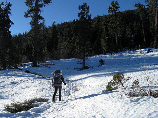
Above Horse Meadow
Mt San Gorgonio
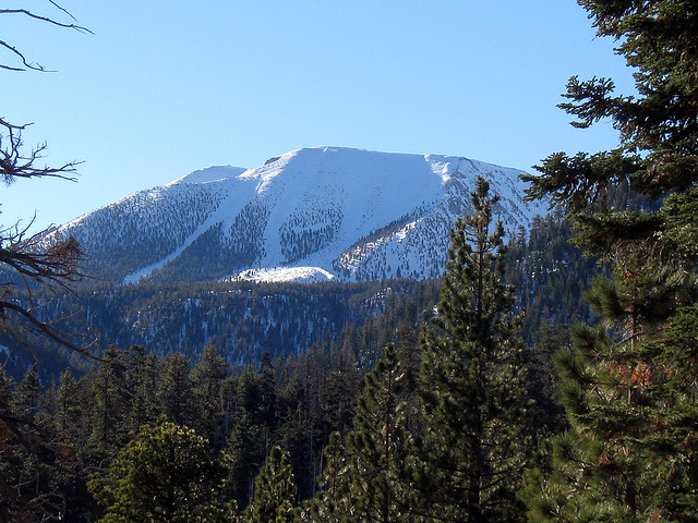
11,500 foot Mt San Gorgonio from Poopout Hill. Our camp that night was at the lower end of that big long couloir to the left, only about 2,120 feet from the summit.
Starting up the draw below Dry Lake
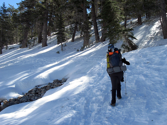
One of the advantages - or disadvantages - of climbing in winter is the emergence of "winter trace trails," bootracks through the snow that usually offer a more direct route than the maintained trails. From South Fork Meadows, you go left to follow the draw that empties Dry Lake (heading straight up from the meadows takes you over Christmas Tree Hill, normally inaccessible during the rest of the year). This route is much steeper than the summer trail, which switchbacks leisurely up the left side of the draw. It was a real workout getting up to Dry Lake.
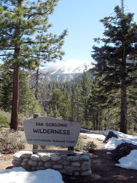
Dry Lake at last!
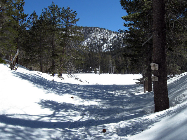
Boy were we glad to finally see these signs.
Dry Lake
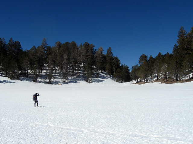
Looking north back from where we emerged from the draw below the lake.
Though I have seen Dry Lake full of water, it is normally a spongy marsh or even dry, so we weren't worried about breaking through an icy crust into cold water. In any case, I don't think it is ever more than a few feet deep, even during those rare years when it is full of water.
Commercial developers who battled to turn San Gorgonio into a ski resort during the 1950s and 1960s had planned to make a parking lot of Dry Lake.
Jepson Peak from Dry Lake
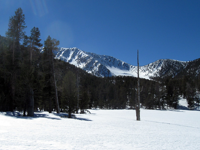
11,205 foot Jepson Peak on the left and 10,680 Little Charlton Peak on the right. Dry Lake is roughly 9,100 feet high.
We had intended to spend the night at Dry Lake, but because we got there a little after noon, with lots of time to spare, Ingrid urged us higher. So after a lunch break we hoisted the stones again and trudged back across the lakebed to rejoin the trail to the top.
As with the trail below Dry Lake, the winter trace trail through the ancient moraines above Dry Lake was steeper and more direct than the summer trail. It took us an hour to climb about half a mile and 300 feet of elevation gain, when, fairly exhausted, we decided to set up camp well before Trail Flat.
That's another difference with winter backpacking: while in the summer it is a legal requirement to camp only in designated sites in the Wilderness Area, in the winter you can stop and camp pretty much wherever you like. I don't know if that is strictly according to the rules, but you aren't going to leave any permanent trace behind you, and in any case there's no one from the Forest Service patrolling in the winter.
Melting snow

As were were panting up the draw between moraines, we looked around for a relatively level area in the trees (I don't think there was much risk of avalanche this weekend, but I wasn't taking any chances). We trudged up through the snow and dropped our packs at about 9,380 feet on the northern flank of Mt San Gorgonio.
The first thing I did after the tent was set up was dig a pit in the snow so we could sit upright, a real luxury when primitive camping. Then I got started melting snow. The purple bandanna was used to filter dirt and organic matter from the snowmelt (it worked very well!).
I had no appetite at all at the end of the day. Ingrid forced a couple mouthfuls of chicken and potatoes into me, but I wasn't interested. Also, my feet got cold as soon as the sun slipped behind Jepson Peak, so we retired into the tent by about 5:00pm. It was a long night.
Other than my cold feet and lack of appetite, I felt fine, just great.
Winter camp at 9,380 feet
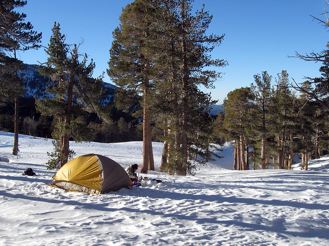
This really was a superb location for a campsite. For much of the night we heard the wind roaring down beyond the moraine in the distance, but all we experienced was a slight breeze and few mild gusts. We left the tent fly door open. The views to the west and south were magnificent, especially after the sun went down. We were warm and comfortable all night.
Beyond the trees at center right, just on the other side of the moraine, a party of three set up camp, the only other people we saw all day once we left the parking lot..
We are so blessed, living in Southern California. Life is good.
The next morning

Our camp well before sunup on Sunday. The water I left in the pan on the stove was frozen solid, but the water in the Nalgene bottles we kept in the tent wasn't frozen, nor was Ingrid's pack bladder that was left in the tent vestibule.
You can see the trekking pole used as an anchor for the rear of the tent fly.
Continuing up the couloir

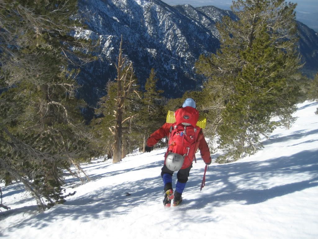
After breakfast, having decided not to attempt the summit, we packed a small pack and headed up the couloir a bit to see what we could see. We didn't bring crampons and Ingrid only had a pole, no ice axe. After a short climb the way became steep and slick and I dropped to the snow to demonstrate how fast I could slide down in the event of a fall (arresting easily with my ice axe). So we thought it would be best to turn back.
A little later, the three campers from the other side of the moraine started up this draw, and after that a pair of skiers, one of whom we knew from the OCHC, came up. Those were just about the only people we saw all day until we got to Horse Meadow on the way down.
Our camp is down there in the trees somewhere.
Poopout Hill
We decided a summit climb would add too much time to our descent, and so after a brief reconnoiter above our camp, we packed up and headed down. It took us five hours to maneuver our heavy packs over melting snow back to the parking lot.
The rest of the pics.
Preparing for a winter ascent of Mt Whitney this year, Ingrid and I decided to take a crack at 11,500 foot Mt San Gorgonio in a winter overnight.
My first winter backpacking trip since I was a Boy Scout was a hike up the South Fork Trail to about 300 feet above Dry Lake. Cold feet drove me into our tent once the sun set behind 11,205 foot Jepson Peak, but otherwise it was a warm and pleasant night on the snow.
Pics:
Above Horse Meadow

Mt San Gorgonio

11,500 foot Mt San Gorgonio from Poopout Hill. Our camp that night was at the lower end of that big long couloir to the left, only about 2,120 feet from the summit.
Starting up the draw below Dry Lake

One of the advantages - or disadvantages - of climbing in winter is the emergence of "winter trace trails," bootracks through the snow that usually offer a more direct route than the maintained trails. From South Fork Meadows, you go left to follow the draw that empties Dry Lake (heading straight up from the meadows takes you over Christmas Tree Hill, normally inaccessible during the rest of the year). This route is much steeper than the summer trail, which switchbacks leisurely up the left side of the draw. It was a real workout getting up to Dry Lake.
Dry Lake at last!

Boy were we glad to finally see these signs.
Dry Lake

Looking north back from where we emerged from the draw below the lake.
Though I have seen Dry Lake full of water, it is normally a spongy marsh or even dry, so we weren't worried about breaking through an icy crust into cold water. In any case, I don't think it is ever more than a few feet deep, even during those rare years when it is full of water.
Commercial developers who battled to turn San Gorgonio into a ski resort during the 1950s and 1960s had planned to make a parking lot of Dry Lake.
Jepson Peak from Dry Lake

11,205 foot Jepson Peak on the left and 10,680 Little Charlton Peak on the right. Dry Lake is roughly 9,100 feet high.
We had intended to spend the night at Dry Lake, but because we got there a little after noon, with lots of time to spare, Ingrid urged us higher. So after a lunch break we hoisted the stones again and trudged back across the lakebed to rejoin the trail to the top.
As with the trail below Dry Lake, the winter trace trail through the ancient moraines above Dry Lake was steeper and more direct than the summer trail. It took us an hour to climb about half a mile and 300 feet of elevation gain, when, fairly exhausted, we decided to set up camp well before Trail Flat.
That's another difference with winter backpacking: while in the summer it is a legal requirement to camp only in designated sites in the Wilderness Area, in the winter you can stop and camp pretty much wherever you like. I don't know if that is strictly according to the rules, but you aren't going to leave any permanent trace behind you, and in any case there's no one from the Forest Service patrolling in the winter.
Melting snow

As were were panting up the draw between moraines, we looked around for a relatively level area in the trees (I don't think there was much risk of avalanche this weekend, but I wasn't taking any chances). We trudged up through the snow and dropped our packs at about 9,380 feet on the northern flank of Mt San Gorgonio.
The first thing I did after the tent was set up was dig a pit in the snow so we could sit upright, a real luxury when primitive camping. Then I got started melting snow. The purple bandanna was used to filter dirt and organic matter from the snowmelt (it worked very well!).
I had no appetite at all at the end of the day. Ingrid forced a couple mouthfuls of chicken and potatoes into me, but I wasn't interested. Also, my feet got cold as soon as the sun slipped behind Jepson Peak, so we retired into the tent by about 5:00pm. It was a long night.
Other than my cold feet and lack of appetite, I felt fine, just great.
Winter camp at 9,380 feet

This really was a superb location for a campsite. For much of the night we heard the wind roaring down beyond the moraine in the distance, but all we experienced was a slight breeze and few mild gusts. We left the tent fly door open. The views to the west and south were magnificent, especially after the sun went down. We were warm and comfortable all night.
Beyond the trees at center right, just on the other side of the moraine, a party of three set up camp, the only other people we saw all day once we left the parking lot..
We are so blessed, living in Southern California. Life is good.
The next morning

Our camp well before sunup on Sunday. The water I left in the pan on the stove was frozen solid, but the water in the Nalgene bottles we kept in the tent wasn't frozen, nor was Ingrid's pack bladder that was left in the tent vestibule.
You can see the trekking pole used as an anchor for the rear of the tent fly.
Continuing up the couloir

After breakfast, having decided not to attempt the summit, we packed a small pack and headed up the couloir a bit to see what we could see. We didn't bring crampons and Ingrid only had a pole, no ice axe. After a short climb the way became steep and slick and I dropped to the snow to demonstrate how fast I could slide down in the event of a fall (arresting easily with my ice axe). So we thought it would be best to turn back.
A little later, the three campers from the other side of the moraine started up this draw, and after that a pair of skiers, one of whom we knew from the OCHC, came up. Those were just about the only people we saw all day until we got to Horse Meadow on the way down.
Our camp is down there in the trees somewhere.
Poopout Hill

We decided a summit climb would add too much time to our descent, and so after a brief reconnoiter above our camp, we packed up and headed down. It took us five hours to maneuver our heavy packs over melting snow back to the parking lot.
The rest of the pics.
