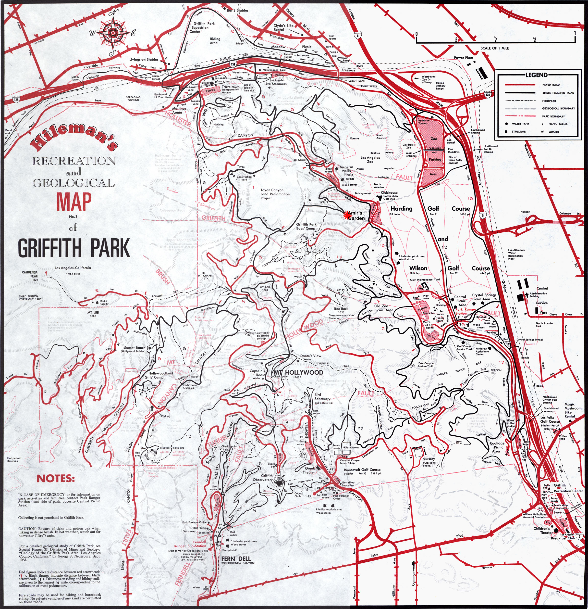
Griffith Park Map - does one exist?
Posted: Wed Dec 29, 2010 6:38 pm
The City of L.A. doesn't seem to publish one (you'd think they would, since its a city park and fairly large?). Something like a Tom Harrison map showing all the fire roads would work great. After doing a short hike on Tuesday from Los Feliz/Ferndell to Mt. Hollywood (major 'wimp' hike with my wimpy bro'), thought it might be interesting to explore the place a little further. Anyone aware of where to get one?