Page 1 of 1
20101205 Baden Powell
Posted: Sun Dec 05, 2010 6:26 pm
by Taco
Norma and i went to BP to go up the NE face, which I deemed to be out of condition upon seeing it from the highway. It's a nice varied face with some cool options, and some ice/mixed early in the season.
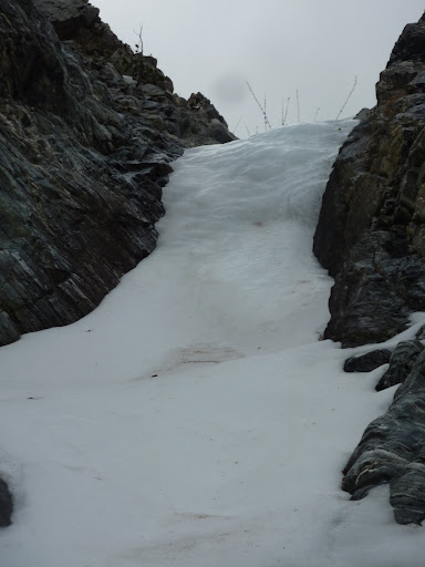
Ended up going to the main couloir system that comes off the north/northwest side of BP, ending near the new bridge on ACH. Not a lot of snow down low. Encountered a few sections of water ice up to WI2. Norma did a great job dispatching it.

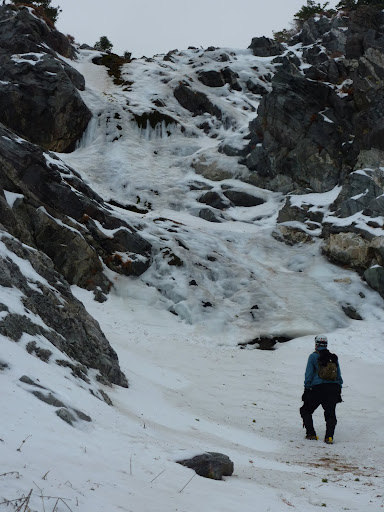
We passed a +/- 60ft waterfall but went around it. I'll be back to climb it if I find it in condition again.
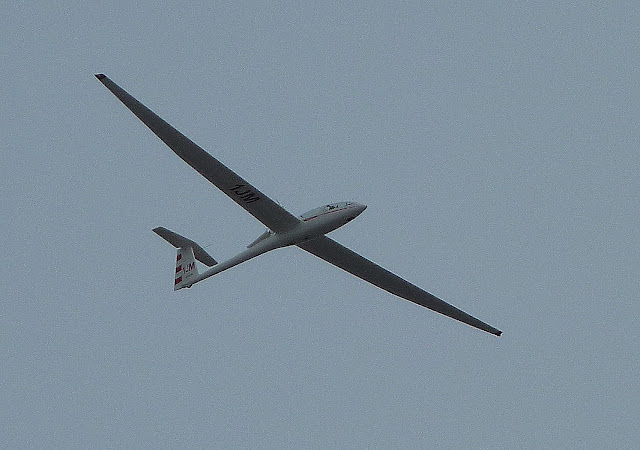
Continued up, mae a left make a right, up the various gullies until reaching the summit ridge just west of the top. A motor-assisted glider flew over slowly while we made our way to the top. We descended via the slopes and switchbacks, doing a lot of glissading. I took a lot of rocks in the ass. My cries helped Norma tell where the offending rocks and logs were.
Pics be here:
http://www.flickr.com/photos/tacodelrio ... 412639751/
I don't know how to use Flickr yet. Dunno how to post individual pics.
All in all, a really good first day of the season for me. No injuries!
Re: 20101205 Baden Powell
Posted: Sun Dec 05, 2010 6:48 pm
by lilbitmo
Nice work Norma and Taco - hopefully we are getting more snow/ice as I write this - let it snow, let it snow, let it snow

Pictures are great as well.
Re: 20101205 Baden Powell
Posted: Sun Dec 05, 2010 8:37 pm
by obie
Nice climb.
How would you rate that route?
How much gain and, how long (time/distance) to summit?
Re: 20101205 Baden Powell
Posted: Sun Dec 05, 2010 9:37 pm
by HikeUp
Cool beans. Was the ACH closed at Vincent Gap?
Re: 20101205 Baden Powell
Posted: Mon Dec 06, 2010 12:32 am
by He219
Nice recce you two! Well done :]
Re: 20101205 Baden Powell
Posted: Mon Dec 06, 2010 6:37 am
by simonov
Taco wrote: I don't know how to use Flickr yet. Dunno how to post individual pics.
They make it easy.
In the upper left corner of your photo is a button that says "Share This." Clicking that gives you a menu, one item of which is "Grab the HTML/BBCode." When you click that it gives you a text box filled with the code needed to embed photos in web pages. The default is HTML (which this forum will support), but in general for forum posts you should select the BBCode radio button. It also allows you to pic a size. For this forum, 640x480 works pretty well without scrolling off the screen to the right.
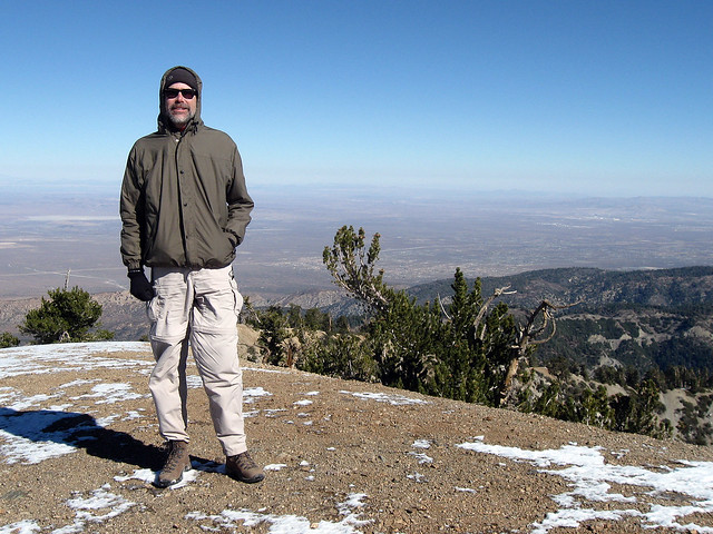 Simonov at the top
 by
simonov, on Flickr
The code you copy and paste into your post includes the link back to your photo's Flickr Page, which is required by Flickr's Terms of Service when you are hotlinking to your photos. That's why I always linked back to Flickr when I hotlinked a photo here. The second line in my example above is optional and can be deleted.
Re: 20101205 Baden Powell
Posted: Mon Dec 06, 2010 6:49 am
by norma r
It's early in the season and the snow coverage is decent, at best , so when in doubt head North! Had I not stared at the alpen-glowing peaks last Sunday morning as I was heading from Riverside to Baldy I might have stayed on the 210 freeway. But I found I was unknowingly heading north on I-15. As I realized my mistake I looked around and spotted the north side of Baden-Powell bathed in white. I knew Baldy would be fun that day but I also knew that I had to get to BP soon and check out the snow.
Taco was jonesin' for a winter adventure and thought BP sounded like a great idea. I have to admit when I looked up at the couloir he proposed I thought, “dear God what have I gotten myself into?”

But ever the good sport, I smiled like it was going be just another fun day in the mountains. And as it turned out I did enjoy a very fun day of mixed alpine for sure. Lot's of rock, a decent amount of snow and ice.
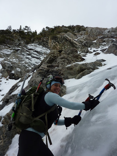
Thank you Taco for the excellent instruction on how to climb ice! That little ice number we first climbed had me so pumped up with adrenaline that I could have lifted a Ford F-150 off the ground! But thankfully i got my arse up the ice and afforded me my first ever ice climb. The 2nd little ice section was a piece of cake next to the first since it was far less steep and the exposure minimal. The rest of the day was a great mixture of soft snow, semi-exposed rock, short glissades and fun route-finding. Having the glider fly so close overhead as we summited was way cool. He circled and I knew the pilot was smiling at us as I madly waved my arm. I've had 3 great early season climbs in the San Gab's and I can't wait for the “Real Season” to begin!
Ice
Ice instruction
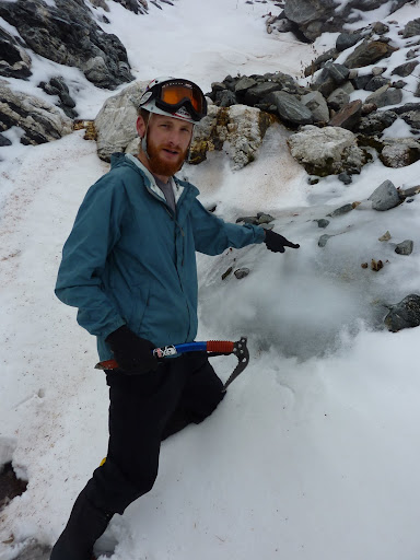
Taco through Ice
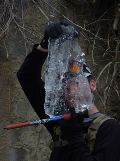
Me having fun on Ice
Ice for another day
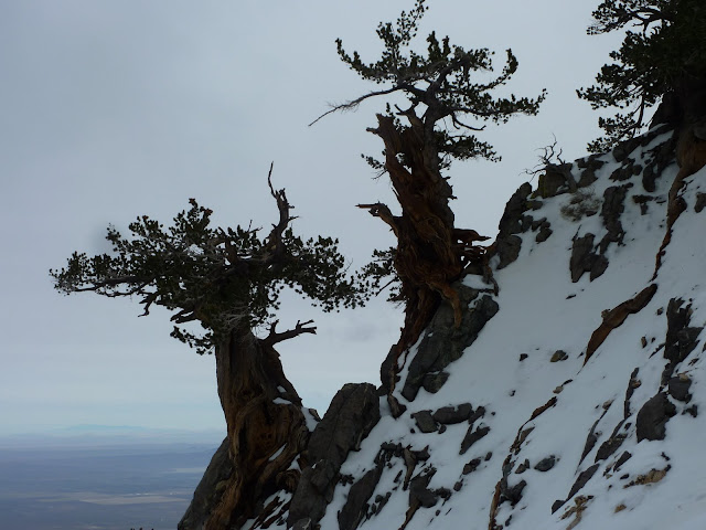
Limber Pines hanging on an edge
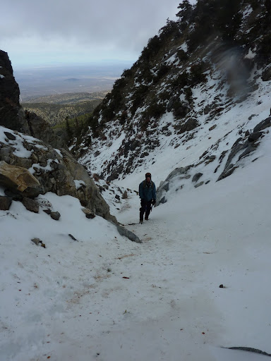
Working our way up
The glider that greeted us at the summit
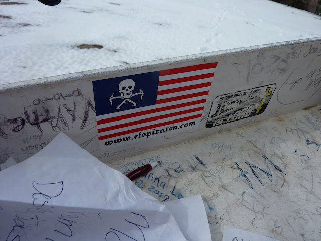
Eispiraten, have this way come
Rest of my pix are here:
http://picasaweb.google.com/ryan.norma8 ... lNECouloir#
Re: 20101205 Baden Powell
Posted: Mon Dec 06, 2010 11:57 am
by mve
Great trip and pictures Norma and Ryan! What a blast.
Re: 20101205 Baden Powell
Posted: Mon Dec 06, 2010 12:02 pm
by Dave G
Looks like a fun outing, guys! That li'l bulge looks quite slippery; I'm thinking my microspikes wouldn't have cut it.
Does this mean Norma is now the official SGMDF Ice Queen?

Re: 20101205 Baden Powell
Posted: Mon Dec 06, 2010 12:08 pm
by 406
NICE!
How much snow on the upper part of the mt near the summer trail? Was it firm or powder? Could you see how the NE gully looked? Any ski tracks?
Re: 20101205 Baden Powell
Posted: Mon Dec 06, 2010 12:59 pm
by norma r
no ski tracks at all. i looked around for them but too much exposed rock and shrubs to make it fun, yet. the snow on the north side was not firm, still pretty soft. the ridge trail from the V Gap TH switchbacks to the summit was pretty bare. Sun and wind have depleted snow on the true ridge. a good dump will change all that! our glissades were carefully executed since we had to watch-out for the "just under the surface" obstacles and we found every one. ouch!

Re: 20101205 Baden Powell
Posted: Mon Dec 06, 2010 2:05 pm
by MattCav
awesome posts taco and norma! i feel inspired.
Re: 20101205 Baden Powell
Posted: Mon Dec 06, 2010 9:38 pm
by Taco
obie wrote: Nice climb.
How would you rate that route?
How much gain and, how long (time/distance) to summit?
2600ft gain, 1.15 miles from ACH to summit according to Google Earth's built-in elevation profile feature.
40-50 degree slopes, ice to WI4 likely (that big waterfall).
Route name & grade would read like this:
North Baldy Route II WI2+, 780m
(Explanation of grades here:
http://www.summitpost.org/handy-alpine- ... cts/173430)
Thanks Simonov!
Re: 20101205 Baden Powell
Posted: Tue Dec 07, 2010 8:29 am
by obie
Taco wrote: obie wrote: Nice climb.
How would you rate that route?
How much gain and, how long (time/distance) to summit?
2600ft gain, 1.15 miles from ACH to summit according to Google Earth's built-in elevation profile feature.
40-50 degree slopes, ice to WI4 likely (that big waterfall).
Route name & grade would read like this:
North Baldy Route II WI2+, 780m
(Explanation of grades here:
http://www.summitpost.org/handy-alpine- ... cts/173430)
Thanks Simonov!
thanks. good stuff.
Re: 20101205 Baden Powell
Posted: Tue Dec 07, 2010 9:01 am
by Johnny Bronson
The waterfall looks good!
Re: 20101205 Baden Powell
Posted: Tue Dec 07, 2010 2:33 pm
by Taco
Re: 20101205 Baden Powell
Posted: Wed Dec 08, 2010 6:21 am
by norma r
well done. cool, i've been published, in a way.
Re: 20101205 Baden Powell
Posted: Wed Dec 08, 2010 1:01 pm
by Taco
Mind if I use any of your pics on the page? Credits will go to you, of course.