Page 1 of 1
Olancha Peak 6-6-10
Posted: Tue Jun 08, 2010 5:15 pm
by Dave G
Olancha Peak (12,123') is the highest point in the Southern Sierra and lies at the southern boundary of the Golden Trout Wilderness. Norma and I started at the Sage Flat Trailhead, from where cattle are driven every year up to the High Sierra meadows. We started up the Horse/Hiker trail, which switchbacks above the Cow Driveway, eventually reaching Olancha Pass and Summit Meadow. From that point we headed north along the PCT to the western flank of Olancha, where we left the trail and scrambled ~1500' over mostly class 2 boulders to the summit. Once on top, we were treated to views of Mts Whitney and Langley to the north, Owens Peak to the south, and Telescope Peak in the east. Approximately 22 miles rt and 6300' of climbing for the day.
Decisions, decisions...

Norma on Olancha

More pix:
http://www.flickr.com/photos/21042415@N ... 106864301/
Re: Olancha Peak 6-6-10
Posted: Tue Jun 08, 2010 5:41 pm
by Taco
Lotsa mosquitos?
Re: Olancha Peak 6-6-10
Posted: Tue Jun 08, 2010 5:52 pm
by Dave G
Skeeters? Oh yeah

Even to the point of protective headgear deployment:

Re: Olancha Peak 6-6-10
Posted: Tue Jun 08, 2010 7:09 pm
by Taco
I'm going to have to start bringing mine along. The bugs here are bad, as well. Lots of mosquito bites all over my legs.
Still haven't climbed Olancha. How's that big gully going up from the water company?
Re: Olancha Peak 6-6-10
Posted: Tue Jun 08, 2010 8:18 pm
by lilbitmo
Dave and Norma, can you explain to me what cool (temp wise) hiking is all about


hindsight tells me I might have had more fun in those temps.
Nice work, great shots - looks like you "Moo'd" along quite nicely.
Dave can you send me a PM on the details of this hike? How long it took to drive up etc... I might go do this soon.
Re: Olancha Peak 6-6-10
Posted: Tue Jun 08, 2010 10:03 pm
by HikeUp
Is it a secret?
Re: Olancha Peak 6-6-10
Posted: Wed Jun 09, 2010 8:17 am
by Dave G
TacoDelRio wrote:l haven't climbed Olancha. How's that big gully going up from the water company?
Cartago Creek? The south wall of Cartago Canyon (NNE ridge of Olancha) has some interesting lines.
I'd like to climb Olancha's NE ridge from the desert sometime. Questionable whether I could do it as a dayhike, though, and it would suck hauling a heavy pack up there.
BTW, an easier, shorter way to climb Olancha is from Monache Meadows to the west. The drive to the trailhead is much longer though, and usually requires 4WD.
Re: Olancha Peak 6-6-10
Posted: Wed Jun 09, 2010 12:35 pm
by Taco
Harumph.
I can't find any pics to describe it.
Uh, wanna go scout out those lines? Trad/rock, right?

Re: Olancha Peak 6-6-10
Posted: Wed Jun 09, 2010 1:30 pm
by lilbitmo
Didn't mean it to sound that way

Re: Olancha Peak 6-6-10
Posted: Wed Jun 09, 2010 2:46 pm
by HikeUp
lilbitmo wrote:Didn't mean it to sound that way
I know. I was trying to be funny about it or something
To quote my favorite dog...
"I've got to start acting more sensible--TOMORROW!" Snoopy
Re: Olancha Peak 6-6-10
Posted: Wed Jun 09, 2010 5:02 pm
by TracieB
Sorry I missed out on that one. Great photos and TR.
I have my mosquito armor in my pack.
Re: Olancha Peak 6-6-10
Posted: Thu Jun 10, 2010 8:28 am
by norma r
With my trip to Shasta canceled at the last minute due to poor weather (we know that didn't stop Tina!!) Dave G graciously accepted my spontaneous proposal of marriage (that would certainly piss-off his wife Dina!) err... i mean he accepetd my spontaneous proposal to hike Olancha (elev 12,123 feet) as a day hike. I needed to channel the energy i had reserved for Shasta and going north to Olancha seemed would beat the heat that was forecasted for the local ranges. I slept at the TH, Dave rolled in at 6:15 am and we were off by 6:45. With the knowledge that this was an ambitious 22 mile round-trip 6,335 foot elevation gain hike, we knew we had a challenge before us! A couple small navigational errors increased our mileage and added some time to the hike as did our leisurely 45 minute summit break. We finished it in the dark with tired bodies, but great respect for this emblem peak in the southern Sierra.
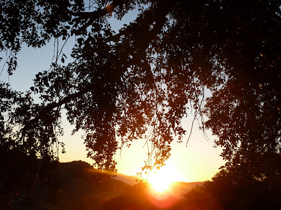
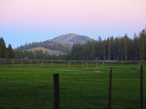
5:36 am. Morning has broken at the Olancha Pass TH, elev 5790 feet
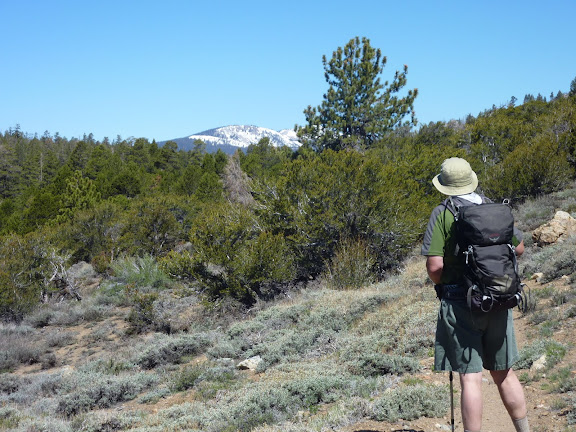
Just beyond the pass at 9500k we view our first Sierra snow-capped peak
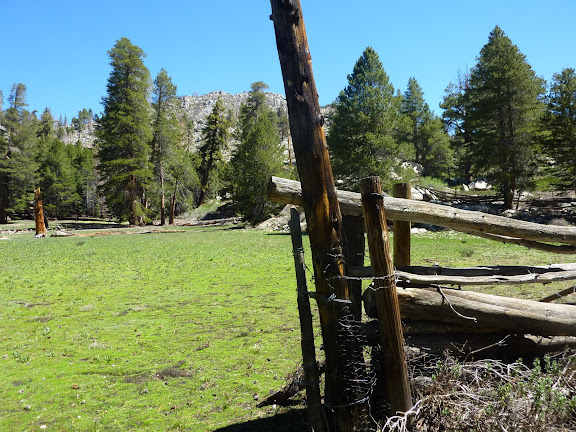
Bear Trap Meadow
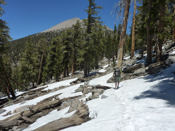
At 10,500k we leave the PCT and begin the steep 1600k cross-country talus climb to the summit in the distance
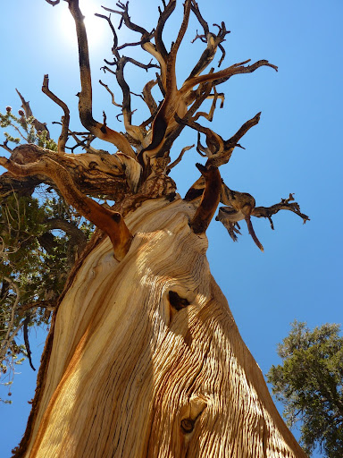
The weathered character of a tree hundreds of years old
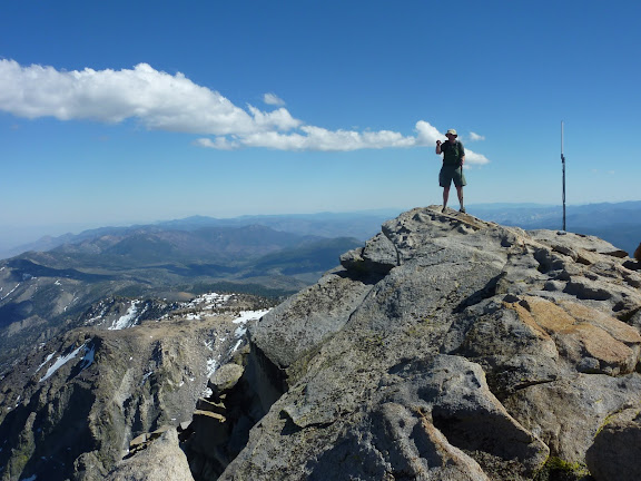
Dave G on top of the world, or at least Olancha Peak, elev 12,123 feet. Owens Peak in distance.
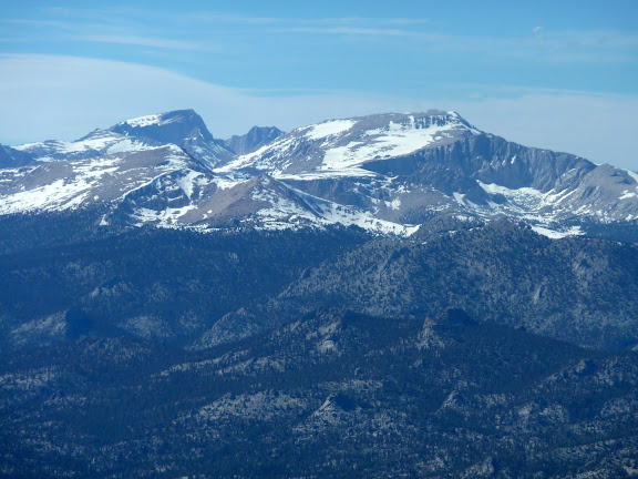
From the summit a commanding view of Mount's Whitney, Russell and Langley
Heading back down the pass, Summit Meadow and Round Mountain in the setting sun
rest of my pix are here:
http://picasaweb.google.com/ryan.norma8 ... haPeak6610#
Patrick,
Sage Flat Road is about 5 miles south of the town of Olancha, so MapQuest that distance from your house. The TH is about 15 mins from Hwy 395 and 4WD is not nesessary. It takes the average strong hiker 13-15 hours to do this as a day hike, though most do it as an overnight backpack. The 360 degree view from the summit is outstanding!
Re: Olancha Peak 6-6-10
Posted: Thu Jun 10, 2010 11:55 am
by TracieB
Awesome photos, Norma!
Re: Olancha Peak 6-6-10
Posted: Thu Jun 10, 2010 11:59 am
by lilbitmo
Great pictures Norma - this hike just moved up my list (near the top), thanks for the info on starting spot