Baldy Chutes, 03-Apr-2010
Posted: Tue Apr 06, 2010 10:23 pm
One of my goals is to climb and photo document all of the chutes in Baldy Bowl. I ended up climbing The Dare and The Hourglass.
I woke up late and leisurely arrived at Manker Flats at 10:30am. It was already quite warm so I didn't think I'd even climb any chutes because of the rockfall danger. I left my helmet and my second semi-technical axe in the car. I figured I'd just get some photos from the base of the Bowl or climb the easy route up the West Ridge. When I got to the Bowl, I couldn't help it. I had to climb it.
So up I went. But I stopped at the base for a long time to plan my route. I wanted to survey how much rock was coming down, where they were coming from and at what frequency. At one point three bogeys headed right at a climber halfway up the Bowl from 1 O'clock high and it looked like he was just frozen there. But he was actually watching their trajectories to make a move at the last second. The three rocks whizzed by on either side of him. Then another time a huge rock let loose, started tumbling and smashed into a stationary boulder, causing it to explode into 4 or 5 large fragments with a huge kaboom! Wow!
Luckily my side of the Bowl was relatively calm. I made it up The Dare without incident, met a nice young couple from Santa Monica and then continued up the ridge, taking pictures.
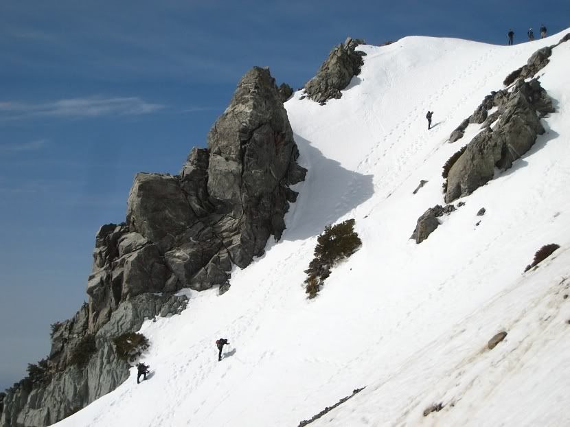
This is an illustration I made based on a photo in the Ski Hut. The picture is from March.
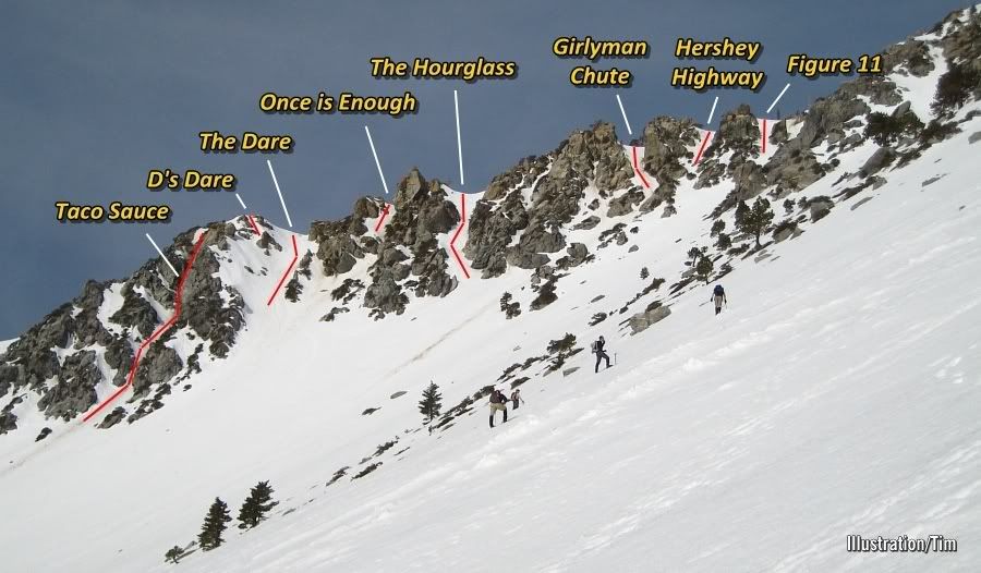
You can see a skier near the bottom. For some reason he skinned across and then climbed the left side of the rocks to gain the ridge.
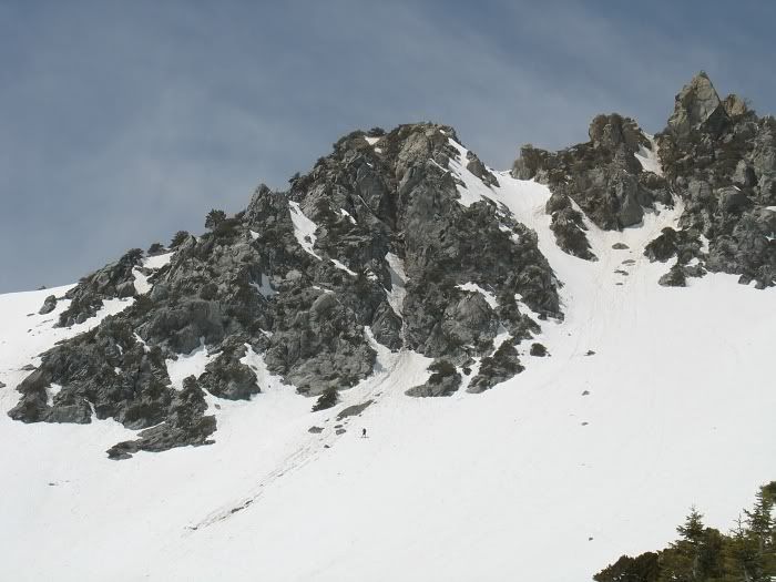
The Dare and Once is Enough.
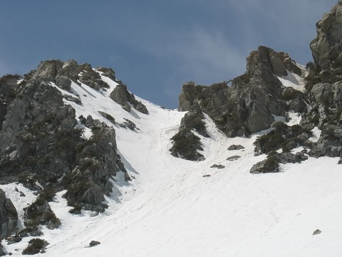
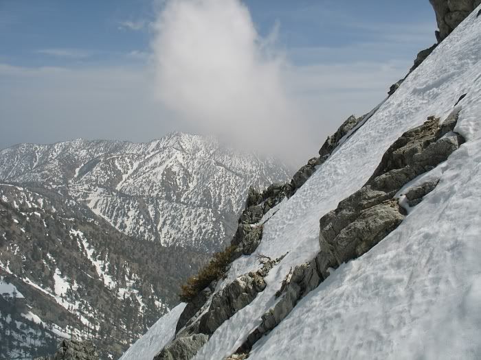
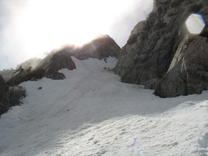
This is looking towards climber's left in The Dare chute. It measures out to be about 45°. The center of the chute is not as steep. My guess is 40°.
This is the top of The Dare.
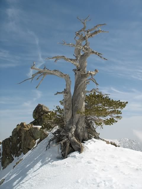
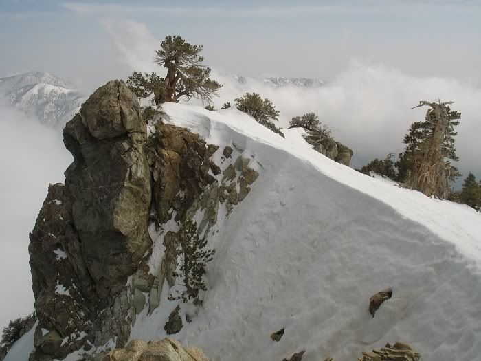
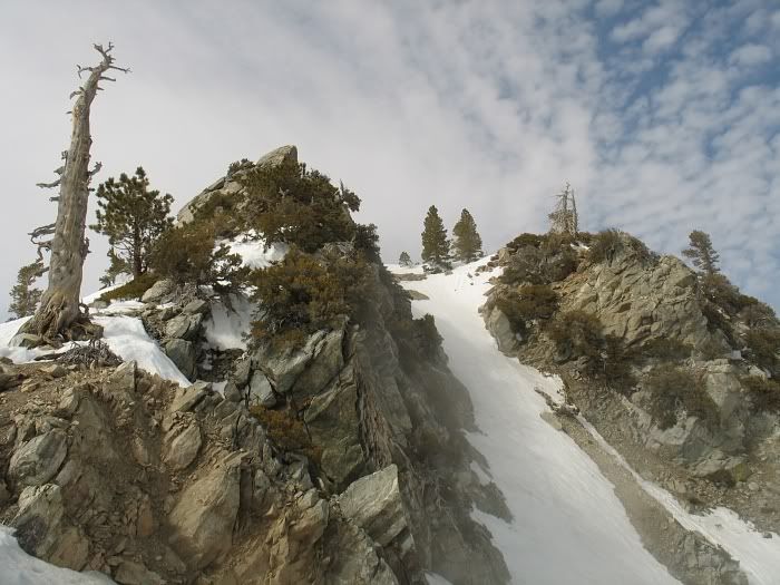
This is that famous tree that marks The Hourglass Chute.
Top of Hourglass
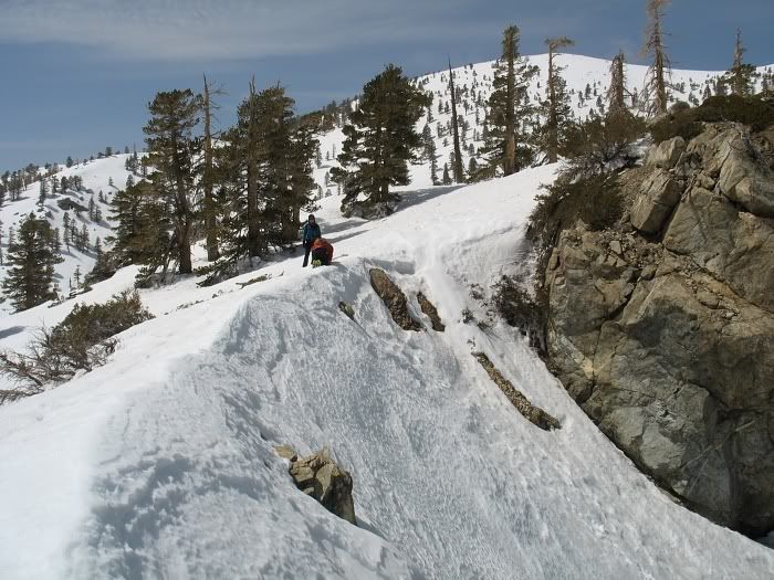
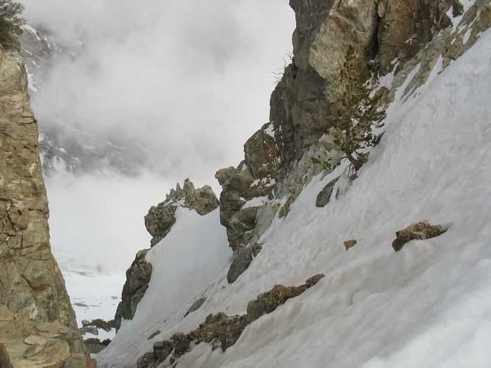
I went down The Hourglass and then back up. Here's the view from the bottom. At its narrowest, the chute is maybe about 6' wide, I think.
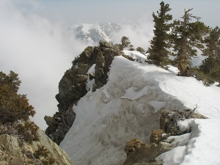
This is top of Girlyman Chute. The chute itself is pretty bare but the top is sort of corniced over with this very steep slap of snow. It's probably 60°+ in spots?
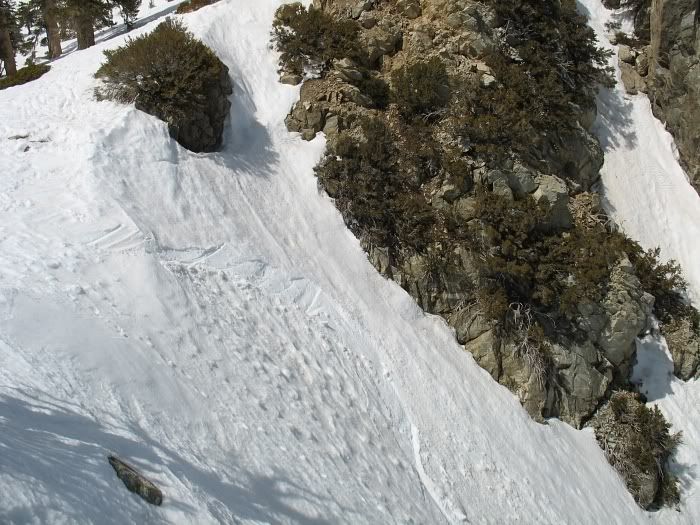
Looking down Girlyman Chute.
Here's Hershey Highway
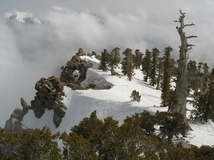
This is looking north. The snag on the left marks Figure 11 and beyond it is Employee Entrance/Zen Chute (I think).
This is looking south. From near to far is Figure 11, Hershey Highway and Girlyman Chute. You can see that snag again.
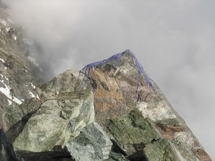
The purple paint bandit strikes again! I first saw purple graffiti on Iron a few years ago and now this rock at the top of Zeke's Chute. Idiots!
This is that tree that greets everyone at the top of Zeke's Chute (the center chute that everyone goes up)
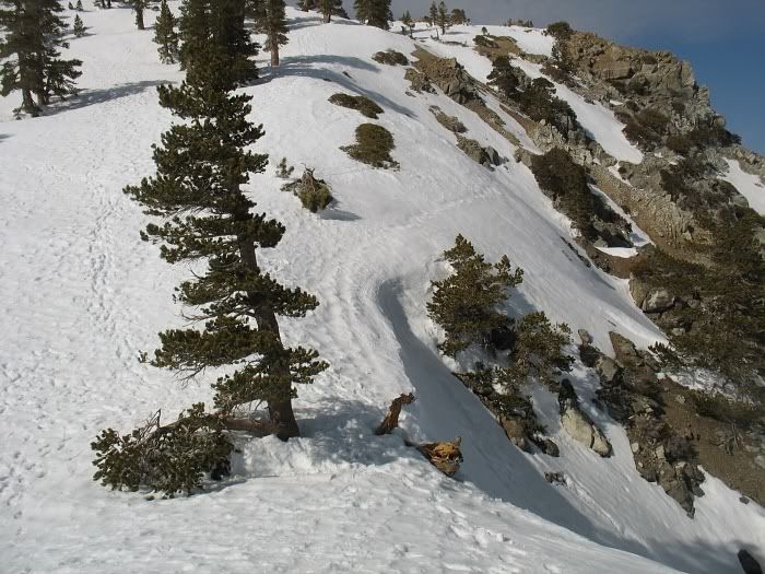
Another view, from a different day of Zeke's Chute and that big rock outcropping. The climbers are taking the leftside variation.
Had a nice ride down too:
I woke up late and leisurely arrived at Manker Flats at 10:30am. It was already quite warm so I didn't think I'd even climb any chutes because of the rockfall danger. I left my helmet and my second semi-technical axe in the car. I figured I'd just get some photos from the base of the Bowl or climb the easy route up the West Ridge. When I got to the Bowl, I couldn't help it. I had to climb it.
So up I went. But I stopped at the base for a long time to plan my route. I wanted to survey how much rock was coming down, where they were coming from and at what frequency. At one point three bogeys headed right at a climber halfway up the Bowl from 1 O'clock high and it looked like he was just frozen there. But he was actually watching their trajectories to make a move at the last second. The three rocks whizzed by on either side of him. Then another time a huge rock let loose, started tumbling and smashed into a stationary boulder, causing it to explode into 4 or 5 large fragments with a huge kaboom! Wow!
Luckily my side of the Bowl was relatively calm. I made it up The Dare without incident, met a nice young couple from Santa Monica and then continued up the ridge, taking pictures.
This is an illustration I made based on a photo in the Ski Hut. The picture is from March.
You can see a skier near the bottom. For some reason he skinned across and then climbed the left side of the rocks to gain the ridge.
The Dare and Once is Enough.
This is looking towards climber's left in The Dare chute. It measures out to be about 45°. The center of the chute is not as steep. My guess is 40°.
This is the top of The Dare.
This is that famous tree that marks The Hourglass Chute.
Top of Hourglass
I went down The Hourglass and then back up. Here's the view from the bottom. At its narrowest, the chute is maybe about 6' wide, I think.
This is top of Girlyman Chute. The chute itself is pretty bare but the top is sort of corniced over with this very steep slap of snow. It's probably 60°+ in spots?
Looking down Girlyman Chute.
Here's Hershey Highway
This is looking north. The snag on the left marks Figure 11 and beyond it is Employee Entrance/Zen Chute (I think).
This is looking south. From near to far is Figure 11, Hershey Highway and Girlyman Chute. You can see that snag again.
The purple paint bandit strikes again! I first saw purple graffiti on Iron a few years ago and now this rock at the top of Zeke's Chute. Idiots!
This is that tree that greets everyone at the top of Zeke's Chute (the center chute that everyone goes up)
Another view, from a different day of Zeke's Chute and that big rock outcropping. The climbers are taking the leftside variation.
Had a nice ride down too: