Running Water Trail 2010/02/11
Posted: Fri Feb 12, 2010 7:42 am
TR on everytrail.com
Photos @ picasa

After experiencing the east ridge of Cougar Cyn a better way in and out of the area had to be found!
A check of old maps shows a trail from Bear Divide to Pacoima Cyn.
I started on Santa Clara Divide road where the plantation road meets it. Down I went and at the appropriate point I started looking for signs of an old trail. At 070 I spotted a trail and took it down to the creek bed and went up the other side. trying to make it work with the trail shown on the map.
There is a cliff and slide area where it is impossible to traverse with out safety gear, I spotted a trail descending from the plantation further down from where I dropped in so back I went and took it (102)
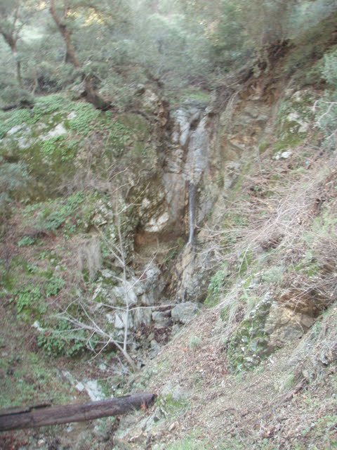
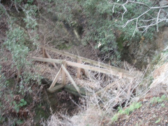
Now this is more like it! as I got to the creek there is a small waterfall about 40ft high and several smaller ones below. There is also the remains of an old stock bridge ! Hah this is it! A faint trail is on the other side off I go.

While faint there was a trail here at one time, it is covered with slides but it is a trail. As I rounded the first ridge there was a wall of brush. Probing it looks like the trail has disappeared but I persisted. I can see signs of the trail in the distance and hack my way through the brush on the line where the trail should be.
I emerge at a slide... I carefully traverse (don't slip!) and rejoin the faint trail grade. I arrive at the next draw to be greeted by another decrepit stock bridge!

I set up a handline and dropped down to the draw and up the other side leaving my rope behind. Down trees and patches of poison oak block my progress, but persistence wins out as does my Sandivk brush axe, folding saw, and loppers.
I'd resolved to continue until 10am before turning back. My initial mission accomplished, so after hacking my way through a brush and poison oak choked draw I made it to an open area (200) and took a break
A check of my watch indicates 9:55am. I stow the Sandvik and saw and neaten up the path on the way back, when I come back a Pulaski would be good to make those slide areas safer
I get back to my truck and consider the outing a total success!
Wracking my brain for a name for the trail since there is none on the old map I decided on Running Water Trail since Pacoima is according to "California Place Names" by Erwin T Gudde, Pacoima is derived from a Gabrielino- Shoshonean word, and may mean Running Water
Though Maple Cyn trail at one time might be a more accurate name. The trail goes from Bear Divide tp Limekiln Cyn by way of Maple Cyn where some structures are shown on the map. There was no homestead claims filed with the BLM and there are no mines in Maple Cyn or claims in the area
My guess is, and it is a pure unadulterated guess is they are Forest Service permitted recreational cabins , likely revoked when Pacoima Dam was constructed. Again this is pure speculation
Photos @ picasa

After experiencing the east ridge of Cougar Cyn a better way in and out of the area had to be found!
A check of old maps shows a trail from Bear Divide to Pacoima Cyn.
I started on Santa Clara Divide road where the plantation road meets it. Down I went and at the appropriate point I started looking for signs of an old trail. At 070 I spotted a trail and took it down to the creek bed and went up the other side. trying to make it work with the trail shown on the map.
There is a cliff and slide area where it is impossible to traverse with out safety gear, I spotted a trail descending from the plantation further down from where I dropped in so back I went and took it (102)
Now this is more like it! as I got to the creek there is a small waterfall about 40ft high and several smaller ones below. There is also the remains of an old stock bridge ! Hah this is it! A faint trail is on the other side off I go.
While faint there was a trail here at one time, it is covered with slides but it is a trail. As I rounded the first ridge there was a wall of brush. Probing it looks like the trail has disappeared but I persisted. I can see signs of the trail in the distance and hack my way through the brush on the line where the trail should be.
I emerge at a slide... I carefully traverse (don't slip!) and rejoin the faint trail grade. I arrive at the next draw to be greeted by another decrepit stock bridge!
I set up a handline and dropped down to the draw and up the other side leaving my rope behind. Down trees and patches of poison oak block my progress, but persistence wins out as does my Sandivk brush axe, folding saw, and loppers.
I'd resolved to continue until 10am before turning back. My initial mission accomplished, so after hacking my way through a brush and poison oak choked draw I made it to an open area (200) and took a break
A check of my watch indicates 9:55am. I stow the Sandvik and saw and neaten up the path on the way back, when I come back a Pulaski would be good to make those slide areas safer
I get back to my truck and consider the outing a total success!
Wracking my brain for a name for the trail since there is none on the old map I decided on Running Water Trail since Pacoima is according to "California Place Names" by Erwin T Gudde, Pacoima is derived from a Gabrielino- Shoshonean word, and may mean Running Water
Though Maple Cyn trail at one time might be a more accurate name. The trail goes from Bear Divide tp Limekiln Cyn by way of Maple Cyn where some structures are shown on the map. There was no homestead claims filed with the BLM and there are no mines in Maple Cyn or claims in the area
My guess is, and it is a pure unadulterated guess is they are Forest Service permitted recreational cabins , likely revoked when Pacoima Dam was constructed. Again this is pure speculation