Little Fish Fork Overnighter, 7/2 - 7/3/2009
Posted: Mon Jul 06, 2009 1:40 pm
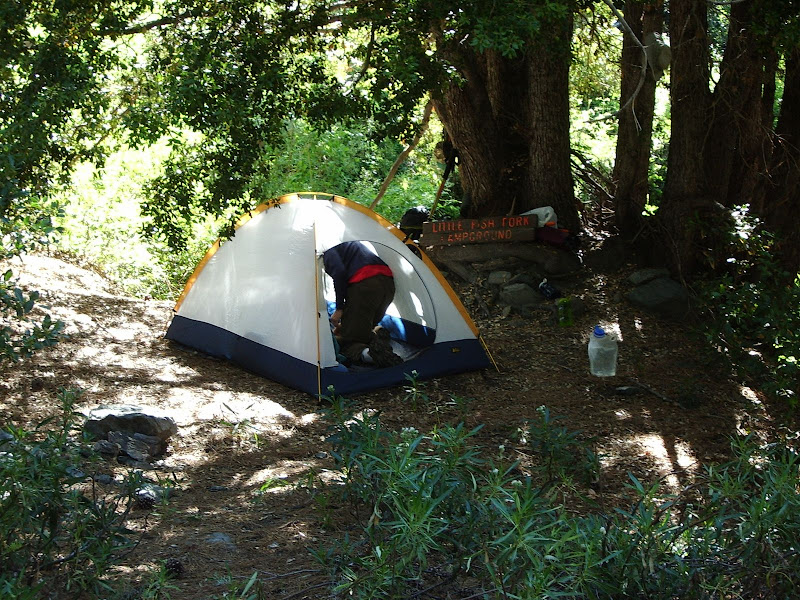
A couple of friends and I went down to Little Fish Fork on Thursday, 7/2/2009, after work for a quick overnighter. It's a really peaceful spot and worth checking out. The really good news (for me) is that my injured knee held up well.

We felt like we were really "away from it all" while we were there although we did run into a couple of other "backpackers" (see note at end) the next day who had camped further down towards UFF and then one set of day hikers on our way out. Still, running into only two other groups on a Fourth of July weekend isn't bad.
More photos: http://picasaweb.google.com/jim.barbour ... slideshow/
Someone please check and see if I've identified Ross Mountain and Rattlesnake Peak correctly.
WATER
The creek at Little Fish Fork Camp, and the spring in the next drainage down were both flowing well.
NAVIGATION
The navigation is fairly straightforward even though the USGS topo shows quite a number of different trails scattered about and, if you switch to satellite photo mode, you can see that there are even more bits of trail than shown on the topo map.
Basically, you park near the trailhead which is Point "A" on this topo map, just before you get to Lupine Campground. There's no lot; I just pulled off the dirt road. I was driving a Honda Accord and had no problems with driving the road down into Prairie Fork. From the trailhead, one follows the old road bed. There's good sized stream at point "B." A pipe leads from here down towards Lupine; I assume this is where the campground gets it's water. At point "C," you cut up to the trail going up Pine Mountain Ridge. Note that you do NOT have to proceed all the way to point "D" where the old road ran. The trail cuts up at point "C". There is a trail sign on top of the ridge at point "C." From "C," proceed up Pine Mountain Ridge following the old road bed to point "E" where an old road bed cuts off of Pine Mtn Ridge and heads for LFF. Look for a fallen sign here:

From the point where the fallen sign is (point "E"), visually follow the most prominent road bed to a small saddle (point "F") on a an intervening ridge between the LFF drainage and Pine Mountain Ridge. The saddle:

Just walk the old road bed until you get to the small saddle. The old road is pretty wiped out by a slide about mid-way to the saddle, but the slide can be traversed on foot without too much difficulty. Those nervous around slidey rocks on steep slopes may wish to hike elsewhere.
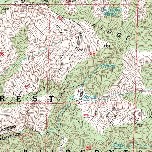
A trail leads south, down from the small saddle via a series of switchbacks until it joins an old road bed at approx point "G." Follow the old road bed as it first goes east, crosses the drainage, and then switchbacks down to LFF Camp ("H"). Note that the topo map shows that the switchback stops short of re-crossing the creek in the vicinity of point "H." The map is incorrect. The road bed does re-cross the creek, and LFF Camp is in a wide spot in the road on the lower switchback on the NW side of the creek. I've tried to show the location of the camp a little bit more precisely with the little red star on this topo:

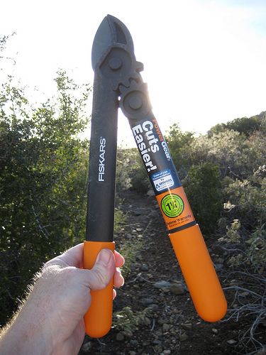
The trail is a bit rougher below LFF Camp, but still followable. You should notice a little bit of lopper work through this section where we trimmed back a bit of brush. The thing to bear in mind is that the trail follows the creek approximately equi-distant above the creek as it descends to UFF Camp as shown on the above map snippet. On the ACME map link, you want to proceed via point "K" in order to get to UFF Camp.
I didn't try to find or follow the Dawson Peak Trail (DPT) which is denoted by point "L" on the ACME link, although we did meet two backpackers who said that they had descended it part way, losing the trail at some point. We could see the DPT above us as we descended towards UFF. The two trails diverge in a dry wash immediately south of the wet creek at point "I." The dry wash is denoted by point "J." Note that even though Dawson Peak lies to the east, the DPT proceeds SW at this point roughly paralleling the trail to UFF although higher up. I think the topo map snippet inserted inline above shows the relationship between the trail to UFF and the DPT best.
We were taking our time and didn't even leave LFF until after noon to go to UFF. My friends wanted to be back in town Friday P.M. at a reasonable hour, so we stopped short of going all the way to UFF, much to my dismay. It was nice, however, to sleep in and just while away the hours Friday morning at LFF. Next time I'm out, I'll have to be a little bit more goal oriented and get all the way down to UFF!
I hadn't been back into this area in a number of years and was gratified to see that it's still as nice as I remember it!
END NOTES
We ran into a couple of "backpackers" who said that they had come down the Dawson Peak Trail but had lost the route to get into the Little Fish Fork area. I think they may be relatively new to backpacking. I saw no evidence of map, compass, or GPS. They seemed quite surprised to see us and even more surprised that we we had come in from Lupine (a much easier way in to the area).
They informed us that they had left behind some "supplies" in case we needed anything. I followed their trail to their camp "site" -- they hadn't found a site at all but had camped in a semi-level rocky dry spot in the creek bed. I found their supplies all right -- all 12.6 pounds worth. It was mostly food, but also trash, clothing, fuel, and batteries. Like I say, I think they were noobs. They had just carried way too much stuff and had jettisoned a bunch of gear in the back country (and when we saw them we commented amongst ourselves on how big and stuffed full their packs were AFTER they had jettisoned gear). We also noticed how their gear was clean and new. Like I say: noobs. Nothing against noobs, mind you, but don't jettison a load of gear in the backcountry. Grrr.
  Note: We packed out their crap. Some of the battieres were fully charged lithium AAA cells. Score!
However, these guys weren't the worst case. If you saw the link to the photos from Matt's recent TR, you'll see some trash. What Matt doesn't mention is that trash is a family type car camping tent. Below it, we found the remains of a double bed sized inflatable car-camping mattress -- the kind that have a pump and are two feet thick. We also found a two burner propane grill with regulator and propane tank as well as aluminum frame camp chairs. How the heck did these people get this stuff back in there? Noooobs! Now come back and haul your frickin' trash out!!
Note: We didn't haul out that old crap. Even I have my limits.
We felt like we were really "away from it all" while we were there although we did run into a couple of other "backpackers" (see note at end) the next day who had camped further down towards UFF and then one set of day hikers on our way out. Still, running into only two other groups on a Fourth of July weekend isn't bad.
More photos: http://picasaweb.google.com/jim.barbour ... slideshow/
Someone please check and see if I've identified Ross Mountain and Rattlesnake Peak correctly.
WATER
The creek at Little Fish Fork Camp, and the spring in the next drainage down were both flowing well.
NAVIGATION
The navigation is fairly straightforward even though the USGS topo shows quite a number of different trails scattered about and, if you switch to satellite photo mode, you can see that there are even more bits of trail than shown on the topo map.
Basically, you park near the trailhead which is Point "A" on this topo map, just before you get to Lupine Campground. There's no lot; I just pulled off the dirt road. I was driving a Honda Accord and had no problems with driving the road down into Prairie Fork. From the trailhead, one follows the old road bed. There's good sized stream at point "B." A pipe leads from here down towards Lupine; I assume this is where the campground gets it's water. At point "C," you cut up to the trail going up Pine Mountain Ridge. Note that you do NOT have to proceed all the way to point "D" where the old road ran. The trail cuts up at point "C". There is a trail sign on top of the ridge at point "C." From "C," proceed up Pine Mountain Ridge following the old road bed to point "E" where an old road bed cuts off of Pine Mtn Ridge and heads for LFF. Look for a fallen sign here:
From the point where the fallen sign is (point "E"), visually follow the most prominent road bed to a small saddle (point "F") on a an intervening ridge between the LFF drainage and Pine Mountain Ridge. The saddle:
Just walk the old road bed until you get to the small saddle. The old road is pretty wiped out by a slide about mid-way to the saddle, but the slide can be traversed on foot without too much difficulty. Those nervous around slidey rocks on steep slopes may wish to hike elsewhere.
A trail leads south, down from the small saddle via a series of switchbacks until it joins an old road bed at approx point "G." Follow the old road bed as it first goes east, crosses the drainage, and then switchbacks down to LFF Camp ("H"). Note that the topo map shows that the switchback stops short of re-crossing the creek in the vicinity of point "H." The map is incorrect. The road bed does re-cross the creek, and LFF Camp is in a wide spot in the road on the lower switchback on the NW side of the creek. I've tried to show the location of the camp a little bit more precisely with the little red star on this topo:

The trail is a bit rougher below LFF Camp, but still followable. You should notice a little bit of lopper work through this section where we trimmed back a bit of brush. The thing to bear in mind is that the trail follows the creek approximately equi-distant above the creek as it descends to UFF Camp as shown on the above map snippet. On the ACME map link, you want to proceed via point "K" in order to get to UFF Camp.
I didn't try to find or follow the Dawson Peak Trail (DPT) which is denoted by point "L" on the ACME link, although we did meet two backpackers who said that they had descended it part way, losing the trail at some point. We could see the DPT above us as we descended towards UFF. The two trails diverge in a dry wash immediately south of the wet creek at point "I." The dry wash is denoted by point "J." Note that even though Dawson Peak lies to the east, the DPT proceeds SW at this point roughly paralleling the trail to UFF although higher up. I think the topo map snippet inserted inline above shows the relationship between the trail to UFF and the DPT best.
We were taking our time and didn't even leave LFF until after noon to go to UFF. My friends wanted to be back in town Friday P.M. at a reasonable hour, so we stopped short of going all the way to UFF, much to my dismay. It was nice, however, to sleep in and just while away the hours Friday morning at LFF. Next time I'm out, I'll have to be a little bit more goal oriented and get all the way down to UFF!
I hadn't been back into this area in a number of years and was gratified to see that it's still as nice as I remember it!
END NOTES
We ran into a couple of "backpackers" who said that they had come down the Dawson Peak Trail but had lost the route to get into the Little Fish Fork area. I think they may be relatively new to backpacking. I saw no evidence of map, compass, or GPS. They seemed quite surprised to see us and even more surprised that we we had come in from Lupine (a much easier way in to the area).
They informed us that they had left behind some "supplies" in case we needed anything. I followed their trail to their camp "site" -- they hadn't found a site at all but had camped in a semi-level rocky dry spot in the creek bed. I found their supplies all right -- all 12.6 pounds
However, these guys weren't the worst case. If you saw the link to the photos from Matt's recent TR, you'll see some trash. What Matt doesn't mention is that trash is a family type car camping tent. Below it, we found the remains of a double bed sized inflatable car-camping mattress -- the kind that have a pump and are two feet thick. We also found a two burner propane grill with regulator and propane tank as well as aluminum frame camp chairs. How the heck did these people get this stuff back in there?
Note: We didn't haul out that old crap. Even I have my limits.

