Cedar Canyon, 16-May-2009
Posted: Sat May 16, 2009 10:11 pm
This morning HikeUp and I descended Cedar Canyon from the Thunder-Telegraph Saddle to the Chapman Trail leading to Icehouse Canyon.
The upper canyon is very straightforward. There are no major obstacles. There are paths through the brush or you can traverse the slopes on either side of the canyon to bypass any thick patches. The terrain is quite uneven and rocky, making it uncomfortable to walk on.
The only issue we encountered was near where Telegraph's west ridge terminates. Here the brush changes from low-lying manzanita to some kind of buckthorn. This was very tall buckthorn, with some groves over 6 ft high. Most of it was down in the center of the canyon so if you stayed high on the slopes, you could bypass the majority of it. Since you eventually need to head south to intersect the Chapman Trail, we recommend staying high on the left (south) slope starting at around 6700 ft.
Neither of us had been on the Chapman Trail before and we didn't know exactly where it intersects Cedar Canyon, so we continued down the center of the canyon a little bit further than the optimal point of crossing over to the south. We managed to create a small path through the buckthorn with just minimal damage. We would not recommend going further down the canyon unless you're totally out of your mind. This buckthorn is extremely formidable. It is much thicker and taller than what the satellite photos or even my own recon photos made me believe.
I can see how this canyon would suck in the winter. If snow covered the buckthorn and you postholed right into one, you'd get messed up real good.
One last thing, I have never seen so many cars at MF and IHC! At MF, there were cars parked past the Snack Bar and at IHC, they were lined up almost to the first switchback on Mt. Baldy Rd!
We started at 6am, went up the road from MF to Baldy Notch and got back to the IHC parking lot at 11am:
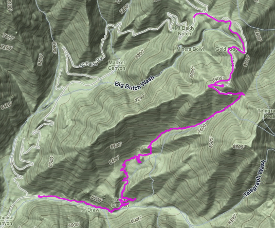
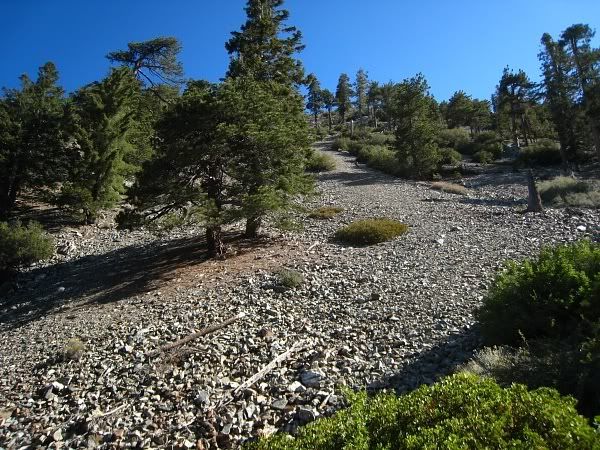
Start of the canyon at the saddle:
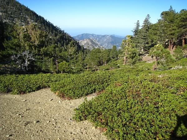
Lots of manzanita at the beginning, but this can be easily bypassed on the right:
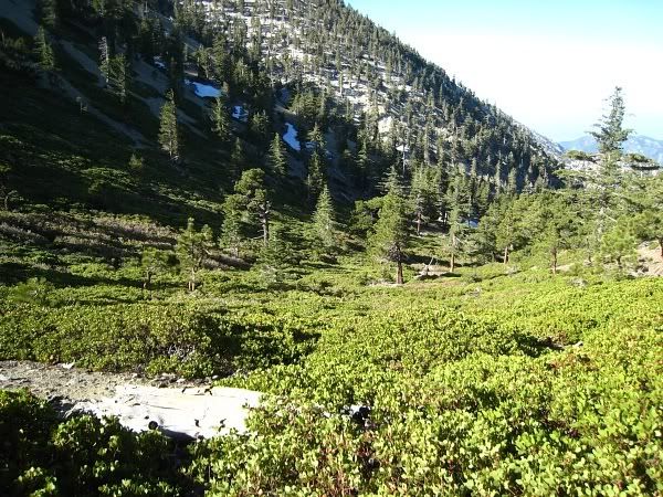
Heading down, GRR in the background:
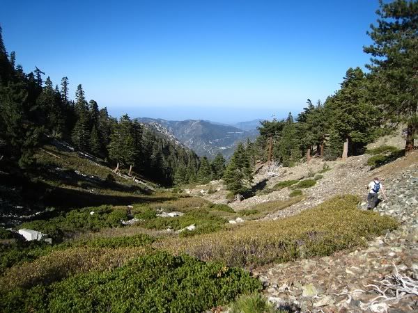
Looking up one of the south slopes of Thunder's West Ridge:
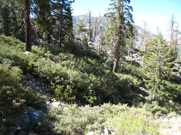
Here comes the buckthorn:
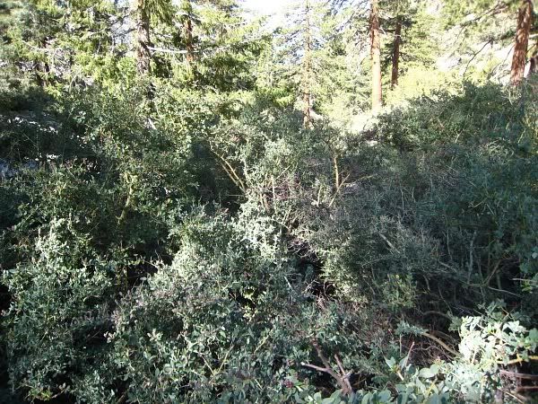
This won't be pleasant.
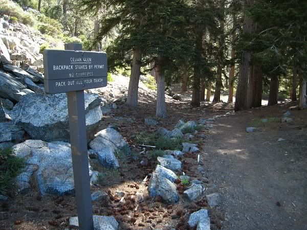
Cedar Glen. I really liked the Chapman Trail. I can't believe I've never been on it despite going up and down IHC numerous times over the years.
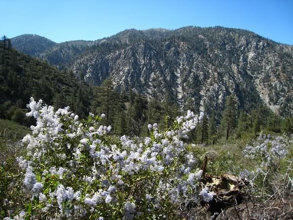
Lots of flowers are in bloom so the bees are out.
The upper canyon is very straightforward. There are no major obstacles. There are paths through the brush or you can traverse the slopes on either side of the canyon to bypass any thick patches. The terrain is quite uneven and rocky, making it uncomfortable to walk on.
The only issue we encountered was near where Telegraph's west ridge terminates. Here the brush changes from low-lying manzanita to some kind of buckthorn. This was very tall buckthorn, with some groves over 6 ft high. Most of it was down in the center of the canyon so if you stayed high on the slopes, you could bypass the majority of it. Since you eventually need to head south to intersect the Chapman Trail, we recommend staying high on the left (south) slope starting at around 6700 ft.
Neither of us had been on the Chapman Trail before and we didn't know exactly where it intersects Cedar Canyon, so we continued down the center of the canyon a little bit further than the optimal point of crossing over to the south. We managed to create a small path through the buckthorn with just minimal damage. We would not recommend going further down the canyon unless you're totally out of your mind. This buckthorn is extremely formidable. It is much thicker and taller than what the satellite photos or even my own recon photos made me believe.
I can see how this canyon would suck in the winter. If snow covered the buckthorn and you postholed right into one, you'd get messed up real good.
One last thing, I have never seen so many cars at MF and IHC! At MF, there were cars parked past the Snack Bar and at IHC, they were lined up almost to the first switchback on Mt. Baldy Rd!
We started at 6am, went up the road from MF to Baldy Notch and got back to the IHC parking lot at 11am:
Start of the canyon at the saddle:
Lots of manzanita at the beginning, but this can be easily bypassed on the right:
Heading down, GRR in the background:
Looking up one of the south slopes of Thunder's West Ridge:
Here comes the buckthorn:
This won't be pleasant.
Cedar Glen. I really liked the Chapman Trail. I can't believe I've never been on it despite going up and down IHC numerous times over the years.
Lots of flowers are in bloom so the bees are out.

