Snack Shack Couloir and Thunder Ridge, 15-Mar-2009
Posted: Mon Mar 16, 2009 9:26 pm
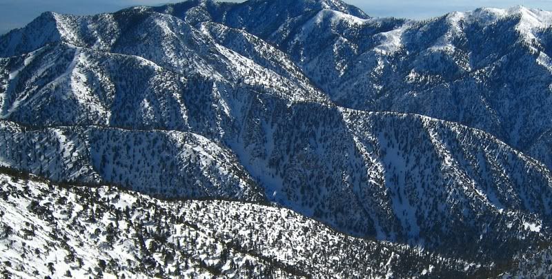
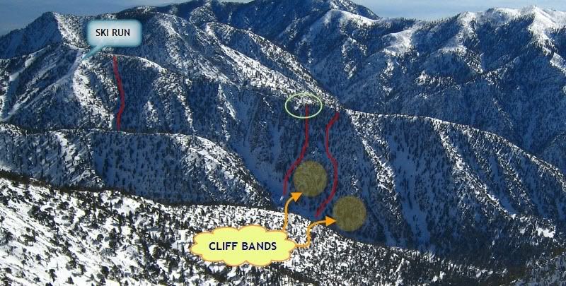
I don't know if this couloir has a name, but it's the one that empties into the Snack Shack at Manker Flats.
I didn't plan on doing this climb but it worked out pretty well. I originally wanted to climb Baldy, but halfway up Falls Rd I turned around because my new backpack was bothering me. This pack was a North Face Pivot 22. It's a nice little technical daypack but the shoulder straps kept digging into my neck.
As I was walking back to my car to get my other pack, I spotted this couloir. It looked doable and best of all the approach consisted of walking across the road. Perfect! I was too lazy to hike back up Baldy anyway. The topo indicated it was a 1400 ft climb, although it didn't look very high. Once on top I figured I would follow the ridge to Thunder Mtn and then descend one of the ski runs.
The couloir starts at 30° and steepens to almost 40° near the top (as measured in Photoshop). The snow was very hard packed and somewhat icy, but pretty good for cramponing. You couldn't really self-belay, though, because the axe wouldn't go in more than an an inch or two. Also, maybe my technique was off, but my ankles were killing me from constantly having to twist them to the angle of the slope.
At 7,250 ft, the snow changed to a soft top layer with a hard icy layer underneath. I didn't feel safe climbing here anymore so I exited the couloir and climbed the bare dirt and rocks on the left side. I topped out at 9:30am--about 1:45 hrs after I started.
The views at the top were really sweet. The ridge drops off sharply so there was nothing in front of me except air and two huge mountain ranges (Ontario to the south and Baldy to the north). I even started to get a bit of vertigo while looking at the Ontario Peak Ridge, which rises more than 3,000 ft from Icehouse Canyon.
After regaining my senses, I continued east along the ridge. Overall, it was a straightforward traverse, but there were a couple of short sections where I had to scramble over some rocks and bushes. At noon I arrived on Thunder Mtn. I loitered around a bit and then made my way down to Miner's Bowl.
From there, I took Big Butch Wash down to where it meets Lightning Couloir. When I got there, a cloud moved in really fast and reduced visibility to almost nil. This was no good at all. Rocks were constantly raining down this gully every few minutes. I thought about making a run for it down the couloir, but the sound of more falling rocks convinced me to hike back up to Miner's Bowl and take the gully beneath Chair 1. I got back to my car at about 3pm.


Literally within seconds, this:

turned into this:

This was at the first hard left switchback as you're going down the road. He went straight into the turnout and head-on with the boulder. Visibility was down to 20-30 ft. Must not be familiar with the road or must have missed the 10 mph caution sign.

I didn't plan on doing this climb but it worked out pretty well. I originally wanted to climb Baldy, but halfway up Falls Rd I turned around because my new backpack was bothering me. This pack was a North Face Pivot 22. It's a nice little technical daypack but the shoulder straps kept digging into my neck.
As I was walking back to my car to get my other pack, I spotted this couloir. It looked doable and best of all the approach consisted of walking across the road. Perfect! I was too lazy to hike back up Baldy anyway. The topo indicated it was a 1400 ft climb, although it didn't look very high. Once on top I figured I would follow the ridge to Thunder Mtn and then descend one of the ski runs.
The couloir starts at 30° and steepens to almost 40° near the top (as measured in Photoshop). The snow was very hard packed and somewhat icy, but pretty good for cramponing. You couldn't really self-belay, though, because the axe wouldn't go in more than an an inch or two. Also, maybe my technique was off, but my ankles were killing me from constantly having to twist them to the angle of the slope.
At 7,250 ft, the snow changed to a soft top layer with a hard icy layer underneath. I didn't feel safe climbing here anymore so I exited the couloir and climbed the bare dirt and rocks on the left side. I topped out at 9:30am--about 1:45 hrs after I started.
The views at the top were really sweet. The ridge drops off sharply so there was nothing in front of me except air and two huge mountain ranges (Ontario to the south and Baldy to the north). I even started to get a bit of vertigo while looking at the Ontario Peak Ridge, which rises more than 3,000 ft from Icehouse Canyon.
After regaining my senses, I continued east along the ridge. Overall, it was a straightforward traverse, but there were a couple of short sections where I had to scramble over some rocks and bushes. At noon I arrived on Thunder Mtn. I loitered around a bit and then made my way down to Miner's Bowl.
From there, I took Big Butch Wash down to where it meets Lightning Couloir. When I got there, a cloud moved in really fast and reduced visibility to almost nil. This was no good at all. Rocks were constantly raining down this gully every few minutes. I thought about making a run for it down the couloir, but the sound of more falling rocks convinced me to hike back up to Miner's Bowl and take the gully beneath Chair 1. I got back to my car at about 3pm.


Literally within seconds, this:

turned into this:

This was at the first hard left switchback as you're going down the road. He went straight into the turnout and head-on with the boulder. Visibility was down to 20-30 ft. Must not be familiar with the road or must have missed the 10 mph caution sign.


