mattmaxon wrote:
Comparing your measurements to someone else without knowing how the measurement was taken is
impossible
It's like having an apple and an orange and saying they are not the same, well yeah
Well my final point kind of touches on this, you need to know what the person used to determine their elevation #'s, as each method will give different results. But I would not say it's comparing apples and oranges -
both are trying to estimate the same thing - elevation gain.
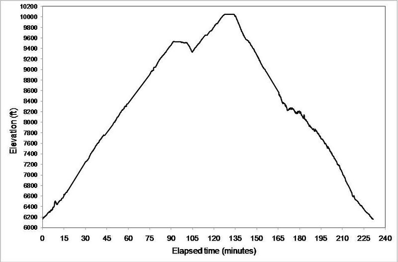
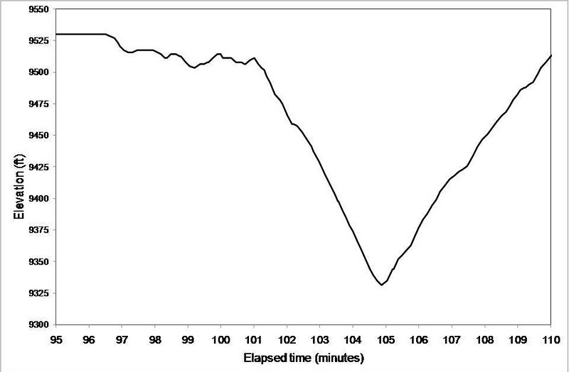
The graphs I showed have properties that are consistent with any GPS device, whether it determines altitude using only GPS, altimeter, or a combination: When estimating total elevation gain, different smoothing values will give different results.
You can see that when you have no smoothing, the values get ridiculously high. It is sort of like fractal patterns - Alan alluded to this before - but this is based on the fact that any device is going to have error, and if you sample more frequently, the error is going to accumulate.
Rumpled wrote:Good analysis. On your last graph, I'd go for at least 20 points. I would think that as you approach infinity you get to the actual elevation.
Actually you don't want too many points. Look at the purple line in the second graph, which has 60 points. You are already losing too much information, if you use 1000 points, the elevation curve would not even distinguish between all the bumps between Harwood, Baldy, West Baldy, etc...it would be just one big hump.
AlanK wrote:
I know that Garmin combines GPS and barometric altimeter readings. GPS data are used to calibrate the altimeter and barometric data are used to smooth the GPS data acquired as one moves around. The GPS data are used to calibrate the barometric altimeter constantly to compensate for barometric pressure changes due to the weather. I am not familiar with the algorithm that Garmin uses but I am impressed by the results.
With my model I use the altimeter mode, have not tried the GPS alone mode. I also have a separate barometric altimeter watch, and its values may vary up to 1,000 ft from the Garmin device. It makes sense of course that they are using GPS altitude coordinate to make sure the altimeter is not swaying due to weather changes, but is it updated every second, minute? One wonders. And how much of these algorithms are applied only to the data they display as opposed to output. But yeah I agree the results are pretty good. Definitely better than with an altimeter alone.
DamOTclese wrote:
In the canyons I find GOS reception to be off as much as 50 feet depending upon oblique angle to whatever satelites are visible and topological maps are overwhelmingly more accurate since many are based upon USGS benchmarkings.
And that's at an individual point, think of the calculation of total gain with that much error!
Well I assume Garmin also incorporates their time-dependent accuracy values into their algorithms. In a canyon, the GPS pick up fewer satellites and state the error is higher as compared to on a peak where the error is down to 10-12 ft. So they probably filter differently based on this.

