
the 'Guess the Photo' thread

-
Hikin_Jim

- Posts: 4688
- Joined: Thu Sep 27, 2007 9:04 pm
Actually, I'm on the trail to Upper Fish Fork; the photo is looking down canyon. I'd say both HikeUp and Zé got it right, Zé being slightly more on target but both within the bullseye; pretty darn good sleuthing, guys.Zé wrote:little fish fork campground
Honorable mention to Taco for most humorous entry.
HikeUp, "tag", you're it.
HJ
-
HikeUp

- Posts: 4070
- Joined: Thu Sep 27, 2007 9:21 pm
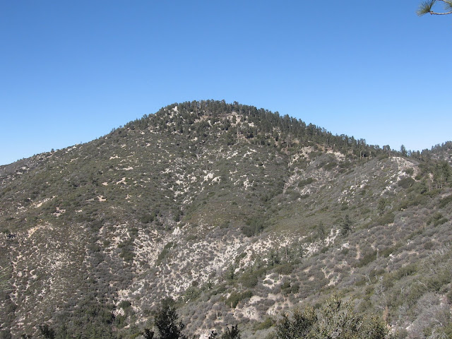
What peak is that between the trees?

Tie-breaker question is...where's the picture taken from?
Tie-breaker question is...where's the picture taken from?
-
Hikin_Jim
- Posts: 4688
- Joined: Thu Sep 27, 2007 9:04 pm
Dang. Beats the heck out of me. You're fairly high, that much can be seen, but I can't see enough of that ridge to identify it. It's probably some place I've been but at an angle I don't recognize. 
Maybe it's Blue Ridge and possibly Wright seen from PMR, but it doesn't look quite like what I would expect.
HJ
Maybe it's Blue Ridge and possibly Wright seen from PMR, but it doesn't look quite like what I would expect.
HJ
-
HikeUp
- Posts: 4070
- Joined: Thu Sep 27, 2007 9:21 pm
Same peak, but from a slightly different spot - sans trees!

-
Hikin_Jim
- Posts: 4688
- Joined: Thu Sep 27, 2007 9:04 pm
Yes, the transition from chaparral to pines should narrow things down a bit as should the line of Doug Firs in the drainage which suggest we're looking more or less north. All very helpful except for the fact I don't recognize it a bit. 
I was thinking it might be somewhere around Pacifico or Gleason, but you just shot down that idea.
Middle high country (Three Points to BP) or eastern high country?
HJ
I was thinking it might be somewhere around Pacifico or Gleason, but you just shot down that idea.
Middle high country (Three Points to BP) or eastern high country?
HJ
-
Hikin_Jim
- Posts: 4688
- Joined: Thu Sep 27, 2007 9:04 pm
I are confused. So this is in the area affected by the Station Fire and a photo taken today would look different?
HJ
HJ
-
Ze Hiker

- Posts: 1432
- Joined: Mon Jul 28, 2008 7:14 pm
I am making no statement about the location, only that the picture was taken before the station fire so you cannot use the change in terrain to make a conclusion 8)Hikin_Jim wrote:I are confused. So this is in the area affected by the Station Fire and a photo taken today would look different?
HJ
-
HikeUp
- Posts: 4070
- Joined: Thu Sep 27, 2007 9:21 pm
LOL. I think it's Pacifico from the east/southeast - the approach from Alder Saddle.

-
Hikin_Jim
- Posts: 4688
- Joined: Thu Sep 27, 2007 9:04 pm
Name that peak? OK, Bob. I vote for Bob. I think Bob is a good name, although some might prefer Josephine.
HJ
HJ
-
Ze Hiker
- Posts: 1432
- Joined: Mon Jul 28, 2008 7:14 pm
tough. wrong part of the range by Browns? how about Condor?
-
HikeUp
- Posts: 4070
- Joined: Thu Sep 27, 2007 9:21 pm
Not Condor. And even more wrong.
It's a zoomed in picture. I'll post the non-zoomed pic if no correct guesses.
It's a zoomed in picture. I'll post the non-zoomed pic if no correct guesses.
-
HikeUp
- Posts: 4070
- Joined: Thu Sep 27, 2007 9:21 pm
Not Clamshell.
Obscure and probably useless hint: picture taken from a point marked on USGS maps as 3529.
Obscure and probably useless hint: picture taken from a point marked on USGS maps as 3529.