
the 'Guess the Photo' thread
-
Mike P

- Posts: 1005
- Joined: Tue Oct 02, 2007 10:48 pm
Nope. That's Taco looking for condor eggs for breakfast.
-
Taco

- Snownado survivor
- Posts: 6193
- Joined: Thu Sep 27, 2007 4:35 pm
It's the dang road that connects Gobblers Knob and Lone Pine Cyn Rd.
-
Rumpled
- Posts: 271
- Joined: Mon Feb 25, 2008 10:57 pm
I just wanted a fucking mango! Fucking tigers! Never get off the boat!

That's all I could think of there. Prolly got the quote a bit off.

-
Hikin_Jim

- Posts: 4688
- Joined: Thu Sep 27, 2007 9:04 pm
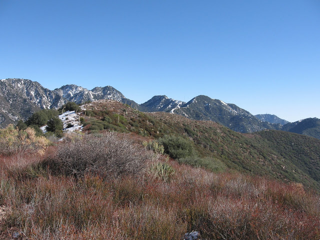
Which one is close, Throop or PVR?
I still think it's somewhere along PVR even if it isn't the HPS high point. My second guess would be the unnamed peak (Point "A" on the above linked map) between Mt. Williamson's summit block and Pallett Mountain. If not "A," then "B" (Pallett Mountain itself).
HJ
I still think it's somewhere along PVR even if it isn't the HPS high point. My second guess would be the unnamed peak (Point "A" on the above linked map) between Mt. Williamson's summit block and Pallett Mountain. If not "A," then "B" (Pallett Mountain itself).
HJ
-
Ze Hiker

- Posts: 1432
- Joined: Mon Jul 28, 2008 7:14 pm
it's A, nice job! bonus points for you since I had a brain fart thinking this summit was named Williamson and not the lower point to the SE, 8214'
-
Hikin_Jim
- Posts: 4688
- Joined: Thu Sep 27, 2007 9:04 pm
I think I might still be off a bump, but I thought it was somewhere on PVR. Really nice XC hiking country.
Where did you go on that particular day? Was this a loop from West Williamson trailhead over PVR to Burkhart Saddle, then up and out through Buckhorn? Before the frog closure, that loop used to be shorter because one could go up and out through Eagles Roost.
HJ
Where did you go on that particular day? Was this a loop from West Williamson trailhead over PVR to Burkhart Saddle, then up and out through Buckhorn? Before the frog closure, that loop used to be shorter because one could go up and out through Eagles Roost.
HJ
-
Ze Hiker
- Posts: 1432
- Joined: Mon Jul 28, 2008 7:14 pm
west trailhead - williamson all the way to Will Thrall and PVR (next bump) and back! I had some people stopping on Pallett, so we did out and back. Shoulda done a loop.Hikin_Jim wrote:I think I might still be off a bump, but I thought it was somewhere on PVR. Really nice XC hiking country.
Where did you go on that particular day? Was this a loop from West Williamson trailhead over PVR to Burkhart Saddle, then up and out through Buckhorn? Before the frog closure, that loop used to be shorter because one could go up and out through Eagles Roost.
HJ
-
Hikin_Jim
- Posts: 4688
- Joined: Thu Sep 27, 2007 9:04 pm
Yeah, if you've got the energy to go all the way to the HPS designated point on the western side of PVR, a loop should be pretty doable. Save you from re-climbing all that stuff on the way back.Zé wrote:west trailhead - williamson all the way to Will Thrall and PVR (next bump) and back! I had some people stopping on Pallett, so we did out and back. Shoulda done a loop.Hikin_Jim wrote:I think I might still be off a bump, but I thought it was somewhere on PVR. Really nice XC hiking country.
Where did you go on that particular day? Was this a loop from West Williamson trailhead over PVR to Burkhart Saddle, then up and out through Buckhorn? Before the frog closure, that loop used to be shorter because one could go up and out through Eagles Roost.
HJ
If you were ever wanting to do a loop in that area again, you could start at the west Williamson trailhead, head west, descend via Goodykoontz Peak (13K on the HPS list) to the Burkhart Trail, and then exit via Buckhorn.
HJ
-
Ze Hiker
- Posts: 1432
- Joined: Mon Jul 28, 2008 7:14 pm
yes I have yet to climb Goodykoontz...eventually, although for now got a little UFF on my mind!
HJ, your turn, post a pic!
HJ, your turn, post a pic!

-
Mike P
- Posts: 1005
- Joined: Tue Oct 02, 2007 10:48 pm
Everest?
Seriously... not sure, but I think your in the San Berdoos.
Seriously... not sure, but I think your in the San Berdoos.
-
Hikin_Jim
- Posts: 4688
- Joined: Thu Sep 27, 2007 9:04 pm
Not quite Everest. 
No, not the San Berdoos. This is a San Gabs forum, so I limited myself to a San Gabs location.
HJ
No, not the San Berdoos. This is a San Gabs forum, so I limited myself to a San Gabs location.
HJ
-
Hikin_Jim
- Posts: 4688
- Joined: Thu Sep 27, 2007 9:04 pm
-
Mike P
- Posts: 1005
- Joined: Tue Oct 02, 2007 10:48 pm
Heading down to Prairie Fork in Vincent Gulch...?
-
Elwood

- Posts: 623
- Joined: Fri Aug 15, 2008 5:23 pm
How's about Copter Ridge, w/ Ross between you and Iron?
-
HikeUp

- Posts: 4070
- Joined: Thu Sep 27, 2007 9:21 pm
Somewhere on the Fish Fork side of Pine Mtn. Ridge.