

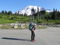
the 'Guess the Photo' thread

-
Taco

- Snownado survivor
- Posts: 6193
- Joined: Thu Sep 27, 2007 4:35 pm
And it's not EF SGC? That's Iron right there, and the long straight near Rattlesnake Canyon is near.
-
AW~

- Posts: 2110
- Joined: Mon Oct 01, 2007 12:00 pm
Missed your post...you are correct on the locale....although thats not Iron..pk6327 SHawkins ridge.TacoDelRio wrote:And it's not EF SGC? That's Iron right there, and the long straight near Rattlesnake Canyon is near.
-
Taco
- Snownado survivor
- Posts: 6193
- Joined: Thu Sep 27, 2007 4:35 pm
The one on the right is part of South Hawkins?
-
AW~
- Posts: 2110
- Joined: Mon Oct 01, 2007 12:00 pm
Yes...the green arrow showing the camera location and direction of photo...with red balloon "D" being pk6327 S Hawkins.TacoDelRio wrote:The one on the right is part of South Hawkins?


-
Taco
- Snownado survivor
- Posts: 6193
- Joined: Thu Sep 27, 2007 4:35 pm
Looks kinda like it, but Ontario is too far East.
-
tinaballina
- Posts: 182
- Joined: Thu Jun 18, 2009 11:28 am
-
Ze Hiker

- Posts: 1432
- Joined: Mon Jul 28, 2008 7:14 pm
damn that's a tough one. hard to get a good eye on the flora
Smith?
Smith?

-
HikeUp

- Posts: 4070
- Joined: Thu Sep 27, 2007 9:21 pm
Lawlor.
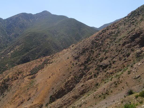
Where is this photo taken from and which drainage area is it overlooking?

Where is this photo taken from and which drainage area is it overlooking?
-
HikeUp
- Posts: 4070
- Joined: Thu Sep 27, 2007 9:21 pm
Nice guess though Ze. I can see what you were thinking.
The pic is taken from the trail between Icehouse Saddle and Cucamonga Peak, looking northeast into the Middle Fork Lytle Creek drainage. The ridge in the distance looks to be worth exploring in the "pick a random ridge" hike series!
The pic is taken from the trail between Icehouse Saddle and Cucamonga Peak, looking northeast into the Middle Fork Lytle Creek drainage. The ridge in the distance looks to be worth exploring in the "pick a random ridge" hike series!
-
Ze Hiker
- Posts: 1432
- Joined: Mon Jul 28, 2008 7:14 pm
Ah tricky! Ok post another one.HikeUp wrote:Nice guess though Ze. I can see what you were thinking.
The pic is taken from the trail between Icehouse Saddle and Cucamonga Peak, looking northeast into the Middle Fork Lytle Creek drainage. The ridge in the distance looks to be worth exploring in the "pick a random ridge" hike series!

-
HikeUp
- Posts: 4070
- Joined: Thu Sep 27, 2007 9:21 pm
That's a 'how not to vertically bushwhack' demonstration by Taco?
-
Ze Hiker
- Posts: 1432
- Joined: Mon Jul 28, 2008 7:14 pm
easy. Taco climbing down a tree after thrown out of his car after an accident on GRR.