
Bobcat Fire in West Fork
-
David R
- OG of the SG
- Posts: 687
- Joined: Sun Jun 12, 2011 10:28 pm
The fire is pretty close to being out, largest hot spot appears to be near Red Box. In the north there are hot spots west of Waterman and near Lewis.
-
AW~

- Posts: 2124
- Joined: Mon Oct 01, 2007 12:00 pm
Thats what they all say, but every night the fire returns.David R wrote: The fire is pretty close to being out, largest hot spot appears to be near Red Box. In the north there are hot spots west of Waterman and near Lewis.
This is the 'hotspot' near Lewis.
The left part is east side of Dorr towards Vincent Gap. I dont know what the right part is..not sure if I want to know.
In the larger context, millions of acres burnt. Creek Fire had 12 hours of rain...and came back to life...unbelievable.
Castle fire....first one to burn above 10,000ft? At least the Dolan is out.
To me we have bet the farm on there will be no Santa Anas.
Closeup of the left..
You do not have the required permissions to view the files attached to this post.
-
AW~
- Posts: 2124
- Joined: Mon Oct 01, 2007 12:00 pm
North side fire info: all in all looks nice after all.
https://www.wrightwoodcalif.com/forum/i ... 391.0.html
"...Multiple contingency lines have been put in place including a retardant line from above Hwy 2 east of Dawson Saddle that extends to Big Rock Creek. This line was reinforced with a fire line cut in by hand crews, who also extended a hose line to the bottom. A dozer line has been placed from Vincent Gap to the top of Pinion Ridge. Sb County dozers are additionally constructing a dozer line from Blue Ridge, up behind Mountain High West. I am cautiously optimistic that the community is safe, but we cannot let our guard down. High heat, low Relative Humidity, and a possible mild Santa Ana Wind event are forecasted for this weekend into next week. SB County Fire currently has two Strike Teams positioned in the area including 10 fire engines and 2 Battalion Chiefs. We are also inserted into the Command Post with an Agency Representative as well as myself positioned in the community And coordinating with our assisting fire agencies. Once again, I believe things look good but we have much work to do in preparation for the upcoming weather change."
-
HikeUp

- Posts: 4098
- Joined: Thu Sep 27, 2007 9:21 pm
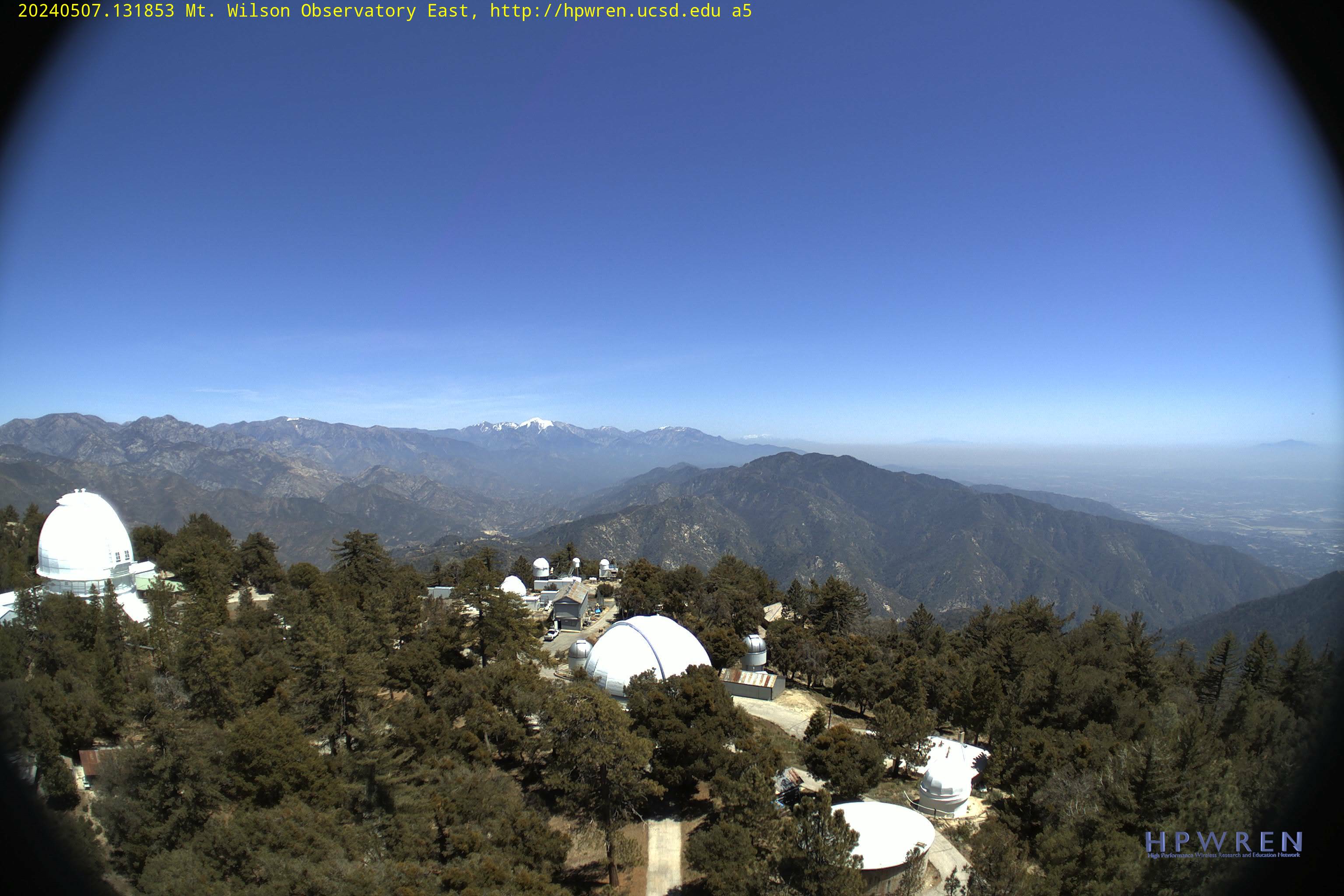
Here's a current picture from Mt. Wilson looking directly towards the Redbox area. Looks like all the little side valleys are going up in flames 1 by 1 the last few days. You can see flames in this shot.
Also, look at that beautiful ridge hike straight up Lawlor's south ridge. Park at Redbox and head straight up the ridge. I wonder if the bulldozers finally buried the cables for good, exposed them or tore them out! At least the damn Fucca's will be out of the way for a while.
Also, look at that beautiful ridge hike straight up Lawlor's south ridge. Park at Redbox and head straight up the ridge. I wonder if the bulldozers finally buried the cables for good, exposed them or tore them out! At least the damn Fucca's will be out of the way for a while.
You do not have the required permissions to view the files attached to this post.
-
Anthony

- Posts: 349
- Joined: Mon Jun 05, 2017 11:53 am
Lawlor's south ridge is no joke. I flew down that thing, managed to skip over the cables but stabbed myself on a yucca.
-
HikeUp
- Posts: 4098
- Joined: Thu Sep 27, 2007 9:21 pm
Not dead yet!
You do not have the required permissions to view the files attached to this post.
-
Taco

- Snownado survivor
- Posts: 6218
- Joined: Thu Sep 27, 2007 4:35 pm
What’s the latest on the fire? I’ve been ignoring things cause it was making me a not nice person.
-
davidwiese

- Posts: 92
- Joined: Mon Jul 30, 2018 4:00 pm
From the inciweb page:
Overnight firefighters monitored and patrolled the active areas of the fire. Burning continued in the Valley Forge and Falls Canyon areas north of Mt. Wilson, within fire containment lines with no perimeter growth reported overnight. For the past few days, this interior island north of Mt. Wilson has been produced a large amount of smoke and it will continue to consume internal acres within the control fire lines. The smoke from this area may be more visible during the peak heat areas of the day. The containment line is not threatened with this internal burning and fire crews are in this area to monitor for possible spotting.
Due to the fire containment achieved in the last week, incident commanders of the Bobcat Fire will be transitioning from California Interagency Incident Management Team 11, to the Angeles National Forest. Resources have begun to be released from the incident to allow them to shift firefighting efforts to other critical needs throughout the state. This is the final update.
-
Taco
- Snownado survivor
- Posts: 6218
- Joined: Thu Sep 27, 2007 4:35 pm
Big thank. I saw how big the smoke was earlier. Hope it’s all the way out soon. God damn, a month long and from city to desert.
I take it the poor air quality lately has been from the fire near Santa Clarita?
I take it the poor air quality lately has been from the fire near Santa Clarita?
-
HikeUp
- Posts: 4098
- Joined: Thu Sep 27, 2007 9:21 pm
Winds are kicking up a lot of dust and ash...snowing again in Pasadena.
Got to wonder if a sleeping ember will start up.
Got to wonder if a sleeping ember will start up.
-
maxmapper
- Posts: 56
- Joined: Fri Jan 17, 2020 5:50 pm
Looks like it already has re-ignited around Twin Peaks... http://www.alertwildfire.org/orangecoca ... &v=81e002f
https://rammb-slider.cira.colostate.edu ... 3349609375
https://rammb-slider.cira.colostate.edu ... 3349609375
-
Taco
- Snownado survivor
- Posts: 6218
- Joined: Thu Sep 27, 2007 4:35 pm
I saw smoke rising from below the south face of west twin (or so) from GMR last week. Looked like it was still burning, but small.
Cool page with all those cameras and their orientation displayed on the map. Thanks.
Cool page with all those cameras and their orientation displayed on the map. Thanks.
-
Sean

- Cucamonga
- Posts: 4415
- Joined: Wed Jul 27, 2011 12:32 pm
An update from the folks at Sturtevant Camp.
Big Santa Anita Canyon remains closed to the general public. Most of the surrounding Angeles National Forest has reopened, but for now, hiking into the canyon could still earn you a nasty fine.
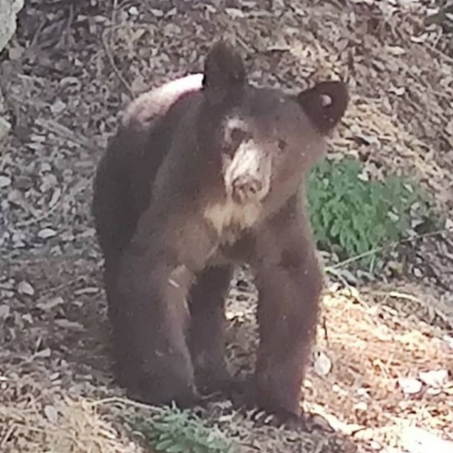
In Camp, the immediate fire (and bear) damage has been cleaned up...
The U.S. Forest Service has not yet changed its estimate of keeping the forest closed until spring 2022...
The Big News: Los Angeles County has announced that the road from the Santa Anita Avenue gate to Chantry Flat will be closed for six months starting October 2021. The purpose will be to do a major repair of the road where it has been down to one lane, not far from the pack station...
We are currently paying fees, taxes and insurance out of the cash in the checking account; there is no reserve fund or endowment but we can dream. Volunteers have funded many of the repair materials, and many small donations are helping along the way.
So we expect to present a simple fund-raising campaign soon, focused on the big ticket item of the water tanks, along with a few special projects to make the camp an even more compelling experience once guests can get their boots dusty coming up canyon. Until then, stay tuned, and thanks for your interest and support.