
Last week I was out in the Duarte area, so I decided to check out the Silver Fish Trail, with the ambitious idea that maybe I could drop down through upper Fish Fork to the falls.
I got started around 2pm and it was quite hot.
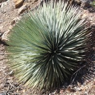
I found a little rattlesnake.
There's not a lot of shade on the way up to Mt. Bliss. It's about 4 miles and 3,300' of elevation gain to get to the top, on a well-maintained fire road. I passed a guy on a mountain bike suffering up the road. About a mile after the summit (I didn't bother going to the true summit with the powerlines, I was more interested to see the canyon), Silver Fish Road branches off to the right. I had brought a machete and was prepared for a bushwhacking battle, but surprisingly the road was pretty clear. The roadbed is almost entirely intact, except for one washout not far from where it splits from the main fire road.
There were dozens and dozens of bear droppings. I was a little disappointed I didn't see one.
This was once a very well maintained road. There are multiple sections that cross side canyons with big drainage pipes underneath, and even cement dams/retaining walls to keep the road intact.
I eventually made it down to Stone Cabin Flat, which is filled with some massive old oaks. It was looking pretty spooky by the time I got there.
There was once a fire here, but it seems like most of the oaks survived.
This tree bore the mark of some strange forgotten symbol... or was it just the tree's weird growth?
Anyways, I finally made it down to some flowing water. Pushing on a bit further, as the last of the evening twilight faded, I looked at my watch and realized I had already gone 9 miles. Time to turn around. The 3.25 miles of Silver Fish Road I'd traveled so far had been surprisingly free from major obstruction. There are a few downed trees and some growth, but overall it's fairly open and even bikeable as far as I went (and from a distance it looked like it could continue that way for a while). After crossing the stream the road had more taller weeds and there was a big downed tree covering it at one point, but there wasn't much to slow hiking progress from a normal pace.
On the way back to the stream, I saw a PVC pipe sticking up to the side of the trail. Walking towards it, I found a bunch of fencing that must've been attached to it at some point. There were also a bunch of reeds unique to that area that I didn't see anywhere else around. Poking around more, I found a game camera, and a recently cleared roughly 10'x10' area of dirt (to pick up tracks?) The game camera and dirt made sense, the fencing and pvc not so much. What gives?
Anyways, I refilled my water bottles and made the trek out in the dark. I found a bunch of toads, and also an unfired round.
As I was finishing around 9pm or so, I saw fireworks start going off all over the place down below, telling me the Dodgers had won the World Series.
If you'd like to watch the video version, it's here:
Silver Fish Trail/Stone Cabin Flat
-
Blaise
- Posts: 45
- Joined: Sat Nov 17, 2018 5:46 pm
You do not have the required permissions to view the files attached to this post.
-
dima

- Posts: 1930
- Joined: Wed Feb 12, 2014 1:35 am
- Location: Los Angeles
Ooh, that's cool. I've thought about checking this out many times, but never did it. You went a bit past the Fish Canyon crossing, and it stayed passable?
-
JakubRZ

- Posts: 56
- Joined: Sat Jun 11, 2022 4:08 pm
That is super bold to wander alone into bear country. Kudos! Did you see any remnants of the cabin itself?
-
Blaise
- Posts: 45
- Joined: Sat Nov 17, 2018 5:46 pm
I just went a bit past the crossing (maybe half a mile). As far as I went, it was pretty easily passable, just some tall weeds. My guess is that it's probably similar at least until the ridge that separates Fish Canyon from Roberts Canyon. The road was visible from afar all the way to that ridge.dima wrote: Mon Nov 10, 2025 11:44 pm Ooh, that's cool. I've thought about checking this out many times, but never did it. You went a bit past the Fish Canyon crossing, and it stayed passable?
-
Blaise
- Posts: 45
- Joined: Sat Nov 17, 2018 5:46 pm
Thanks! I didn't see any remains of a cabin, but I didn't look around very much. I can't find anything online about what was there before, or why it's called Stone Cabin Flat, but there must've been a cabin, right?JakubRZ wrote: Wed Nov 12, 2025 8:57 am That is super bold to wander alone into bear country. Kudos! Did you see any remnants of the cabin itself?

-
Taco

- Snownado survivor
- Posts: 6218
- Joined: Thu Sep 27, 2007 4:35 pm
I've been thinking of trying to hike the whole road (by bike). I took it up from 39 once with a buddy probably 5+ years ago and we dealt with very thick brush just to get to the Silver Peak ridge, taking up all the time we meant to use for descending a canyon nearby.
Dima, wanna go with me? We can chop our way through.
Dima, wanna go with me? We can chop our way through.
-
dima
- Posts: 1930
- Joined: Wed Feb 12, 2014 1:35 am
- Location: Los Angeles
I did the same years ago: 39 to silver peak ridge. It sucked. Let's do it. Blaise: you should join us!
-
David R
- OG of the SG
- Posts: 687
- Joined: Sun Jun 12, 2011 10:28 pm
There is a shortcut up the ridge that allows for easy passage versus following the road from the 39. I want to do this as a hike so let me know if you guys are going otherwise I'll probably go up in the next month with the cooler temps on a Sunday.
-
Matthew

- Supercaff
- Posts: 636
- Joined: Mon Nov 30, 2015 8:25 am
- Location: Pasadena
Let’s do it! Im game for a weekend getaway!David R wrote: Sat Nov 15, 2025 7:01 pm There is a shortcut up the ridge that allows for easy passage versus following the road from the 39. I want to do this as a hike so let me know if you guys are going otherwise I'll probably go up in the next month with the cooler temps on a Sunday.
stoke is high
-
dima
- Posts: 1930
- Joined: Wed Feb 12, 2014 1:35 am
- Location: Los Angeles
Yep. The one time I did this I tried to take the road, but eventually gave up and jumped onto the ridge. Never went past the ridge. Taco: do you still never have free weekends?David R wrote: Sat Nov 15, 2025 7:01 pm There is a shortcut up the ridge that allows for easy passage versus following the road from the 39
-
David R
- OG of the SG
- Posts: 687
- Joined: Sun Jun 12, 2011 10:28 pm
I'm in my slow season at work so could hike during the week with a little planning.dima wrote: Sat Nov 15, 2025 7:23 pmYep. The one time I did this I tried to take the road, but eventually gave up and jumped onto the ridge. Never went past the ridge. Taco: do you still never have free weekends?David R wrote: Sat Nov 15, 2025 7:01 pm There is a shortcut up the ridge that allows for easy passage versus following the road from the 39
-
Taco
- Snownado survivor
- Posts: 6218
- Joined: Thu Sep 27, 2007 4:35 pm
Next weekend is my last free weekend, then work, then no saturdays off.
I know of the shortcut. I should probably go up the normal way by myself soon on the bike to see how bad it is. Alternate is very steep but lacks tree-swimming.
I know of the shortcut. I should probably go up the normal way by myself soon on the bike to see how bad it is. Alternate is very steep but lacks tree-swimming.
-
Blaise
- Posts: 45
- Joined: Sat Nov 17, 2018 5:46 pm
Sounds fun! I was hoping this would inspire exploration of more of the road between Stone Cabin Flat and Silver Peak Ridge. My schedule and living in Ventura county now probably would make it too difficult to coordinate a date that works, but I'll be interested to see what happens. Appreciate the invite!dima wrote: Sat Nov 15, 2025 10:35 am I did the same years ago: 39 to silver peak ridge. It sucked. Let's do it. Blaise: you should join us!
-
Taco
- Snownado survivor
- Posts: 6218
- Joined: Thu Sep 27, 2007 4:35 pm
Yesterday afternoon I rode up Silverfish TT to see how bad the bushwhacking is. I left late and am slow as I’m working through sciatica issues, so I didn’t reach the bushwhacking until dark, nor did I go far enough up the TT from 39 to hit a wall of brush. I did some trail maintenance, trimmed bushes and moved big rocks and stones off the trail, making it a lot nicer to ride. I fantasized about eventually being able to ride the whole way from Monrovia to 39 via the TT, making my meager efforts worthwhile. It would be nice, a quiet way to head home through the hills with perhaps a bivy back there.
The road bed washed out badly not far from here. I trimmed back some dead foliage and a handful of Poison Oak bits.
I’d like to go back soon if anyone wants to go with me. Next job is to see how far I can push a bike up it from 39 before it’s too thick, and then work through that with a machete and hand saw etc etc. I’ve not been down the TT below Silver Ridge and as Dima said it was very tough going up to that point. I assume it’ll be real tough below.
You do not have the required permissions to view the files attached to this post.
-
Sewellymon
- Posts: 113
- Joined: Tue Feb 12, 2008 8:55 pm
I mountain biked up the Silver Fish fire road from 39 as far as I could in early 1986. Even then it got horrifically overgrown after a few miles. Not sure how far past Silver Mtn Ridge I got.. prob not very far.
My big take away is my dog got about 40 ticks following me on that ride. Me.. i guess i must have killed them all in the washing machine.
That road/ trail needs to be reclaimed and rehabbed into an adventure ride.
My big take away is my dog got about 40 ticks following me on that ride. Me.. i guess i must have killed them all in the washing machine.
That road/ trail needs to be reclaimed and rehabbed into an adventure ride.
-
Taco
- Snownado survivor
- Posts: 6218
- Joined: Thu Sep 27, 2007 4:35 pm
I met a buddy on GMR the other night and we both talked about working on it. Would be real cool to be able to connect Azusa and Monrovia, and have a quiet place to camp down there as well. A nice getaway. I’ll give it another go soon with more gardening equipment. Not sure how bad the roadbed is on the Azusa side on the western slope of Silver Ridge, but it looks bad on Google Earth. Hopefully not too bad.
-
Sean

- Cucamonga
- Posts: 4417
- Joined: Wed Jul 27, 2011 12:32 pm
It's the tree version of a stigmata.Blaise wrote: Sun Nov 09, 2025 3:12 pmThis tree bore the mark of some strange forgotten symbol... or was it just the tree's weird growth?
Thanks for the report and photos. I used to hike up that trail a lot and even do some maintenance. Would be cool to see it cleared.